close
-
Layers w
- Weather Layers
- Pro
- Pro
- Pro
- Pro
- Pro
- Pro
- More Layers
- Pro
- Pro
- Pro
- Pro
-
Upgrade to

3D
Trail Conditions
- Unknown
- Snow Groomed
- Snow Packed
- Snow Covered
- Snow Cover Partial
- Freeze/thaw Cycle
- Icy
- Prevalent Mud
- Wet
- Variable
- Ideal
- Dry
- Very Dry
Trail Flow (Ridden Direction)
Trailforks scans users ridelogs to determine the most popular direction each trail is ridden. A good flowing trail network will have most trails flowing in a single direction according to their intension.
The colour categories are based on what percentage of riders are riding a trail in its intended direction.
The colour categories are based on what percentage of riders are riding a trail in its intended direction.
- > 96%
- > 90%
- > 80%
- > 70%
- > 50%
- < 50%
- bi-directional trail
- no data
Trail Last Ridden
Trailforks scans ridelogs to determine the last time a trail was ridden.
- < 2 days
- < 1 week
- < 2 weeks
- < 1 month
- < 6 months
- > 6 months
Trail Ridden Direction
The intended direction a trail should be ridden.
- Downhill Only
- Downhill Primary
- Both Directions
- Uphill Primary
- Uphill Only
- One Direction
Contribute Details
Colors indicate trail is missing specified detail.
- Description
- Photos
- Description & Photos
- Videos
Trail Popularity ?
Trailforks scans ridelogs to determine which trails are ridden the most in the last 9 months.
Trails are compared with nearby trails in the same city region with a possible 25 colour shades.
Think of this as a heatmap, more rides = more kinetic energy = warmer colors.
- most popular
- popular
- less popular
- not popular
ATV/ORV/OHV Filter
Max Vehicle Width
inches
US Cell Coverage
Legend

Radar Time
Activity Recordings
Trailforks uses anonymized public activity data.
?
Activity Recordings
Trailforks uses anonymized public activity data.
?
Personal Heatmap
▶
Activity Types
all
/
none
▶
Options
2
Date range
month
–
Winter Trails
Warning
A routing network for winter maps does not exist. Selecting trails using the winter trails layer has been disabled.
Missing Trails
Most Popular
Least Popular
Trails are colored based on popularity. The more popular a trail is, the more red. Less popular trails trend towards green.
Jump Magnitude Heatmap
Heatmap of where riders jump on trails. Zoom in to see individual jumps, click circles to view jump details.
BC Backroad Status
![map legend]()
Service Road Atlas is a free to use, community-driven service for viewing and creating reports on the numerous back-country service roads around B.C. and Alberta.

Slope Aspect
Direction the slope faces
Trails Deemphasized
Trails are shown in grey.
Only show trails with no bike usage.
Suggested Layers
Based on selected activity type
Save the current map location and zoom level as your default home location whenever this page is loaded.
Save
No description for Kirkhill Forest has been added yet!
Login or register to submit one.
 google parking directions
Primary Trail Type: Cross-Country
Land Status: Regional Recreation Area
google parking directionsThis region uses the Uk/Euro style trail grading system.
Activities Click to view
- Mountain Bike
108 trails
- E-Bike
107 trails
- Hike
94 trails
- Trail Running
93 trails
Region Details
- 31
- 2
- 9
- 35
- 3
- 1
Region Status
Open as of 2 daysStats
- Avg Trail Rating
- Trails (view details)
- 81
- Trails Mountain Bike
- 108
- Trails E-Bike
- 107
- Trails Gravel Bike
- 1
- Trails Hike
- 94
- Trails Trail Running
- 93
- Total Distance
- 22 miles
- Total Descent
- 4,377 ft
- Total Vertical
- 389 ft
- Highest Trailhead
- 843 ft
- Reports
- 1,016
- Photos
- 64
- Ridden Counter
- 16,560
Popular Kirkhill Forest Mountain Biking Trails
• 100 ★ 3.5 • 3,146 ft • 26 ft • 569 •
Popular blue difficulty singletrack. This mountain bike primary trail can be used downhill primary and has a easy overall physical rating with a 26 ft green climb. It features berm and jump. On average it takes 5 minutes to complete this trail.
• 100 ★ 3.0 • 879 ft • 39 ft • 521 • • hike
Popular blue difficulty gravel path. This hike primary trail can be used uphill only and has a moderate overall physical rating with a 39 ft blue climb. On average it takes 1 minutes to complete this trail.
• 95 ★ 4.0 • 1,132 ft • 0 ft • 482 •
Rocky pedally descent. Plenty of lines to pick through to get the speed up. Some bits are much rockier than others
• 100 ★ 4.0 • 801 ft • 0 ft • 424 •
A variation to the usual . Take a sharp right about 150m from the top of the main and more obvious descent line from the tower
• 95 ★ 4.0 • 1,680 ft • 0 ft • 353 •
Fast rock trail down an old logger path. Some loose rocky turns and small drop offs Good trail in dry weather.
• 100 ★ 4.0 • 633 ft • 0 ft • 328 •
The dirt trail features roots, stumps and a log to clear. It has a steep finish to the with small ditch at the bottom.
• 95 ★ 4.0 • 892 ft • 0 ft • 326 •
Popular red difficulty singletrack. This mountain bike primary trail can be used downhill primary. It features drop and jump. On average it takes 1 minutes to complete this trail.
• 50 ★ 0.0 • 240 ft • 0 ft • 324 •
Moderately popular red difficulty singletrack. This mountain bike primary trail and has a hard overall physical rating with a 0 ft blue climb. Adaptive MTB rating: amtb blue. On average it takes minutes to complete this trail.
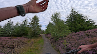
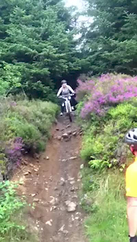
Photos of Kirkhill Forest Mountain Bike
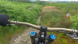
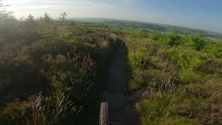
Videos of Kirkhill Forest Mountain Bike
trail: Tower Descent
0:01 |
17 |
Aug 25, 2025
trail: Kirkhill Fun Park
0:39 |
873 |
Jul 11, 2016

trail: The Escape
0:00 |
11 |
Jun 1, 2026 , Aberdeen

trail: Rashford Mansory
0:35 |
15 |
Jun 1, 2026 , Aberdeen

trail: Marcus Flint
0:35 |
9 |
Jun 1, 2026 , Aberdeen
trail: Descenderoo
0:41 |
330 |
Jul 30, 2023 , Aberdeen

trail: Fast Forwarder
2:15 |
284 |
Jul 30, 2023 , Aberdeen
trail: Fast Forwarder
226 |
Jun 23, 2021 , Aberdeen
Recent Trail Reports
| status | trail | date | condition | info | user |
|---|---|---|---|---|---|
| Forest Path | Jun 16, 2026 @ 10:39am (Europe/London) 2 days | Prevalent Mud | bighitter | ||
| Forest Road | Jun 15, 2026 @ 7:51am (Europe/Isle_of_Man) Jun 14, 2026 | Variable | CalumvnqJD2 | ||
| Fast Forwarder | May 17, 2026 @ 4:56am (America/Los_Angeles) May 17, 2026 | Ideal | w0rldexplorer | ||
| Sweet and Sour | May 17, 2026 @ 4:56am (America/Los_Angeles) May 17, 2026 | Ideal | w0rldexplorer | ||
| lastminute.com | May 17, 2026 @ 12:55pm (Europe/London) May 17, 2026 | Ideal | w0rldexplorer | ||
| Woodpecker | May 17, 2026 @ 12:54pm (Europe/London) May 17, 2026 | Variable | w0rldexplorer | ||
| Tight as a Badgers | May 5, 2026 @ 4:23pm (Europe/Isle_of_Man) May 5, 2026 | Ideal | chombo | ||
| Fallen Trees Hidden DH | Apr 27, 2026 @ 11:41am (Europe/London) Apr 27, 2026 | Ideal | citizenlee | ||
| Slip N Slide | Apr 27, 2026 @ 11:39am (Europe/London) Apr 27, 2026 | Ideal | citizenlee | ||
| Side-tracked | Apr 27, 2026 @ 11:36am (Europe/London) Apr 27, 2026 | Ideal | citizenlee |
Activity Feed
| username | action | type | title | date |
|---|---|---|---|---|
| bighitter | add | report | activity #97095732 | Jun 16, 2026 @ 2:39am 2 days |
| CalumvnqJD2 | add | report | activity #97088142 | Jun 15, 2026 @ 10:20pm 3 days |
| mccarroll311 | add | video | activity #96003494 and 2 more | Jun 1, 2026 @ 1:04am Jun 1, 2026 |
| ooB88Y | add | photo | activity #95885897 | May 30, 2026 @ 2:06pm May 30, 2026 |
| w0rldexplorer | add | report | activity #94889891 and 3 more | May 17, 2026 @ 4:54am May 17, 2026 |
Recent Comments
| username | type | title | comment | date |
|---|---|---|---|---|
| trail | Currently a fallen tree at the end of this... | Oct 8, 2025 @ 10:56am Oct 8, 2025 | ||
| trail | Trail is called Woodpecker. I am one of the... | Sep 24, 2025 @ 3:07pm Sep 24, 2025 | ||
| trail | Trail open and running well, 07/25 | Jul 25, 2025 @ 7:56am Jul 25, 2025 | ||
| trail | Trail open and running well | Jul 25, 2025 @ 7:55am Jul 25, 2025 | ||
| trail | Trail open again, with a few improvements.... | Dec 21, 2024 @ 5:56pm Dec 21, 2024 |
Nearby Areas
| name | distance | ||||
|---|---|---|---|---|---|
| Tyrebagger | 3 | 7 | 1.4 km | ||
| Countesswells | 6 | 13 | 4.8 km | ||
| Hazlehead Park | 5.4 km | ||||
| Foggieton Woods | 5 | 3 | 5.6 km | ||
| Cults Woods | 6.1 km |
Local Badges
-

Completionist1 awarded
Activity Type Stats
| activitytype | trails | distance | descent | descent distance | total vertical | rating | global rank | state rank | photos | reports | routes | ridelogs |
|---|---|---|---|---|---|---|---|---|---|---|---|---|
| Mountain Bike | 108 | 22 miles | 4,377 ft | 11 miles | 390 ft | #1,093 | #45 | 57 | 1,016 | 8,753 | ||
| E-Bike | 107 | 22 miles | 4,377 ft | 11 miles | 390 ft | #1,821 | #66 | 7 | 961 | 1,699 | ||
| Gravel Bike | 1 | #718 | #38 | 1 | 7 | |||||||
| Hike | 94 | 20 miles | 3,622 ft | 10 miles | 390 ft | #3,742 | #62 | 951 | 131 | |||
| Trail Running | 93 | 20 miles | 3,622 ft | 10 miles | 390 ft | #3,420 | #67 | 951 | 286 |
Frequently Asked Questions About Kirkhill Forest
▼
What are the highest rated mountain biking trails in Kirkhill Forest?
The highest rated mountain biking trails in Kirkhill Forest are:
- Sweet and Sour (4.3/5)
- Berm the witch (4.2/5)
- Corner Cut (4.1/5)
- Tight as a Badgers (4.1/5)
- Flee the Tower (4/5)
▼
What is the best time of the year to ride in Kirkhill Forest?
Based on ride log data, the most popular months to ride in Kirkhill Forest are:
- July (56 activities)
- May (52 activities)
- August (52 activities)
▼
Where can I park to ride in Kirkhill Forest?
There are 3 parking locations listed in Kirkhill Forest. The most popular parking spots are: View all parking and trailhead locations on the map to plan your visit.
▼
What is the longest trail in Kirkhill Forest?
The longest trail in Kirkhill Forest is Kirkhill Fun Park at 3,146 ft. View all trails sorted by distance.
Activities
- By BenTravis
 & contributors
 - Admins: ATA, NEAT
- #6593 - 23,288 views
- kirkhill forest activity log | embed map of Kirkhill Forest mountain bike trails | kirkhill forest mountain biking points of interest
Downloading of trail gps tracks in kml & gpx formats is enabled for Kirkhill Forest.
You must login to download files.