close
-
Layers w
- Weather Layers
- Pro
- Pro
- Pro
- Pro
- Pro
- Pro
- More Layers
- Pro
- Pro
- Pro
- Pro
-
Upgrade to

3D
Trail Conditions
- Unknown
- Snow Groomed
- Snow Packed
- Snow Covered
- Snow Cover Partial
- Freeze/thaw Cycle
- Icy
- Prevalent Mud
- Wet
- Variable
- Ideal
- Dry
- Very Dry
Trail Flow (Ridden Direction)
Trailforks scans users ridelogs to determine the most popular direction each trail is ridden. A good flowing trail network will have most trails flowing in a single direction according to their intension.
The colour categories are based on what percentage of riders are riding a trail in its intended direction.
The colour categories are based on what percentage of riders are riding a trail in its intended direction.
- > 96%
- > 90%
- > 80%
- > 70%
- > 50%
- < 50%
- bi-directional trail
- no data
Trail Last Ridden
Trailforks scans ridelogs to determine the last time a trail was ridden.
- < 2 days
- < 1 week
- < 2 weeks
- < 1 month
- < 6 months
- > 6 months
Trail Ridden Direction
The intended direction a trail should be ridden.
- Downhill Only
- Downhill Primary
- Both Directions
- Uphill Primary
- Uphill Only
- One Direction
Contribute Details
Colors indicate trail is missing specified detail.
- Description
- Photos
- Description & Photos
- Videos
Trail Popularity ?
Trailforks scans ridelogs to determine which trails are ridden the most in the last 9 months.
Trails are compared with nearby trails in the same city region with a possible 25 colour shades.
Think of this as a heatmap, more rides = more kinetic energy = warmer colors.
- most popular
- popular
- less popular
- not popular
ATV/ORV/OHV Filter
Max Vehicle Width
inches
US Cell Coverage
Legend

Radar Time
Activity Recordings
Trailforks uses anonymized public activity data.
?
Activity Recordings
Trailforks uses anonymized public activity data.
?
Personal Heatmap
▶
Activity Types
all
/
none
▶
Options
2
Date range
month
–
Winter Trails
Warning
A routing network for winter maps does not exist. Selecting trails using the winter trails layer has been disabled.
Missing Trails
Most Popular
Least Popular
Trails are colored based on popularity. The more popular a trail is, the more red. Less popular trails trend towards green.
Jump Magnitude Heatmap
Heatmap of where riders jump on trails. Zoom in to see individual jumps, click circles to view jump details.
BC Backroad Status
![map legend]()
Service Road Atlas is a free to use, community-driven service for viewing and creating reports on the numerous back-country service roads around B.C. and Alberta.

Slope Aspect
Direction the slope faces
Trails Deemphasized
Trails are shown in grey.
Only show trails with no bike usage.
Suggested Layers
Based on selected activity type
Save the current map location and zoom level as your default home location whenever this page is loaded.
Save
No description for Kirroughtree has been added yet!
Login or register to submit one.
 google parking directions
Primary Trail Type: Cross-Country
Land Status: National Forest
Land Manager: Forestry And Land Scotland
google parking directionsThis region uses the Uk/Euro style trail grading system.
Activities Click to view
- Mountain Bike
83 trails
- E-Bike
84 trails
- Horse
27 trails
- Hike
30 trails
- Trail Running
30 trails
Region Details
- 27
- 4
- 10
- 13
- 27
Region Status
Caution as of May 13, 2026Local Trail Association
Stats
- Avg Trail Rating
- Trails (view details)
- 81
- Trails Mountain Bike
- 84
- Trails E-Bike
- 84
- Trails Horse
- 27
- Trails Hike
- 30
- Trails Trail Running
- 30
- Total Distance
- 59 miles
- Total Descent
- 8,922 ft
- Total Vertical
- 1,141 ft
- Highest Trailhead
- 1,171 ft
- Reports
- 787
- Photos
- 50
- Ridden Counter
- 25,847
Popular Kirroughtree Mountain Biking Trails
• 100 ★ 3.0 • 572 ft • 47 ft • 951 •
from the car park, past the skills area. This trail is used by Blue, Red and Black routes.
• 95 ★ 3.7 • 1,842 ft • 12 ft • 866 •
is part of the Blue and Red routes. The rocky section at the end can be bypassed by taking the path to the right at the start of the rocks.
• 95 ★ 3.4 • 669 ft • 0 ft • 840 •
This section is part of the Blue and Red routes
• 95 ★ 3.5 • 1,416 ft • 29 ft • 840 •
Popular red difficulty singletrack. This mountain bike primary trail can be used one direction and has a moderate overall physical rating with a 29 ft blue climb. On average it takes 5 minutes to complete this trail.
• 90 ★ 3.8 • 1 mile • 173 ft • 830 •
Part of the Kirroughtree Red Route (The Twister)
• 100 ★ 4.0 • 3,360 ft • 85 ft • 828 •
Popular red difficulty singletrack. This mountain bike primary trail can be used one direction and has a moderate overall physical rating with a 85 ft blue climb. Trail visibility is always easy to follow. On average it takes 7 minutes to complete this trail.
Kirroughtree Mountain Bike Routes
16 miles • 2,771 ft • 26 • Point to Point • Race •
Official route of the 2021 PMBA Enduro
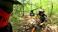
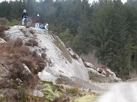
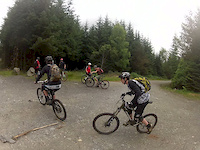
Photos of Kirroughtree Mountain Bike
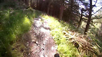
Videos of Kirroughtree Mountain Bike
trail: Link
0:00 |
81 |
Aug 29, 2018

trail: Forest Road
0:12 |
34 |
Jun 11, 2016

trail: The Twister
4:56 |
387 |
Sep 8, 2015
trail: McMoab
0:27 |
368 |
Apr 14, 2013
trail: Rocky Road (Blue & Red)
4:04 |
491 |
Jul 8, 2012
trail: Forest Road
9:16 |
326 |
Jul 17, 2011
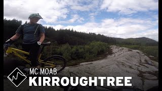
trail: McMoab
4:47 |
133 |
Mar 28, 2024 , Newton Stewart
trail: Forest Road
0:24 |
113 |
Nov 12, 2010
Recent Trail Reports
| status | trail | date | condition | info | user |
|---|---|---|---|---|---|
| Rocky Road (Blue & Red) | May 13, 2026 @ 10:08pm (Europe/London) May 13, 2026 | Unknown | seamanstanes | ||
| Rivendell | May 13, 2026 @ 10:08pm (Europe/London) May 13, 2026 | Unknown | seamanstanes | ||
| The Nut Cracker | May 13, 2026 @ 10:08pm (Europe/London) May 13, 2026 | Unknown | seamanstanes | ||
| The Twister | May 13, 2026 @ 10:08pm (Europe/London) May 13, 2026 | Unknown | seamanstanes | ||
| The White Witch | May 13, 2026 @ 10:07pm (Europe/London) May 13, 2026 | Unknown | seamanstanes | ||
| RedWocky | May 13, 2026 @ 10:06pm (Europe/London) May 13, 2026 | Unknown | seamanstanes | ||
| Little Park Doon Hill | Feb 5, 2026 @ 8:52am (Europe/London) Feb 5, 2026 | Dry | rabb93 | ||
| The Chopper | Aug 27, 2025 @ 3:23am Aug 27, 2025 | Ideal | rabb93 | ||
| Larg Hill Descent (Official) | Jul 16, 2025 @ 1:25pm Jul 16, 2025 | Ideal | TamGB7 | ||
| Jaberwocky | May 12, 2025 @ 9:47am May 12, 2025 | Dry | ruckusflow |
Activity Feed
| username | action | type | title | date |
|---|---|---|---|---|
| James-Hirst | wishlist | route | activity #95162763 | May 21, 2026 @ 2:37am May 21, 2026 |
| seamanstanes | add | report | activity #94648471 and 5 more | May 13, 2026 @ 2:06pm May 13, 2026 |
| uujero | wishlist | route | activity #89616745 | Feb 27, 2026 @ 2:48am Feb 27, 2026 |
| uujero | vote | route | activity #89114168 | Feb 18, 2026 @ 1:03am Feb 18, 2026 |
| rabb93 | add | report | activity #88367832 | Feb 5, 2026 @ 12:52am Feb 5, 2026 |
Recent Comments
| username | type | title | comment | date |
|---|---|---|---|---|
| trail | Running great when rode this week | Oct 26, 2024 @ 2:31am Oct 26, 2024 | ||
| trail | I think this is one of my favourite trails in... | Oct 26, 2024 @ 2:31am Oct 26, 2024 | ||
| trail | trees blocking trail | Aug 29, 2024 @ 4:15am Aug 29, 2024 | ||
| report | Trail open, 22/06/24 | Jun 22, 2024 @ 1:31pm Jun 22, 2024 | ||
| trail | One leaning tree which can be ducked under | Mar 3, 2024 @ 12:58pm Mar 3, 2024 |
Nearby Areas
| name | distance | ||||
|---|---|---|---|---|---|
| Glentrool | 5 | 3 | 8.6 km | ||
| Glengap Forest | 3 | 12.5 km | |||
| Cornish Hill | 17.3 km | ||||
| Mochrum hill | 1 | 28.9 km | |||
| Craighall Wood | 3 | 1 | 34.5 km |
Local Badges
-

Completionist1 awarded
Activity Type Stats
| activitytype | trails | distance | descent | descent distance | total vertical | rating | global rank | state rank | photos | reports | routes | ridelogs |
|---|---|---|---|---|---|---|---|---|---|---|---|---|
| Mountain Bike | 83 | 59 miles | 8,921 ft | 28 miles | 1,142 ft | #1,035 | #41 | 46 | 787 | 6 | 5,420 | |
| E-Bike | 84 | 59 miles | 8,921 ft | 28 miles | 1,142 ft | #376 | #32 | 4 | 751 | 4 | 645 | |
| Horse | 27 | 39 miles | 4,321 ft | 17 miles | 1,142 ft | #758 | #34 | 467 | ||||
| Hike | 30 | 39 miles | 4,406 ft | 17 miles | 1,142 ft | #4,838 | #82 | 656 | 45 | |||
| Trail Running | 30 | 39 miles | 4,406 ft | 17 miles | 1,142 ft | #4,009 | #76 | 656 | 105 |
Frequently Asked Questions About Kirroughtree
▼
What are the highest rated mountain biking trails in Kirroughtree?
The highest rated mountain biking trails in Kirroughtree are:
- The Judgement (4.3/5)
- The Thousand Foot Trail (4.1/5)
- To The Gem Stane (Blue and Red) (4.1/5)
- The White Witch (4/5)
- Jaberwocky (4/5)
▼
What is the best time of the year to ride in Kirroughtree?
Based on ride log data, the most popular months to ride in Kirroughtree are:
- September (24 activities)
- April (17 activities)
- July (15 activities)
▼
Where can I park to ride in Kirroughtree?
▼
What is the longest trail in Kirroughtree?
The longest trail in Kirroughtree is Black Craig at 3.8 km. View all trails sorted by distance.
Activities
Trails
Points of Interest
- By alii
 & contributors
 - Admins: ATB, GHBC, GHBC
- #6975 - 14,781 views
- kirroughtree activity log | embed map of Kirroughtree mountain bike trails | kirroughtree mountain biking points of interest
Downloading of trail gps tracks in kml & gpx formats is enabled for Kirroughtree.
You must login to download files.