close
-
Layers w
- Weather Layers
- Pro
- Pro
- Pro
- Pro
- Pro
- Pro
- More Layers
- Pro
- Pro
- Pro
- Pro
-
Upgrade to

3D
Trail Conditions
- Unknown
- Snow Groomed
- Snow Packed
- Snow Covered
- Snow Cover Partial
- Freeze/thaw Cycle
- Icy
- Prevalent Mud
- Wet
- Variable
- Ideal
- Dry
- Very Dry
Trail Flow (Ridden Direction)
Trailforks scans users ridelogs to determine the most popular direction each trail is ridden. A good flowing trail network will have most trails flowing in a single direction according to their intension.
The colour categories are based on what percentage of riders are riding a trail in its intended direction.
The colour categories are based on what percentage of riders are riding a trail in its intended direction.
- > 96%
- > 90%
- > 80%
- > 70%
- > 50%
- < 50%
- bi-directional trail
- no data
Trail Last Ridden
Trailforks scans ridelogs to determine the last time a trail was ridden.
- < 2 days
- < 1 week
- < 2 weeks
- < 1 month
- < 6 months
- > 6 months
Trail Ridden Direction
The intended direction a trail should be ridden.
- Downhill Only
- Downhill Primary
- Both Directions
- Uphill Primary
- Uphill Only
- One Direction
Contribute Details
Colors indicate trail is missing specified detail.
- Description
- Photos
- Description & Photos
- Videos
Trail Popularity ?
Trailforks scans ridelogs to determine which trails are ridden the most in the last 9 months.
Trails are compared with nearby trails in the same city region with a possible 25 colour shades.
Think of this as a heatmap, more rides = more kinetic energy = warmer colors.
- most popular
- popular
- less popular
- not popular
ATV/ORV/OHV Filter
Max Vehicle Width
inches
US Cell Coverage
Legend

Radar Time
Activity Recordings
Trailforks uses anonymized public activity data.
?
Activity Recordings
Trailforks uses anonymized public activity data.
?
Personal Heatmap
▶
Activity Types
all
/
none
▶
Options
2
Date range
month
–
Winter Trails
Warning
A routing network for winter maps does not exist. Selecting trails using the winter trails layer has been disabled.
Missing Trails
Most Popular
Least Popular
Trails are colored based on popularity. The more popular a trail is, the more red. Less popular trails trend towards green.
Jump Magnitude Heatmap
Heatmap of where riders jump on trails. Zoom in to see individual jumps, click circles to view jump details.
BC Backroad Status
![map legend]()
Service Road Atlas is a free to use, community-driven service for viewing and creating reports on the numerous back-country service roads around B.C. and Alberta.

Slope Aspect
Direction the slope faces
Trails Deemphasized
Trails are shown in grey.
Only show trails with no bike usage.
Suggested Layers
Based on selected activity type
Save the current map location and zoom level as your default home location whenever this page is loaded.
Save
No description for Kitchener-Waterloo has been added yet!
Login or register to submit one.
Activities Click to view
- Mountain Bike
509 trails
- E-Bike
313 trails
- Gravel Bike
6 trails
- Adaptive Bike
3 trails
- Winter Fat Bike
6 trails
- Horse
14 trails
- Hike
459 trails
- Trail Running
459 trails
- Dirtbike/Moto
9 trails
- Snowshoe
114 trails
- Downhill Ski
12 trails
- Backcountry Ski
22 trails
- Nordic Ski
71 trails
Region Details
- 152
- 85
- 105
- 98
- 35
- 8
Region Status
Open as of Jun 23, 2026Stats
- Avg Trail Rating
- Trails (view details)
- 497
- Trails Mountain Bike
- 509
- Trails E-Bike
- 313
- Trails Gravel Bike
- 6
- Trails Adaptive Bike
- 3
- Trails Winter Fat Bike
- 6
- Trails Horse
- 14
- Trails Hike
- 459
- Trails Trail Running
- 459
- Trails Dirtbike/Moto
- 9
- Trails Snowshoe
- 114
- Trails Downhill Ski
- 12
- Trails Backcountry Ski
- 22
- Trails Nordic Ski
- 71
- Total Distance
- 174 miles
- Total Descent
- 12,360 ft
- Total Vertical
- 477 ft
- Highest Trailhead
- 1,380 ft
- Reports
- 4,528
- Photos
- 665
- Ridden Counter
- 125,088
Sub Regions
-
Bechtel Park
- 4
- 5
- 4
-
Chicopee Ski Hill
- 2
- 5
- 2
-
Columbia Forest/Vista Hills
- 32
- 20
- 9
- 1
-
Deerfoot Reserve
-
Huron Natural Area
- 5
- 13
- 3
- 1
-
Laurel Creek Conservation
- 12
- 14
-
McLennan Park
- 3
- 3
- 5
- 2
-
Monarch Woods
- 4
- 1
-
Natchez Woods
- 5
- 3
- 3
-
Stamm Woodlot
- 2
- 2
-
The Hydrocut
- 4
- 32
- 12
- 4
Popular Kitchener-Waterloo Mountain Biking Trails
• 100 ★ 4.5 • 2,136 ft • 0 ft • 2,933 •
Great down hill from the Map Kiosk. Loads of flow with a great sweeping corner at the end. Keep the flow going all the way back to the Glasgow Lot.
• 100 ★ 3.9 • 1,827 ft • 85 ft • 2,902 •
Mostly uphill with a few quick descents where it pays to carry speed into the next uphill. has 2 steeper sections that will challenge newer riders. There is an optional rock rollover to the right of the trail on an uphill and an...
• 95 ★ 3.3 • 2,093 ft • 25 ft • 2,802 •
Popular blue difficulty singletrack. This mountain bike primary trail and has a easy overall physical rating with a 25 ft green climb. On average it takes 3 minutes to complete this trail.
• 95 ★ 3.6 • 3,133 ft • 86 ft • 2,762 •
Popular blue difficulty singletrack. This mountain bike primary trail and has a hard overall physical rating with a 86 ft black diamond climb. On average it takes 6 minutes to complete this trail.
• 100 ★ 4.2 • 3,035 ft • 96 ft • 2,737 •
Return Trail with a steady climb up a hill back to the start where you can either go back to the East Parking Lot via , ride , or go back down via or .
• 95 ★ 3.9 • 3,829 ft • 65 ft • 2,667 •
Return Trail that goes back to the Glasgow parking lot. Fun flowy downhill throughout parallel to the power lines.
• 95 ★ 4.0 • 4,511 ft • 58 ft • 2,606 •
Popular blue difficulty singletrack. This mountain bike primary trail. On average it takes 5 minutes to complete this trail.
Kitchener-Waterloo Mountain Bike Routes
★ 5.0 • 13 miles • 1,222 ft • 35 • Loop •
The Hydrocut is running an official Time Trial this year using Strava. The course has been set. It was...
★ 5.0 • 6 miles • 516 ft • 23 • Loop •
This route maximizes downhill trails while minimizing uphill trails. Before riding out, ride Adam's Run if...
★ 3.5 • 17 miles • 1,563 ft • 48 • Loop •
This is the full route for all the current trails as of 2021 without any backtracking, except and . If you...
★ 2.0 • 124 miles • 5,871 ft • 143 • Loop •
If there was ever an Ontario bikepacking route worthy of a dropper post and squish, it’s this one. The...
★ 1.0 • 17 miles • 1,462 ft • 39 • Loop •
A complete loop of The Hydrocut trails starting at the Glasgow entrance. This includes 2022 new trail ....
7 miles • 582 ft • 17 • Loop •
A good flow route with minimal climbing for this trail system. Take instead of if you like or take for a...
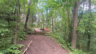
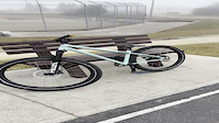
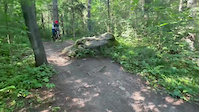
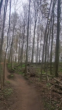
Photos of Kitchener-Waterloo Mountain Bike
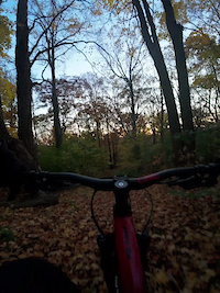
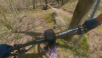
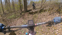
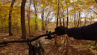
Videos of Kitchener-Waterloo Mountain Bike
trail: Adam's Run
0:09 |
2 |
Jun 20, 2026
trail: Single track with jump
0:12 |
6 |
Nov 2, 2025
trail: Arriscraft
0:11 |
22 |
May 13, 2025
trail: Arriscraft
0:06 |
12 |
May 13, 2025
0:20 |
|
May 5, 2025
trail: Muddy Paws
0:09 |
71 |
Mar 22, 2023
trail: Adam's Run
0:15 |
409 |
Aug 5, 2021
trail: Emotional Roller Coaster
0:48 |
450 |
May 7, 2021
Current Trail Warnings
| status | trail | date | condition | user | info |
|---|---|---|---|---|---|
| Dead Camel Bend | Jun 20, 2026 @ 10:49am (America/Toronto) Jun 20, 2026 | Ideal | Joel123456 KWTA |
Recent Trail Reports
| status | trail | date | condition | info | user |
|---|---|---|---|---|---|
| Kaitlyn's Switchbacks | Jun 23, 2026 @ 5:53pm (America/Toronto) Jun 23, 2026 | Ideal | phatcat | ||
| Crazy Carter | Jun 20, 2026 @ 10:49am (America/Toronto) Jun 20, 2026 | Ideal | Joel123456 KWTA | ||
| Sweet Street Expert section | Jun 20, 2026 @ 10:49am (America/Toronto) Jun 20, 2026 | Ideal | Joel123456 KWTA | ||
| Jake's Breakaway | Jun 20, 2026 @ 10:49am (America/Toronto) Jun 20, 2026 | Ideal | Joel123456 KWTA | ||
| Mountain Goat Loop | Jun 20, 2026 @ 10:49am (America/Toronto) Jun 20, 2026 | Ideal | Joel123456 KWTA | ||
| Jake's Attack | Jun 20, 2026 @ 10:49am (America/Toronto) Jun 20, 2026 | Ideal | Joel123456 KWTA | ||
| Sweet Street | Jun 20, 2026 @ 10:49am (America/Toronto) Jun 20, 2026 | Ideal | Joel123456 KWTA | ||
| Scrambler | Jun 20, 2026 @ 10:49am (America/Toronto) Jun 20, 2026 | Ideal | Joel123456 KWTA | ||
| Dirty Donna's Downhill | Jun 20, 2026 @ 10:49am (America/Toronto) Jun 20, 2026 | Ideal | Joel123456 KWTA | ||
| Up Schmidts Creek | Jun 20, 2026 @ 10:49am (America/Toronto) Jun 20, 2026 | Ideal | Joel123456 KWTA |
Activity Feed
| username | action | type | title | date |
|---|---|---|---|---|
| RichD76 | wishlist | region | activity #98116459 | Jun 30, 2026 @ 2:42am 1 day |
| Drose72 | wishlist | trail | activity #98004782 | Jun 28, 2026 @ 10:40am 3 days |
| francisgagnon | ridden | trail | activity #97995188 | Jun 28, 2026 @ 8:58am 3 days |
| phatcat | add | report | activity #97667354 | Jun 23, 2026 @ 6:43pm Jun 23, 2026 |
| KevinWaterloo | vote | trail | activity #97443161 | Jun 20, 2026 @ 4:55pm Jun 20, 2026 |
Recent Comments
| username | type | title | comment | date |
|---|---|---|---|---|
| trail | @Djangoh @Canadmos is right. The open area... | Oct 28, 2025 @ 7:39am Oct 28, 2025 | ||
| trail | Wild guess, but these types of public jump... | Oct 28, 2025 @ 5:16am Oct 28, 2025 | ||
| trail | No one at thehydrocut.ca has replied to my... | Oct 27, 2025 @ 6:45pm Oct 27, 2025 | ||
| trail | No one at thehydrocut.ca has replied to my... | Oct 12, 2025 @ 9:43am Oct 12, 2025 | ||
| trail | Why has this bike park been abandoned? And... | Oct 12, 2025 @ 5:38am Oct 12, 2025 |
Local Badges
-

10 Black Trails1,435 awarded -

Epic Ride 50k1,944 awarded -

Top 10 Trails1,875 awarded -

Completionist376 awarded -
Completionist3 awarded -

10 Green Trails482 awarded
Bike & Skill Parks
| name | type | city | rating |
|---|---|---|---|
| McLennan Park | skill park | Kitchener-Waterloo | |
| Chicopee Pump Track | skill park | Kitchener-Waterloo | |
| Chicopee Pines Stunt Park | skill park | Kitchener-Waterloo | |
| RIM Park Pumptrack | skill park | Kitchener-Waterloo |
Activity Type Stats
| activitytype | trails | distance | descent | descent distance | total vertical | rating | global rank | state rank | photos | reports | routes | ridelogs |
|---|---|---|---|---|---|---|---|---|---|---|---|---|
| Mountain Bike | 509 | 172 miles | 12,136 ft | 63 miles | 479 ft | #43 | #4 | 474 | 4,526 | 13 | 65,516 | |
| E-Bike | 313 | 96 miles | 6,411 ft | 35 miles | 443 ft | #501 | #37 | 1 | 4,269 | 6 | 1,725 | |
| Gravel Bike | 6 | #271 | #38 | 2 | 2 | 346 | ||||||
| Adaptive Bike | 3 | #125 | #67 | 7 | ||||||||
| Winter Fat Bike | 6 | #143 | #63 | 3 | 7 | 32 | ||||||
| Horse | 14 | 3 miles | 187 ft | 1 mile | 272 ft | #1,119 | #17 | 730 | 1 | 1 | ||
| Hike | 459 | 162 miles | 10,817 ft | 58 miles | 479 ft | #255 | #4 | 186 | 4,443 | 1 | 1,809 | |
| Trail Running | 459 | 165 miles | 10,932 ft | 60 miles | 479 ft | #393 | #5 | 1 | 4,442 | 3 | 3,877 | |
| Dirtbike/Moto | 9 | 2 miles | 128 ft | 4,682 ft | 118 ft | #637 | #10 | 732 | 1 | 3 | ||
| Snowshoe | 114 | 24 miles | 2,116 ft | 9 miles | 348 ft | #179 | #20 | 28 | 93 | |||
| Downhill Ski | 12 | 2 miles | 167 ft | 5,000 ft | 272 ft | #406 | #10 | 17 | 84 | |||
| Backcountry Ski | 22 | 2 miles | 197 ft | 5,207 ft | 174 ft | #316 | #2 | 3 | 51 | |||
| Nordic Ski | 71 | 14 miles | 797 ft | 4 miles | 302 ft | #257 | #14 | 4 | 801 |
Frequently Asked Questions About Kitchener-Waterloo
▼
What are the best places to ride in Kitchener-Waterloo?
Kitchener-Waterloo has 13 areas to explore for mountain biking. The top rated areas are:
▼
What are the highest rated mountain biking trails in Kitchener-Waterloo?
The highest rated mountain biking trails in Kitchener-Waterloo are:
- Muddy Paws (4.6/5)
- Flow Thru (4.5/5)
- Captain Crunch (4.5/5)
- Adam's Run (4.4/5)
- Sweet Street Expert section (4.4/5)
▼
What is the best time of the year to ride in Kitchener-Waterloo?
Based on ride log data, the most popular months to ride in Kitchener-Waterloo are:
- July (896 activities)
- August (757 activities)
- June (672 activities)
▼
Where can I park to ride in Kitchener-Waterloo?
There are 24 parking locations listed in Kitchener-Waterloo. The most popular parking spots are: View all parking and trailhead locations on the map to plan your visit.
Activities
- Kitchener-Waterloo Mountain Biking Trails
- Kitchener-Waterloo E-Biking Trails
- Kitchener-Waterloo Gravel Biking Trails
- Kitchener-Waterloo Winter Fat Biking Trails
- Kitchener-Waterloo Horseback Trails
- Kitchener-Waterloo Hiking Trails
- Kitchener-Waterloo Trail Running Trails
- Kitchener-Waterloo Dirtbiking Trails
- Kitchener-Waterloo Snowshoeing Trails
- Kitchener-Waterloo Skiing Trails
- Kitchener-Waterloo Backcountry Skiing Trails
- Kitchener-Waterloo Nordic Skiing Trails
Trails
- Hard trails in Kitchener-Waterloo
- Easy trails in Kitchener-Waterloo
- Favorite trails in Kitchener-Waterloo
- Most ridden trails in Kitchener-Waterloo
- Singletrack in Kitchener-Waterloo
- Viewpoint trails in Kitchener-Waterloo
- Trails with technical features in Kitchener-Waterloo
- Race routes in Kitchener-Waterloo
- By brenthillier
 NSMBA TRAILFORKS & contributors
 - Admins: WCC, HTC
- #3286 - 43,747 views
- kitchener-waterloo activity log | embed map of Kitchener-Waterloo mountain bike trails | kitchener-waterloo mountain biking points of interest polygons
Downloading of trail gps tracks in kml & gpx formats is enabled for Kitchener-Waterloo.
You must login to download files.