close
-
Layers w
- Weather Layers
- Pro
- Pro
- Pro
- Pro
- Pro
- Pro
- More Layers
- Pro
- Pro
- Pro
- Pro
-
Upgrade to

3D
Trail Conditions
- Unknown
- Snow Groomed
- Snow Packed
- Snow Covered
- Snow Cover Partial
- Freeze/thaw Cycle
- Icy
- Prevalent Mud
- Wet
- Variable
- Ideal
- Dry
- Very Dry
Trail Flow (Ridden Direction)
Trailforks scans users ridelogs to determine the most popular direction each trail is ridden. A good flowing trail network will have most trails flowing in a single direction according to their intension.
The colour categories are based on what percentage of riders are riding a trail in its intended direction.
The colour categories are based on what percentage of riders are riding a trail in its intended direction.
- > 96%
- > 90%
- > 80%
- > 70%
- > 50%
- < 50%
- bi-directional trail
- no data
Trail Last Ridden
Trailforks scans ridelogs to determine the last time a trail was ridden.
- < 2 days
- < 1 week
- < 2 weeks
- < 1 month
- < 6 months
- > 6 months
Trail Ridden Direction
The intended direction a trail should be ridden.
- Downhill Only
- Downhill Primary
- Both Directions
- Uphill Primary
- Uphill Only
- One Direction
Contribute Details
Colors indicate trail is missing specified detail.
- Description
- Photos
- Description & Photos
- Videos
Trail Popularity ?
Trailforks scans ridelogs to determine which trails are ridden the most in the last 9 months.
Trails are compared with nearby trails in the same city region with a possible 25 colour shades.
Think of this as a heatmap, more rides = more kinetic energy = warmer colors.
- most popular
- popular
- less popular
- not popular
ATV/ORV/OHV Filter
Max Vehicle Width
inches
US Cell Coverage
Legend

Radar Time
Activity Recordings
Trailforks uses anonymized public activity data.
?
Activity Recordings
Trailforks uses anonymized public activity data.
?
Personal Heatmap
▶
Activity Types
all
/
none
▶
Options
2
Date range
month
–
Winter Trails
Warning
A routing network for winter maps does not exist. Selecting trails using the winter trails layer has been disabled.
Missing Trails
Most Popular
Least Popular
Trails are colored based on popularity. The more popular a trail is, the more red. Less popular trails trend towards green.
Jump Magnitude Heatmap
Heatmap of where riders jump on trails. Zoom in to see individual jumps, click circles to view jump details.
BC Backroad Status
![map legend]()
Service Road Atlas is a free to use, community-driven service for viewing and creating reports on the numerous back-country service roads around B.C. and Alberta.

Slope Aspect
Direction the slope faces
Trails Deemphasized
Trails are shown in grey.
Only show trails with no bike usage.
Suggested Layers
Based on selected activity type
Save the current map location and zoom level as your default home location whenever this page is loaded.
SaveMoore Park Trails
Activities Click to view
- Mountain Bike
165 trails
- E-Bike
63 trails
- Gravel Bike
0 trails
- Adaptive Bike
1 trails
- Winter Fat Bike
0 trails
- Horse
96 trails
- Hike
235 trails
- Trail Running
233 trails
Region Details
- 26
- 5
- 53
- 51
- 24
- 6
Region Status
Open as of 1 dayStats
- Avg Trail Rating
- Trails (view details)
- 279
- Trails Mountain Bike
- 165
- Trails E-Bike
- 63
- Trails Adaptive Bike
- 1
- Trails Horse
- 96
- Trails Hike
- 235
- Trails Trail Running
- 233
- Total Distance
- 546 miles
- Total Descent
- 62,271 ft
- Total Vertical
- 5,860 ft
- Highest Trailhead
- 9,488 ft
- Reports
- 1,261
- Photos
- 661
- Ridden Counter
- 17,691
Articles
Traveling on a Budget? These 10 U.S. National Parks Are the Most Affordable to Visit.
Jun 16, 2024 from outsideonline.com
Our parks expert has put together long weekend trips for as little as $204, with details on free entrance fees and campsites, and active...
Sub Regions
-
Brown Mountain
- 12
- 5
-
Hogsback
- 1
-
Keno
- 3
- 2
-
Moore Mountain
- 2
- 29
- 28
- 9
- 3
-
Spence Mountain
- 11
- 19
- 11
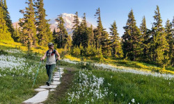
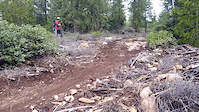
Popular Klamath Falls Mountain Biking Trails
• 100 ★ 4.5 • 5 miles • 1,383 ft • 628 •
This trail is predominantly uphill but can be ridden both ways. The lower half gets a fair amount of hikers, so downhill traffic should be careful. This is a fairly classic singletrack using existing rocks for features - all climbable,...
• 100 ★ 3.5 • 1,250 ft • 3 ft • 522 •
Hand-built during an IMBA trail meeting a couple years ago. A little rocky, and a nice bermed corner.
• 90 ★ 3.9 • 2 miles • 32 ft • 518 •
This is a downhill one-way flow trail. The first mile has lots of berms, tabletops and small jumps. The last mile of the trail is a little narrower in the trees with short rocky sections, but nothing to slow you down too much.
• 75 ★ 4.4 • 2 miles • 160 ft • 376 •
will start as a fun "enduro" style DH trail with berms, rocks and jumps with similar features found throughout the entire length of trail. Use to connect to Lower Hooligan for 5 miles of exceptional downhill riding engineered by Dirt...
• 90 ★ 4.5 • 6 miles • 1,614 ft • 322 •
A great new from Klamath Trails Alliance and built by the pros at Dirt Mechanics. Incredibly scenery and a great way to get to the top of Spence.
• 100 ★ 4.8 • 2 miles • 0 ft • 302 •
is a flow trail that is wide, smooth, with bermed corners and lots of jumps (mainly tabletops and a few small doubles on the blue portion).
• 70 ★ 0.0 • 2,481 ft • 3 ft • 260 •
A rocky and steep trail. Good as a downhill run, but very difficult as a climb. A couple of extremely steep sections on switchbacks and right at the upper entrance.
• 95 ★ 4.8 • 2,805 ft • 0 ft • 258 •
is a flow trail that is wide, smooth with large berms and lots of jumps (mainly doubles on the black portion). Everything can be rolled as needed.
Klamath Falls Mountain Bike Routes
6 miles • 946 ft • 4 •
It's a pretty simple plan, climb up to the top of and hit it hard! Take a break at the parking lot, refuel...
★ 5.0 • 19 miles • 1,761 ft • 2 • Loop •
Overview Head to Lake of the Woods for endless views, deep forests, and alpine lakes, a scenic one-hour...
12 miles • 2,180 ft • 4 • Loop •
The north side of Spence Mountain has some fabulously techy downhills that are a must-ride for expert...
★ 4.4 • 15 miles • 2,427 ft • 28 • Loop •
A full value, singletrack only loop linking the best downhill sections ( & Lower Hooligan) with...
6 miles • 781 ft • 3 • Loop •
Quick climb and short fire road traverse for the flow keys section of Hooligan. A great loop for when...
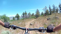
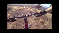
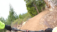
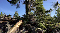
Photos of Klamath Falls Mountain Bike
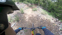
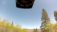
Videos of Klamath Falls Mountain Bike
trail: North Ridge
3:55 |
1264 |
Jun 11, 2017
trail: Spence Mt South Ridge
0:12 |
341 |
Apr 26, 2016
trail: Tunnel of Love
0:42 |
147 |
May 26, 2015
trail: Buzzard
2:12 |
148 |
May 26, 2015
trail: Salted Fatback
0:39 |
660 |
Apr 29, 2015

trail: Junker
22:49 |
332 |
Apr 26, 2015
trail: Spence Mt South Ridge
13:00 |
648 |
Apr 11, 2015
trail: Spence Mt South Ridge
0:23 |
352 |
Mar 8, 2015
Recent Trail Reports
| status | trail | date | condition | info | user |
|---|---|---|---|---|---|
| Upper Endo | Jun 16, 2026 @ 3:37pm (America/Los_Angeles) 1 day | Unknown | OG_MTB_831 | ||
| Peak Tie | Jun 5, 2026 @ 3:15pm (America/Los_Angeles) Jun 5, 2026 | Dry | everettw | ||
| Queen of the Lake | May 29, 2026 @ 5:23pm (America/Los_Angeles) May 29, 2026 | Ideal | Dang3 | ||
| North Ridge | May 28, 2026 @ 6:52pm (America/Los_Angeles) May 28, 2026 | Dry | kwietrick | ||
| Brown Mountain Loop | May 27, 2026 @ 2:46pm (America/Los_Angeles) May 27, 2026 | Ideal | brundlefly | ||
| Old Eagle | May 25, 2026 @ 12:53pm (America/Boise) May 25, 2026 | Ideal | RsinFyter | ||
| IMBA Trail | May 25, 2026 @ 11:02am (America/Los_Angeles) May 25, 2026 | Dry | Jasoncoatney | ||
| Spence Mt South Ridge | May 25, 2026 @ 11:02am (America/Los_Angeles) May 25, 2026 | Dry | Jasoncoatney | ||
| Eulana | May 24, 2026 @ 5:41pm (America/Boise) May 24, 2026 | Ideal | RsinFyter | ||
| Chinquapin | May 19, 2026 @ 2:09pm (America/Los_Angeles) May 19, 2026 | Dry | everettw |
Activity Feed
| username | action | type | title | date |
|---|---|---|---|---|
| ws2158 | vote | route | activity #97143313 | Jun 16, 2026 @ 3:58pm 1 day |
| ws2158 | ridden | route | activity #97143308 | Jun 16, 2026 @ 3:58pm 1 day |
| OG_MTB_831 | add | report | activity #97141962 | Jun 16, 2026 @ 3:37pm 1 day |
| mgoodm3 | add | trail | activity #97135276 and 5 more | Jun 16, 2026 @ 1:36pm 2 days |
| Ccball0525 | wishlist | trail | activity #97023661 | Jun 14, 2026 @ 10:30pm Jun 14, 2026 |
Recent Comments
| username | type | title | comment | date |
|---|---|---|---|---|
| trail | NOT an “aggressive” DH trail. More of an... | Jun 11, 2026 @ 12:13pm Jun 11, 2026 | ||
| trail | It does not appear that there have been many... | Jun 7, 2026 @ 2:27pm Jun 7, 2026 | ||
| trail | great trail system. lots of green-blue tech... | Jun 2, 2026 @ 8:31pm Jun 2, 2026 | ||
| trail | I'm | May 29, 2026 @ 9:28pm May 29, 2026 | ||
| trail | Dirt Mechanics strike again. More fun than a... | May 25, 2026 @ 9:00pm May 25, 2026 |
Local Badges
-

Completionist0 awarded -

Big Ride 30k1,223 awarded -

Epic Ride 50k389 awarded -

Top 10 Trails16 awarded -
Completionist0 awarded -
Completionist0 awarded
Bike & Skill Parks
| name | type | city | rating |
|---|---|---|---|
| Moore Park Bike Skills Area | skill park | Klamath Falls |
Activity Type Stats
| activitytype | trails | distance | descent | descent distance | total vertical | rating | global rank | state rank | photos | reports | routes | ridelogs |
|---|---|---|---|---|---|---|---|---|---|---|---|---|
| Mountain Bike | 165 | 296 miles | 37,290 ft | 137 miles | 2,756 ft | #446 | #165 | 637 | 1,258 | 22 | 16,783 | |
| E-Bike | 63 | 86 miles | 12,684 ft | 39 miles | 2,073 ft | #532 | #727 | 2 | 970 | 1 | 1,354 | |
| Adaptive Bike | 1 | #627 | #849 | |||||||||
| Horse | 96 | 320 miles | 25,285 ft | 124 miles | 4,554 ft | #49 | #337 | 9 | 298 | 23 | ||
| Hike | 235 | 508 miles | 55,400 ft | 208 miles | 5,860 ft | #102 | #58 | 15 | 1,224 | 3 | 2,658 | |
| Trail Running | 233 | 507 miles | 56,289 ft | 209 miles | 5,860 ft | #170 | #76 | 1,229 | 3 | 1,410 |
Frequently Asked Questions About Klamath Falls
▼
What are the best places to ride in Klamath Falls?
Klamath Falls has 8 areas to explore for mountain biking. The top rated areas are:
▼
What are the highest rated mountain biking trails in Klamath Falls?
The highest rated mountain biking trails in Klamath Falls are:
- Nighthawk (4.4/5)
- North Ridge (4.4/5)
- Spence Mt South Ridge (4.4/5)
- Chinquapin (4.3/5)
- Junker (4.3/5)
▼
What is the best time of the year to ride in Klamath Falls?
Based on ride log data, the most popular months to ride in Klamath Falls are:
- July (266 activities)
- October (190 activities)
- May (177 activities)
▼
Where can I park to ride in Klamath Falls?
There are 46 parking locations listed in Klamath Falls. The most popular parking spots are: View all parking and trailhead locations on the map to plan your visit.
Activities
Trails
Points of Interest
- Hogback Mountain Summit
- Sunset Campground Camping
- Aspen Point Campground Camping
- Fish Lake Campground Camping
- Doe Point Campground Summit
- North Fork Campground Camping
- Brown Mountain Summit
- Union Peak Summit
- Mount Scott Summit
- Garfield Peak Summit
- Aspen Butte (2,502 m)
- Gearhart Mountain (2,451 m)
- Mount Harriman (2,407 m)
- By ACLakey
 & contributors
 - Admins: KTA
- #3356 - 19,579 views
- klamath falls activity log | embed map of Klamath Falls mountain bike trails | klamath falls mountain biking points of interest
Downloading of trail gps tracks in kml & gpx formats is enabled for Klamath Falls.
You must login to download files.