close
-
Layers w
- Weather Layers
- Pro
- Pro
- Pro
- Pro
- Pro
- Pro
- More Layers
- Pro
- Pro
- Pro
- Pro
-
Upgrade to

3D
Trail Conditions
- Unknown
- Snow Groomed
- Snow Packed
- Snow Covered
- Snow Cover Partial
- Freeze/thaw Cycle
- Icy
- Prevalent Mud
- Wet
- Variable
- Ideal
- Dry
- Very Dry
Trail Flow (Ridden Direction)
Trailforks scans users ridelogs to determine the most popular direction each trail is ridden. A good flowing trail network will have most trails flowing in a single direction according to their intension.
The colour categories are based on what percentage of riders are riding a trail in its intended direction.
The colour categories are based on what percentage of riders are riding a trail in its intended direction.
- > 96%
- > 90%
- > 80%
- > 70%
- > 50%
- < 50%
- bi-directional trail
- no data
Trail Last Ridden
Trailforks scans ridelogs to determine the last time a trail was ridden.
- < 2 days
- < 1 week
- < 2 weeks
- < 1 month
- < 6 months
- > 6 months
Trail Ridden Direction
The intended direction a trail should be ridden.
- Downhill Only
- Downhill Primary
- Both Directions
- Uphill Primary
- Uphill Only
- One Direction
Contribute Details
Colors indicate trail is missing specified detail.
- Description
- Photos
- Description & Photos
- Videos
Trail Popularity ?
Trailforks scans ridelogs to determine which trails are ridden the most in the last 9 months.
Trails are compared with nearby trails in the same city region with a possible 25 colour shades.
Think of this as a heatmap, more rides = more kinetic energy = warmer colors.
- most popular
- popular
- less popular
- not popular
ATV/ORV/OHV Filter
Max Vehicle Width
inches
US Cell Coverage
Legend

Radar Time
Activity Recordings
Trailforks uses anonymized public activity data.
?
Activity Recordings
Trailforks uses anonymized public activity data.
?
Personal Heatmap
▶
Activity Types
all
/
none
▶
Options
2
Date range
month
–
Winter Trails
Warning
A routing network for winter maps does not exist. Selecting trails using the winter trails layer has been disabled.
Missing Trails
Most Popular
Least Popular
Trails are colored based on popularity. The more popular a trail is, the more red. Less popular trails trend towards green.
Jump Magnitude Heatmap
Heatmap of where riders jump on trails. Zoom in to see individual jumps, click circles to view jump details.
BC Backroad Status
![map legend]()
Service Road Atlas is a free to use, community-driven service for viewing and creating reports on the numerous back-country service roads around B.C. and Alberta.

Slope Aspect
Direction the slope faces
Trails Deemphasized
Trails are shown in grey.
Only show trails with no bike usage.
Suggested Layers
Based on selected activity type
Save the current map location and zoom level as your default home location whenever this page is loaded.
SaveThis was the venue for the National Secondary Schools MTB Champs up until 2012?
Trails are clay based and very slippery when wet. These trails are really enjoyable but sadly it doesn't look as if Levin MTB Club are doing much as far as maintenance and building new trails?
Thoroughly recommended to check out if you are heading past on travels
Trails are clay based and very slippery when wet. These trails are really enjoyable but sadly it doesn't look as if Levin MTB Club are doing much as far as maintenance and building new trails?
Thoroughly recommended to check out if you are heading past on travels
Primary Trail Type: Cross-Country
Land Status: City Managed
 google parking directions
 Access Info:
30 Denton Road, Levin
Activities Click to view
- Mountain Bike
10 trails
- Hike
6 trails
- Trail Running
6 trails
Region Details
- 2
- 4
- 1
- 2
Region Status
Caution as of May 3, 2026Stats
- Avg Trail Rating
- Trails (view details)
- 10
- Trails Mountain Bike
- 10
- Trails E-Bike
- 3
- Trails Hike
- 6
- Trails Trail Running
- 6
- Total Distance
- 10 miles
- Total Descent
- 4,346 ft
- Total Vertical
- 973 ft
- Highest Trailhead
- 1,242 ft
- Reports
- 77
- Photos
- 37
- Ridden Counter
- 471
Popular Kohitere Forest Mountain Biking Trails
• 85 ★ 4.5 • 1 mile • 951 ft • 74 •
Singletrack climb that takes you up to the top of the trig 4x4 trail, from there the trails are undulating to the awesome Gardiner trail or turn straight down the hill on the trail
• 65 ★ 4.0 • 1 mile • 280 ft • 51 •
Moderately popular blue difficulty singletrack. This mountain bike primary trail can be used uphill primary and has a moderate overall physical rating with a 280 ft blue climb. On average it takes 12 minutes to complete this trail.
• 55 ★ 5.0 • 3,465 ft • 20 ft • 44 •
Moderately popular green difficulty dirt/gravel road. This mountain bike primary trail can be used both directions. On average it takes 8 minutes to complete this trail.
• 95 ★ 5.0 • 3,540 ft • 0 ft • 42 •
The is a fast and techy double black diamond trail packed with features. Best ridden in dry conditions, there are multiple steep chutes, gap jumps, drops, a rock garden, etc. Its a good idea to check out some of the bigger jumps before...
• 75 ★ 4.0 • 4,375 ft • 211 ft • 34 •
Takes you across the middle skipping out the top trig climb over to . Un names so came up with this. out in the open as it has been logged a few years a go
• 45 ★ 5.0 • 1,522 ft • 3 ft • 6 •
Moderately popular advanced difficulty singletrack. This mountain bike primary trail can be used downhill only. Adaptive MTB rating: amtb blue. Trail visibility is always easy to follow. On average it takes 3 minutes to complete this trail.
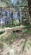
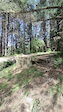
Photos of Kohitere Forest Mountain Bike
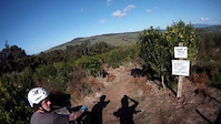
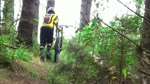
Videos of Kohitere Forest Mountain Bike
trail: DH Track
0:05 |
260 |
Jan 1, 2022

trail: DH Track
0:25 |
131 |
Jan 1, 2022
trail: DH Track
0:04 |
66 |
Jan 1, 2022

trail: DH Track
3:28 |
1843 |
May 25, 2014

trail: DH Track
3:30 |
938 |
Mar 24, 2014
trail: DH Track
2:12 |
573 |
Sep 4, 2011
trail: DH Track
2:57 |
1550 |
Jan 30, 2011

trail: DH Track
5:13 |
545 |
Nov 2, 2009
Recent Trail Reports
| status | trail | date | condition | info | user |
|---|---|---|---|---|---|
| Edge | Feb 22, 2026 @ 4:32pm (Pacific/Auckland) Feb 21, 2026 | Dry | cdine | ||
| Kurts Track | Jan 6, 2026 @ 11:45am (Pacific/Auckland) Jan 5, 2026 | Dry | Jaket30X3u | ||
| Back track | May 19, 2024 @ 2:52pm May 19, 2024 | Wet | newbermuda | ||
| Fern | May 19, 2024 @ 2:51pm May 19, 2024 | Wet | newbermuda | ||
| Top 4x4 | Jan 10, 2022 @ 6:06pm Jan 10, 2022 | Unknown | Markneilson | ||
| Double Dipper | Jul 2, 2021 @ 11:22pm Jul 2, 2021 | Variable | Farmzy | ||
| Lower Top Track | Oct 21, 2018 @ 7:26pm Oct 21, 2018 | Variable | DocNZ |
Activity Feed
| username | action | type | title | date |
|---|---|---|---|---|
| xCoster | wishlist | region | activity #95288525 | May 22, 2026 @ 9:06pm May 22, 2026 |
| cdine | add | report | activity #89335242 | Feb 22, 2026 @ 1:53am Feb 22, 2026 |
| Jaket30X3u | add | report | activity #86877788 | Jan 8, 2026 @ 6:20pm Jan 8, 2026 |
| SeanBurkhalter | comment | trail | activity #85708877 | Dec 18, 2025 @ 12:50pm Dec 18, 2025 |
| MarkcMtgH | comment | trail | activity #69167739 | Apr 7, 2025 @ 12:15am Apr 7, 2025 |
Recent Comments
| username | type | title | comment | date |
|---|---|---|---|---|
| trail | Do the trails still run because I heard that... | Dec 18, 2025 @ 12:50pm Dec 18, 2025 | ||
| trail | Hill has been logged. From what I could see on... | Apr 7, 2025 @ 12:15am Apr 7, 2025 | ||
| trail | Forest is closed until April 2025. Not sure... | Jan 19, 2025 @ 5:58pm Jan 19, 2025 | ||
| trail | I couldn't find the top section due to new... | Sep 7, 2023 @ 11:59pm Sep 7, 2023 | ||
| trail | Running nicely in interesting bottom third.... | Apr 3, 2021 @ 1:37am Apr 3, 2021 |
Nearby Areas
| name | distance | ||||
|---|---|---|---|---|---|
| Mt Thompson | 2 | 9.4 km | |||
| Foxton MTB Trails | 4 | 13.4 km | |||
| Foxton Beach MTB Trails | 14.7 km | ||||
| Tararua Forest Park | 18.1 km | ||||
| Arapuke Forest | 4 | 11 | 7 | 1 | 18.8 km |
Activity Type Stats
| activitytype | trails | distance | descent | descent distance | total vertical | rating | global rank | state rank | photos | reports | routes | ridelogs |
|---|---|---|---|---|---|---|---|---|---|---|---|---|
| Mountain Bike | 10 | 10 miles | 4,347 ft | 6 miles | 974 ft | #4,109 | #90 | 37 | 77 | 787 | ||
| E-Bike | 3 | 2 miles | 1,503 ft | 2 miles | 784 ft | 38 | 23 | |||||
| Hike | 6 | 7 miles | 2,336 ft | 4 miles | 938 ft | #10,329 | #203 | 56 | 47 | |||
| Trail Running | 6 | 7 miles | 2,336 ft | 4 miles | 938 ft | #9,465 | #184 | 56 | 24 |
Frequently Asked Questions About Kohitere Forest
▼
What are the highest rated mountain biking trails in Kohitere Forest?
The highest rated mountain biking trails in Kohitere Forest are:
- Edge (4.4/5)
- DH Track (4.3/5)
- Goat Track (4.2/5)
- Fern (4.1/5)
- Back track (4.1/5)
▼
What is the best time of the year to ride in Kohitere Forest?
Based on ride log data, the most popular months to ride in Kohitere Forest are:
- April (13 activities)
- October (8 activities)
- November (7 activities)
▼
Where can I park to ride in Kohitere Forest?
There are 1 parking locations listed in Kohitere Forest. The most popular parking spots are:
▼
What is the longest trail in Kohitere Forest?
The longest trail in Kohitere Forest is Gardener at 1.6 miles. View all trails sorted by distance.
- By mccmartini
 MCG & contributors
 - Admins: apply
- #5785 - 7,155 views
- kohitere forest activity log | embed map of Kohitere Forest mountain bike trails | kohitere forest mountain biking points of interest
Downloading of trail gps tracks in kml & gpx formats is enabled for Kohitere Forest.
You must login to download files.