close
-
Layers w
- Weather Layers
- Pro
- Pro
- Pro
- Pro
- Pro
- Pro
- More Layers
- Pro
- Pro
- Pro
- Pro
-
Upgrade to

3D
Trail Conditions
- Unknown
- Snow Groomed
- Snow Packed
- Snow Covered
- Snow Cover Partial
- Freeze/thaw Cycle
- Icy
- Prevalent Mud
- Wet
- Variable
- Ideal
- Dry
- Very Dry
Trail Flow (Ridden Direction)
Trailforks scans users ridelogs to determine the most popular direction each trail is ridden. A good flowing trail network will have most trails flowing in a single direction according to their intension.
The colour categories are based on what percentage of riders are riding a trail in its intended direction.
The colour categories are based on what percentage of riders are riding a trail in its intended direction.
- > 96%
- > 90%
- > 80%
- > 70%
- > 50%
- < 50%
- bi-directional trail
- no data
Trail Last Ridden
Trailforks scans ridelogs to determine the last time a trail was ridden.
- < 2 days
- < 1 week
- < 2 weeks
- < 1 month
- < 6 months
- > 6 months
Trail Ridden Direction
The intended direction a trail should be ridden.
- Downhill Only
- Downhill Primary
- Both Directions
- Uphill Primary
- Uphill Only
- One Direction
Contribute Details
Colors indicate trail is missing specified detail.
- Description
- Photos
- Description & Photos
- Videos
Trail Popularity ?
Trailforks scans ridelogs to determine which trails are ridden the most in the last 9 months.
Trails are compared with nearby trails in the same city region with a possible 25 colour shades.
Think of this as a heatmap, more rides = more kinetic energy = warmer colors.
- most popular
- popular
- less popular
- not popular
ATV/ORV/OHV Filter
Max Vehicle Width
inches
US Cell Coverage
Legend

Radar Time
Activity Recordings
Trailforks uses anonymized public activity data.
?
Activity Recordings
Trailforks uses anonymized public activity data.
?
Personal Heatmap
▶
Activity Types
all
/
none
▶
Options
2
Date range
month
–
Winter Trails
Warning
A routing network for winter maps does not exist. Selecting trails using the winter trails layer has been disabled.
Missing Trails
Most Popular
Least Popular
Trails are colored based on popularity. The more popular a trail is, the more red. Less popular trails trend towards green.
Jump Magnitude Heatmap
Heatmap of where riders jump on trails. Zoom in to see individual jumps, click circles to view jump details.
BC Backroad Status
![map legend]()
Service Road Atlas is a free to use, community-driven service for viewing and creating reports on the numerous back-country service roads around B.C. and Alberta.

Slope Aspect
Direction the slope faces
Trails Deemphasized
Trails are shown in grey.
Only show trails with no bike usage.
Suggested Layers
Based on selected activity type
Save the current map location and zoom level as your default home location whenever this page is loaded.
SaveThis region is Unsanctioned, Ride at your own Risk!
No description for Kolín has been added yet! Login or register to submit one.This region uses the Uk/Euro style trail grading system.
Activities Click to view
- Mountain Bike
16 trails
- E-Bike
14 trails
- Hike
7 trails
- Trail Running
9 trails
Region Details
- 6
- 7
- 2
- 1
Region Status
Caution as of May 29, 2026Stats
- Avg Trail Rating
- Trails (view details)
- 16
- Trails Mountain Bike
- 16
- Trails E-Bike
- 14
- Trails Horse
- 1
- Trails Hike
- 7
- Trails Trail Running
- 9
- Total Distance
- 8 miles
- Total Descent
- 1,310 ft
- Total Vertical
- 279 ft
- Highest Trailhead
- 998 ft
- Reports
- 144
- Photos
- 29
- Ridden Counter
- 1,194
Sub Regions
-
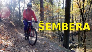
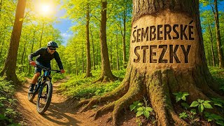
Šemberské stezky
- 3
- 4
- 1
- 2
-
Údolí Šembery
- 1
- 1
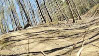
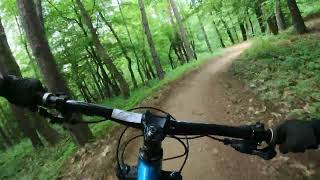
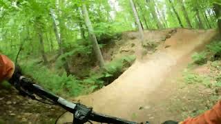
Popular Kolín Mountain Biking Trails
• 75 ★ 4.4 • 1,713 ft • 0 ft • 191 •
Trailu převážuje charakter flow s utaženějšími klopenými zatáčkami a drsnějším povrchem. V horní druhé čtvrtině je technické místo, kde je za sebou příkrá lávka, malý drop a příkrý rock garden v zatáčce....
Photos of Kolín Mountain Bike
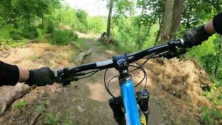
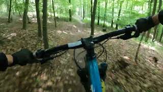
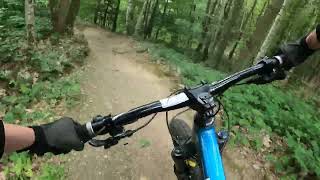
Videos of Kolín Mountain Bike
trail: Hláska
0:07 |
190 |
Apr 21, 2022
trail: Marná snaha
0:17 |
89 |
Jul 12, 2025 , Kolín
trail: Klouzek
0:44 |
85 |
Jul 12, 2025 , Kolín
trail: Mrzák
2:05 |
48 |
Jul 10, 2025 , Kolín
trail: Plynovod
2:50 |
36 |
Jul 9, 2025 , Kolín
trail: Hláska
3:41 |
69 |
Jul 7, 2025 , Kolín
trail: Boulder
0:03 |
47 |
May 4, 2025 , Kolín
trail: Propojovák
11:54 |
24 |
Apr 13, 2025 , Kolín
Recent Trail Reports
| status | trail | date | condition | info | user |
|---|---|---|---|---|---|
| Hláska | Apr 26, 2026 @ 3:45pm (Europe/Prague) Apr 26, 2026 | Dry | Dragomira | ||
| Dropy | Apr 26, 2026 @ 3:45pm (Europe/Prague) Apr 26, 2026 | Unknown | Dragomira | ||
| Marná snaha | Apr 26, 2026 @ 3:45pm (Europe/Prague) Apr 26, 2026 | Dry | Dragomira | ||
| Jormungandr | Apr 26, 2026 @ 3:45pm (Europe/Prague) Apr 26, 2026 | Dry | Dragomira | ||
| Propojovák | Apr 26, 2026 @ 3:45pm (Europe/Prague) Apr 26, 2026 | Dry | Dragomira | ||
| Plynovod | Apr 26, 2026 @ 3:45pm (Europe/Prague) Apr 26, 2026 | Dry | Dragomira | ||
| Stoupák Express | Apr 16, 2026 @ 5:13pm (Europe/Prague) Apr 16, 2026 | Ideal | Tomaszidek | ||
| Mrzák | Apr 16, 2026 @ 5:13pm (Europe/Prague) Apr 16, 2026 | Ideal | Tomaszidek | ||
| Klouzek | Oct 25, 2025 @ 1:56pm (Europe/Prague) Oct 25, 2025 | Wet | Denny21 | ||
| Stoupák | Oct 26, 2025 @ 11:09pm (Europe/Prague) Oct 26, 2025 | Ideal | Denny21 |
Activity Feed
| username | action | type | title | date |
|---|---|---|---|---|
| DavidNuRzoW | ridden | trail | activity #93760741 and 3 more | May 1, 2026 @ 12:50am May 1, 2026 |
| Dragomira | add | report | activity #93463449 and 5 more | Apr 26, 2026 @ 11:32am Apr 26, 2026 |
| janedbal | ridden | trail | activity #93355834 | Apr 25, 2026 @ 7:52am Apr 25, 2026 |
| Tomaszidek | add | report | activity #92772050 and 1 more | Apr 17, 2026 @ 12:03am Apr 17, 2026 |
| Denny21 | add | report | activity #83076757 and 8 more | Oct 26, 2025 @ 12:39pm Oct 26, 2025 |
Recent Comments
| username | type | title | comment | date |
|---|---|---|---|---|
| trail | this is super good fun and flowy built. good... | Jul 21, 2024 @ 1:56pm Jul 21, 2024 | ||
| trail | very nice and flat uphill-trail | Jul 21, 2024 @ 1:54pm Jul 21, 2024 | ||
| trail | mostly two various lines at the track. lots of... | Jul 21, 2024 @ 1:54pm Jul 21, 2024 | ||
| trail | steep fireroad. with e-bike okay, with a... | Jul 21, 2024 @ 1:52pm Jul 21, 2024 | ||
| trail | cool rock section which makes the trail "black... | Jul 21, 2024 @ 1:51pm Jul 21, 2024 |
Local Badges
-

Epic Mountain Bike Climb 2k0 awarded -

Climbing 10k Badge0 awarded -

Mountain Biking 100k Badge0 awarded -

Epic Ride Descent 2k0 awarded -

Descent 10k Badge0 awarded -

Descent 100k Badge0 awarded
Activity Type Stats
| activitytype | trails | distance | descent | descent distance | total vertical | rating | global rank | state rank | photos | reports | routes | ridelogs |
|---|---|---|---|---|---|---|---|---|---|---|---|---|
| Mountain Bike | 16 | 8 miles | 1,309 ft | 4 miles | 279 ft | #3,788 | #29 | 27 | 144 | 3,719 | ||
| E-Bike | 14 | 7 miles | 1,109 ft | 3 miles | 272 ft | #2,531 | #25 | 2 | 123 | 53 | ||
| Horse | 1 | 1,624 ft | 20 ft | 545 ft | 30 ft | 12 | ||||||
| Hike | 7 | 5 miles | 505 ft | 2 miles | 272 ft | #5,037 | #40 | 121 | 54 | |||
| Trail Running | 9 | 6 miles | 600 ft | 3 miles | 279 ft | #4,427 | #40 | 122 | 44 |
Frequently Asked Questions About Kolín
▼
What are the best places to ride in Kolín?
Kolín has 2 areas to explore for mountain biking. The top rated areas are:
▼
What are the highest rated mountain biking trails in Kolín?
▼
What is the best time of the year to ride in Kolín?
Based on ride log data, the most popular months to ride in Kolín are:
- May (24 activities)
- June (21 activities)
- February (20 activities)
▼
Where can I park to ride in Kolín?
There are 1 parking locations listed in Kolín. The most popular parking spots are:
- By zvirze
 ČeMBA & contributors
 - Admins: ČeMBA, ČeMBA, ČeMBA, ČeMBA, ČeMBA, ČeMBA, ČeMBA, ČeMBA, ČeMBA, ČeMBA
- #25549 - 3,069 views
- kolín activity log | embed map of Kolín mountain bike trails | kolín mountain biking points of interest
Downloading of trail gps tracks in kml & gpx formats is enabled for Kolín.
You must login to download files.