close
-
Layers w
- Weather Layers
- Pro
- Pro
- Pro
- Pro
- Pro
- Pro
- More Layers
- Pro
- Pro
- Pro
- Pro
-
Upgrade to

3D
Trail Conditions
- Unknown
- Snow Groomed
- Snow Packed
- Snow Covered
- Snow Cover Partial
- Freeze/thaw Cycle
- Icy
- Prevalent Mud
- Wet
- Variable
- Ideal
- Dry
- Very Dry
Trail Flow (Ridden Direction)
Trailforks scans users ridelogs to determine the most popular direction each trail is ridden. A good flowing trail network will have most trails flowing in a single direction according to their intension.
The colour categories are based on what percentage of riders are riding a trail in its intended direction.
The colour categories are based on what percentage of riders are riding a trail in its intended direction.
- > 96%
- > 90%
- > 80%
- > 70%
- > 50%
- < 50%
- bi-directional trail
- no data
Trail Last Ridden
Trailforks scans ridelogs to determine the last time a trail was ridden.
- < 2 days
- < 1 week
- < 2 weeks
- < 1 month
- < 6 months
- > 6 months
Trail Ridden Direction
The intended direction a trail should be ridden.
- Downhill Only
- Downhill Primary
- Both Directions
- Uphill Primary
- Uphill Only
- One Direction
Contribute Details
Colors indicate trail is missing specified detail.
- Description
- Photos
- Description & Photos
- Videos
Trail Popularity ?
Trailforks scans ridelogs to determine which trails are ridden the most in the last 9 months.
Trails are compared with nearby trails in the same city region with a possible 25 colour shades.
Think of this as a heatmap, more rides = more kinetic energy = warmer colors.
- most popular
- popular
- less popular
- not popular
ATV/ORV/OHV Filter
Max Vehicle Width
inches
US Cell Coverage
Legend

Radar Time
Activity Recordings
Trailforks uses anonymized public activity data.
?
Activity Recordings
Trailforks uses anonymized public activity data.
?
Personal Heatmap
▶
Activity Types
all
/
none
▶
Options
2
Date range
month
–
Winter Trails
Warning
A routing network for winter maps does not exist. Selecting trails using the winter trails layer has been disabled.
Missing Trails
Most Popular
Least Popular
Trails are colored based on popularity. The more popular a trail is, the more red. Less popular trails trend towards green.
Jump Magnitude Heatmap
Heatmap of where riders jump on trails. Zoom in to see individual jumps, click circles to view jump details.
BC Backroad Status
![map legend]()
Service Road Atlas is a free to use, community-driven service for viewing and creating reports on the numerous back-country service roads around B.C. and Alberta.

Slope Aspect
Direction the slope faces
Trails Deemphasized
Trails are shown in grey.
Only show trails with no bike usage.
Suggested Layers
Based on selected activity type
Save the current map location and zoom level as your default home location whenever this page is loaded.
SaveKonitsa is a city within the prefecture of Ioannina and is located 64 km North of the city of Ioannina near the borders between Greece and Albania. It lies amphitheatrically in the side of Mt. Trapezitsa with an astoning view at the valley where Aoos river meets Voidomatis and Sarantaporos rivers.
Konitsa is a peripheral center for many of the small villages that are located in the outskirts of Pindos and has a well established market with many local products, banks, post office and a small hospital / first aid center.
It is a central point for all tourists who wish to explore Pindos mountains or wish to engage in activities such as hiking, kayaking, rafting, horseriding, etc.
Nearby points of interest are the following:
The National Park of Vikos - Aoos where the famous Vikos gorge is located.
Tymphi Mountain
Smolikas Mountain (2.637m), second highest summit in Greece
The hot springs of Kavasila and Amarantos
The village complex of Zagori and Pogoni
The village complex of Mastorohoria which is comprised of 43 villages with the most famous of which are Molista, Gannadio, Monastiri, Kastaniani, and Pyrsogianni.
The nearest large city is Ioannina city.
Activities Click to view
- Mountain Bike
14 trails
- E-Bike
9 trails
- Gravel Bike
0 trails
- Adaptive Bike
0 trails
- Winter Fat Bike
0 trails
- Hike
15 trails
- Trail Running
13 trails
Region Details
- 1
- 4
- 9
Region Status
Caution as of Jun 13, 2026Stats
- Avg Trail Rating
- Trails (view details)
- 14
- Trails Mountain Bike
- 14
- Trails E-Bike
- 9
- Trails Hike
- 15
- Trails Trail Running
- 13
- Total Distance
- 17 miles
- Total Descent
- 9,472 ft
- Total Vertical
- 4,534 ft
- Highest Trailhead
- 6,235 ft
- Reports
- 102
- Photos
- 81
- Ridden Counter
- 75
Sub Regions
-
Molista
- 4
- 6
Popular Konitsa Mountain Biking Trails
• 100 ★ 5.0 • 3 miles • 10 ft • 31 •
The trail starts near the top of Mt. Smolikas and ends at the village of Pades
• 5 ★ 5.0 • 3 miles • 1,928 ft • 4 • • hike
Less popular blue difficulty gravel path. This hike primary trail can be used both directions and has a moderate overall physical rating with a 1,928 ft blue climb. Trail visibility is sometimes hard to follow.
• 5 ★ 5.0 • 1,673 ft • 6 ft • 4 •
This trail is an old trail that connects the villages of Monastiri and Molista. It is named as "Yiogou Trail" due to the small church of Virgin Mary of Yiogou that the visitor may find along . During the old days, all families of the...
• 5 ★ 4.0 • 1,161 ft • 2 ft • 4 •
This is the old trail that used to be the primary route that connected the villages of Molista and Gannadio before a motorized road was created. In its entirety, it is a trail paved with black cobble stone, making it a full scale rock...
• 5 ★ 3.5 • 1,159 ft • 24 ft • 3 •
This trail shares the same initial climb as the U-Turn trail but it switches direction and goes through the old meadows of the village of Gannadio. It is named as because it was used to connect the village to the old crop field owned by...
• 5 ★ 3.0 • 1 mile • 273 ft • 3 •
This trail initiates at the parking lot of Molista village moving through the village and crossing an old stone bridge close to the area where an old watermill used to exist. It continues further as a very smooth singletrack up to the...
• 5 ★ 4.0 • 2 miles • 56 ft • 2 •
starts at the road in front of the old school building and following the forest road reaches the small church of St. Sotirios ( ). From then on changes into a rather technical and some times steep and off camber trail until it reaches...
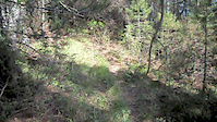
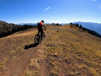
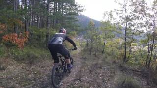
Photos of Konitsa Mountain Bike
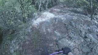
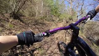
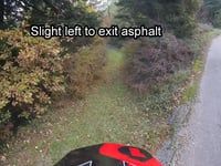
Videos of Konitsa Mountain Bike

trail: THE Trail
0:08 |
402 |
Oct 23, 2014
trail: U-turn
0:06 |
150 |
Apr 25, 2014
trail: Dragonlake downhill
24:06 |
317 |
Oct 10, 2022 , Konitsa
trail: Yiogou Trail
2:18 |
324 |
May 21, 2019 , Konitsa
trail: La Scala
3:49 |
734 |
Apr 25, 2018 , Konitsa

trail: The Cross
649 |
May 3, 2017 , Konitsa
trail: U-turn
624 |
Nov 20, 2016 , Konitsa
trail: Yiogou Trail
5:18 |
516 |
Nov 15, 2016 , Konitsa
Recent Trail Reports
| status | trail | date | condition | info | user |
|---|---|---|---|---|---|
| Dragonlake downhill | Jun 13, 2026 @ 9:31am (Europe/Tirane) Jun 13, 2026 | Ideal | JimmyKane | ||
| St. Theodore Trail | Jul 23, 2020 @ 2:22am Jul 23, 2020 | Ideal | hellequine | ||
| Back To School | Jul 23, 2020 @ 2:21am Jul 23, 2020 | Prevalent Mud | hellequine | ||
| The Cross | Jul 23, 2020 @ 2:19am Jul 23, 2020 | Dry | hellequine | ||
| U-turn | Jul 6, 2020 @ 7:46am Jul 6, 2020 | Ideal | hellequine | ||
| Thia Marina | Jul 4, 2020 @ 5:36am Jul 4, 2020 | Dry | hellequine | ||
| Yiogou Trail | Jun 28, 2020 @ 7:32am Jun 28, 2020 | Wet | hellequine |
Activity Feed
| username | action | type | title | date |
|---|---|---|---|---|
| JimmyKane | add | report | activity #96966411 | Jun 14, 2026 @ 7:28am Jun 14, 2026 |
| Aronhor | wishlist | trail | activity #90436895 | Mar 12, 2026 @ 7:11am Mar 12, 2026 |
| NickLVHZn0 | wishlist | trail | activity #89729423 | Feb 28, 2026 @ 2:44pm Feb 28, 2026 |
| ioanninamountainbikecoalition | update | trail | activity #82860256 | Oct 23, 2025 @ 1:30am Oct 23, 2025 |
| cain1977 | add | photo | activity #80392393 | Sep 15, 2025 @ 2:19am Sep 15, 2025 |
Recent Comments
| username | type | title | comment | date |
|---|---|---|---|---|
| trail | Το μονοπάτι ξεκινά από το... | Sep 13, 2025 @ 11:57am Sep 13, 2025 | ||
| trail | Το μονοπάτι ξεκινά από... | Sep 13, 2025 @ 11:38am Sep 13, 2025 | ||
| report | Αντε να δούμε πότε θα... | Nov 25, 2020 @ 2:55am Nov 25, 2020 |
Local Badges
-

Epic Ride Climb 2k9 awarded -

Climbing 10k Badge1 awarded -

Climbing 100k Badge0 awarded -

Epic Ride Descent 2k9 awarded -

Descent 10k Badge1 awarded -

Descent 100k Badge0 awarded
Activity Type Stats
| activitytype | trails | distance | descent | descent distance | total vertical | rating | global rank | state rank | photos | reports | routes | ridelogs |
|---|---|---|---|---|---|---|---|---|---|---|---|---|
| Mountain Bike | 14 | 17 miles | 9,472 ft | 11 miles | 4,534 ft | #2,957 | #22 | 81 | 102 | 176 | ||
| E-Bike | 9 | 10 miles | 6,860 ft | 8 miles | 4,534 ft | #1,895 | #17 | 88 | 25 | |||
| Hike | 15 | 17 miles | 9,472 ft | 11 miles | 4,534 ft | #979 | #6 | 102 | 180 | |||
| Trail Running | 13 | 17 miles | 9,472 ft | 11 miles | 4,534 ft | #2,724 | #24 | 102 | 2 |
Frequently Asked Questions About Konitsa
▼
What are the best places to ride in Konitsa?
Konitsa has 1 areas to explore for mountain biking. The top rated areas are:
▼
What are the highest rated mountain biking trails in Konitsa?
The highest rated mountain biking trails in Konitsa are:
- Dragonlake downhill (4.2/5)
- I.M.Stomiou (4.1/5)
- Agia Varvara (4.1/5)
- Yiogou Trail (4.1/5)
- San Salvatore (4/5)
▼
What is the best time of the year to ride in Konitsa?
Based on ride log data, the most popular months to ride in Konitsa are:
- April (4 activities)
- June (3 activities)
- July (1 activities)
▼
Where can I park to ride in Konitsa?
There are 2 parking locations listed in Konitsa. The most popular parking spots are:
Activities
Trails
- By hellequine & contributors
- Admins: IMBC
- #13356 - 2,906 views
- konitsa activity log | embed map of Konitsa mountain bike trails | konitsa mountain biking points of interest
Downloading of trail gps tracks in kml & gpx formats is enabled for Konitsa.
You must login to download files.