close
-
Layers w
- Weather Layers
- Pro
- Pro
- Pro
- Pro
- Pro
- Pro
- More Layers
- Pro
- Pro
- Pro
- Pro
-
Upgrade to

3D
Trail Conditions
- Unknown
- Snow Groomed
- Snow Packed
- Snow Covered
- Snow Cover Partial
- Freeze/thaw Cycle
- Icy
- Prevalent Mud
- Wet
- Variable
- Ideal
- Dry
- Very Dry
Trail Flow (Ridden Direction)
Trailforks scans users ridelogs to determine the most popular direction each trail is ridden. A good flowing trail network will have most trails flowing in a single direction according to their intension.
The colour categories are based on what percentage of riders are riding a trail in its intended direction.
The colour categories are based on what percentage of riders are riding a trail in its intended direction.
- > 96%
- > 90%
- > 80%
- > 70%
- > 50%
- < 50%
- bi-directional trail
- no data
Trail Last Ridden
Trailforks scans ridelogs to determine the last time a trail was ridden.
- < 2 days
- < 1 week
- < 2 weeks
- < 1 month
- < 6 months
- > 6 months
Trail Ridden Direction
The intended direction a trail should be ridden.
- Downhill Only
- Downhill Primary
- Both Directions
- Uphill Primary
- Uphill Only
- One Direction
Contribute Details
Colors indicate trail is missing specified detail.
- Description
- Photos
- Description & Photos
- Videos
Trail Popularity ?
Trailforks scans ridelogs to determine which trails are ridden the most in the last 9 months.
Trails are compared with nearby trails in the same city region with a possible 25 colour shades.
Think of this as a heatmap, more rides = more kinetic energy = warmer colors.
- most popular
- popular
- less popular
- not popular
ATV/ORV/OHV Filter
Max Vehicle Width
inches
US Cell Coverage
Legend

Radar Time
Activity Recordings
Trailforks uses anonymized public activity data.
?
Activity Recordings
Trailforks uses anonymized public activity data.
?
Personal Heatmap
▶
Activity Types
all
/
none
▶
Options
2
Date range
month
–
Winter Trails
Warning
A routing network for winter maps does not exist. Selecting trails using the winter trails layer has been disabled.
Missing Trails
Most Popular
Least Popular
Trails are colored based on popularity. The more popular a trail is, the more red. Less popular trails trend towards green.
Jump Magnitude Heatmap
Heatmap of where riders jump on trails. Zoom in to see individual jumps, click circles to view jump details.
BC Backroad Status
![map legend]()
Service Road Atlas is a free to use, community-driven service for viewing and creating reports on the numerous back-country service roads around B.C. and Alberta.

Slope Aspect
Direction the slope faces
Trails Deemphasized
Trails are shown in grey.
Only show trails with no bike usage.
Suggested Layers
Based on selected activity type
Save the current map location and zoom level as your default home location whenever this page is loaded.
Save
No description for Konstanz has been added yet!
Login or register to submit one.
This region uses the Uk/Euro style trail grading system.
Activities Click to view
- Mountain Bike
11 trails
- E-Bike
11 trails
- Winter Fat Bike
0 trails
- Hike
5 trails
- Trail Running
6 trails
Region Details
- 3
- 7
- 1
Region Status
Open as of May 31, 2026Stats
- Avg Trail Rating
- Trails (view details)
- 11
- Trails Mountain Bike
- 11
- Trails E-Bike
- 11
- Trails Hike
- 5
- Trails Trail Running
- 6
- Total Distance
- 4 miles
- Total Descent
- 1,988 ft
- Total Vertical
- 863 ft
- Highest Trailhead
- 2,255 ft
- Reports
- 199
- Photos
- 19
- Ridden Counter
- 573
Popular Konstanz Mountain Biking Trails
• 45 ★ 4.4 • 4,063 ft • 117 ft • 66 •
Flowy technical climbing, followed by a high speed bermed descent with nice jumps.... In sections a little rough...
• 95 ★ 4.5 • 822 ft • 7 ft • 64 •
Short and intense trail. Perfect berms and catch berms, some roots in between. Nice and safe jumps.
• 75 ★ 4.5 • 1,319 ft • 3 ft • 51 •
Popular blue difficulty singletrack. This mountain bike primary trail can be used downhill only and has a easy overall physical rating with a 3 ft blue climb. It features berm and jump. Trail visibility is always easy to follow. On average it takes 1 minutes to complete this trail.
• 65 ★ 3.5 • 948 ft • 54 ft • 48 •
Moderately popular blue difficulty singletrack. This mountain bike primary trail can be used downhill only. It features berm. Trail visibility is always easy to follow. On average it takes 2 minutes to complete this trail.
• 40 ★ 4.5 • 1,171 ft • 0 ft • 46 •
Nice and fast jump line with a few doubles. Good airtime! And easily accessible through the fire road. But take a look at the jumps first.
• 55 ★ 4.0 • 676 ft • 0 ft • 39 •
Nice Jumpline leading down to the University with a few Jumps and Berms
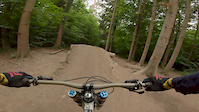
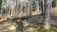
Photos of Konstanz Mountain Bike
Videos of Konstanz Mountain Bike

trail: noname
2:58 |
1636 |
Jan 23, 2021
trail: noname
0:47 |
616 |
Jun 28, 2020
trail: Root Boy 2
0:09 |
441 |
Apr 6, 2020

trail: Stahringer Trail
14:24 |
32 |
Dec 8, 2025 , Konstanz

trail: Alter Stahringer Downhill
14:24 |
40 |
Dec 8, 2025 , Konstanz
Current Trail Warnings
| status | trail | date | condition | user | info |
|---|---|---|---|---|---|
| Stahringer Trail | May 31, 2026 @ 8:49pm (Europe/Berlin) May 31, 2026 | Unknown | Lindenallee | Few trees down across trail. Part of the... |
Recent Trail Reports
| status | trail | date | condition | info | user |
|---|---|---|---|---|---|
| Fast & Furious - Tabor Jumpline | Mar 20, 2024 @ 9:55am Mar 20, 2024 | Variable | pmrwright | ||
| noname | Mar 20, 2024 @ 9:55am Mar 20, 2024 | Variable | pmrwright | ||
| Root Boy 2 | Mar 20, 2024 @ 9:55am Mar 20, 2024 | Variable | pmrwright | ||
| Kapelle | Mar 20, 2024 @ 9:55am Mar 20, 2024 | Variable | pmrwright | ||
| Jumpline an der Uni | Oct 3, 2023 @ 11:35am Oct 3, 2023 | Dry | LarsjyoJC | ||
| Fuchs Trail | May 29, 2023 @ 1:32am May 29, 2023 | Ideal | pmrwright | ||
| Root Boy Trail | May 29, 2023 @ 1:32am May 29, 2023 | Ideal | pmrwright | ||
| Holgas haengende kurven | Nov 7, 2021 @ 4:04am Nov 7, 2021 | Variable | pmrwright | ||
| St. Katharina | Jun 11, 2021 @ 8:09am Jun 11, 2021 | Variable | HAL2000 | ||
| Alter Stahringer Downhill | Mar 20, 2021 @ 12:32am Mar 20, 2021 | Wet | alteoma301 |
Activity Feed
| username | action | type | title | date |
|---|---|---|---|---|
| Lindenallee | comment | report | activity #95965377 | May 31, 2026 @ 12:01pm May 31, 2026 |
| Lindenallee | add | report | activity #95964540 | May 31, 2026 @ 11:53am May 31, 2026 |
| Lindenallee | add | report | activity #92419259 | Apr 11, 2026 @ 12:38pm Apr 11, 2026 |
| blaisebolwy | add | video | activity #85243834 and 1 more | Dec 8, 2025 @ 1:19am Dec 8, 2025 |
| i4KZsI | ridden | trail | activity #85065812 and 1 more | Dec 2, 2025 @ 11:24am Dec 2, 2025 |
Recent Comments
| username | type | title | comment | date |
|---|---|---|---|---|
| report | First section is fine to ride. Second part... | May 31, 2026 @ 12:01pm May 31, 2026 | ||
| trail | Trail has been almost completely destroyed by... | Nov 4, 2025 @ 4:02am Nov 4, 2025 | ||
| trail | RIP | Oct 31, 2025 @ 7:35am Oct 31, 2025 | ||
| trail | First part is still closed. The rest is pretty... | May 14, 2025 @ 6:56am May 14, 2025 | ||
| trail | Access is still really hard to find. It’s a... | May 14, 2025 @ 6:55am May 14, 2025 |
Local Badges
-

Epic Mountain Bike Climb 2k41 awarded -

Climbing 10k Badge16 awarded -

Mountain Biking 100k Badge1 awarded -

Epic Ride Descent 2k41 awarded -

Descent 10k Badge16 awarded -

Descent 100k Badge1 awarded
Bike & Skill Parks
| name | type | city | rating |
|---|---|---|---|
| Konstanz | skill park | Konstanz |
Activity Type Stats
| activitytype | trails | distance | descent | descent distance | total vertical | rating | global rank | state rank | photos | reports | routes | ridelogs |
|---|---|---|---|---|---|---|---|---|---|---|---|---|
| Mountain Bike | 11 | 4 miles | 1,988 ft | 3 miles | 863 ft | #3,423 | #43 | 19 | 199 | 4,319 | ||
| E-Bike | 11 | 4 miles | 1,988 ft | 3 miles | 863 ft | #3,239 | #72 | 174 | 224 | |||
| Hike | 5 | 2 miles | 531 ft | 4,383 ft | 262 ft | #5,683 | #59 | 170 | 59 | |||
| Trail Running | 6 | 3 miles | 1,201 ft | 1 mile | 863 ft | #4,907 | #55 | 172 | 85 |
Frequently Asked Questions About Konstanz
▼
What are the highest rated mountain biking trails in Konstanz?
The highest rated mountain biking trails in Konstanz are:
- Stahringer Trail (4.3/5)
- Root Boy 2 (4.2/5)
- noname (4.2/5)
- Kapelle (4.2/5)
- Fuchs Trail (4.2/5)
▼
What is the best time of the year to ride in Konstanz?
Based on ride log data, the most popular months to ride in Konstanz are:
- May (17 activities)
- July (17 activities)
- June (16 activities)
▼
Where can I park to ride in Konstanz?
Check the Konstanz trail map for trailhead and parking information. Community members regularly update access and parking details for trails in the area.
▼
What is the longest trail in Konstanz?
The longest trail in Konstanz is Stahringer Trail at 1.1 miles. View all trails sorted by distance.
Activities
Trails
- By Oellze & contributors
- Admins: HDRiders, Sasse82, sp00n82, martywis
- #21041 - 13,191 views
- konstanz activity log | embed map of Konstanz mountain bike trails | konstanz mountain biking points of interest
Downloading of trail gps tracks in kml & gpx formats is enabled for Konstanz.
You must login to download files.