close
-
Layers w
- Weather Layers
- Pro
- Pro
- Pro
- Pro
- Pro
- Pro
- More Layers
- Pro
- Pro
- Pro
- Pro
-
Upgrade to

3D
Trail Conditions
- Unknown
- Snow Groomed
- Snow Packed
- Snow Covered
- Snow Cover Partial
- Freeze/thaw Cycle
- Icy
- Prevalent Mud
- Wet
- Variable
- Ideal
- Dry
- Very Dry
Trail Flow (Ridden Direction)
Trailforks scans users ridelogs to determine the most popular direction each trail is ridden. A good flowing trail network will have most trails flowing in a single direction according to their intension.
The colour categories are based on what percentage of riders are riding a trail in its intended direction.
The colour categories are based on what percentage of riders are riding a trail in its intended direction.
- > 96%
- > 90%
- > 80%
- > 70%
- > 50%
- < 50%
- bi-directional trail
- no data
Trail Last Ridden
Trailforks scans ridelogs to determine the last time a trail was ridden.
- < 2 days
- < 1 week
- < 2 weeks
- < 1 month
- < 6 months
- > 6 months
Trail Ridden Direction
The intended direction a trail should be ridden.
- Downhill Only
- Downhill Primary
- Both Directions
- Uphill Primary
- Uphill Only
- One Direction
Contribute Details
Colors indicate trail is missing specified detail.
- Description
- Photos
- Description & Photos
- Videos
Trail Popularity ?
Trailforks scans ridelogs to determine which trails are ridden the most in the last 9 months.
Trails are compared with nearby trails in the same city region with a possible 25 colour shades.
Think of this as a heatmap, more rides = more kinetic energy = warmer colors.
- most popular
- popular
- less popular
- not popular
ATV/ORV/OHV Filter
Max Vehicle Width
inches
US Cell Coverage
Legend

Radar Time
Activity Recordings
Trailforks uses anonymized public activity data.
?
Activity Recordings
Trailforks uses anonymized public activity data.
?
Personal Heatmap
▶
Activity Types
all
/
none
▶
Options
2
Date range
month
–
Winter Trails
Warning
A routing network for winter maps does not exist. Selecting trails using the winter trails layer has been disabled.
Missing Trails
Most Popular
Least Popular
Trails are colored based on popularity. The more popular a trail is, the more red. Less popular trails trend towards green.
Jump Magnitude Heatmap
Heatmap of where riders jump on trails. Zoom in to see individual jumps, click circles to view jump details.
BC Backroad Status
![map legend]()
Service Road Atlas is a free to use, community-driven service for viewing and creating reports on the numerous back-country service roads around B.C. and Alberta.

Slope Aspect
Direction the slope faces
Trails Deemphasized
Trails are shown in grey.
Only show trails with no bike usage.
Suggested Layers
Based on selected activity type
Save the current map location and zoom level as your default home location whenever this page is loaded.
Saveoldest coast trails since 2001
This region uses the Uk/Euro style trail grading system.
Activities Click to view
- Mountain Bike
30 trails
- E-Bike
9 trails
- Gravel Bike
5 trails
- Adaptive Bike
4 trails
- Winter Fat Bike
3 trails
- Horse
7 trails
- Hike
27 trails
- Trail Running
27 trails
- Dirtbike/Moto
3 trails
- ATV/ORV/OHV
3 trails
Region Details
- 16
- 1
- 7
- 3
- 2
Region Status
Open as of Mar 7, 2026Stats
- Avg Trail Rating
- Trails (view details)
- 29
- Trails Mountain Bike
- 30
- Trails E-Bike
- 9
- Trails Gravel Bike
- 5
- Trails Adaptive Bike
- 4
- Trails Winter Fat Bike
- 3
- Trails Horse
- 7
- Trails Hike
- 27
- Trails Trail Running
- 27
- Trails Dirtbike/Moto
- 3
- Trails ATV/ORV/OHV
- 3
- Total Distance
- 29 miles
- Total Descent
- 3,314 ft
- Total Vertical
- 948 ft
- Highest Trailhead
- 956 ft
- Reports
- 179
- Photos
- 51
- Ridden Counter
- 840
Popular Korte Mountain Biking Trails
• 50 ★ 5.0 • 250 ft • 8 ft • 30 •
Moderately popular red difficulty singletrack. This mountain bike primary trail can be used downhill only. It features berm and jump. On average it takes 1 minutes to complete this trail.
• 5 ★ 4.0 • 2 miles • 105 ft • 15 •
Old singletrail on an old hiking path. Passing near an MX track
• 5 ★ 2.0 • 2 miles • 94 ft • 7 •
Easy XC trail on an old village hiking path thru olives fields and great views.
• ★ 0.0 • 1 mile • 228 ft • 3 •
Old connection of village Padna to Nova vas. Double track, dirt and rocks
• ★ 4.0 • 4,193 ft • 436 ft •
NEW , machine groomed, last 100m concrete. Some steep parts, sorry :) Excellent for Emtb
• ★ 0.0 • 3 miles • 273 ft •
A mixed XC trail, centuries ago was a village connecting path. from single track, to double track, to rocky path. Beautiful views.
Korte Mountain Bike Routes
★ 4.0 • 17 miles • 2,988 ft • 0 •
Try the , start in the town of Izola to KORTE with 3 different trails (from technical DH, steep or flow...
4 miles • 720 ft • 0 • Loop •
Funded by the European Union. Views and opinions expressed are however those of the author(s) only and do...
★ 3.0 • 17 miles • 2,988 ft • 0 •
Try the , start in the town of Izola to KORTE with 3 different trails (from technical DH, steep or flow...
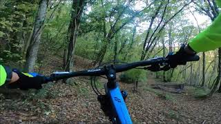
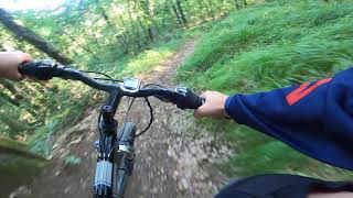
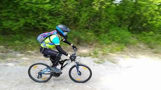
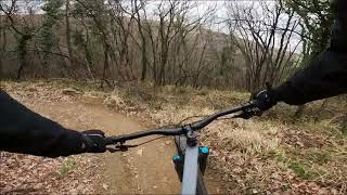
Videos of Korte Mountain Bike
0:10 |
1 |
Jan 9, 2026
0:06 |
1 |
Jan 9, 2026
0:40 |
1 |
Jan 9, 2026
0:21 |
1 |
Jan 9, 2026
4:18 |
226 |
Dec 11, 2021 , Korte
3:41 |
336 |
Jul 8, 2021 , Korte
trail: Grbci
2:27 |
370 |
Apr 30, 2021 , Korte
4:07 |
333 |
Apr 24, 2021 , Korte
Recent Trail Reports
| status | trail | date | condition | info | user |
|---|---|---|---|---|---|
| access road to konjska | Feb 28, 2026 @ 10:53am (Europe/Ljubljana) Feb 28, 2026 | Ideal | Istriano | ||
| Kaštelir access | Feb 28, 2026 @ 10:53am (Europe/Ljubljana) Feb 28, 2026 | Ideal | Istriano | ||
| First Flow Trail | Oct 4, 2025 @ 9:29am (Europe/Ljubljana) Oct 4, 2025 | Ideal | Istriano | ||
| access road to pomjan | Aug 12, 2025 @ 4:50pm Aug 12, 2025 | Ideal | Istriano | ||
| access road to pomjan | Aug 12, 2025 @ 4:50pm Aug 12, 2025 | Dry | Istriano | ||
| First DH track | May 28, 2025 @ 11:12am May 28, 2025 | Dry | Kriveta | ||
| access road | May 13, 2025 @ 4:44pm May 13, 2025 | Ideal | Istriano | ||
| Korte access road | May 13, 2025 @ 4:44pm May 13, 2025 | Ideal | Istriano | ||
| Transfer parenzana-krog | Mar 5, 2025 @ 2:50pm Mar 5, 2025 | Variable | Istriano | ||
| access road | Feb 22, 2025 @ 11:38am Feb 22, 2025 | Ideal | Istriano |
Activity Feed
| username | action | type | title | date |
|---|---|---|---|---|
| JrgenNobjcf | wishlist | region | activity #94699213 | May 14, 2026 @ 10:29am May 14, 2026 |
| BoBo69 | wishlist | trail | activity #93646915 and 1 more | Apr 29, 2026 @ 7:42am Apr 29, 2026 |
| GreenWheels | update | route | activity #92133275 | Apr 7, 2026 @ 11:55am Apr 7, 2026 |
| Istriano | vote | trail | activity #92058393 | Apr 6, 2026 @ 9:08am Apr 6, 2026 |
| lovro81 | add | trail | activity #90792386 and 1 more | Mar 18, 2026 @ 5:35am Mar 18, 2026 |
Recent Comments
| username | type | title | comment | date |
|---|---|---|---|---|
| trail | Due to overgrown vegetation at the downhill... | Sep 19, 2021 @ 1:05am Sep 19, 2021 | ||
| trail | Nice XC track in the forest with green shade... | Sep 19, 2021 @ 12:58am Sep 19, 2021 | ||
| trail | Dirt doubletrack and gravel road majority of... | Sep 19, 2021 @ 12:50am Sep 19, 2021 | ||
| trail | Growing up since 1999 | Feb 25, 2021 @ 11:49am Feb 25, 2021 | ||
| trail | Rode all three trails in the Korte area, super... | Jul 1, 2020 @ 8:26am Jul 1, 2020 |
Local Badges
-

Epic Ride Climb 2k5 awarded -

Climbing 10k Badge7 awarded -

Climbing 100k Badge0 awarded -

Epic Ride Descent 2k5 awarded -

Descent 10k Badge7 awarded -

Descent 100k Badge0 awarded
Activity Type Stats
| activitytype | trails | distance | descent | descent distance | total vertical | rating | global rank | state rank | photos | reports | routes | ridelogs |
|---|---|---|---|---|---|---|---|---|---|---|---|---|
| Mountain Bike | 30 | 29 miles | 3,314 ft | 11 miles | 948 ft | #2,178 | #17 | 48 | 201 | 5 | 749 | |
| E-Bike | 9 | 4 miles | 203 ft | 2 miles | 374 ft | #1,797 | #19 | 143 | 2 | 162 | ||
| Gravel Bike | 5 | #203 | #13 | 7 | 6 | |||||||
| Adaptive Bike | 4 | #167 | #33 | |||||||||
| Winter Fat Bike | 3 | #135 | #31 | |||||||||
| Horse | 7 | 3 miles | 381 ft | 2 miles | 404 ft | #616 | #6 | 35 | ||||
| Hike | 27 | 24 miles | 2,556 ft | 9 miles | 948 ft | #2,181 | #15 | 163 | 17 | |||
| Trail Running | 27 | 24 miles | 2,556 ft | 9 miles | 948 ft | #1,694 | #14 | 163 | 5 | |||
| Dirtbike/Moto | 3 | #501 | #4 | 33 | ||||||||
| ATV/ORV/OHV | 3 | #195 | #1 | 33 | 9 |
Frequently Asked Questions About Korte
▼
What are the highest rated mountain biking trails in Korte?
The highest rated mountain biking trails in Korte are:
- Druga trail (4.2/5)
- Grbci (4.1/5)
- UPHILL (4/5)
- Koshta XC (4/5)
- Medoshi XC (3.7/5)
▼
What is the best time of the year to ride in Korte?
Based on ride log data, the most popular months to ride in Korte are:
- April (16 activities)
- July (10 activities)
- May (8 activities)
▼
Where can I park to ride in Korte?
There are 1 parking locations listed in Korte. The most popular parking spots are:
▼
What is the longest trail in Korte?
The longest trail in Korte is Medoshi at 3.3 miles. View all trails sorted by distance.
Activities
Trails
Points of Interest
- By lovro81
 OBS & contributors
 - Admins: OBS
- #17320 - 8,624 views
- korte activity log | embed map of Korte mountain bike trails | korte mountain biking points of interest
Downloading of trail gps tracks in kml & gpx formats is enabled for Korte.
You must login to download files.