close
-
Layers w
- Weather Layers
- Pro
- Pro
- Pro
- Pro
- Pro
- Pro
- More Layers
- Pro
- Pro
- Pro
- Pro
-
Upgrade to

3D
Trail Conditions
- Unknown
- Snow Groomed
- Snow Packed
- Snow Covered
- Snow Cover Partial
- Freeze/thaw Cycle
- Icy
- Prevalent Mud
- Wet
- Variable
- Ideal
- Dry
- Very Dry
Trail Flow (Ridden Direction)
Trailforks scans users ridelogs to determine the most popular direction each trail is ridden. A good flowing trail network will have most trails flowing in a single direction according to their intension.
The colour categories are based on what percentage of riders are riding a trail in its intended direction.
The colour categories are based on what percentage of riders are riding a trail in its intended direction.
- > 96%
- > 90%
- > 80%
- > 70%
- > 50%
- < 50%
- bi-directional trail
- no data
Trail Last Ridden
Trailforks scans ridelogs to determine the last time a trail was ridden.
- < 2 days
- < 1 week
- < 2 weeks
- < 1 month
- < 6 months
- > 6 months
Trail Ridden Direction
The intended direction a trail should be ridden.
- Downhill Only
- Downhill Primary
- Both Directions
- Uphill Primary
- Uphill Only
- One Direction
Contribute Details
Colors indicate trail is missing specified detail.
- Description
- Photos
- Description & Photos
- Videos
Trail Popularity ?
Trailforks scans ridelogs to determine which trails are ridden the most in the last 9 months.
Trails are compared with nearby trails in the same city region with a possible 25 colour shades.
Think of this as a heatmap, more rides = more kinetic energy = warmer colors.
- most popular
- popular
- less popular
- not popular
ATV/ORV/OHV Filter
Max Vehicle Width
inches
US Cell Coverage
Legend

Radar Time
Activity Recordings
Trailforks uses anonymized public activity data.
?
Activity Recordings
Trailforks uses anonymized public activity data.
?
Personal Heatmap
▶
Activity Types
all
/
none
▶
Options
2
Date range
month
–
Winter Trails
Warning
A routing network for winter maps does not exist. Selecting trails using the winter trails layer has been disabled.
Missing Trails
Most Popular
Least Popular
Trails are colored based on popularity. The more popular a trail is, the more red. Less popular trails trend towards green.
Jump Magnitude Heatmap
Heatmap of where riders jump on trails. Zoom in to see individual jumps, click circles to view jump details.
BC Backroad Status
![map legend]()
Service Road Atlas is a free to use, community-driven service for viewing and creating reports on the numerous back-country service roads around B.C. and Alberta.

Slope Aspect
Direction the slope faces
Trails Deemphasized
Trails are shown in grey.
Only show trails with no bike usage.
Suggested Layers
Based on selected activity type
Save the current map location and zoom level as your default home location whenever this page is loaded.
SaveThe Košice Region (Slovak: Košický kraj, pronounced [ˈkɔʃitskiː ˈkraj], Hungarian: Kassai kerület; Ukrainian: Кошицький край) is one of the eight Slovak administrative regions. The region was first established in 1923 and its present borders were established in 1996.
It is located in the southern part of eastern Slovakia and covers an area of 6,752 km2. The western part of the region is composed of the eastern part of the Slovak Ore Mountains, including its subdivisions: Slovak Karst, Slovak Paradise, Volovské vrchy, Čierna hora. The Hornád Basin is located in the northwest. The area between Slovak Ore Mountains and Slanské vrchy is covered by the Košice Basin, named after the city. The area east of Slanské vrchy is covered by the Eastern Slovak Lowland and there is a volcanic range, Vihorlat Mountains, in the northeast, close to the Ukrainian border.
It is located in the southern part of eastern Slovakia and covers an area of 6,752 km2. The western part of the region is composed of the eastern part of the Slovak Ore Mountains, including its subdivisions: Slovak Karst, Slovak Paradise, Volovské vrchy, Čierna hora. The Hornád Basin is located in the northwest. The area between Slovak Ore Mountains and Slanské vrchy is covered by the Košice Basin, named after the city. The area east of Slanské vrchy is covered by the Eastern Slovak Lowland and there is a volcanic range, Vihorlat Mountains, in the northeast, close to the Ukrainian border.
source: Košice Region
AKA: Košice
Region Details
- 38
- 1
- 19
- 52
- 28
- 2
- 2
Stats
- Avg Trail Rating
- Trails (view details)
- 153
- Trails Mountain Bike
- 181
- Trails E-Bike
- 83
- Trails Horse
- 1
- Trails Hike
- 126
- Trails Trail Running
- 132
- Trails Backcountry Ski
- 1
- Trails Nordic Ski
- 2
- Total Distance
- 151 miles
- Total Descent
- 34,972 ft
- Total Vertical
- 3,623 ft
- Highest Trailhead
- 4,186 ft
- Reports
- 2,632
- Photos
- 304
- Ridden Counter
- 10,058
Popular Trail Networks
view all areas »Sub Regions
- Slovenský Kras (1)
- Slovenský Raj (22)
- Spišská Nová Ves (19)
- Trailpark Žehra (0)
- DC-Trails (7)
- Spišská Nová Ves (19)
- Volovské Vrchy a Čierna Hora (154)
- Flos Trails (14)
- Košické Cyklotraily (46)
- Mine Trails (50)
- Zahura (2)
- Košice (70)
- Slanske vrchy - juh (14)
- Roznava (72)
Popular Košický kraj Mountain Biking Trails
• 95 ★ 4.7 • 2,805 ft • 0 ft • 229 •
Popular blue difficulty singletrack. This mountain bike primary trail can be used downhill only. It features berm and jump. Trail visibility is always easy to follow. On average it takes 3 minutes to complete this trail.
• 95 ★ 4.9 • 3,763 ft • 17 ft • 219 •
Highly rated popular blue difficulty singletrack. This mountain bike primary trail and has a moderate overall physical rating. It features berm, drop and jump. On average it takes 2 minutes to complete this trail.
• 90 ★ 4.6 • 1,995 ft • 0 ft • 216 •
Popular black diamond difficulty singletrack. This mountain bike primary trail can be used downhill only. It features bridge, drop and jump. Trail visibility is always easy to follow. On average it takes 4 minutes to complete this trail.
• 85 ★ 4.4 • 2,195 ft • 38 ft • 211 •
Popular blue difficulty singletrack. This mountain bike primary trail can be used downhill only and has a hard overall physical rating. It features berm, bridge, drop, jump, gap jump, ladder bridge and rock face. On average it takes 5 minutes to complete this trail.
• 90 ★ 5.0 • 2,953 ft • 44 ft • 201 •
Popular black diamond difficulty singletrack. This mountain bike primary trail. It features drop, jump and rock face. Trail visibility is always easy to follow. On average it takes 3 minutes to complete this trail.
• 95 ★ 4.0 • 2,756 ft • 0 ft • 195 •
Popular black diamond difficulty singletrack. This mountain bike primary trail can be used downhill only. It features bridge, drop, jump, gap jump, rock face and rock garden. Trail visibility is always easy to follow. On average it takes 2 minutes to complete this trail.
• 85 ★ 4.7 • 1 mile • 0 ft • 190 •
Highly rated popular blue difficulty singletrack. This mountain bike primary trail can be used downhill only and has a moderate overall physical rating. It features berm, bridge, drop, jump, gap jump and rock garden. On average it takes 8 minutes to complete this trail.
• 75 ★ 4.6 • 1 mile • 9 ft • 181 •
Popular blue difficulty singletrack. This mountain bike primary trail. It features jump, pump track and roller coaster. Trail visibility is always easy to follow. On average it takes 10 minutes to complete this trail.
Košický kraj Mountain Bike Routes
4 miles • 744 ft • 0 • Loop •
New nordic ski and bike route in hearth of Spiš region in Slovakia.
34 miles • 6,224 ft • 0 • Loop •
All KE.CY trails in a single route. Length optimised.
11 miles • 2,523 ft • 0 • Loop •
Short round if you want to do Hriesny I/II trails and Surawy, Lesmir in a shortest possible way.
46 miles • 7,510 ft • 0 •
nová KE singeltrail 2022 vvvvvvvvvvvvvvvvvvvvvvvvv
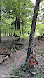
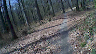
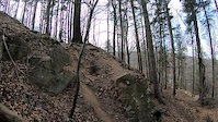
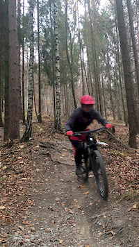
Photos of Košický kraj Mountain Bike
Videos of Košický kraj Mountain Bike
featured
![KE.CY košické cyklotraily PROMO video 2015]()

4:16 |
5392 |
Sep 26, 2015

trail: Hriešny - Flow
0:46 |
105 |
Aug 17, 2021
trail: Bedľa
0:06 |
143 |
Oct 4, 2020

trail: Davidoff flow trail
0:19 |
238 |
Oct 30, 2019
trail: Zlatoklopka 1. segment
2:20 |
59 |
Apr 8, 2019
trail: SuRAWý 1. segment
0:07 |
273 |
Mar 24, 2019
trail: Zahura Stará Galmuska
0:08 |
114 |
Nov 3, 2018
trail: Lesmír 1. segment
4:53 |
251 |
Jun 28, 2017
Recent Trail Reports
Activity Feed
| username | action | type | title | date |
|---|---|---|---|---|
| Andrej6ZbeXZ | ridden | route | activity #96546336 | Jun 8, 2026 @ 9:48am Jun 8, 2026 |
| Spaff | add | report | activity #96475427 and 1 more | Jun 7, 2026 @ 10:21am Jun 7, 2026 |
| Spaff | add | report | activity #96303387 | Jun 5, 2026 @ 9:40am Jun 5, 2026 |
| grapperr | add | report | activity #96032747 and 5 more | Jun 1, 2026 @ 11:59am Jun 1, 2026 |
| canadaka | update | trail | activity #95429419 | May 24, 2026 @ 11:22am May 24, 2026 |
Recent Comments
| username | type | title | comment | date |
|---|---|---|---|---|
| trail | Super trail 👌👌👌 | Oct 18, 2025 @ 10:02am Oct 18, 2025 | ||
| trail | Trail is reshaped. Ready to ride. Enjoy!🤟👍 | Sep 12, 2025 @ 10:42pm Sep 12, 2025 | ||
| trail | O tém jedného strmšieho úseku tam nie je... | Jun 4, 2025 @ 10:33am Jun 4, 2025 | ||
| trail | Trails is clear but lower part after the road... | Jun 3, 2025 @ 12:26pm Jun 3, 2025 | ||
| trail | Trail is clean and reshaped. | Jun 3, 2025 @ 12:25pm Jun 3, 2025 |
Local Badges
-

Mountain Biking 100k Badge0 awarded -

Big Ride 30k67 awarded -

Descent 100k Badge0 awarded -

Descent 10k Badge1 awarded -

Epic Ride Descent 2k2 awarded -

Epic Mountain Bike Climb 2k2 awarded
Bike & Skill Parks
| name | type | city | rating |
|---|---|---|---|
| Bikros Furča | skill park | Košice | |
| Dirt park Drábova | skill park | Košice |
Activity Type Stats
| activitytype | trails | distance | descent | descent distance | total vertical | rating | global rank | state rank | photos | reports | routes | ridelogs |
|---|---|---|---|---|---|---|---|---|---|---|---|---|
| Mountain Bike | 181 | 143 miles | 34,934 ft | 68 miles | 3,622 ft | 304 | 2,632 | 10 | 30,999 | |||
| E-Bike | 83 | 48 miles | 9,511 ft | 18 miles | 3,130 ft | 2,174 | 5 | 2,894 | ||||
| Horse | 1 | 1 mile | 3 ft | 3,136 ft | 167 ft | 264 | ||||||
| Hike | 126 | 126 miles | 23,205 ft | 50 miles | 3,622 ft | 2,271 | 1 | 3,201 | ||||
| Trail Running | 132 | 127 miles | 23,232 ft | 50 miles | 3,622 ft | 2,268 | 1 | 997 | ||||
| Backcountry Ski | 1 | 1 | 301 | |||||||||
| Nordic Ski | 2 | 1 | 304 |
Activities
Trails
- By brenthillier
 NSMBA TRAILFORKS & contributors
 - Admins: jxxw
- #10072 - 4,894 views
- košický kraj activity log | embed map of Košický kraj mountain bike trails | košický kraj mountain biking points of interest
Downloading of trail gps tracks in kml & gpx formats is enabled for Košický kraj.
You must login to download files.