close
-
Layers w
- Weather Layers
- Pro
- Pro
- Pro
- Pro
- Pro
- Pro
- More Layers
- Pro
- Pro
- Pro
- Pro
-
Upgrade to

3D
Trail Conditions
- Unknown
- Snow Groomed
- Snow Packed
- Snow Covered
- Snow Cover Partial
- Freeze/thaw Cycle
- Icy
- Prevalent Mud
- Wet
- Variable
- Ideal
- Dry
- Very Dry
Trail Flow (Ridden Direction)
Trailforks scans users ridelogs to determine the most popular direction each trail is ridden. A good flowing trail network will have most trails flowing in a single direction according to their intension.
The colour categories are based on what percentage of riders are riding a trail in its intended direction.
The colour categories are based on what percentage of riders are riding a trail in its intended direction.
- > 96%
- > 90%
- > 80%
- > 70%
- > 50%
- < 50%
- bi-directional trail
- no data
Trail Last Ridden
Trailforks scans ridelogs to determine the last time a trail was ridden.
- < 2 days
- < 1 week
- < 2 weeks
- < 1 month
- < 6 months
- > 6 months
Trail Ridden Direction
The intended direction a trail should be ridden.
- Downhill Only
- Downhill Primary
- Both Directions
- Uphill Primary
- Uphill Only
- One Direction
Contribute Details
Colors indicate trail is missing specified detail.
- Description
- Photos
- Description & Photos
- Videos
Trail Popularity ?
Trailforks scans ridelogs to determine which trails are ridden the most in the last 9 months.
Trails are compared with nearby trails in the same city region with a possible 25 colour shades.
Think of this as a heatmap, more rides = more kinetic energy = warmer colors.
- most popular
- popular
- less popular
- not popular
ATV/ORV/OHV Filter
Max Vehicle Width
inches
US Cell Coverage
Legend

Radar Time
Activity Recordings
Trailforks uses anonymized public activity data.
?
Activity Recordings
Trailforks uses anonymized public activity data.
?
Personal Heatmap
▶
Activity Types
all
/
none
▶
Options
2
Date range
month
–
Winter Trails
Warning
A routing network for winter maps does not exist. Selecting trails using the winter trails layer has been disabled.
Missing Trails
Most Popular
Least Popular
Trails are colored based on popularity. The more popular a trail is, the more red. Less popular trails trend towards green.
Jump Magnitude Heatmap
Heatmap of where riders jump on trails. Zoom in to see individual jumps, click circles to view jump details.
BC Backroad Status
![map legend]()
Service Road Atlas is a free to use, community-driven service for viewing and creating reports on the numerous back-country service roads around B.C. and Alberta.

Slope Aspect
Direction the slope faces
Trails Deemphasized
Trails are shown in grey.
Only show trails with no bike usage.
Suggested Layers
Based on selected activity type
Save the current map location and zoom level as your default home location whenever this page is loaded.
SaveKosovo Kosova Defined in an area of 10,887 square kilometres (4,203 sq mi), Kosovo is landlocked in the center of the Balkans and bordered by the uncontested territory of Serbia to the north and east, North Macedonia to the southeast, Albania to the southwest and Montenegro to the west. Geographically, Kosovo possesses varied and opposing landscapes for its size determined by the ideal climate along with the geology and hydrology. Most of central Kosovo is dominated by the vast plains and fields of Dukagjin and Kosovo. The Prokletije and Šar Mountains rise in the southwest and southeast respectively.Kosovo is landlocked and located in the center of the Balkan Peninsula in Southeastern Europe. It is defined in a total area of 10,887 square kilometres (4,203 square miles). It lies between latitudes 42° and 43° N, and longitudes 20° and 22° Kosovo's northernmost point is Bellobërda at 43° 14' 06" northern latitude; the southernmost is Restelica at 41° 56' 40" northern latitude; the westernmost point is Bogë at 20° 3' 23" eastern longitude; and the easternmost point is Desivojca at 21° 44' 21" eastern longitude. The highest point is Đeravica at 2,656 metres (8,714 ft) above sea level, and the lowest is the White Drin at 297 metres (974 ft).Most of the Kosovo's borders are dominated by mountainous and high terrain. The most noticeable topographical features are the Albanian Alps and the Šar Mountains. The Albanian Alps, also commonly known as Bjeshkët e Nemuna, are a geological continuation of the Dinaric Alps. The mountains run laterally through the west along the border with Albania and Montenegro. The southeast is predominantly the Šar Mountains, which form the border with North Macedonia. Besides the mountain ranges, Kosovo's territory consists mostly of two major plains: the Kosovo Plain in the east and the Metohija Plain in the west.
Kosovo's hydrological resources are relatively small. The longest rivers of Kosovo include the White Drin, the South Morava and the Ibar. Sitnica, a tributary of Ibar, is the largest river lying completely within Kosovo's territory. River Nerodimka represents Europe's only instance of a river bifurcation flowing into the Black Sea and Aegean Sea.
Kosovo's hydrological resources are relatively small. The longest rivers of Kosovo include the White Drin, the South Morava and the Ibar. Sitnica, a tributary of Ibar, is the largest river lying completely within Kosovo's territory. River Nerodimka represents Europe's only instance of a river bifurcation flowing into the Black Sea and Aegean Sea.
Region Details
- 30
- 7
- 29
- 49
- 5
Stats
- Avg Trail Rating
- Trails (view details)
- 144
- Trails Mountain Bike
- 126
- Trails E-Bike
- 99
- Trails Horse
- 60
- Trails Hike
- 145
- Trails Trail Running
- 139
- Trails Dirtbike/Moto
- 19
- Trails Observed Trials
- 5
- Trails ATV/ORV/OHV
- 30
- Trails Snowmobile
- 13
- Trails Snowshoe
- 29
- Trails Downhill Ski
- 16
- Trails Backcountry Ski
- 11
- Trails Nordic Ski
- 7
- Total Distance
- 248 miles
- Total Descent
- 81,195 ft
- Total Vertical
- 7,517 ft
- Highest Trailhead
- 8,644 ft
- Reports
- 36
- Photos
- 353
- Ridden Counter
- 313
Sub Regions
- Brezovicë (13)
- Shtërpcë (2)
- Shtërpcë (2)
- District of Gjakova (0)
- District of Gjilan (0)
- District of Mitrovica (0)
- District of Peja (0)
- District of Pristina (0)
- District of Prizren (0)
- Gjakova (3)
- Gjakova (3)
- Parku i Shkugzës (0)
- Gjakova (3)
- Prevalla (6)
- Prizren (10)
- Dragash (5)
- Fushë Kosovë (7)
- Gjilan (8)
- Junik (5)
- Gjeravica (4)
- Kaçanik (1)
- Kamenicë (1)
- Klinë (1)
- Parku i Mirushës (0)
- Mitrovica (6)
- Pejë (9)
- Bjeshkët e Nemuna (6)
- Rugova Canyon (0)
- Pristina (35)
- Germia Park (35)
- Prizren (27)
- Šar Mountains (11)
- Theranda (2)
- Каlаја e Prizrenit (1)
Popular Kosovo Mountain Biking Trails
• 90 ★ 4.0 • 2 miles • 80 ft • 5 •
the trail of Saka meadow thats used by all #people who like #outdoor activities like #hiking#walking#trail #running and #mtb 90% of the trail is #bothdirections the second part of the trail is the fastest during this part you’re all...
• 5 ★ 4.0 • 2 miles • 761 ft • 5 •
Less popular green difficulty family friendly singletrack. This multi-use trail can be used downhill primary and has a moderate overall physical rating with a 761 ft green climb. Trail visibility is sometimes hard to follow. On average it takes 8 minutes to complete this trail.
• 100 ★ 4.0 • 2 miles • 1,371 ft • 4 •
Popular blue difficulty alpine singletrack. This multi-use trail can be used downhill primary and has a moderate overall physical rating with a 1,371 ft blue climb. It features berm, rock face and rock garden. Trail visibility is always easy to follow.
• 5 ★ 0.0 • 3 miles • 356 ft • 4 •
Less popular green difficulty family friendly singletrack. This multi-use trail can be used both directions and has a moderate overall physical rating with a 356 ft blue climb. It features berm. Trail visibility is no clear path.
• 5 ★ 4.5 • 4,721 ft • 29 ft • 4 •
Less popular blue difficulty singletrack. This multi-use trail can be used downhill only and has a moderate overall physical rating. It features berm, drop and jump. Trail visibility is always easy to follow. On average it takes 13 minutes to complete this trail.
• 100 ★ 3.0 • 2 miles • 561 ft • 3 •
Popular green difficulty family friendly gravel path. This multi-use trail can be used both directions and has a easy overall physical rating with a 561 ft blue climb. It features berm. Trail visibility is always easy to follow. On average it takes 39 minutes to complete this trail.
• 5 ★ 3.0 • 3,912 ft • 0 ft • 3 •
Less popular blue difficulty alpine singletrack. This mountain bike primary trail can be used downhill only and has a moderate overall physical rating with a 0 ft blue climb. It features berm. Trail visibility is sometimes hard to follow.
• ★ 2.0 • 2 miles • 36 ft • 2 •
A more challenging descent of the lower Shutmani lake.
Kosovo Mountain Bike Routes
1 mile • 124 ft • 0 • Out & Back •
The Banjska river hike takes place near the village of Banjska. It's situated in northern Kosovo and it's...
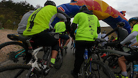
Photos of Kosovo Mountain Bike
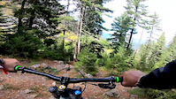
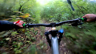
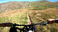
Videos of Kosovo Mountain Bike

trail: Gërmia Path AK
0:43 |
|
Mar 7, 2023
trail: Goat Trail
0:43 |
|
Mar 7, 2023

trail: Gërmia Path
0:43 |
|
Mar 7, 2023

trail: Shutmani lake
0:49 |
36 |
Jan 4, 2021

trail: Goat Trail
0:54 |
33 |
Nov 13, 2020
trail: Liqeni i Kuqishtës
0:41 |
44 |
Oct 19, 2020
trail: Outer Trail
0:41 |
115 |
Oct 16, 2020
trail: Cule Peak
0:45 |
36 |
Sep 14, 2020
Recent Comments
| username | type | title | comment | date |
|---|---|---|---|---|
| trail | fast and flowy one with very nice "airy" views... | Aug 27, 2025 @ 7:32am Aug 27, 2025 | ||
| trail | trail has changed, bottom section is gravel road | Nov 29, 2021 @ 7:34am Nov 29, 2021 | ||
| trail | Trail is in super condition riden in late February | Feb 26, 2021 @ 1:00am Feb 26, 2021 |
Activity Type Stats
| activitytype | trails | distance | descent | descent distance | total vertical | rating | global rank | state rank | photos | reports | routes | ridelogs |
|---|---|---|---|---|---|---|---|---|---|---|---|---|
| Mountain Bike | 125 | 213 miles | 72,844 ft | 117 miles | 7,123 ft | #75 | 354 | 37 | 1 | 2,768 | ||
| E-Bike | 99 | 177 miles | 59,314 ft | 100 miles | 7,123 ft | #52 | 34 | 1 | 90 | |||
| Horse | 60 | 127 miles | 36,066 ft | 58 miles | 7,467 ft | #38 | 5 | |||||
| Hike | 145 | 237 miles | 78,163 ft | 121 miles | 7,516 ft | #63 | 36 | 2 | 772 | |||
| Trail Running | 139 | 233 miles | 72,133 ft | 116 miles | 7,516 ft | #68 | 35 | 1 | 161 | |||
| Dirtbike/Moto | 19 | 57 miles | 7,129 ft | 17 miles | 7,123 ft | #47 | 2 | 1 | 10 | |||
| Observed Trials | 5 | 20 miles | 817 ft | 2 miles | 4,341 ft | #46 | 1 | |||||
| ATV/ORV/OHV | 30 | 80 miles | 16,690 ft | 33 miles | 7,008 ft | #37 | 1 | |||||
| Snowmobile | 13 | 28 miles | 7,041 ft | 9 miles | 6,375 ft | #31 | 1 | |||||
| Snowshoe | 29 | 59 miles | 15,167 ft | 21 miles | 5,794 ft | #37 | 1 | 7 | ||||
| Downhill Ski | 16 | 19 miles | 5,571 ft | 6 miles | 4,035 ft | #38 | 1 | 221 | ||||
| Backcountry Ski | 11 | 14 miles | 6,109 ft | 7 miles | 4,954 ft | #40 | 1 | 142 | ||||
| Nordic Ski | 7 | 10 miles | 3,369 ft | 4 miles | 3,241 ft | #40 | 1 | 15 |
Activities
- Kosovo Mountain Biking Trails
- Kosovo E-Biking Trails
- Kosovo Horseback Trails
- Kosovo Hiking Trails
- Kosovo Trail Running Trails
- Kosovo Dirtbiking Trails
- Kosovo Observed Trials Trails
- Kosovo ATVing/Offroading Trails
- Kosovo Snowmobiling Trails
- Kosovo Snowshoeing Trails
- Kosovo Skiing Trails
- Kosovo Backcountry Skiing Trails
- Kosovo Nordic Skiing Trails
Trails
- By markholloway
 Trailforks Map Team & contributors
 - Admins: andiqyqja
- #26930 - 8,233 views
- kosovo activity log | embed map of Kosovo mountain bike trails | kosovo mountain biking points of interest
Downloading of trail gps tracks in kml & gpx formats is enabled for Kosovo.
You must login to download files.