close
-
Layers w
- Weather Layers
- Pro
- Pro
- Pro
- Pro
- Pro
- Pro
- More Layers
- Pro
- Pro
- Pro
- Pro
-
Upgrade to

3D
Trail Conditions
- Unknown
- Snow Groomed
- Snow Packed
- Snow Covered
- Snow Cover Partial
- Freeze/thaw Cycle
- Icy
- Prevalent Mud
- Wet
- Variable
- Ideal
- Dry
- Very Dry
Trail Flow (Ridden Direction)
Trailforks scans users ridelogs to determine the most popular direction each trail is ridden. A good flowing trail network will have most trails flowing in a single direction according to their intension.
The colour categories are based on what percentage of riders are riding a trail in its intended direction.
The colour categories are based on what percentage of riders are riding a trail in its intended direction.
- > 96%
- > 90%
- > 80%
- > 70%
- > 50%
- < 50%
- bi-directional trail
- no data
Trail Last Ridden
Trailforks scans ridelogs to determine the last time a trail was ridden.
- < 2 days
- < 1 week
- < 2 weeks
- < 1 month
- < 6 months
- > 6 months
Trail Ridden Direction
The intended direction a trail should be ridden.
- Downhill Only
- Downhill Primary
- Both Directions
- Uphill Primary
- Uphill Only
- One Direction
Contribute Details
Colors indicate trail is missing specified detail.
- Description
- Photos
- Description & Photos
- Videos
Trail Popularity ?
Trailforks scans ridelogs to determine which trails are ridden the most in the last 9 months.
Trails are compared with nearby trails in the same city region with a possible 25 colour shades.
Think of this as a heatmap, more rides = more kinetic energy = warmer colors.
- most popular
- popular
- less popular
- not popular
ATV/ORV/OHV Filter
Max Vehicle Width
inches
US Cell Coverage
Legend

Radar Time
Activity Recordings
Trailforks uses anonymized public activity data.
?
Activity Recordings
Trailforks uses anonymized public activity data.
?
Personal Heatmap
▶
Activity Types
all
/
none
▶
Options
2
Date range
month
–
Winter Trails
Warning
A routing network for winter maps does not exist. Selecting trails using the winter trails layer has been disabled.
Missing Trails
Most Popular
Least Popular
Trails are colored based on popularity. The more popular a trail is, the more red. Less popular trails trend towards green.
Jump Magnitude Heatmap
Heatmap of where riders jump on trails. Zoom in to see individual jumps, click circles to view jump details.
BC Backroad Status
![map legend]()
Service Road Atlas is a free to use, community-driven service for viewing and creating reports on the numerous back-country service roads around B.C. and Alberta.

Slope Aspect
Direction the slope faces
Trails Deemphasized
Trails are shown in grey.
Only show trails with no bike usage.
Suggested Layers
Based on selected activity type
Save the current map location and zoom level as your default home location whenever this page is loaded.
Save
No description for Kotor has been added yet!
Login or register to submit one.
Activities Click to view
- Mountain Bike
5 trails
- E-Bike
2 trails
- Gravel Bike
0 trails
- Hike
5 trails
- Trail Running
5 trails
Region Details
- 1
- 3
- 1
Region Status
Caution as of May 10, 2026Stats
- Avg Trail Rating
- Trails (view details)
- 5
- Trails Mountain Bike
- 5
- Trails E-Bike
- 2
- Trails Hike
- 5
- Trails Trail Running
- 5
- Total Distance
- 6 miles
- Total Descent
- 5,279 ft
- Total Vertical
- 2,935 ft
- Highest Trailhead
- 2,958 ft
- Reports
- 7
- Photos
- 12
- Ridden Counter
- 182
Popular Kotor Mountain Biking Trails
• ★ 4.3 • 4 miles • 65 ft • 34 •
Old Roman road which became a trail. Upper part in the forest is nice enduro, lower part very rough open trail with magnificent views of Kotor bay
• ★ 5.0 • 2 miles • 77 ft • 12 •
Old Austrian road with a beautiful view to Kotor. Easy & wide first part, but after 5,6 switchbacks it becomes really hard, with large fallen rocks, and very skinny rocky trail which is highly exposed to the steep terrain. Dangerous...
• ★ 3.0 • 3,296 ft • 0 ft • 5 •
Double black diamond difficulty singletrack. This mountain bike primary trail can be used downhill only. On average it takes 7 minutes to complete this trail.
• ★ 0.0 • 0 ft • 0 ft • 1 •
Tight little bit of singletrack with some very sharp switchbacks
Kotor Mountain Bike Routes
17 miles • 2,387 ft • 0 • Loop •
Bike up and down Vrmac, a hill peninsula set in the middle of the UNESCO-listed Boka Bay with stunning...
Photos of Kotor Mountain Bike
Videos of Kotor Mountain Bike
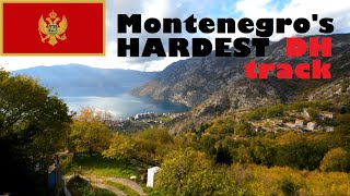
trail: Risan DH Track
8:16 |
648 |
Jul 3, 2022 , Kotor
Recent Trail Reports
| status | trail | date | condition | info | user |
|---|---|---|---|---|---|
| Kotor DH | Sep 16, 2024 @ 11:04am Sep 16, 2024 | Dry | jens212 | ||
| Vrmac-Kotor Switchbacks | Mar 5, 2024 @ 1:33pm Mar 5, 2024 | Unknown | OtherTrails Other Trails |
Activity Feed
| username | action | type | title | date |
|---|---|---|---|---|
| Hoschl | comment | trail | activity #95620005 | May 27, 2026 @ 1:40am May 27, 2026 |
| NielsVroom | ridden | route | activity #92883732 | Apr 18, 2026 @ 12:21pm Apr 18, 2026 |
| NielsVroom | wishlist | route | activity #92883165 | Apr 18, 2026 @ 12:13pm Apr 18, 2026 |
| shamix | wishlist | trail | activity #87837489 | Jan 26, 2026 @ 1:13am Jan 26, 2026 |
| ChristyLqjcn3 | ridden | trail | activity #83421022 | Nov 1, 2025 @ 11:32pm Nov 1, 2025 |
Recent Comments
| username | type | title | comment | date |
|---|---|---|---|---|
| trail | It’s one of a kind. Technical and quite... | May 27, 2026 @ 1:40am May 27, 2026 | ||
| trail | Great views of Kotor harbor and fun for first... | Aug 17, 2025 @ 1:24am Aug 17, 2025 | ||
| trail | So many switchback, rocks, no flow but worth... | Jan 22, 2025 @ 9:46am Jan 22, 2025 | ||
| trail | Trail wasn't maintained for 5years, there are... | Mar 5, 2024 @ 1:43pm Mar 5, 2024 | ||
| trail | The trail is nice and rideable in the first... | Mar 5, 2024 @ 1:33pm Mar 5, 2024 |
Activity Type Stats
| activitytype | trails | distance | descent | descent distance | total vertical | rating | global rank | state rank | photos | reports | routes | ridelogs |
|---|---|---|---|---|---|---|---|---|---|---|---|---|
| Mountain Bike | 5 | 6 miles | 5,279 ft | 5 miles | 2,936 ft | #2,575 | #2 | 12 | 7 | 2 | 698 | |
| E-Bike | 2 | 2 miles | 1,302 ft | 1 mile | 1,227 ft | #1,899 | #7 | 8 | 1 | 134 | ||
| Hike | 5 | 6 miles | 5,279 ft | 5 miles | 2,936 ft | #2,665 | #4 | 8 | 290 | |||
| Trail Running | 5 | 6 miles | 5,279 ft | 5 miles | 2,936 ft | #2,173 | #4 | 8 | 15 |
- By StuHolley & contributors
- Admins: apply
- #11032 - 7,244 views
- kotor activity log | embed map of Kotor mountain bike trails |
Downloading of trail gps tracks in kml & gpx formats is enabled for Kotor.
You must login to download files.