close
-
Layers w
- Weather Layers
- Pro
- Pro
- Pro
- Pro
- Pro
- Pro
- More Layers
- Pro
- Pro
- Pro
- Pro
-
Upgrade to

3D
Trail Conditions
- Unknown
- Snow Groomed
- Snow Packed
- Snow Covered
- Snow Cover Partial
- Freeze/thaw Cycle
- Icy
- Prevalent Mud
- Wet
- Variable
- Ideal
- Dry
- Very Dry
Trail Flow (Ridden Direction)
Trailforks scans users ridelogs to determine the most popular direction each trail is ridden. A good flowing trail network will have most trails flowing in a single direction according to their intension.
The colour categories are based on what percentage of riders are riding a trail in its intended direction.
The colour categories are based on what percentage of riders are riding a trail in its intended direction.
- > 96%
- > 90%
- > 80%
- > 70%
- > 50%
- < 50%
- bi-directional trail
- no data
Trail Last Ridden
Trailforks scans ridelogs to determine the last time a trail was ridden.
- < 2 days
- < 1 week
- < 2 weeks
- < 1 month
- < 6 months
- > 6 months
Trail Ridden Direction
The intended direction a trail should be ridden.
- Downhill Only
- Downhill Primary
- Both Directions
- Uphill Primary
- Uphill Only
- One Direction
Contribute Details
Colors indicate trail is missing specified detail.
- Description
- Photos
- Description & Photos
- Videos
Trail Popularity ?
Trailforks scans ridelogs to determine which trails are ridden the most in the last 9 months.
Trails are compared with nearby trails in the same city region with a possible 25 colour shades.
Think of this as a heatmap, more rides = more kinetic energy = warmer colors.
- most popular
- popular
- less popular
- not popular
ATV/ORV/OHV Filter
Max Vehicle Width
inches
US Cell Coverage
Legend

Radar Time
Activity Recordings
Trailforks uses anonymized public activity data.
?
Activity Recordings
Trailforks uses anonymized public activity data.
?
Personal Heatmap
▶
Activity Types
all
/
none
▶
Options
2
Date range
month
–
Winter Trails
Warning
A routing network for winter maps does not exist. Selecting trails using the winter trails layer has been disabled.
Missing Trails
Most Popular
Least Popular
Trails are colored based on popularity. The more popular a trail is, the more red. Less popular trails trend towards green.
Jump Magnitude Heatmap
Heatmap of where riders jump on trails. Zoom in to see individual jumps, click circles to view jump details.
BC Backroad Status
![map legend]()
Service Road Atlas is a free to use, community-driven service for viewing and creating reports on the numerous back-country service roads around B.C. and Alberta.

Slope Aspect
Direction the slope faces
Trails Deemphasized
Trails are shown in grey.
Only show trails with no bike usage.
Suggested Layers
Based on selected activity type
Save the current map location and zoom level as your default home location whenever this page is loaded.
Save
No description for Kurrajong has been added yet!
Login or register to submit one.
Activities Click to view
- Mountain Bike
55 trails
- E-Bike
44 trails
- Adaptive Bike
- Hike
46 trails
- Trail Running
44 trails
Region Details
- 14
- 4
- 19
- 11
- 4
Region Status
Open as of May 24, 2026Stats
- Avg Trail Rating
- Trails (view details)
- 52
- Trails Mountain Bike
- 55
- Trails E-Bike
- 44
- Trails Gravel Bike
- 1
- Trails Hike
- 46
- Trails Trail Running
- 44
- Total Distance
- 17 miles
- Total Descent Distance
- 11 miles
- Total Descent
- 5,364 ft
- Total Vertical
- 1,439 ft
- Highest Trailhead
- 1,555 ft
- Reports
- 130
- Photos
- 117
- Ridden Counter
- 320
Sub Regions
-
Bowen Mountain Trails
- 2
- 15
- 10
- 4
-
Cabbage Tree Trails
- 1
- 4
- 1
Popular Kurrajong Mountain Biking Trails
• 100 ★ 5.0 • 2,904 ft • 48 ft • 37 •
tehnical XC trail featuring lookouts, rock drops and rock gardens.
• 80 ★ 4.5 • 1,503 ft • 9 ft • 37 •
Popular blue difficulty singletrack. This mountain bike primary trail can be used both directions. It features rock face, rock garden and wallride. On average it takes 4 minutes to complete this trail.
• 90 ★ 5.0 • 2,654 ft • 11 ft • 35 •
The best trail on the mountain. Fast downhill ride with rock rolls, gaps, berms, step downs etc. Track partly follows an old over grown logging trail. Ride out at the end to .
• 50 ★ 4.0 • 2,274 ft • 0 ft • 35 •
Some major berm action and some tidy drops, doubles (all mostly rollable).
• 95 ★ 4.5 • 1,732 ft • 3 ft • 33 •
Rocky tech trail with many rock features, small drops and tight corners. A little elevation drop, but mostly pedally.
• 80 ★ 4.0 • 1,526 ft • 19 ft • 30 •
Follow to top of rise, trail is on the left. Flat at first with a few obstacles, a couple of rock roll offs, then a downhill run onto .
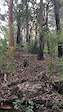
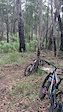
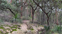
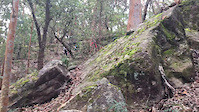
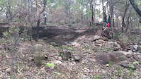
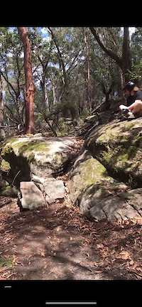
Photos of Kurrajong Mountain Bike
Videos of Kurrajong Mountain Bike
trail: Pasqals Pot Plants
0:09 |
86 |
Apr 23, 2023
trail: Pasqals Pot Plants
0:07 |
82 |
Apr 23, 2023
trail: Car Boot Sale
0:12 |
159 |
Mar 11, 2022
trail: Bowen Mountain Bear’s Club
0:13 |
118 |
Feb 19, 2022
trail: Sausage
0:10 |
186 |
Feb 19, 2022
trail: Bowen Mountain Bear’s Club
0:09 |
112 |
Feb 17, 2022
trail: Sausage
0:10 |
106 |
Feb 3, 2022
![OLD SCHOOL DH TRAILS [] Cabbage Tree Trails []...](https://ev1.pinkbike.org/tf/vt/1/yvt-215258-4.jpg)
14:27 |
60 |
Sep 15, 2024
Current Trail Warnings
| status | trail | date | condition | user | info |
|---|---|---|---|---|---|
| XXXC | May 24, 2026 @ 10:20pm (Australia/Sydney) May 24, 2026 | Unknown | Joe89 | Tree down just after the ladder |
Recent Trail Reports
| status | trail | date | condition | info | user |
|---|---|---|---|---|---|
| Blues Clues | Mar 11, 2026 @ 7:15pm (Australia/Sydney) Mar 11, 2026 | Ideal | Joe89 | ||
| Chasing the Dragon | Mar 9, 2026 @ 9:33pm (Australia/Sydney) Mar 9, 2026 | Ideal | Joe89 | ||
| Pasqals Pot Plants | Mar 9, 2026 @ 9:21pm (Australia/Sydney) Mar 9, 2026 | Ideal | Joe89 | ||
| Cam Greens Neck Tattoo | Feb 20, 2026 @ 9:49am (Australia/Sydney) Feb 19, 2026 | Ideal | albymongrlz | ||
| Lost Facemask | Feb 7, 2026 @ 4:14pm (Australia/Sydney) Feb 6, 2026 | Dry | albymongrlz | ||
| Orgasming Barnaby | Feb 1, 2026 @ 2:42pm (Australia/Sydney) Jan 31, 2026 | Prevalent Mud | albymongrlz | ||
| Goats Road | Jan 19, 2026 @ 9:10am (Australia/Sydney) Jan 18, 2026 | Unknown | albymongrlz | ||
| Car Boot Sale | Dec 29, 2025 @ 4:42pm (Australia/Sydney) Dec 28, 2025 | Dry | albymongrlz | ||
| Camel Joe | Nov 25, 2025 @ 11:40pm (Australia/Sydney) Nov 25, 2025 | Unknown | Joe89 | ||
| Pipeline Trail | Oct 24, 2025 @ 8:09am (Australia/Sydney) Oct 23, 2025 | Ideal | albymongrlz |
Activity Feed
| username | action | type | title | date |
|---|---|---|---|---|
| 9QyD5o | add | photo | activity #96282593 and 2 more | Jun 5, 2026 @ 2:30am Jun 5, 2026 |
| Joe89 | add | report | activity #95398840 | May 24, 2026 @ 5:20am May 24, 2026 |
| Joe89 | add | photo | activity #95398266 and 1 more | May 24, 2026 @ 5:11am May 24, 2026 |
| 9QyD5o | add | report | activity #94963849 and 4 more | May 18, 2026 @ 1:25am May 18, 2026 |
| zokstar | comment | trail | activity #94873919 | May 16, 2026 @ 10:30pm May 16, 2026 |
Recent Comments
| username | type | title | comment | date |
|---|---|---|---|---|
| trail | Tree down. Unrideable. | May 16, 2026 @ 10:30pm May 16, 2026 | ||
| trail | Sick track! | Feb 19, 2026 @ 2:49pm Feb 19, 2026 | ||
| report | @Joe89 legend | Dec 29, 2025 @ 11:48am Dec 29, 2025 | ||
| report | Bridge repaired | Nov 25, 2025 @ 4:31am Nov 25, 2025 | ||
| trail | Great track with a few features | Oct 11, 2025 @ 5:16pm Oct 11, 2025 |
Local Badges
-

10 Blue Trails0 awarded -

Epic Mountain Bike Climb 2k0 awarded -

Climbing 10k Badge0 awarded -

Mountain Biking 100k Badge0 awarded -

Epic Ride Descent 2k0 awarded -

Descent 10k Badge0 awarded
Activity Type Stats
| activitytype | trails | distance | descent | descent distance | total vertical | rating | global rank | state rank | photos | reports | routes | ridelogs |
|---|---|---|---|---|---|---|---|---|---|---|---|---|
| Mountain Bike | 55 | 17 miles | 5,364 ft | 11 miles | 1,440 ft | #4,455 | #174 | 113 | 130 | 1,527 | ||
| E-Bike | 44 | 13 miles | 4,508 ft | 9 miles | 1,257 ft | #4,987 | #229 | 125 | 129 | |||
| Hike | 46 | 14 miles | 4,022 ft | 8 miles | 1,440 ft | #7,872 | #248 | 4 | 116 | 51 | ||
| Trail Running | 44 | 13 miles | 3,537 ft | 8 miles | 1,440 ft | #7,498 | #236 | 113 | 60 |
Frequently Asked Questions About Kurrajong
▼
What are the best places to ride in Kurrajong?
Kurrajong has 2 areas to explore for mountain biking. The top rated areas are:
▼
What are the highest rated mountain biking trails in Kurrajong?
The highest rated mountain biking trails in Kurrajong are:
- The Old logging trail (4.4/5)
- XXXC (4.2/5)
- Car Boot Sale (4.2/5)
- Sausage (4.2/5)
- Chasing the Dragon (4.1/5)
▼
Where can I park to ride in Kurrajong?
▼
What is the longest trail in Kurrajong?
The longest trail in Kurrajong is No Corners for Old Men at 1.1 miles. View all trails sorted by distance.
Activities
- By RomanMark
 & contributors
 - Admins: stuartrichardson, RBM
- #58585 - 1,171 views
- kurrajong activity log | embed map of Kurrajong mountain bike trails | kurrajong mountain biking points of interest
Downloading of trail gps tracks in kml & gpx formats is enabled for Kurrajong.
You must login to download files.