close
-
Layers w
- Weather Layers
- Pro
- Pro
- Pro
- Pro
- Pro
- Pro
- More Layers
- Pro
- Pro
- Pro
- Pro
-
Upgrade to

3D
Trail Conditions
- Unknown
- Snow Groomed
- Snow Packed
- Snow Covered
- Snow Cover Partial
- Freeze/thaw Cycle
- Icy
- Prevalent Mud
- Wet
- Variable
- Ideal
- Dry
- Very Dry
Trail Flow (Ridden Direction)
Trailforks scans users ridelogs to determine the most popular direction each trail is ridden. A good flowing trail network will have most trails flowing in a single direction according to their intension.
The colour categories are based on what percentage of riders are riding a trail in its intended direction.
The colour categories are based on what percentage of riders are riding a trail in its intended direction.
- > 96%
- > 90%
- > 80%
- > 70%
- > 50%
- < 50%
- bi-directional trail
- no data
Trail Last Ridden
Trailforks scans ridelogs to determine the last time a trail was ridden.
- < 2 days
- < 1 week
- < 2 weeks
- < 1 month
- < 6 months
- > 6 months
Trail Ridden Direction
The intended direction a trail should be ridden.
- Downhill Only
- Downhill Primary
- Both Directions
- Uphill Primary
- Uphill Only
- One Direction
Contribute Details
Colors indicate trail is missing specified detail.
- Description
- Photos
- Description & Photos
- Videos
Trail Popularity ?
Trailforks scans ridelogs to determine which trails are ridden the most in the last 9 months.
Trails are compared with nearby trails in the same city region with a possible 25 colour shades.
Think of this as a heatmap, more rides = more kinetic energy = warmer colors.
- most popular
- popular
- less popular
- not popular
ATV/ORV/OHV Filter
Max Vehicle Width
inches
US Cell Coverage
Legend

Radar Time
Activity Recordings
Trailforks uses anonymized public activity data.
?
Activity Recordings
Trailforks uses anonymized public activity data.
?
Personal Heatmap
▶
Activity Types
all
/
none
▶
Options
2
Date range
month
–
Winter Trails
Warning
A routing network for winter maps does not exist. Selecting trails using the winter trails layer has been disabled.
Missing Trails
Most Popular
Least Popular
Trails are colored based on popularity. The more popular a trail is, the more red. Less popular trails trend towards green.
Jump Magnitude Heatmap
Heatmap of where riders jump on trails. Zoom in to see individual jumps, click circles to view jump details.
BC Backroad Status
![map legend]()
Service Road Atlas is a free to use, community-driven service for viewing and creating reports on the numerous back-country service roads around B.C. and Alberta.

Slope Aspect
Direction the slope faces
Trails Deemphasized
Trails are shown in grey.
Only show trails with no bike usage.
Suggested Layers
Based on selected activity type
Save the current map location and zoom level as your default home location whenever this page is loaded.
Save
No description for La Baie has been added yet!
Login or register to submit one.
Activities Click to view
- Mountain Bike
17 trails
- E-Bike
7 trails
- Gravel Bike
0 trails
- Adaptive Bike
0 trails
- Winter Fat Bike
0 trails
- Hike
11 trails
- Trail Running
11 trails
- Nordic Ski
6 trails
Region Details
- 3
- 3
- 1
- 7
- 2
- 1
Region Status
Open as of Jun 18, 2025Local Trail Association
Stats
- Avg Trail Rating
- Trails (view details)
- 23
- Trails Mountain Bike
- 17
- Trails E-Bike
- 7
- Trails Hike
- 11
- Trails Trail Running
- 11
- Trails Nordic Ski
- 6
- Total Distance
- 22 miles
- Total Descent
- 4,586 ft
- Total Vertical
- 736 ft
- Highest Trailhead
- 819 ft
- Reports
- 52
- Photos
- 11
- Ridden Counter
- 1,653
Sub Regions
-
Centre de plein air Bec-Scie
- 2
- 4
-
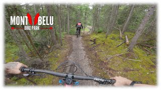
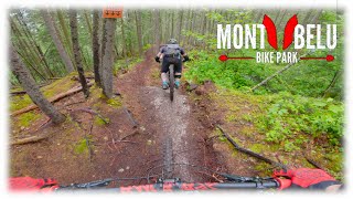
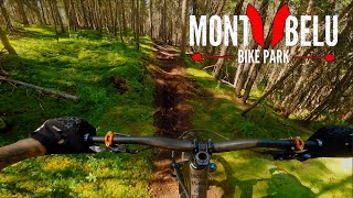
Mont-Bélu Bike Park
- 1
- 1
- 3
- 2
- 1
Popular La Baie Mountain Biking Trails
• 100 ★ 4.2 • 3,612 ft • 0 ft • 180 •
Highly rated popular blue difficulty singletrack. This mountain bike primary trail can be used downhill only. On average it takes 3 minutes to complete this trail.
• 75 ★ 4.4 • 4,236 ft • 0 ft • 174 •
Fast and Quick track withs jumps, rocks, berms, loose turn, roots and slippy sections. Host of Quebec Cup race
• 85 ★ 4.0 • 3,041 ft • 0 ft • 167 •
Popular black diamond difficulty singletrack. This mountain bike primary trail can be used downhill only and has a moderate overall physical rating. It features a-frame, drop, jump, pump track and rock face. On average it takes 3 minutes to complete this trail.
• 55 ★ 4.0 • 2,769 ft • 0 ft • 148 •
intermediate Single track but one difficult roots section on top. Slippy end section
• 40 ★ 4.4 • 3,054 ft • 0 ft • 113 •
Highly rated moderately popular double black diamond difficulty singletrack. This mountain bike primary trail can be used downhill only. It features berm, bridge, drop, jump, rock face and rock garden. On average it takes 6 minutes to complete this trail.
• 45 ★ 4.5 • 2,671 ft • 0 ft • 85 •
Moderately popular double black diamond difficulty singletrack. This mountain bike primary trail can be used downhill only. It features berm, bridge, drop, jump, rock face, rock garden and other. On average it takes 5 minutes to complete this trail.
• 65 ★ 4.0 • 4,380 ft • 444 ft • 69 •
Moderately popular blue difficulty singletrack. This mountain bike primary trail can be used uphill only. On average it takes 12 minutes to complete this trail.
• 5 ★ 0.0 • 2 miles • 575 ft • 10 •
Less popular black diamond difficulty mixed. This mountain bike primary trail. On average it takes 30 minutes to complete this trail.
Photos of La Baie Mountain Bike
Videos of La Baie Mountain Bike

trail: La Plantation
0:06 |
|
Sep 24, 2021
trail: La Sunset (Gendron)
0:06 |
127 |
Jun 24, 2021

trail: La Plantation
0:06 |
|
Jun 15, 2021
youtuber
![On refais le Mont Bélu au complet en monster...]()
18:04 |
42 |
Sep 29, 2025
youtuber
![On roule le magnifique Mont Bélu en DH!]()
19:30 |
55 |
Jul 14, 2025
0:00 |
328 |
Jun 24, 2022
youtuber
![Deux gem old school pour le dessert!]()

trail: La Minoune
6:41 |
462 |
Mar 28, 2021 , La Baie
youtuber
![Deux gem old school pour le dessert!]()
trail: La Old School
6:41 |
472 |
Mar 28, 2021 , La Baie
Recent Trail Reports
| status | trail | date | condition | info | user |
|---|---|---|---|---|---|
| La Plantation | Jun 18, 2025 @ 6:01pm Jun 18, 2025 | Ideal | josim90 | ||
| La Old School | Jun 18, 2025 @ 6:01pm Jun 18, 2025 | Ideal | josim90 | ||
| La Minoune | Jun 18, 2025 @ 6:01pm Jun 18, 2025 | Ideal | josim90 | ||
| L’Autobahn | Jun 18, 2025 @ 6:01pm Jun 18, 2025 | Ideal | josim90 | ||
| Connector | Jun 18, 2025 @ 6:01pm Jun 18, 2025 | Dry | josim90 | ||
| La Sunset (Gendron) | Jun 18, 2025 @ 6:01pm Jun 18, 2025 | Very Dry | josim90 | ||
| T-Bar | Jun 18, 2025 @ 6:01pm Jun 18, 2025 | Variable | josim90 | ||
| La Road Gap | Jun 18, 2025 @ 6:01pm Jun 18, 2025 | Dry | josim90 | ||
| Griptape | Jul 2, 2023 @ 9:31pm Jul 2, 2023 | Unknown | StephaneMarceau TRAILFORKS |
Activity Feed
| username | action | type | title | date |
|---|---|---|---|---|
| maximebeaudoin | update | trail | activity #83272119 | Oct 30, 2025 @ 10:06am Oct 30, 2025 |
| emileber | add | trail | activity #83119536 | Oct 27, 2025 @ 10:19am Oct 27, 2025 |
| trailforks | add | video | activity #81365010 | Sep 29, 2025 @ 10:00am Sep 29, 2025 |
| maximebeaudoin | update | region | activity #80946587 | Sep 23, 2025 @ 5:43am Sep 23, 2025 |
| kyleluvsdh | wishlist | trail | activity #80932111 | Sep 22, 2025 @ 8:11pm Sep 22, 2025 |
Recent Comments
| username | type | title | comment | date |
|---|---|---|---|---|
| trail | Please build more awesome trails like this!... | Dec 24, 2020 @ 4:08pm Dec 24, 2020 | ||
| trail | need cleanup in the trail. The vegetation is... | Jul 26, 2019 @ 12:25pm Jul 26, 2019 |
Local Badges
-

Epic Mountain Bike Climb 2k40 awarded -

Climbing 10k Badge13 awarded -

Mountain Biking 100k Badge0 awarded -

Epic Ride Descent 2k40 awarded -

Descent 10k Badge13 awarded -

Descent 100k Badge0 awarded
Bike & Skill Parks
| name | type | city | rating |
|---|---|---|---|
| Mont-Bélu Bike Park | bike park | La Baie |
Activity Type Stats
| activitytype | trails | distance | descent | descent distance | total vertical | rating | global rank | state rank | photos | reports | routes | ridelogs |
|---|---|---|---|---|---|---|---|---|---|---|---|---|
| Mountain Bike | 17 | 13 miles | 3,796 ft | 7 miles | 584 ft | #4,068 | #63 | 11 | 52 | 2,073 | ||
| E-Bike | 7 | 4 miles | 2,831 ft | 4 miles | 541 ft | #6,209 | #70 | 26 | 77 | |||
| Hike | 11 | 5 miles | 804 ft | 2 miles | 348 ft | #8,696 | #85 | 50 | 378 | |||
| Trail Running | 11 | 5 miles | 804 ft | 2 miles | 348 ft | #8,905 | #85 | 50 | 43 | |||
| Nordic Ski | 6 | 9 miles | 791 ft | 4 miles | 427 ft | #1,051 | #55 | 99 |
Frequently Asked Questions About La Baie
▼
What are the best places to ride in La Baie?
La Baie has 2 areas to explore for mountain biking. The top rated areas are:
▼
What are the highest rated mountain biking trails in La Baie?
The highest rated mountain biking trails in La Baie are:
- L’Autobahn (4.2/5)
- La Old School (4.2/5)
- La Sunset (Gendron) (4.1/5)
- La Minoune (4.1/5)
- La Road Gap (4/5)
▼
What is the best time of the year to ride in La Baie?
Based on ride log data, the most popular months to ride in La Baie are:
- September (20 activities)
- June (17 activities)
- August (16 activities)
▼
Where can I park to ride in La Baie?
There are 2 parking locations listed in La Baie. The most popular parking spots are:
Activities
Trails
- By frriv31
 & contributors
 - Admins: VQ, bigjay, StephaneMarceau, Canadmos, VS, maximebeaudoin
- #4893 - 2,648 views
- la baie activity log | embed map of La Baie mountain bike trails | la baie mountain biking points of interest
Downloading of trail gps tracks in kml & gpx formats is enabled for La Baie.
You must login to download files.