close
-
Layers w
- Weather Layers
- Pro
- Pro
- Pro
- Pro
- Pro
- Pro
- More Layers
- Pro
- Pro
- Pro
- Pro
-
Upgrade to

3D
Trail Conditions
- Unknown
- Snow Groomed
- Snow Packed
- Snow Covered
- Snow Cover Partial
- Freeze/thaw Cycle
- Icy
- Prevalent Mud
- Wet
- Variable
- Ideal
- Dry
- Very Dry
Trail Flow (Ridden Direction)
Trailforks scans users ridelogs to determine the most popular direction each trail is ridden. A good flowing trail network will have most trails flowing in a single direction according to their intension.
The colour categories are based on what percentage of riders are riding a trail in its intended direction.
The colour categories are based on what percentage of riders are riding a trail in its intended direction.
- > 96%
- > 90%
- > 80%
- > 70%
- > 50%
- < 50%
- bi-directional trail
- no data
Trail Last Ridden
Trailforks scans ridelogs to determine the last time a trail was ridden.
- < 2 days
- < 1 week
- < 2 weeks
- < 1 month
- < 6 months
- > 6 months
Trail Ridden Direction
The intended direction a trail should be ridden.
- Downhill Only
- Downhill Primary
- Both Directions
- Uphill Primary
- Uphill Only
- One Direction
Contribute Details
Colors indicate trail is missing specified detail.
- Description
- Photos
- Description & Photos
- Videos
Trail Popularity ?
Trailforks scans ridelogs to determine which trails are ridden the most in the last 9 months.
Trails are compared with nearby trails in the same city region with a possible 25 colour shades.
Think of this as a heatmap, more rides = more kinetic energy = warmer colors.
- most popular
- popular
- less popular
- not popular
ATV/ORV/OHV Filter
Max Vehicle Width
inches
US Cell Coverage
Legend

Radar Time
Activity Recordings
Trailforks uses anonymized public activity data.
?
Activity Recordings
Trailforks uses anonymized public activity data.
?
Personal Heatmap
▶
Activity Types
all
/
none
▶
Options
2
Date range
month
–
Winter Trails
Warning
A routing network for winter maps does not exist. Selecting trails using the winter trails layer has been disabled.
Missing Trails
Most Popular
Least Popular
Trails are colored based on popularity. The more popular a trail is, the more red. Less popular trails trend towards green.
Jump Magnitude Heatmap
Heatmap of where riders jump on trails. Zoom in to see individual jumps, click circles to view jump details.
BC Backroad Status
![map legend]()
Service Road Atlas is a free to use, community-driven service for viewing and creating reports on the numerous back-country service roads around B.C. and Alberta.

Slope Aspect
Direction the slope faces
Trails Deemphasized
Trails are shown in grey.
Only show trails with no bike usage.
Suggested Layers
Based on selected activity type
Save the current map location and zoom level as your default home location whenever this page is loaded.
Save
No description for La Bresse has been added yet!
Login or register to submit one.
This region uses the Uk/Euro style trail grading system.
Activities Click to view
- Mountain Bike
87 trails
- E-Bike
67 trails
- Adaptive Bike
0 trails
- Winter Fat Bike
0 trails
- Hike
68 trails
- Trail Running
68 trails
- Backcountry Ski
8 trails
Region Details
- 9
- 2
- 25
- 14
- 2
- 1
Region Status
Open as of 2 daysStats
- Avg Trail Rating
- Trails (view details)
- 64
- Trails Mountain Bike
- 87
- Trails E-Bike
- 67
- Trails Hike
- 68
- Trails Trail Running
- 68
- Trails Backcountry Ski
- 8
- Total Distance
- 47 miles
- Total Descent
- 28,146 ft
- Total Vertical
- 2,573 ft
- Highest Trailhead
- 4,446 ft
- Reports
- 390
- Photos
- 206
- Ridden Counter
- 4,172
Sub Regions
-
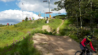
Bikepark La Bresse
- 1
- 2
- 3
- 1
- 1
-
Enduro Bressaud
- 1
- 17
- 5
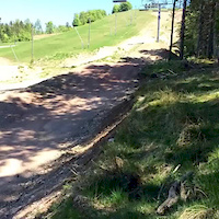
Popular La Bresse Mountain Biking Trails
• 100 ★ 3.2 • 1 mile • 25 ft • 431 •
Blue Track of La Bresse Bikepark. Can be done on AM bikes as well
• 70 ★ 3.9 • 1 mile • 67 ft • 410 •
Blue track, very nice atmosphere descending alongside a waterway, there track is often humid due to the small stream. You will see some north shore, rocky and rooty sections. It's a bit harsh on a AM bike there.
• 60 ★ 5.0 • 2,589 ft • 8 ft • 262 •
Moderately popular red difficulty singletrack. This mountain bike primary trail and has a hard overall physical rating with a 8 ft green climb. It features berm, drop and jump. Trail visibility is always easy to follow. On average it takes 3 minutes to complete this trail.
• 95 ★ 4.5 • 2 miles • 31 ft • 135 • • hike
Popular blue difficulty singletrack. This hike primary trail and has a moderate overall physical rating with a 31 ft black diamond climb. Trail visibility is always easy to follow. On average it takes 14 minutes to complete this trail.
• 45 ★ 4.0 • 5,151 ft • 0 ft • 129 •
Moderately popular green difficulty singletrack. This mountain bike primary trail can be used downhill only and has a easy overall physical rating with a 0 ft green climb. It features berm. Trail visibility is always easy to follow. On average it takes 3 minutes to complete this trail.
• 35 ★ 0.0 • 633 ft • 0 ft • 126 •
Less popular black difficulty singletrack. This mountain bike primary trail can be used both directions. It features berm, drop and jump. On average it takes 1 minutes to complete this trail.
La Bresse Mountain Bike Routes
★ 4.0 • 33 miles • 5,104 ft • 0 •
LA BRESSE GB 15 :TOUR DE LA BRESSE VTT 55KMS
14 miles • 2,551 ft • 0 •
the trail start on a asphalt road then continue on offroad. the downhills follow typical Vosgian...
8 miles • 815 ft • 0 •
LA BRESSE:CIRCUIT VTT N°1 Les balcons de la bresse
15 miles • 1,309 ft • 0 •
LA BRESSE :CIRCUIT VTT N°12 TOUR DU GRAND JEAN
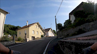
Photos of La Bresse Mountain Bike
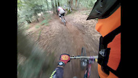
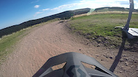
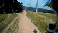
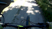
Videos of La Bresse Mountain Bike
trail: Virolo
0:06 |
180 |
Jul 11, 2020
trail: Louis Ziddore
6:36 |
538 |
Jul 30, 2019
4:00 |
114 |
Jul 16, 2019
trail: D5 Schuss
0:10 |
123 |
May 28, 2017
trail: D3 Chitelet
4:10 |
199 |
Nov 19, 2016
trail: D3 Chitelet
5:11 |
112 |
Sep 21, 2015
trail: D4 Barrage
4:33 |
166 |
Sep 8, 2015
trail: D4 Barrage
2:30 |
93 |
Aug 31, 2015
Recent Trail Reports
| status | trail | date | condition | info | user |
|---|---|---|---|---|---|
| la haute goutte | Jun 21, 2026 @ 9:34am (Europe/Busingen) 2 days | Dry | arthurit | ||
| La ballade des contrebandiers | Jun 21, 2026 @ 9:34am (Europe/Busingen) 2 days | Dry | arthurit | ||
| Retour A l'École | Jun 21, 2026 @ 9:34am (Europe/Busingen) 2 days | Dry | arthurit | ||
| D5 Schuss | Jun 21, 2026 @ 9:34am (Europe/Busingen) 2 days | Dry | arthurit | ||
| D4 Barrage | Jun 21, 2026 @ 9:34am (Europe/Busingen) 2 days | Dry | arthurit | ||
| L'express | Jun 21, 2026 @ 9:34am (Europe/Busingen) 2 days | Dry | arthurit | ||
| D3 Chitelet | Jun 21, 2026 @ 9:34am (Europe/Busingen) 2 days | Ideal | arthurit | ||
| Virolo | Jun 21, 2026 @ 9:34am (Europe/Busingen) 2 days | Dry | arthurit | ||
| Sp Tremplin d'entre les gouttes | Nov 21, 2025 @ 9:09pm (Europe/Paris) Nov 21, 2025 | Wet | Catatafish01 | ||
| Louis Ziddore | Sep 30, 2025 @ 4:18pm (Europe/Busingen) Sep 30, 2025 | Ideal | BaptouM88 |
Activity Feed
| username | action | type | title | date |
|---|---|---|---|---|
| DanielTimo | wishlist | region | activity #97570134 | Jun 22, 2026 @ 10:16am 6 hours |
| DanielTimo | wishlist | region | activity #97570063 | Jun 22, 2026 @ 10:15am 6 hours |
| Bermhard | wishlist | region | activity #97547665 | Jun 22, 2026 @ 12:48am 15 hours |
| arthurit | add | report | activity #97481121 and 7 more | Jun 21, 2026 @ 7:08am 1 day |
| alb-bdr | wishlist | region | activity #97366134 | Jun 19, 2026 @ 9:51pm 3 days |
Recent Comments
| username | type | title | comment | date |
|---|---|---|---|---|
| trail | Way more difficult than the red one.... | Aug 8, 2025 @ 3:01am Aug 8, 2025 | ||
| trail | Really nice and mostly easy trail. We had a... | Jun 21, 2025 @ 8:31am Jun 21, 2025 | ||
| trail | Really nice and mostly easy trail. Only the... | Jun 21, 2025 @ 8:27am Jun 21, 2025 | ||
| trail | This is not an uphill trail. It has been... | Jun 21, 2025 @ 8:23am Jun 21, 2025 | ||
| trail | It's a green with a few blue features | Sep 19, 2024 @ 4:10am Sep 19, 2024 |
Local Badges
-

Epic Ride Climb 2k519 awarded -

Climbing 10k Badge45 awarded -

Climbing 100k Badge5 awarded -

Epic Ride Descent 2k636 awarded -

Descent 10k Badge57 awarded -

Descent 100k Badge5 awarded
Bike & Skill Parks
| name | type | city | rating |
|---|---|---|---|
| Bikepark La Bresse | bike park | La Bresse |
Activity Type Stats
| activitytype | trails | distance | descent | descent distance | total vertical | rating | global rank | state rank | photos | reports | routes | ridelogs |
|---|---|---|---|---|---|---|---|---|---|---|---|---|
| Mountain Bike | 87 | 47 miles | 28,146 ft | 35 miles | 2,572 ft | #2,057 | #45 | 201 | 389 | 10 | 5,162 | |
| E-Bike | 67 | 36 miles | 20,538 ft | 26 miles | 2,572 ft | #1,548 | #101 | 4 | 347 | 7 | 373 | |
| Hike | 68 | 37 miles | 21,227 ft | 26 miles | 2,572 ft | #2,479 | #60 | 377 | 781 | |||
| Trail Running | 68 | 37 miles | 21,227 ft | 26 miles | 2,572 ft | #2,316 | #66 | 377 | 262 | |||
| Backcountry Ski | 8 | 4 miles | 1,781 ft | 3 miles | 1,476 ft | #68 | #7 | 165 |
Frequently Asked Questions About La Bresse
▼
What are the best places to ride in La Bresse?
La Bresse has 2 areas to explore for mountain biking. The top rated areas are:
▼
What are the highest rated mountain biking trails in La Bresse?
The highest rated mountain biking trails in La Bresse are:
- Sp Tremplin d'entre les gouttes (4.4/5)
- Blanchemer (4.3/5)
- Blanchemer (4.2/5)
- La Belle Vierge (4.2/5)
- Victor Mimi (4.1/5)
▼
What is the best time of the year to ride in La Bresse?
Based on ride log data, the most popular months to ride in La Bresse are:
- May (84 activities)
- July (72 activities)
- June (71 activities)
▼
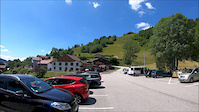
Where can I park to ride in La Bresse?
There are 6 parking locations listed in La Bresse. The most popular parking spots are: View all parking and trailhead locations on the map to plan your visit.
Activities
Trails
- By payze & contributors
- Admins: apply
- #4313 - 13,654 views
- la bresse activity log | embed map of La Bresse mountain bike trails | la bresse mountain biking points of interest
Downloading of trail gps tracks in kml & gpx formats is enabled for La Bresse.
You must login to download files.