close
-
Layers w
- Weather Layers
- Pro
- Pro
- Pro
- Pro
- Pro
- Pro
- More Layers
- Pro
- Pro
- Pro
- Pro
-
Upgrade to

3D
Trail Conditions
- Unknown
- Snow Groomed
- Snow Packed
- Snow Covered
- Snow Cover Partial
- Freeze/thaw Cycle
- Icy
- Prevalent Mud
- Wet
- Variable
- Ideal
- Dry
- Very Dry
Trail Flow (Ridden Direction)
Trailforks scans users ridelogs to determine the most popular direction each trail is ridden. A good flowing trail network will have most trails flowing in a single direction according to their intension.
The colour categories are based on what percentage of riders are riding a trail in its intended direction.
The colour categories are based on what percentage of riders are riding a trail in its intended direction.
- > 96%
- > 90%
- > 80%
- > 70%
- > 50%
- < 50%
- bi-directional trail
- no data
Trail Last Ridden
Trailforks scans ridelogs to determine the last time a trail was ridden.
- < 2 days
- < 1 week
- < 2 weeks
- < 1 month
- < 6 months
- > 6 months
Trail Ridden Direction
The intended direction a trail should be ridden.
- Downhill Only
- Downhill Primary
- Both Directions
- Uphill Primary
- Uphill Only
- One Direction
Contribute Details
Colors indicate trail is missing specified detail.
- Description
- Photos
- Description & Photos
- Videos
Trail Popularity ?
Trailforks scans ridelogs to determine which trails are ridden the most in the last 9 months.
Trails are compared with nearby trails in the same city region with a possible 25 colour shades.
Think of this as a heatmap, more rides = more kinetic energy = warmer colors.
- most popular
- popular
- less popular
- not popular
ATV/ORV/OHV Filter
Max Vehicle Width
inches
US Cell Coverage
Legend

Radar Time
Activity Recordings
Trailforks uses anonymized public activity data.
?
Activity Recordings
Trailforks uses anonymized public activity data.
?
Personal Heatmap
▶
Activity Types
all
/
none
▶
Options
2
Date range
month
–
Winter Trails
Warning
A routing network for winter maps does not exist. Selecting trails using the winter trails layer has been disabled.
Missing Trails
Most Popular
Least Popular
Trails are colored based on popularity. The more popular a trail is, the more red. Less popular trails trend towards green.
Jump Magnitude Heatmap
Heatmap of where riders jump on trails. Zoom in to see individual jumps, click circles to view jump details.
BC Backroad Status
![map legend]()
Service Road Atlas is a free to use, community-driven service for viewing and creating reports on the numerous back-country service roads around B.C. and Alberta.

Slope Aspect
Direction the slope faces
Trails Deemphasized
Trails are shown in grey.
Only show trails with no bike usage.
Suggested Layers
Based on selected activity type
Save the current map location and zoom level as your default home location whenever this page is loaded.
Save
No description for La Crosse has been added yet!
Login or register to submit one.
Activities Click to view
- Mountain Bike
56 trails
- E-Bike
4 trails
- Gravel Bike
13 trails
- Adaptive Bike
14 trails
- Winter Fat Bike
10 trails
- Hike
102 trails
- Trail Running
101 trails
- Snowmobile
1 trails
- Snowshoe
10 trails
- Downhill Ski
24 trails
- Nordic Ski
1 trails
Region Details
- 9
- 6
- 17
- 18
- 5
- 1
Region Status
Open as of Mar 25, 2026Stats
- Avg Trail Rating
- Trails (view details)
- 126
- Trails Mountain Bike
- 56
- Trails E-Bike
- 4
- Trails Gravel Bike
- 13
- Trails Adaptive Bike
- 14
- Trails Winter Fat Bike
- 10
- Trails Hike
- 102
- Trails Trail Running
- 101
- Trails Snowmobile
- 1
- Trails Snowshoe
- 10
- Trails Downhill Ski
- 24
- Trails Nordic Ski
- 1
- Total Distance
- 62 miles
- Total Descent
- 9,161 ft
- Total Vertical
- 651 ft
- Highest Trailhead
- 1,282 ft
- Reports
- 1,191
- Photos
- 96
- Ridden Counter
- 17,302
Sub Regions
-
Gateway Trails
- 6
- 1
-
Hixon Forest - Lower and Upper
- 5
- 15
- 4
- 1
-
Mathy Quarry Bluffland Tract
- 1
- 1
Popular La Crosse Mountain Biking Trails
• 35 ★ 4.0 • 4,590 ft • 143 ft • 792 •
serves as a bidirectional climbing return for , Nerfherder, and Vader.
• 90 ★ 4.4 • 4,032 ft • 123 ft • 552 •
One of the original trails at Upper Hixon Park, this trail serves as a great introduction to riding hand cut single track. There are some log and skinny options that can be found on this trail.
• 80 ★ 3.0 • 541 ft • 19 ft • 531 •
Updated / Cropped in 2018 with new trail construction. Offers an alternate black old school tech line
• 95 ★ 4.0 • 1,706 ft • 45 ft • 516 •
Newly rebuilt in summer of 2018, this trail offers a great connection to the Nerfherder Downhill. This trail was formerly known as , but has been merged with in an effort to consolidate trail names.This segment of also provides access...
• 95 ★ 4.0 • 2,310 ft • 76 ft • 479 •
Old School hand cut tight single track. This is a directional trail that starts at the s / intersection and ends at / Prairie Loop.
• 55 ★ 4.6 • 2,310 ft • 6 ft • 460 •
Downhill Trail Build by Rock Solid Trail Contractors in 2018. Designed as a intermediate Level DH with Jumps, Berms & Rollers. Best resembles a linear pumptrack.
La Crosse Mountain Bike Routes
★ 3.0 • 3 miles • 316 ft • 7 • Loop •
This is an easy-ish singletrack loop on the Upper Hixon trails.
6 miles • 644 ft • 17 •
A loop of intermediate trails starting and ending from the Upper Hixon trailhead.
★ 1.0 • 14 miles • 2,180 ft • 29 •
A challenging route including lots of fun descents with few repeated sections
8 miles • 1,155 ft • 24 •
A challenging loop of intermediate and advanced technical trails in Upper Hixon.
CTF Shared Use Trail Hidden
2 miles • 698 ft • 0 •
Share use trail that provides plenty of turns, climbs and descents to keep you busy!
• 14 miles • 1,519 ft • 38 •
Photos of La Crosse Mountain Bike
Videos of La Crosse Mountain Bike
![First 8ft Drop on my 5th Time Out [Hardtail]](https://ev1.pinkbike.org/vt/1/svt-525867-1.jpg)
0:09 |
182 |
Oct 17, 2020
0:13 |
54 |
Oct 17, 2018
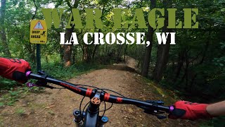
trail: War Eagle
10:08 |
240 |
Mar 23, 2024 , La Crosse

trail: JEDi
2:16 |
303 |
Feb 24, 2024 , La Crosse

trail: War Eagle
5:37 |
384 |
Apr 30, 2023 , La Crosse

trail: Vista
21:57 |
295 |
Apr 30, 2023 , La Crosse
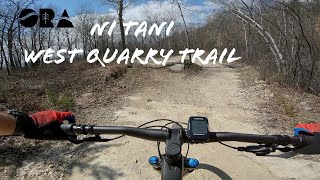
trail: Ni Tani (Quarry West)
4:35 |
146 |
Apr 23, 2023 , La Crosse

trail: Xee Xete (Quarry East)
3:24 |
187 |
Apr 23, 2023 , La Crosse
Recent Trail Reports
| status | trail | date | condition | info | user |
|---|---|---|---|---|---|
| War Eagle | Mar 25, 2026 @ 7:21am (America/Chicago) Mar 25, 2026 | Ideal | Mkue80 | ||
| Compass Loop (South) | Mar 25, 2026 @ 7:21am (America/Chicago) Mar 25, 2026 | Ideal | Mkue80 | ||
| Compass Connector Trail | Mar 25, 2026 @ 7:21am (America/Chicago) Mar 25, 2026 | Ideal | Mkue80 | ||
| Tramway | Dec 5, 2025 @ 7:27am (America/Chicago) Dec 5, 2025 | Snow Covered | mklacross | ||
| Wilder Way | Dec 5, 2025 @ 7:27am (America/Chicago) Dec 5, 2025 | Snow Covered | mklacross | ||
| Moonshine | Oct 28, 2025 @ 4:37pm (America/Chicago) Oct 28, 2025 | Variable | JillianLeigh ORA | ||
| Praire Loop | Oct 28, 2025 @ 4:37pm (America/Chicago) Oct 28, 2025 | Variable | JillianLeigh ORA | ||
| Stinky's | Oct 28, 2025 @ 4:37pm (America/Chicago) Oct 28, 2025 | Variable | JillianLeigh ORA | ||
| Stinky's | Oct 28, 2025 @ 4:37pm (America/Chicago) Oct 28, 2025 | Variable | JillianLeigh ORA | ||
| Twister | Aug 27, 2025 @ 9:06am Aug 27, 2025 | Ideal | Kbswish |
Activity Feed
| username | action | type | title | date |
|---|---|---|---|---|
| jacobabVOd8 | wishlist | region | activity #96252350 | Jun 4, 2026 @ 2:30pm Jun 4, 2026 |
| Jennyaragon49 | wishlist | region | activity #95765944 | May 29, 2026 @ 3:56am May 29, 2026 |
| brandonBcKEGu | wishlist | region | activity #94966924 | May 18, 2026 @ 3:57am May 18, 2026 |
| Braap1ife | ridden | trail | activity #93083671 and 4 more | Apr 21, 2026 @ 8:49am Apr 21, 2026 |
| Braap1ife | ridden | trail | activity #91733198 and 4 more | Apr 1, 2026 @ 4:15pm Apr 1, 2026 |
Recent Comments
| username | type | title | comment | date |
|---|---|---|---|---|
| trail | Tramway is not too muddy today! Relatively dry... | Mar 10, 2025 @ 6:01pm Mar 10, 2025 | ||
| report | Cleared | Sep 15, 2024 @ 8:51am Sep 15, 2024 | ||
| trail | Wow, what a beast of a trail. I haven't run... | Sep 3, 2024 @ 9:32am Sep 3, 2024 | ||
| report | It’s open nkw | Aug 11, 2024 @ 4:12pm Aug 11, 2024 | ||
| trail | nice trail!! I was going to make a report... | Jul 24, 2024 @ 7:45am Jul 24, 2024 |
Local Badges
-

10 Blue Trails311 awarded -

Epic Ride Climb 2k29 awarded -

Climbing 10k Badge56 awarded -

Climbing 100k Badge9 awarded -

Epic Ride Descent 2k27 awarded -

Descent 10k Badge56 awarded
Bike & Skill Parks
| name | type | city | rating |
|---|---|---|---|
| Lueth Park Bicycle Playground and Skate Park | skill park | La Crosse | |
| Upper Hixon Forest Park | skill park | La Crosse |
Activity Type Stats
| activitytype | trails | distance | descent | descent distance | total vertical | rating | global rank | state rank | photos | reports | routes | ridelogs |
|---|---|---|---|---|---|---|---|---|---|---|---|---|
| Mountain Bike | 56 | 39 miles | 4,124 ft | 15 miles | 650 ft | #956 | #379 | 85 | 1,189 | 7 | 20,860 | |
| E-Bike | 4 | 4 miles | 52 ft | 4,672 ft | 46 ft | #5,790 | #1,791 | 834 | 2 | 534 | ||
| Gravel Bike | 13 | 14 miles | 495 ft | 6 miles | 650 ft | #382 | #971 | 163 | 39 | |||
| Adaptive Bike | 14 | 15 miles | 971 ft | 7 miles | 650 ft | #102 | #1,451 | 161 | 18 | |||
| Winter Fat Bike | 10 | 6 miles | 1,463 ft | 3 miles | 643 ft | #241 | #1,021 | 338 | ||||
| Hike | 102 | 59 miles | 7,090 ft | 23 miles | 653 ft | #840 | #384 | 8 | 1,187 | 2 | 1,422 | |
| Trail Running | 101 | 57 miles | 7,057 ft | 23 miles | 653 ft | #642 | #237 | 1,187 | 3 | 2,115 | ||
| Snowmobile | 1 | 1 mile | 279 ft | 3,353 ft | 197 ft | #218 | #100 | 522 | ||||
| Snowshoe | 10 | 9 miles | 1,319 ft | 3 miles | 568 ft | #713 | #308 | 698 | 140 | |||
| Downhill Ski | 24 | 3 miles | 2,070 ft | 3 miles | 413 ft | #466 | #187 | 249 | ||||
| Nordic Ski | 1 | 2,831 ft | 95 ft | 1,358 ft | 95 ft | #940 | #382 | 608 | 399 |
Frequently Asked Questions About La Crosse
▼
What are the best places to ride in La Crosse?
La Crosse has 6 areas to explore for mountain biking. The top rated areas are:
▼
What are the highest rated mountain biking trails in La Crosse?
The highest rated mountain biking trails in La Crosse are:
- War Eagle (4.3/5)
- JEDi (4.3/5)
- Tramway (4.2/5)
- Nerfherder DH (4.2/5)
- Twister (4.2/5)
▼
What is the best time of the year to ride in La Crosse?
Based on ride log data, the most popular months to ride in La Crosse are:
- July (147 activities)
- August (107 activities)
- October (91 activities)
▼
Where can I park to ride in La Crosse?
There are 19 parking locations listed in La Crosse. The most popular parking spots are: View all parking and trailhead locations on the map to plan your visit.
Activities
Trails
- By PPbike & contributors
- Admins: ORA
- #8322 - 23,142 views
- la crosse activity log | embed map of La Crosse mountain bike trails | la crosse mountain biking points of interest polygons
Downloading of trail gps tracks in kml & gpx formats is enabled for La Crosse.
You must login to download files.