close
-
Layers w
- Weather Layers
- Pro
- Pro
- Pro
- Pro
- Pro
- Pro
- More Layers
- Pro
- Pro
- Pro
- Pro
-
Upgrade to

3D
Trail Conditions
- Unknown
- Snow Groomed
- Snow Packed
- Snow Covered
- Snow Cover Partial
- Freeze/thaw Cycle
- Icy
- Prevalent Mud
- Wet
- Variable
- Ideal
- Dry
- Very Dry
Trail Flow (Ridden Direction)
Trailforks scans users ridelogs to determine the most popular direction each trail is ridden. A good flowing trail network will have most trails flowing in a single direction according to their intension.
The colour categories are based on what percentage of riders are riding a trail in its intended direction.
The colour categories are based on what percentage of riders are riding a trail in its intended direction.
- > 96%
- > 90%
- > 80%
- > 70%
- > 50%
- < 50%
- bi-directional trail
- no data
Trail Last Ridden
Trailforks scans ridelogs to determine the last time a trail was ridden.
- < 2 days
- < 1 week
- < 2 weeks
- < 1 month
- < 6 months
- > 6 months
Trail Ridden Direction
The intended direction a trail should be ridden.
- Downhill Only
- Downhill Primary
- Both Directions
- Uphill Primary
- Uphill Only
- One Direction
Contribute Details
Colors indicate trail is missing specified detail.
- Description
- Photos
- Description & Photos
- Videos
Trail Popularity ?
Trailforks scans ridelogs to determine which trails are ridden the most in the last 9 months.
Trails are compared with nearby trails in the same city region with a possible 25 colour shades.
Think of this as a heatmap, more rides = more kinetic energy = warmer colors.
- most popular
- popular
- less popular
- not popular
ATV/ORV/OHV Filter
Max Vehicle Width
inches
US Cell Coverage
Legend

Radar Time
Activity Recordings
Trailforks uses anonymized public activity data.
?
Activity Recordings
Trailforks uses anonymized public activity data.
?
Personal Heatmap
▶
Activity Types
all
/
none
▶
Options
2
Date range
month
–
Winter Trails
Warning
A routing network for winter maps does not exist. Selecting trails using the winter trails layer has been disabled.
Missing Trails
Most Popular
Least Popular
Trails are colored based on popularity. The more popular a trail is, the more red. Less popular trails trend towards green.
Jump Magnitude Heatmap
Heatmap of where riders jump on trails. Zoom in to see individual jumps, click circles to view jump details.
BC Backroad Status
![map legend]()
Service Road Atlas is a free to use, community-driven service for viewing and creating reports on the numerous back-country service roads around B.C. and Alberta.

Slope Aspect
Direction the slope faces
Trails Deemphasized
Trails are shown in grey.
Only show trails with no bike usage.
Suggested Layers
Based on selected activity type
Save the current map location and zoom level as your default home location whenever this page is loaded.
Save
No description for La Jonquera has been added yet!
Login or register to submit one.
This region uses the Uk/Euro style trail grading system.
Activities Click to view
- Mountain Bike
22 trails
- E-Bike
18 trails
- Adaptive Bike
0 trails
- Hike
22 trails
- Trail Running
22 trails
Region Details
- 8
- 6
- 6
- 1
Region Status
Open as of May 23, 2026Stats
- Avg Trail Rating
- Trails (view details)
- 21
- Trails Mountain Bike
- 22
- Trails E-Bike
- 18
- Trails Horse
- 3
- Trails Hike
- 22
- Trails Trail Running
- 22
- Trails Dirtbike/Moto
- 3
- Total Distance
- 22 miles
- Total Descent Distance
- 10 miles
- Total Descent
- 5,697 ft
- Total Vertical
- 3,450 ft
- Highest Trailhead
- 4,094 ft
- Reports
- 56
- Photos
- 18
- Ridden Counter
- 924
Sub Regions
-
L'Albera
- 4
- 10
- 9
- 2
Popular La Jonquera Mountain Biking Trails
• 100 ★ 4.2 • 3 miles • 252 ft • 47 •
CAT: comença per un tros del GR11 en pujada, just començada la baixada enllaça a esquerra amb el Trail, tècnic al principi per pedres, amb més flow la segona part, amb algun salt. Molt recomanable. ENG: it begins following uphill...
• 90 ★ 4.0 • 837 ft • 0 ft • 25 •
Popular blue difficulty singletrack. This multi-use trail can be used downhill primary and has a moderate overall physical rating. It features rock garden. Trail visibility is always easy to follow. On average it takes 8 minutes to complete this trail.
• 100 ★ 5.0 • 3,871 ft • 0 ft • 22 •
EN: Very rocky and pretty chunky singletrak. - CAT: Corriol molt pedregós amb bastants escalons (no gaire grossos).
• 45 ★ 4.5 • 4,505 ft • 0 ft • 21 •
CAT: descens de . Bastantes parts tècniques que no permeten errors. Salts al terç final, amb peraltes i zona també tècnica. Finalitza a la Font de . Marques grogues. ENG: downhill. Really technical, with no marge of mistake. Drop at...
• 55 ★ 3.5 • 1 mile • 89 ft • 21 •
CAT: Descens fàcil de corriol ràpid amb flow. Arriba a la pista de Requesens prop del Coll de Medàs. ENG: Easy trail with flow and possibility to do it in a fast way. It ends close to Medàs pass, to the Requesens doubletrack.
• 25 ★ 4.0 • 1 mile • 0 ft • 20 •
EN: Techy trail with plenty of rocks - CAT: Corriol tècnic amb molts rocs de tots tamanys
• 55 ★ 4.0 • 1 mile • 47 ft • 18 •
CAT: baixada des del Coll de Medàs per la carena, al costat de la . Poca dificultat i ràpida. ENG: downhill from Medàs pass through the ridge, close to the military zone fence. No major difficulties and really fast.
Photos of La Jonquera Mountain Bike
Videos of La Jonquera Mountain Bike
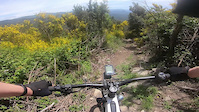
trail: Terres Blanques
14:45 |
230 |
May 15, 2021
youtuber
![The Arrival in Catalonia]()
trail: Terres Blanques
2:00 |
295 |
Jun 29, 2021 , La Jonquera
Recent Trail Reports
| status | trail | date | condition | info | user |
|---|---|---|---|---|---|
| Terres Blanques | May 23, 2026 @ 9:05am (Europe/Madrid) May 23, 2026 | Very Dry | Salvablue | ||
| Avi Paco | May 23, 2026 @ 9:05am (Europe/Madrid) May 23, 2026 | Very Dry | Salvablue | ||
| Indiana Jones | May 23, 2026 @ 9:05am (Europe/Madrid) May 23, 2026 | Very Dry | Salvablue | ||
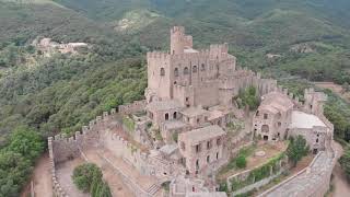
| Castell de Requesens | May 23, 2026 @ 9:05am (Europe/Madrid) May 23, 2026 | Very Dry | Salvablue | ||
| Accés La Solana 1 | May 23, 2026 @ 9:05am (Europe/Madrid) May 23, 2026 | Very Dry | Salvablue | ||
| Coll del Medàs | Dec 1, 2025 @ 12:52pm (Europe/Madrid) Dec 1, 2025 | Ideal | Wolf34 TFSPAIN | ||
| Accés Terres Blanques | Oct 3, 2025 @ 9:56am (Europe/Andorra) Oct 3, 2025 | Variable | CPQS | ||
| Puig Neulos | Oct 3, 2025 @ 9:56am (Europe/Andorra) Oct 3, 2025 | Variable | CPQS | ||
| El Mirador de Sant Silvestre | Sep 19, 2025 @ 8:38am (Europe/Andorra) Sep 18, 2025 | Ideal | CPQS | ||
| Acceso Mirador Sant Silvestre | Sep 19, 2025 @ 8:38am (Europe/Andorra) Sep 18, 2025 | Ideal | CPQS |
Activity Feed
| username | action | type | title | date |
|---|---|---|---|---|
| Salvablue | add | report | activity #95383969 | May 24, 2026 @ 1:06am May 24, 2026 |
| Salvablue | add | report | activity #95383968 and 3 more | May 24, 2026 @ 1:06am May 24, 2026 |
| roeldevalck | add | photo | activity #92115330 and 3 more | Apr 7, 2026 @ 7:09am Apr 7, 2026 |
| Amperecz | vote | trail | activity #91061254 | Mar 22, 2026 @ 5:02am Mar 22, 2026 |
| Amperecz | wishlist | trail | activity #90542852 and 1 more | Mar 14, 2026 @ 5:23am Mar 14, 2026 |
Recent Comments
| username | type | title | comment | date |
|---|---|---|---|---|
| trail | Impossible de passar en alguns trams per... | Mar 5, 2025 @ 5:32am Mar 5, 2025 | ||
| trail | Pista cómoda sube baja en partes ultimos... | Jan 26, 2025 @ 5:26am Jan 26, 2025 | ||
| trail | Increíble de inicio a fin.. pasos de Roca muy... | Jan 26, 2025 @ 5:20am Jan 26, 2025 | ||
| report | Grandess!! | Jan 24, 2025 @ 8:17am Jan 24, 2025 | ||
| trail | És la McAskill. Tècnica i vertical. Exigeix... | Jan 28, 2024 @ 2:52pm Jan 28, 2024 |
Local Badges
-

Epic Mountain Bike Climb 2k12 awarded -

Climbing 10k Badge1 awarded -

Mountain Biking 100k Badge0 awarded -

Epic Ride Descent 2k12 awarded -

Descent 10k Badge1 awarded -

Descent 100k Badge0 awarded
Activity Type Stats
| activitytype | trails | distance | descent | descent distance | total vertical | rating | global rank | state rank | photos | reports | routes | ridelogs |
|---|---|---|---|---|---|---|---|---|---|---|---|---|
| Mountain Bike | 22 | 22 miles | 5,696 ft | 10 miles | 3,451 ft | #6,198 | #335 | 16 | 56 | 328 | ||
| E-Bike | 18 | 20 miles | 5,361 ft | 9 miles | 3,402 ft | #4,414 | #417 | 2 | 53 | 81 | ||
| Horse | 3 | 1 | ||||||||||
| Hike | 22 | 20 miles | 4,764 ft | 9 miles | 3,451 ft | #7,201 | #404 | 53 | 75 | |||
| Trail Running | 22 | 20 miles | 5,541 ft | 9 miles | 3,451 ft | #6,714 | #402 | 53 | 58 | |||
| Dirtbike/Moto | 3 | 2 |
Frequently Asked Questions About La Jonquera
▼
What are the highest rated mountain biking trails in La Jonquera?
The highest rated mountain biking trails in La Jonquera are:
- Coll del Medàs (4.2/5)
- McAskill Gold Edition (4.1/5)
- Formigues (4/5)
- Terres Blanques (4/5)
- Coll de Belitres (4/5)
▼
What is the best time of the year to ride in La Jonquera?
Based on ride log data, the most popular months to ride in La Jonquera are:
- July (4 activities)
- September (1 activities)
- January (1 activities)
▼
Where can I park to ride in La Jonquera?
There are 1 parking locations listed in La Jonquera. The most popular parking spots are:
▼
What is the longest trail in La Jonquera?
The longest trail in La Jonquera is Terres Blanques at 2.9 miles. View all trails sorted by distance.
Activities
Trails
- By Bennek
 & contributors
 - Admins: snaker4, kai-bcn, Wolf34, BertuTronic
- #39042 - 987 views
- la jonquera activity log | embed map of La Jonquera mountain bike trails | la jonquera mountain biking points of interest
Downloading of trail gps tracks in kml & gpx formats is enabled for La Jonquera.
You must login to download files.