close
-
Layers w
- Weather Layers
- Pro
- Pro
- Pro
- Pro
- Pro
- Pro
- More Layers
- Pro
- Pro
- Pro
- Pro
-
Upgrade to

3D
Trail Conditions
- Unknown
- Snow Groomed
- Snow Packed
- Snow Covered
- Snow Cover Partial
- Freeze/thaw Cycle
- Icy
- Prevalent Mud
- Wet
- Variable
- Ideal
- Dry
- Very Dry
Trail Flow (Ridden Direction)
Trailforks scans users ridelogs to determine the most popular direction each trail is ridden. A good flowing trail network will have most trails flowing in a single direction according to their intension.
The colour categories are based on what percentage of riders are riding a trail in its intended direction.
The colour categories are based on what percentage of riders are riding a trail in its intended direction.
- > 96%
- > 90%
- > 80%
- > 70%
- > 50%
- < 50%
- bi-directional trail
- no data
Trail Last Ridden
Trailforks scans ridelogs to determine the last time a trail was ridden.
- < 2 days
- < 1 week
- < 2 weeks
- < 1 month
- < 6 months
- > 6 months
Trail Ridden Direction
The intended direction a trail should be ridden.
- Downhill Only
- Downhill Primary
- Both Directions
- Uphill Primary
- Uphill Only
- One Direction
Contribute Details
Colors indicate trail is missing specified detail.
- Description
- Photos
- Description & Photos
- Videos
Trail Popularity ?
Trailforks scans ridelogs to determine which trails are ridden the most in the last 9 months.
Trails are compared with nearby trails in the same city region with a possible 25 colour shades.
Think of this as a heatmap, more rides = more kinetic energy = warmer colors.
- most popular
- popular
- less popular
- not popular
ATV/ORV/OHV Filter
Max Vehicle Width
inches
US Cell Coverage
Legend

Radar Time
Activity Recordings
Trailforks uses anonymized public activity data.
?
Activity Recordings
Trailforks uses anonymized public activity data.
?
Personal Heatmap
▶
Activity Types
all
/
none
▶
Options
2
Date range
month
–
Winter Trails
Warning
A routing network for winter maps does not exist. Selecting trails using the winter trails layer has been disabled.
Missing Trails
Most Popular
Least Popular
Trails are colored based on popularity. The more popular a trail is, the more red. Less popular trails trend towards green.
Jump Magnitude Heatmap
Heatmap of where riders jump on trails. Zoom in to see individual jumps, click circles to view jump details.
BC Backroad Status
![map legend]()
Service Road Atlas is a free to use, community-driven service for viewing and creating reports on the numerous back-country service roads around B.C. and Alberta.

Slope Aspect
Direction the slope faces
Trails Deemphasized
Trails are shown in grey.
Only show trails with no bike usage.
Suggested Layers
Based on selected activity type
Save the current map location and zoom level as your default home location whenever this page is loaded.
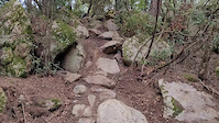
SaveLa Roca, paradís del singletrack te una malla de corriols de gran qualitat, podrien dir que tota la part la Est i Sud-Est la gran majoria es ciclable en ambdós sentits, la part Sud que dona a contra vent de Cellecs es mes complicada i les baixades son les dominants en aquets sector .
Primary Trail Type: All-Mountain & Downhill
eBikes Allowed:
Yes
This region uses the Uk/Euro style trail grading system.
Activities Click to view
- Mountain Bike
99 trails
- E-Bike
97 trails
- Hike
86 trails
- Trail Running
86 trails
Region Details
- 24
- 12
- 36
- 14
- 2
Region Status
Open as of May 25, 2026Stats
- Avg Trail Rating
- Trails (view details)
- 88
- Trails Mountain Bike
- 99
- Trails E-Bike
- 97
- Trails Adaptive Bike
- 6
- Trails Horse
- 3
- Trails Hike
- 86
- Trails Trail Running
- 86
- Trails Dirtbike/Moto
- 1
- Total Distance
- 38 miles
- Total Descent
- 13,787 ft
- Total Vertical
- 1,413 ft
- Highest Trailhead
- 1,724 ft
- Reports
- 425
- Photos
- 45
- Ridden Counter
- 14,308
Popular La Roca Mountain Biking Trails
• 95 ★ 4.7 • 1,811 ft • 0 ft • 281 •
Highly rated popular blue difficulty singletrack. This multi-use trail can be used downhill primary. On average it takes 3 minutes to complete this trail.
• 75 ★ 4.7 • 3,894 ft • 4 ft • 202 •
Highly rated popular blue difficulty singletrack. This multi-use trail can be used downhill primary. It features berm, drop and gap jump. On average it takes 9 minutes to complete this trail.
• 80 ★ 3.4 • 1 mile • 62 ft • 191 •
Long & flow singletrack with all kind of terrain, ups & downs. Best way to end a course in La Roca
• 100 ★ 4.0 • 2,625 ft • 160 ft • 191 •
Shortcut to connect el Coll w/ St. Carles area to trails Castellans flow
• 90 ★ 3.0 • 1,867 ft • 67 ft • 185 •
added from Heatmap and OSM please vote / rate on the technical difficulty, as blue is just a guess and probably wrong.
• 100 ★ 3.0 • 518 ft • 0 ft • 174 •
Popular blue difficulty singletrack. This multi-use trail can be used both directions. On average it takes minutes to complete this trail.
• 75 ★ 0.0 • 1,066 ft • 94 ft • 170 •
Popular blue difficulty singletrack. This multi-use trail can be used both directions and has a moderate overall physical rating with a 94 ft blue climb. Trail visibility is always easy to follow. On average it takes 2 minutes to complete this trail.
La Roca Mountain Bike Routes
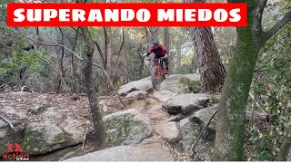
Photos of La Roca Mountain Bike
Videos of La Roca Mountain Bike
trail: Colosal
0:00 |
144 |
Apr 7, 2022
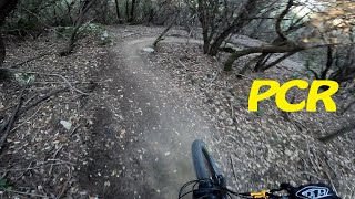
trail: PCR
3:38 |
166 |
Jan 25, 2024 , La Roca del Valles
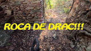
trail: La Roca del Drac
6:28 |
324 |
Jan 25, 2024 , La Roca del Valles
trail: Enfermal
13:14 |
375 |
Sep 15, 2022 , La Roca del Valles

trail: Conejo Perplejo
0:37 |
353 |
Apr 20, 2022 , La Roca del Valles
trail: CDR
2:57 |
336 |
Apr 20, 2022 , La Roca del Valles
trail: La Lola
8:29 |
302 |
Apr 20, 2022 , La Roca del Valles
Recent Trail Reports
| status | trail | date | condition | info | user |
|---|---|---|---|---|---|
| Camí del Coll a Pla de la Bassa del Llop | May 25, 2026 @ 12:09pm (Europe/Andorra) May 25, 2026 | Ideal | DavidSG71 | ||
| del Coll a St. Carles | May 1, 2026 @ 7:55am (Europe/Andorra) Apr 30, 2026 | Dry | gimber | ||
| La Prehistòrica Completa | Apr 22, 2026 @ 9:57am (Europe/Andorra) Apr 22, 2026 | Very Dry | days-on-trails IGMTBZug | ||
| Amic Invisible | Apr 22, 2026 @ 9:57am (Europe/Andorra) Apr 22, 2026 | Very Dry | days-on-trails IGMTBZug | ||
| Vacuna | Apr 22, 2026 @ 9:57am (Europe/Andorra) Apr 22, 2026 | Very Dry | days-on-trails IGMTBZug | ||
| Pista Fins Vacuna i La Lola | Apr 22, 2026 @ 9:57am (Europe/Andorra) Apr 22, 2026 | Very Dry | days-on-trails IGMTBZug | ||
| Pista | Apr 22, 2026 @ 9:57am (Europe/Andorra) Apr 22, 2026 | Very Dry | days-on-trails IGMTBZug | ||
| Coll St Bartomeu a Inici de Corriols | Apr 20, 2026 @ 8:07am (Europe/Andorra) Apr 19, 2026 | Dry | gimber | ||
| Colosal | Apr 11, 2026 @ 8:29am (Europe/Madrid) Apr 10, 2026 | Dry | PLFamiliesOG91 | ||
| Els Tigres | Feb 28, 2026 @ 5:48pm (Europe/Madrid) Feb 28, 2026 | Variable | JuanCarlosForrest |
Activity Feed
| username | action | type | title | date |
|---|---|---|---|---|
| Hpf5A2 | wishlist | trail | activity #97065764 and 3 more | Jun 15, 2026 @ 2:29pm 2 days |
| gastonkitz | wishlist | trail | activity #96221202 and 1 more | Jun 4, 2026 @ 6:03am Jun 4, 2026 |
| gonzalez64 | wishlist | trail | activity #95966445 and 1 more | May 31, 2026 @ 12:12pm May 31, 2026 |
| Yuri66 | ridden | trail | activity #95962520 and 3 more | May 31, 2026 @ 11:33am May 31, 2026 |
| DavidSG71 | add | report | activity #95485633 | May 25, 2026 @ 7:10am May 25, 2026 |
Recent Comments
| username | type | title | comment | date |
|---|---|---|---|---|
| trail | La primera parte es más negra que el sobaco... | Apr 27, 2026 @ 8:05am Apr 27, 2026 | ||
| trail | Muy seco otra vez. !! | Apr 19, 2026 @ 4:50am Apr 19, 2026 | ||
| trail | Molt bona, compte si vas amb un manillar ample. | Nov 30, 2025 @ 9:48am Nov 30, 2025 | ||
| trail | Muy rota, no creo que sea azul. Es roja o en... | Nov 30, 2025 @ 9:44am Nov 30, 2025 | ||
| report | Hostias!!! | Nov 23, 2025 @ 9:39am Nov 23, 2025 |
Nearby Areas
| name | distance | ||||
|---|---|---|---|---|---|
| Argentona | 24 | 37 | 3.7 km | ||
| Vallromanes | 5 | 18 | 4.1 km | ||
| Vilassar-Premià de Dalt | 5 | 8 | 4.6 km | ||
| Serralada Marina - Litoral | 19 | 27 | 6.9 km | ||
| Sant Fost De Campsentelles | 10 | 10 | 7 km |
Local Badges
-

Completionist0 awarded
Activity Type Stats
| activitytype | trails | distance | descent | descent distance | total vertical | rating | global rank | state rank | photos | reports | routes | ridelogs |
|---|---|---|---|---|---|---|---|---|---|---|---|---|
| Mountain Bike | 99 | 38 miles | 13,786 ft | 24 miles | 1,414 ft | #2,288 | #182 | 41 | 425 | 1 | 9,779 | |
| E-Bike | 97 | 35 miles | 12,851 ft | 22 miles | 1,414 ft | #309 | #141 | 4 | 421 | 3,038 | ||
| Adaptive Bike | 6 | #3,364 | #60 | |||||||||
| Horse | 3 | 1 mile | 16 ft | 686 ft | 436 ft | 17 | ||||||
| Hike | 86 | 34 miles | 11,696 ft | 21 miles | 1,414 ft | #4,072 | #465 | 391 | 198 | |||
| Trail Running | 86 | 34 miles | 11,696 ft | 21 miles | 1,414 ft | #3,215 | #447 | 390 | 186 | |||
| Dirtbike/Moto | 1 | 2,343 ft | 3 ft | 351 ft | 82 ft | 12 |
Frequently Asked Questions About La Roca
▼
What are the highest rated mountain biking trails in La Roca?
The highest rated mountain biking trails in La Roca are:
- Amic Invisible (4.4/5)
- Enfermal (4.4/5)
- Colosal (4.3/5)
- PCR (4.3/5)
- Cagando Blando (4.3/5)
▼
What is the best time of the year to ride in La Roca?
Based on ride log data, the most popular months to ride in La Roca are:
- September (30 activities)
- August (30 activities)
- February (29 activities)
▼
Where can I park to ride in La Roca?
Check the La Roca trail map for trailhead and parking information. Community members regularly update access and parking details for trails in the area.
▼
What is the longest trail in La Roca?
The longest trail in La Roca is La Prehistòrica Completa at 2.0 miles. View all trails sorted by distance.
Activities
- By rocabiker & contributors
- Admins: henrikenduro, Galis
- #19159 - 3,836 views
- la roca activity log | embed map of La Roca mountain bike trails | la roca mountain biking points of interest
Downloading of trail gps tracks in kml & gpx formats is enabled for La Roca.
You must login to download files.