close
-
Layers w
- Weather Layers
- Pro
- Pro
- Pro
- Pro
- Pro
- Pro
- More Layers
- Pro
- Pro
- Pro
- Pro
-
Upgrade to

3D
Trail Conditions
- Unknown
- Snow Groomed
- Snow Packed
- Snow Covered
- Snow Cover Partial
- Freeze/thaw Cycle
- Icy
- Prevalent Mud
- Wet
- Variable
- Ideal
- Dry
- Very Dry
Trail Flow (Ridden Direction)
Trailforks scans users ridelogs to determine the most popular direction each trail is ridden. A good flowing trail network will have most trails flowing in a single direction according to their intension.
The colour categories are based on what percentage of riders are riding a trail in its intended direction.
The colour categories are based on what percentage of riders are riding a trail in its intended direction.
- > 96%
- > 90%
- > 80%
- > 70%
- > 50%
- < 50%
- bi-directional trail
- no data
Trail Last Ridden
Trailforks scans ridelogs to determine the last time a trail was ridden.
- < 2 days
- < 1 week
- < 2 weeks
- < 1 month
- < 6 months
- > 6 months
Trail Ridden Direction
The intended direction a trail should be ridden.
- Downhill Only
- Downhill Primary
- Both Directions
- Uphill Primary
- Uphill Only
- One Direction
Contribute Details
Colors indicate trail is missing specified detail.
- Description
- Photos
- Description & Photos
- Videos
Trail Popularity ?
Trailforks scans ridelogs to determine which trails are ridden the most in the last 9 months.
Trails are compared with nearby trails in the same city region with a possible 25 colour shades.
Think of this as a heatmap, more rides = more kinetic energy = warmer colors.
- most popular
- popular
- less popular
- not popular
ATV/ORV/OHV Filter
Max Vehicle Width
inches
US Cell Coverage
Legend

Radar Time
Activity Recordings
Trailforks uses anonymized public activity data.
?
Activity Recordings
Trailforks uses anonymized public activity data.
?
Personal Heatmap
▶
Activity Types
all
/
none
▶
Options
2
Date range
month
–
Winter Trails
Warning
A routing network for winter maps does not exist. Selecting trails using the winter trails layer has been disabled.
Missing Trails
Most Popular
Least Popular
Trails are colored based on popularity. The more popular a trail is, the more red. Less popular trails trend towards green.
Jump Magnitude Heatmap
Heatmap of where riders jump on trails. Zoom in to see individual jumps, click circles to view jump details.
BC Backroad Status
![map legend]()
Service Road Atlas is a free to use, community-driven service for viewing and creating reports on the numerous back-country service roads around B.C. and Alberta.

Slope Aspect
Direction the slope faces
Trails Deemphasized
Trails are shown in grey.
Only show trails with no bike usage.
Suggested Layers
Based on selected activity type
Save the current map location and zoom level as your default home location whenever this page is loaded.
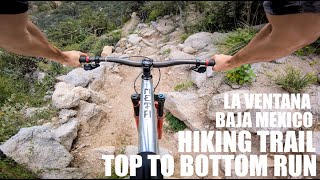
SaveThese trails make up the South part of the region, and they have been built, improved and maintained over the years by the committed local mountain bike community.
The trails are scenic with not a lot of elevation change. What they lack in elevation though they make up for in beautiful vegetation, ancient exposed reefs (which create some short steeper sections), and access to a beautiful cactus forest.
The trails are scenic with not a lot of elevation change. What they lack in elevation though they make up for in beautiful vegetation, ancient exposed reefs (which create some short steeper sections), and access to a beautiful cactus forest.
Activities Click to view
- Mountain Bike
47 trails
- E-Bike
48 trails
- Gravel Bike
0 trails
- Adaptive Bike
0 trails
- Hike
50 trails
- Trail Running
50 trails
Region Details
- 5
- 4
- 34
- 1
- 1
Region Status
Open as of May 24, 2026Stats
- Avg Trail Rating
- Trails (view details)
- 45
- Trails Mountain Bike
- 50
- Trails E-Bike
- 48
- Trails Horse
- 3
- Trails Hike
- 50
- Trails Trail Running
- 50
- Trails Dirtbike/Moto
- 2
- Trails ATV/ORV/OHV
- 1
- Total Distance
- 43 miles
- Total Descent
- 1,892 ft
- Total Vertical
- 157 ft
- Highest Trailhead
- 166 ft
- Reports
- 401
- Photos
- 75
- Ridden Counter
- 16,809
Sub Regions
-
La Ventana Trail System
- 4
- 34
- 1
- 1
Popular La Ventana Mountain Biking Trails
• 100 ★ 3.9 • 4 miles • 39 ft • 1,486 •
Beautiful beginner level trail winding through a cardon forest. Watch for the plant identification signs. Please, no Strava segments on this trail as there are lots of hikers. Slow has right of way on .
• 100 ★ 4.4 • 2 miles • 7 ft • 901 •
is a one way trail designed to return riders towards town to avoid conflicts, This trail is a green rated trail often used by runners and walkers. On average it takes about 10 minutes to complete this trail.
• 95 ★ 4.0 • 1 mile • 80 ft • 484 •
Popular green difficulty singletrack. This mountain bike primary trail can be used both directions and has a easy overall physical rating with a 80 ft green climb. On average it takes 10 minutes to complete this trail.
• 95 ★ 4.5 • 2,988 ft • 6 ft • 408 •
Popular green difficulty singletrack. This mountain bike primary trail can be used both directions and has a easy overall physical rating with a 6 ft green climb. On average it takes 4 minutes to complete this trail.
• 85 ★ 4.5 • 3,133 ft • 43 ft • 408 •
Popular green difficulty singletrack. This mountain bike primary trail can be used both directions and has a easy overall physical rating with a 43 ft green climb. On average it takes 6 minutes to complete this trail.
• 90 ★ 4.4 • 2 miles • 113 ft • 390 •
The is a main artery to the heart of the trail system. It climbs gently to "The Window" (enjoy the bench)! This history was provided by Dan and Val Eiler, Rosemary Wilkes and recorded by Richard Shirey on 3/4/24. The was the second...
• 85 ★ 4.0 • 1,517 ft • 21 ft • 323 •
Easy riding trail connecting Cardon Corridor to La Laguna.
La Ventana Mountain Bike Routes
★ 4.5 • 7 miles • 184 ft • 3 •
The 2022 Sportvision mountain bike race will include the and trails.
★ 5.0 • 5 miles • 541 ft • 10 •
Course for 7.4 km Sportvision trail run and bike race course
14 miles • 2,785 ft • 8 • Loop •
Originally ridden with an E-bike this would also be suitable for a regular bike outing. You will get great...
Photos of La Ventana Mountain Bike

Recent Trail Reports
Activity Feed
| username | action | type | title | date |
|---|---|---|---|---|
| Phil184 | add | report | activity #95457011 and 6 more | May 24, 2026 @ 5:19pm May 24, 2026 |
| hugopetbike | ridden | route | activity #94866699 | May 16, 2026 @ 6:17pm May 16, 2026 |
| LF12 | wishlist | region | activity #94385622 | May 9, 2026 @ 4:08pm May 9, 2026 |
| Talia5joCxh | wishlist | region | activity #93675523 | Apr 29, 2026 @ 3:29pm Apr 29, 2026 |
| Phil184 | add | report | activity #93068164 and 3 more | Apr 21, 2026 @ 2:20am Apr 21, 2026 |
Recent Comments
| username | type | title | comment | date |
|---|---|---|---|---|
| report | E | Feb 26, 2024 @ 5:54pm Feb 26, 2024 | ||
| trail | Not as much Caca as the name would have you... | Jan 22, 2024 @ 3:19pm Jan 22, 2024 | ||
| trail | Not as much as the name would have you... | Jan 22, 2024 @ 3:17pm Jan 22, 2024 | ||
| trail | Flowy and smooth downhill | Jan 22, 2024 @ 3:15pm Jan 22, 2024 | ||
| trail | Beauty little bit o flow | Jan 21, 2024 @ 6:11pm Jan 21, 2024 |
Local Badges
-

Ride 50 km59 awarded -

Climb 500 meters728 awarded -

Big Ride 30k501 awarded -

Descent 100k Badge2 awarded -

Epic Ride 50k86 awarded -

Top 10 Trails2 awarded
Local Trail Supporters
- Jamie and Warren
Activity Type Stats
| activitytype | trails | distance | descent | descent distance | total vertical | rating | global rank | state rank | photos | reports | routes | ridelogs |
|---|---|---|---|---|---|---|---|---|---|---|---|---|
| Mountain Bike | 47 | 43 miles | 1,893 ft | 14 miles | 157 ft | #1,017 | #10 | 72 | 401 | 18 | 12,120 | |
| E-Bike | 48 | 42 miles | 1,890 ft | 14 miles | 157 ft | #1,067 | #20 | 3 | 400 | 7 | 925 | |
| Horse | 3 | 9 miles | 138 ft | 4 miles | 85 ft | 27 | 12 | |||||
| Hike | 50 | 43 miles | 1,893 ft | 14 miles | 157 ft | #1,735 | #18 | 401 | 2 | 776 | ||
| Trail Running | 50 | 43 miles | 1,893 ft | 14 miles | 157 ft | #1,293 | #16 | 401 | 2 | 577 | ||
| Dirtbike/Moto | 2 | 8 miles | 69 ft | 3 miles | 36 ft | 27 | 49 | |||||
| ATV/ORV/OHV | 1 | 3 miles | 26 ft | 2 miles | 30 ft | 27 | 100 |
Frequently Asked Questions About La Ventana
▼
What are the best places to ride in La Ventana?
La Ventana has 1 areas to explore for mountain biking. The top rated areas are:
▼
What are the highest rated mountain biking trails in La Ventana?
The highest rated mountain biking trails in La Ventana are:
- Jodies Spur (4.2/5)
- La Laguna (4.2/5)
- "Rak" n Roll (4.2/5)
- Get Naked (4.2/5)
- Drop! (4.1/5)
▼
What is the best time of the year to ride in La Ventana?
Based on ride log data, the most popular months to ride in La Ventana are:
- February (812 activities)
- December (698 activities)
- January (663 activities)
▼
Where can I park to ride in La Ventana?
There are 1 parking locations listed in La Ventana. The most popular parking spots are:
Activities
Trails
Points of Interest
- By wbruce
 & contributors
 - Admins: LA VESTA, LA VESTA
- #17358 - 59,806 views
- la ventana activity log | embed map of La Ventana mountain bike trails | la ventana mountain biking points of interest
Downloading of trail gps tracks in kml & gpx formats is enabled for La Ventana.
You must login to download files.