close
-
Layers w
- Weather Layers
- Pro
- Pro
- Pro
- Pro
- Pro
- Pro
- More Layers
- Pro
- Pro
- Pro
- Pro
-
Upgrade to

3D
Trail Conditions
- Unknown
- Snow Groomed
- Snow Packed
- Snow Covered
- Snow Cover Partial
- Freeze/thaw Cycle
- Icy
- Prevalent Mud
- Wet
- Variable
- Ideal
- Dry
- Very Dry
Trail Flow (Ridden Direction)
Trailforks scans users ridelogs to determine the most popular direction each trail is ridden. A good flowing trail network will have most trails flowing in a single direction according to their intension.
The colour categories are based on what percentage of riders are riding a trail in its intended direction.
The colour categories are based on what percentage of riders are riding a trail in its intended direction.
- > 96%
- > 90%
- > 80%
- > 70%
- > 50%
- < 50%
- bi-directional trail
- no data
Trail Last Ridden
Trailforks scans ridelogs to determine the last time a trail was ridden.
- < 2 days
- < 1 week
- < 2 weeks
- < 1 month
- < 6 months
- > 6 months
Trail Ridden Direction
The intended direction a trail should be ridden.
- Downhill Only
- Downhill Primary
- Both Directions
- Uphill Primary
- Uphill Only
- One Direction
Contribute Details
Colors indicate trail is missing specified detail.
- Description
- Photos
- Description & Photos
- Videos
Trail Popularity ?
Trailforks scans ridelogs to determine which trails are ridden the most in the last 9 months.
Trails are compared with nearby trails in the same city region with a possible 25 colour shades.
Think of this as a heatmap, more rides = more kinetic energy = warmer colors.
- most popular
- popular
- less popular
- not popular
ATV/ORV/OHV Filter
Max Vehicle Width
inches
US Cell Coverage
Legend

Radar Time
Activity Recordings
Trailforks uses anonymized public activity data.
?
Activity Recordings
Trailforks uses anonymized public activity data.
?
Personal Heatmap
▶
Activity Types
all
/
none
▶
Options
2
Date range
month
–
Winter Trails
Warning
A routing network for winter maps does not exist. Selecting trails using the winter trails layer has been disabled.
Missing Trails
Most Popular
Least Popular
Trails are colored based on popularity. The more popular a trail is, the more red. Less popular trails trend towards green.
Jump Magnitude Heatmap
Heatmap of where riders jump on trails. Zoom in to see individual jumps, click circles to view jump details.
BC Backroad Status
![map legend]()
Service Road Atlas is a free to use, community-driven service for viewing and creating reports on the numerous back-country service roads around B.C. and Alberta.

Slope Aspect
Direction the slope faces
Trails Deemphasized
Trails are shown in grey.
Only show trails with no bike usage.
Suggested Layers
Based on selected activity type
Save the current map location and zoom level as your default home location whenever this page is loaded.
SaveThis region is Unsanctioned, Ride at your own Risk!
Ladysmith is a town located on the 49th parallel on the east coast of Vancouver Island, British Columbia, Canada. As of 2016, the population was 8,537. Please visit our Community Website to discover what Ladysmith has to offer during your visit.
The local trails provide a good variety of varying levels of challenging terrain. Getting to most trail heads requires a climb along access or climbing trails, but the effort is well worth the reward. The Ladysmith trail network is know for it's spectacular views on a clear day. Due to our climate, trails can be ridden mostly all year round, but please refrain from chewing up trails on or immediately after extremely wet weather. Many trails are multi-use, so hikers or trail runners will be encountered. Please be cautious and watch out while riding.
Checkout the local CTSS - Ladysmith Chapter trail association, the Routes page for recommended local ride loops, and the Ladysmith Riders group if you'd like to ride with a local or participate in a group ride while visiting.
Have fun out there Ride at your own risk.
Activities Click to view
- Mountain Bike
155 trails
- E-Bike
187 trails
- Adaptive Bike
78 trails
- Winter Fat Bike
12 trails
- Horse
10 trails
- Hike
216 trails
- Trail Running
216 trails
- Snowshoe
10 trails
- Backcountry Ski
11 trails
- Nordic Ski
5 trails
Region Details
- 69
- 4
- 12
- 56
- 4
Region Status
Open as of Jun 17, 2026Stats
- Avg Trail Rating
- Trails (view details)
- 168
- Trails Mountain Bike
- 194
- Trails E-Bike
- 187
- Trails Gravel Bike
- 46
- Trails Adaptive Bike
- 78
- Trails Winter Fat Bike
- 12
- Trails Horse
- 10
- Trails Hike
- 216
- Trails Trail Running
- 216
- Trails Dirtbike/Moto
- 2
- Trails Snowshoe
- 10
- Trails Backcountry Ski
- 11
- Trails Nordic Ski
- 5
- Total Distance
- 60 miles
- Total Descent
- 9,007 ft
- Total Vertical
- 1,286 ft
- Highest Trailhead
- 1,317 ft
- Reports
- 1,897
- Photos
- 255
- Ridden Counter
- 17,125
Sub Regions
-
Spruston Road Recreation Site
- 1
- 3
-
Stocking Creek Park
- 2
Popular Ladysmith Mountain Biking Trails
• 75 ★ 0.0 • 4,646 ft • 136 ft • 364 •
This section of the appeals to outdoor enthusiasts of all ages. Highlights include the old Colliery Dams as well this is the primary access to get to the trails.
• 100 ★ 4.5 • 620 ft • 0 ft • 196 •
Technical rocky terrain that is mostly DH with several uphill bursts. There are several tight corners and trees to dodge. The rocky surface can be slippery in the winter, adding to the challenge. This trail is very fun and challenging,...
• 100 ★ 4.5 • 1,126 ft • 0 ft • 157 •
Very fun stretch of mostly DH single track that involves a lot of rocky terrain. In and out of the trees with technical steep sections and a few small uphill bursts. A lot like with a little more decent.
• 70 ★ 4.4 • 1,936 ft • 0 ft • 136 •
Highly rated popular blue difficulty singletrack. This mountain bike primary trail can be used downhill primary and has a moderate overall physical rating with a 0 ft blue climb. On average it takes 2 minutes to complete this trail.
• 90 ★ 4.3 • 802 ft • 37 ft • 133 •
Popular blue difficulty singletrack. This mountain bike primary trail can be used uphill primary and has a moderate overall physical rating with a 37 ft blue climb. On average it takes 3 minutes to complete this trail.
• 65 ★ 3.7 • 1,186 ft • 6 ft • 124 •
Technical rocky terrain that is mostly DH with several uphill bursts. There are several tight corners and trees to dodge. The rocky surface can be slippery in the winter, adding to the challenge. This trail is very fun and challenging,...
• 95 ★ 3.0 • 1,037 ft • 0 ft • 119 •
Technical rocky trail with some roots and dirt that weaves through trees. Generally flat with a fairly challenging downhill at the end. There is an open area near the start of the trail that seems to attract garbage and fires. Overall...
Ladysmith Mountain Bike Routes
4 miles • 810 ft • 17 •
route using new trails to get up to for a great downhill run
★ 3.0 • 6 miles • 957 ft • 51 • Loop •
This XC loop has something for (almost) everyone. A no dab lap is quite an accomplishment.
★ 1.7 • 4 miles • 751 ft • 37 • Loop •
Lots of climbing at the beginning and lots of down after mid way.
★ 1.0 • 4 miles • 765 ft • 12 •
Simple loop from Firhall area and back along Malone Road.
Photos of Ladysmith Mountain Bike
Videos of Ladysmith Mountain Bike
youtuber
![Trail Preview / No Brakes / Ladysmith B.C]()
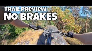
trail: No Brakes!
3:31 |
99 |
Jul 19, 2025 , Ladysmith
youtuber
![Ladysmith Downhill Trail Preview / Ladysmith B.C]()
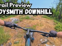
trail: Ladysmith Downhill
119 |
Jun 22, 2025 , Ladysmith
youtuber
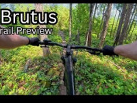
![Brass Monkey Trail Preview / Ladysmith B.C]()

trail: Brass Monkey
3:23 |
236 |
Feb 19, 2024 , Ladysmith
Recent Trail Reports
Activity Feed
| username | action | type | title | date |
|---|---|---|---|---|
| trailshredder08 | ridden | trail | activity #97955863 | Jun 27, 2026 @ 7:18pm 11 hours |
| trailshredder08 | ridden | trail | activity #97659658 and 3 more | Jun 23, 2026 @ 4:38pm Jun 23, 2026 |
| TylorX0GOd0 | wishlist | trail | activity #97534093 | Jun 21, 2026 @ 5:39pm Jun 21, 2026 |
| Wongerchris | ridden | trail | activity #97441762 | Jun 20, 2026 @ 4:31pm Jun 20, 2026 |
| TylorX0GOd0 | wishlist | trail | activity #97441747 | Jun 20, 2026 @ 4:31pm Jun 20, 2026 |
Recent Comments
| username | type | title | comment | date |
|---|---|---|---|---|
| trail | Really nice uptrack! Kudos to the trail... | May 12, 2026 @ 9:01pm May 12, 2026 | ||
| trail | Ladysmith’s own little North Shore style... | Feb 18, 2026 @ 4:37pm Feb 18, 2026 | ||
| trail | One of the better trail sections in this zone.... | Jan 15, 2026 @ 3:22pm Jan 15, 2026 | ||
| trail | Decent trail and fun to try something... | Dec 21, 2025 @ 7:51am Dec 21, 2025 | ||
| trail | Recent logging that's real close to the trail... | Nov 15, 2025 @ 2:21pm Nov 15, 2025 |
Local Badges
-

10 Blue Trails96 awarded -

Epic Ride Climb 2k7 awarded -

Climbing 10k Badge19 awarded -

Climbing 100k Badge0 awarded -

Epic Ride Descent 2k6 awarded -

Descent 10k Badge20 awarded
Bike & Skill Parks
| name | type | city | rating |
|---|---|---|---|
| Frank Jameson Community Centre BMX & Skate Skillpark | skill park | Ladysmith |
Local Trail Supporters
- John Robertson
Activity Type Stats
| activitytype | trails | distance | descent | descent distance | total vertical | rating | global rank | state rank | photos | reports | routes | ridelogs |
|---|---|---|---|---|---|---|---|---|---|---|---|---|
| Mountain Bike | 155 | 48 miles | 6,555 ft | 17 miles | 1,207 ft | #1,697 | #67 | 223 | 1,896 | 5 | 4,835 | |
| E-Bike | 187 | 47 miles | 6,289 ft | 17 miles | 1,207 ft | #469 | #35 | 16 | 1,884 | 2 | 672 | |
| Gravel Bike | 46 | 10 miles | 1,168 ft | 4 miles | 958 ft | #1,214 | #58 | 462 | 63 | |||
| Adaptive Bike | 78 | 13 miles | 942 ft | 4 miles | 748 ft | #287 | #114 | 390 | ||||
| Winter Fat Bike | 12 | 8 miles | 741 ft | 2 miles | 745 ft | #280 | #97 | 9 | ||||
| Horse | 10 | 8 miles | 650 ft | 2 miles | 764 ft | #1,651 | #55 | 699 | 2 | |||
| Hike | 216 | 60 miles | 9,006 ft | 23 miles | 1,286 ft | #1,153 | #56 | 14 | 1,889 | 2 | 2,287 | |
| Trail Running | 216 | 60 miles | 9,006 ft | 23 miles | 1,286 ft | #1,574 | #56 | 2 | 1,889 | 1 | 2,019 | |
| Dirtbike/Moto | 2 | 1,260 ft | 69 ft | 689 ft | 89 ft | 697 | 40 | |||||
| Snowshoe | 10 | 9 miles | 748 ft | 3 miles | 764 ft | #925 | #54 | 2 | 25 | |||
| Backcountry Ski | 11 | 9 miles | 748 ft | 3 miles | 764 ft | #478 | #31 | 2 | 23 | |||
| Nordic Ski | 5 | 1,726 ft | 13 ft | 259 ft | 144 ft | #1,166 | #50 | 2 | 23 |
Frequently Asked Questions About Ladysmith
▼
What are the best places to ride in Ladysmith?
Ladysmith has 2 areas to explore for mountain biking. The top rated areas are:
▼
What are the highest rated mountain biking trails in Ladysmith?
The highest rated mountain biking trails in Ladysmith are:
- IMBY (4.4/5)
- Feliz Navidad Trail (4.4/5)
- Slytherin (4.4/5)
- Hufflepuff (4.3/5)
- Brass Monkey (4.3/5)
▼
What is the best time of the year to ride in Ladysmith?
Based on ride log data, the most popular months to ride in Ladysmith are:
- August (84 activities)
- April (77 activities)
- July (71 activities)
▼
Where can I park to ride in Ladysmith?
There are 6 parking locations listed in Ladysmith. The most popular parking spots are:
- Methuen Street Holland Creek Trail Parking Lot
- Holland Creek Dogwood Drive Trailhead Parking
- Heart Lake Trail Parking (Colonia Dr.)
- Heart Lake Trail Parking (Battie Dr.)
- Parking
Activities
- Ladysmith Mountain Biking Trails
- Ladysmith E-Biking Trails
- Ladysmith Adaptive Biking Trails
- Ladysmith Winter Fat Biking Trails
- Ladysmith Horseback Trails
- Ladysmith Hiking Trails
- Ladysmith Trail Running Trails
- Ladysmith Snowshoeing Trails
- Ladysmith Backcountry Skiing Trails
- Ladysmith Nordic Skiing Trails
Trails
- By brenthillier
 NSMBA TRAILFORKS & contributors
 - Admins: Dubnyk, CRD-Parks, CTSS, CTSS, huggins22, o-KS-o
- #13354 - 20,578 views
- ladysmith activity log | embed map of Ladysmith mountain bike trails | ladysmith mountain biking points of interest
Downloading of trail gps tracks in kml & gpx formats is enabled for Ladysmith.
You must login to download files.