close
-
Layers w
- Weather Layers
- Pro
- Pro
- Pro
- Pro
- Pro
- Pro
- More Layers
- Pro
- Pro
- Pro
- Pro
-
Upgrade to

3D
Trail Conditions
- Unknown
- Snow Groomed
- Snow Packed
- Snow Covered
- Snow Cover Partial
- Freeze/thaw Cycle
- Icy
- Prevalent Mud
- Wet
- Variable
- Ideal
- Dry
- Very Dry
Trail Flow (Ridden Direction)
Trailforks scans users ridelogs to determine the most popular direction each trail is ridden. A good flowing trail network will have most trails flowing in a single direction according to their intension.
The colour categories are based on what percentage of riders are riding a trail in its intended direction.
The colour categories are based on what percentage of riders are riding a trail in its intended direction.
- > 96%
- > 90%
- > 80%
- > 70%
- > 50%
- < 50%
- bi-directional trail
- no data
Trail Last Ridden
Trailforks scans ridelogs to determine the last time a trail was ridden.
- < 2 days
- < 1 week
- < 2 weeks
- < 1 month
- < 6 months
- > 6 months
Trail Ridden Direction
The intended direction a trail should be ridden.
- Downhill Only
- Downhill Primary
- Both Directions
- Uphill Primary
- Uphill Only
- One Direction
Contribute Details
Colors indicate trail is missing specified detail.
- Description
- Photos
- Description & Photos
- Videos
Trail Popularity ?
Trailforks scans ridelogs to determine which trails are ridden the most in the last 9 months.
Trails are compared with nearby trails in the same city region with a possible 25 colour shades.
Think of this as a heatmap, more rides = more kinetic energy = warmer colors.
- most popular
- popular
- less popular
- not popular
ATV/ORV/OHV Filter
Max Vehicle Width
inches
US Cell Coverage
Legend

Radar Time
Activity Recordings
Trailforks uses anonymized public activity data.
?
Activity Recordings
Trailforks uses anonymized public activity data.
?
Personal Heatmap
▶
Activity Types
all
/
none
▶
Options
2
Date range
month
–
Winter Trails
Warning
A routing network for winter maps does not exist. Selecting trails using the winter trails layer has been disabled.
Missing Trails
Most Popular
Least Popular
Trails are colored based on popularity. The more popular a trail is, the more red. Less popular trails trend towards green.
Jump Magnitude Heatmap
Heatmap of where riders jump on trails. Zoom in to see individual jumps, click circles to view jump details.
BC Backroad Status
![map legend]()
Service Road Atlas is a free to use, community-driven service for viewing and creating reports on the numerous back-country service roads around B.C. and Alberta.

Slope Aspect
Direction the slope faces
Trails Deemphasized
Trails are shown in grey.
Only show trails with no bike usage.
Suggested Layers
Based on selected activity type
Save the current map location and zoom level as your default home location whenever this page is loaded.
Save
No description for Lage Vuursche has been added yet!
Login or register to submit one.
Activities Click to view
- Mountain Bike
16 trails
- Adaptive Bike
0 trails
- Winter Fat Bike
0 trails
- Hike
14 trails
- Trail Running
14 trails
Region Details
- 2
- 2
- 11
Region Status
Open as of May 9, 2026Stats
- Avg Trail Rating
- Trails (view details)
- 16
- Trails Mountain Bike
- 16
- Trails E-Bike
- 1
- Trails Hike
- 14
- Trails Trail Running
- 14
- Total Distance
- 16 miles
- Total Descent
- 1,837 ft
- Total Vertical
- 105 ft
- Highest Trailhead
- 115 ft
- Reports
- 193
- Photos
- 120
- Ridden Counter
- 8,707
Popular Lage Vuursche Mountain Biking Trails
• 65 ★ 5.0 • 1,152 ft • 28 ft • 678 •
Moderately popular blue difficulty dirt/gravel road. This mountain bike primary trail can be used downhill primary. On average it takes 1 minutes to complete this trail.
• 100 ★ 5.0 • 1,050 ft • 9 ft • 671 •
Popular blue difficulty singletrack. This mountain bike primary trail can be used both directions. On average it takes 1 minutes to complete this trail.
• 85 ★ 4.5 • 2,687 ft • 35 ft • 671 •
Popular blue difficulty singletrack. This mountain bike primary trail can be used both directions. On average it takes minutes to complete this trail.
• 45 ★ 4.5 • 1 mile • 63 ft • 665 •
Moderately popular blue difficulty singletrack. This mountain bike primary trail can be used downhill primary. On average it takes 7 minutes to complete this trail.
• 75 ★ 4.0 • 1,243 ft • 21 ft • 659 •
Popular blue difficulty singletrack. This mountain bike primary trail can be used both directions. On average it takes 1 minutes to complete this trail.
• 60 ★ 5.0 • 945 ft • 6 ft • 649 •
Moderately popular blue difficulty singletrack. This mountain bike primary trail can be used downhill primary. On average it takes minutes to complete this trail.
• 95 ★ 5.0 • 1,696 ft • 27 ft • 647 •
Popular blue difficulty singletrack. This mountain bike primary trail can be used both directions. On average it takes 1 minutes to complete this trail.
• 50 ★ 4.0 • 3,271 ft • 20 ft • 645 •
Moderately popular blue difficulty family friendly singletrack. This mountain bike primary trail can be used one direction and has a easy overall physical rating with a 20 ft blue climb. Trail visibility is always easy to follow. On average it takes 3 minutes to complete this trail.
Lage Vuursche Mountain Bike Routes
★ 4.0 • 7 miles • 279 ft • 12 • Loop •
https://mtb-utrechtseheuvelrug.nl/mtb-routes/lagevuursche/
★ 5.0 • 11 miles • 320 ft • 0 • Loop •
Official MTB Rote Hooge Vuursche. Very fun route with lots of single tracks. It overlaps the route of Lage...
★ 4.0 • 13 miles • 634 ft • 0 •
Dit is een super leuke track met vele bochten, diepe kuilen en lekkere klimmetjes
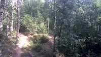
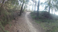
Photos of Lage Vuursche Mountain Bike
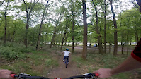
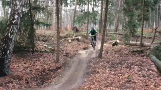
Videos of Lage Vuursche Mountain Bike
trail: FVW hoge Vuursche
0:43 |
475 |
Sep 16, 2019
trail: lage vuursche
0:02 |
63 |
May 12, 2018
trail: lage vuursche
5:24 |
115 |
Jan 18, 2015
trail: FVW hoge Vuursche
0:06 |
686 |
Feb 28, 2020 , Lage Vuursche
Recent Trail Reports
| status | trail | date | condition | info | user |
|---|---|---|---|---|---|
| lage vuursche | Mar 1, 2026 @ 11:20am (Europe/Amsterdam) Mar 1, 2026 | Variable | jeroenslee | ||
| lage vuursche | Jun 9, 2025 @ 12:20pm Jun 9, 2025 | Ideal | Arno71 | ||
| Onbekend Naam | Jun 9, 2025 @ 12:20pm Jun 9, 2025 | Ideal | Arno71 | ||
| Onbekend Naam | Jun 9, 2025 @ 12:20pm Jun 9, 2025 | Ideal | Arno71 | ||
| lage vuursche | Jun 9, 2025 @ 12:20pm Jun 9, 2025 | Ideal | Arno71 | ||
| lage vuursche | Jun 9, 2025 @ 12:20pm Jun 9, 2025 | Ideal | Arno71 | ||
| Onbekend Naam | Jun 9, 2025 @ 12:20pm Jun 9, 2025 | Dry | Arno71 | ||
| Lagevuursche | Jun 9, 2025 @ 12:20pm Jun 9, 2025 | Ideal | Arno71 | ||
| lage vuursche | Jun 9, 2025 @ 12:20pm Jun 9, 2025 | Ideal | Arno71 | ||
| Access Road | Jun 9, 2025 @ 12:20pm Jun 9, 2025 | Ideal | Arno71 |
Activity Feed
| username | action | type | title | date |
|---|---|---|---|---|
| JeffreyfShKi7 | ridden | trail | activity #91444312 and 1 more | Mar 28, 2026 @ 9:11am Mar 28, 2026 |
| Arno71 | vote | trail | activity #89845472 and 6 more | Mar 2, 2026 @ 9:39am Mar 2, 2026 |
| jeroenslee | add | report | activity #89779263 | Mar 1, 2026 @ 8:40am Mar 1, 2026 |
| maartenrijdtver | add | report | activity #82813968 | Oct 22, 2025 @ 6:12am Oct 22, 2025 |
| suravida | add | photo | activity #81808318 | Oct 5, 2025 @ 11:58pm Oct 5, 2025 |
Recent Comments
| username | type | title | comment | date |
|---|---|---|---|---|
| report | Deep soft sand for stretches of 100m in places | Aug 9, 2020 @ 10:07am Aug 9, 2020 | ||
| report | Zegt dit iets over de route ? | Apr 28, 2020 @ 10:57am Apr 28, 2020 |
Local Badges
-

10 Blue Trails409 awarded -

Epic Ride Climb 2k3 awarded -

Climbing 10k Badge47 awarded -

Climbing 100k Badge0 awarded -

Epic Ride Descent 2k3 awarded -

Descent 10k Badge47 awarded
Activity Type Stats
| activitytype | trails | distance | descent | descent distance | total vertical | rating | global rank | state rank | photos | reports | routes | ridelogs |
|---|---|---|---|---|---|---|---|---|---|---|---|---|
| Mountain Bike | 16 | 16 miles | 1,837 ft | 6 miles | 105 ft | #1,148 | #5 | 120 | 193 | 3 | 14,972 | |
| E-Bike | 1 | 594 ft | 30 ft | 413 ft | 23 ft | 173 | 576 | |||||
| Hike | 14 | 15 miles | 1,722 ft | 6 miles | 105 ft | #2,464 | #17 | 192 | 137 | |||
| Trail Running | 14 | 15 miles | 1,722 ft | 6 miles | 105 ft | #1,978 | #17 | 192 | 92 |
Frequently Asked Questions About Lage Vuursche
▼
What are the highest rated mountain biking trails in Lage Vuursche?
The highest rated mountain biking trails in Lage Vuursche are:
- FVW hoge Vuursche (4.2/5)
- Onbekend Naam (4.1/5)
- Onbekend Naam (4.1/5)
- Lagevuursche (4.1/5)
- Access Road (4.1/5)
▼
What is the best time of the year to ride in Lage Vuursche?
Based on ride log data, the most popular months to ride in Lage Vuursche are:
- June (26 activities)
- October (25 activities)
- May (21 activities)
▼
Where can I park to ride in Lage Vuursche?
▼
What is the longest trail in Lage Vuursche?
The longest trail in Lage Vuursche is FVW hoge Vuursche at 8.8 miles. View all trails sorted by distance.
Activities
- By mgtobias & contributors
- Admins: apply
- #17456 - 5,239 views
- lage vuursche activity log | embed map of Lage Vuursche mountain bike trails | lage vuursche mountain biking points of interest
Downloading of trail gps tracks in kml & gpx formats is enabled for Lage Vuursche.
You must login to download files.