close
-
Layers w
- Weather Layers
- Pro
- Pro
- Pro
- Pro
- Pro
- Pro
- More Layers
- Pro
- Pro
- Pro
- Pro
-
Upgrade to

3D
Trail Conditions
- Unknown
- Snow Groomed
- Snow Packed
- Snow Covered
- Snow Cover Partial
- Freeze/thaw Cycle
- Icy
- Prevalent Mud
- Wet
- Variable
- Ideal
- Dry
- Very Dry
Trail Flow (Ridden Direction)
Trailforks scans users ridelogs to determine the most popular direction each trail is ridden. A good flowing trail network will have most trails flowing in a single direction according to their intension.
The colour categories are based on what percentage of riders are riding a trail in its intended direction.
The colour categories are based on what percentage of riders are riding a trail in its intended direction.
- > 96%
- > 90%
- > 80%
- > 70%
- > 50%
- < 50%
- bi-directional trail
- no data
Trail Last Ridden
Trailforks scans ridelogs to determine the last time a trail was ridden.
- < 2 days
- < 1 week
- < 2 weeks
- < 1 month
- < 6 months
- > 6 months
Trail Ridden Direction
The intended direction a trail should be ridden.
- Downhill Only
- Downhill Primary
- Both Directions
- Uphill Primary
- Uphill Only
- One Direction
Contribute Details
Colors indicate trail is missing specified detail.
- Description
- Photos
- Description & Photos
- Videos
Trail Popularity ?
Trailforks scans ridelogs to determine which trails are ridden the most in the last 9 months.
Trails are compared with nearby trails in the same city region with a possible 25 colour shades.
Think of this as a heatmap, more rides = more kinetic energy = warmer colors.
- most popular
- popular
- less popular
- not popular
ATV/ORV/OHV Filter
Max Vehicle Width
inches
US Cell Coverage
Legend

Radar Time
Activity Recordings
Trailforks uses anonymized public activity data.
?
Activity Recordings
Trailforks uses anonymized public activity data.
?
Personal Heatmap
▶
Activity Types
all
/
none
▶
Options
2
Date range
month
–
Winter Trails
Warning
A routing network for winter maps does not exist. Selecting trails using the winter trails layer has been disabled.
Missing Trails
Most Popular
Least Popular
Trails are colored based on popularity. The more popular a trail is, the more red. Less popular trails trend towards green.
Jump Magnitude Heatmap
Heatmap of where riders jump on trails. Zoom in to see individual jumps, click circles to view jump details.
BC Backroad Status
![map legend]()
Service Road Atlas is a free to use, community-driven service for viewing and creating reports on the numerous back-country service roads around B.C. and Alberta.

Slope Aspect
Direction the slope faces
Trails Deemphasized
Trails are shown in grey.
Only show trails with no bike usage.
Suggested Layers
Based on selected activity type
Save the current map location and zoom level as your default home location whenever this page is loaded.
SaveThe Lägern (also spelled Lägeren; 866 m) is a wooded mountain of the Jura Mountains, stretching from Baden to Dielsdorf, about 15 km north-west of Zurich. The culminating point is located 1 km west of Hochwacht within the canton of Zurich, the border with the canton of Aargau running on a slightly lower summit named Burghorn (859 m).
The Lägern lies in the easternmost part of the Jura Mountains, east of the river Aare. It is the highest summit of the range lying between the Rhine, Aare and Limmat. Its location east of the Aare makes it topographically connected to the Appenzell Alps, by the chain of hills running north of Lake Zurich.
View from the crest
The mountain is entirely traversed by a trail following the crest from Baden to Dielsdorf. From Dielsdorf a road also leads to Hochwacht, where a radar is operated by Skyguide (municipality of Boppelsen).
Primary Trail Type: Cross-Country
 google parking directions
This region uses the Uk/Euro style trail grading system.
Activities Click to view
- Mountain Bike
40 trails
- E-Bike
32 trails
- Hike
40 trails
- Trail Running
40 trails
Region Details
- 17
- 12
- 9
- 2
Region Status
Open as of Mar 5, 2026Stats
- Avg Trail Rating
- Trails (view details)
- 40
- Trails Mountain Bike
- 40
- Trails E-Bike
- 32
- Trails Hike
- 40
- Trails Trail Running
- 40
- Total Distance
- 26 miles
- Total Descent
- 6,132 ft
- Total Vertical
- 1,249 ft
- Highest Trailhead
- 2,784 ft
- Reports
- 355
- Photos
- 13
- Ridden Counter
- 1,508
Popular Lägern Mountain Biking Trails
• 95 ★ 4.0 • 2,979 ft • 0 ft • 125 •
Nice trail along the ridge. You can ride it in both directions. Can be busy with hikers, so be aware, especially on weekends.
• 100 ★ 3.0 • 476 ft • 0 ft • 103 •
Popular blue difficulty singletrack. This multi-use trail can be used both directions. On average it takes minutes to complete this trail.
• 90 ★ 4.3 • 2,812 ft • 0 ft • 76 •
Steiler Singeltrail von der Walhalla hinunter Richtung Wettingen. Im oberen Teil einige enge Spitzkehren.
• 60 ★ 3.8 • 1,844 ft • 182 ft • 73 •
Der Trail beginnt aufwärts mit einer gemütlichen Steigung welche immer steiler wird. Im letzten Abschnitt hat es eineige Felspasagen welche einem aufwärts einiges abverlangen. Nach unten gefahren ist der Trail relativ einfach.
• 85 ★ 3.0 • 1,594 ft • 0 ft • 70 •
Schneller Trail welcher als Verlängerung des Altbergtrail gefahren werden kann und auch bei nassen Bedingungen gut fuktioniert. Insbesondere an Wochenenden muss mit Fussgängern gerechnet werden.
• 75 ★ 2.5 • 1,463 ft • 0 ft • 57 •
Einfacher Trail welcher sich in beide Richtungen fahren lässt.
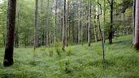
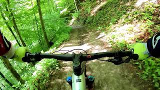
Photos of Lägern Mountain Bike


Recent Trail Reports
| status | trail | date | condition | info | user |
|---|---|---|---|---|---|
| Lägerntrail part 3 | Mar 5, 2026 @ 3:25pm (Europe/Zurich) Mar 5, 2026 | Ideal | matherj | ||
| Lägerntrail part 1 | Mar 5, 2026 @ 3:25pm (Europe/Zurich) Mar 5, 2026 | Ideal | matherj | ||
| Lägerntrail part 2 | Mar 5, 2026 @ 3:25pm (Europe/Zurich) Mar 5, 2026 | Ideal | matherj | ||
| Access Road Lägern | Mar 5, 2026 @ 3:25pm (Europe/Zurich) Mar 5, 2026 | Dry | matherj | ||
| Mooshalden Trail | Jan 22, 2026 @ 6:39pm (Europe/Zurich) Jan 22, 2026 | Ideal | iomi | ||
| Walhalla Downhill | Jan 22, 2026 @ 6:39pm (Europe/Zurich) Jan 22, 2026 | Ideal | iomi | ||
| Quicky | Nov 21, 2025 @ 11:31am (Europe/Zurich) Nov 21, 2025 | Wet | srocky | ||
| Burghorn Süd DH | Nov 21, 2025 @ 11:31am (Europe/Zurich) Nov 21, 2025 | Snow Packed | srocky | ||
| Burghorn Nord | Nov 21, 2025 @ 11:31am (Europe/Zurich) Nov 21, 2025 | Snow Packed | srocky | ||
| Access Road | Nov 21, 2025 @ 11:31am (Europe/Zurich) Nov 21, 2025 | Snow Covered | srocky |
Activity Feed
| username | action | type | title | date |
|---|---|---|---|---|
| Winters3 | difficultyvote | trail | activity #92894602 | Apr 18, 2026 @ 2:38pm Apr 18, 2026 |
| 7qtcSk | wishlist | trail | activity #90910390 | Mar 20, 2026 @ 5:12am Mar 20, 2026 |
| matherj | add | report | activity #90025296 and 3 more | Mar 5, 2026 @ 12:42pm Mar 5, 2026 |
| iomi | add | report | activity #87663325 and 1 more | Jan 22, 2026 @ 11:43pm Jan 22, 2026 |
| trailforks | add | video | activity #85251418 | Dec 8, 2025 @ 2:00pm Dec 8, 2025 |
Recent Comments
| username | type | title | comment | date |
|---|---|---|---|---|
| trail | How to get to the top without going through... | Oct 10, 2025 @ 3:22am Oct 10, 2025 | ||
| report | The sign at the top is confusing people. This... | Dec 10, 2023 @ 11:07pm Dec 10, 2023 | ||
| report | Two large trees | Oct 29, 2023 @ 8:34am Oct 29, 2023 | ||
| trail | The trails is hard, first few turns need... | Jul 22, 2023 @ 1:05pm Jul 22, 2023 | ||
| trail | Look, go for a hike and see, that this is 80%... | Jul 22, 2023 @ 1:01pm Jul 22, 2023 |
Nearby Areas
| name | distance | ||||
|---|---|---|---|---|---|
| Altberg | 18 | 6 | 3.2 km | ||
| Baregg Rüsler | 14 | 17 | 4.8 km | ||
| Wasserschloss Baldegg | 25 | 19 | 5.4 km | ||
| Obersiggenthal | 6 | 2 | 6.1 km | ||
| Bikepark Bülach | 4 | 3 | 7 km |
Local Badges
-

Completionist0 awarded
Activity Type Stats
| activitytype | trails | distance | descent | descent distance | total vertical | rating | global rank | state rank | photos | reports | routes | ridelogs |
|---|---|---|---|---|---|---|---|---|---|---|---|---|
| Mountain Bike | 40 | 26 miles | 6,132 ft | 10 miles | 1,250 ft | #3,608 | #55 | 12 | 355 | 2,307 | ||
| E-Bike | 32 | 22 miles | 5,325 ft | 8 miles | 1,243 ft | #1,996 | #47 | 1 | 329 | 249 | ||
| Hike | 40 | 26 miles | 6,132 ft | 10 miles | 1,250 ft | #2,187 | #35 | 347 | 216 | |||
| Trail Running | 40 | 26 miles | 6,132 ft | 10 miles | 1,250 ft | #1,600 | #29 | 347 | 107 |
Frequently Asked Questions About Lägern
▼
What are the highest rated mountain biking trails in Lägern?
The highest rated mountain biking trails in Lägern are:
- Walhalla Downhill (4.1/5)
- Mooshalden Trail (4.1/5)
- Burghorn Süd DH (4.1/5)
- Lägerntrail part 1 (4/5)
- Snake (4/5)
▼
What is the best time of the year to ride in Lägern?
Based on ride log data, the most popular months to ride in Lägern are:
- July (14 activities)
- May (11 activities)
- February (10 activities)
▼
Where can I park to ride in Lägern?
There are 1 parking locations listed in Lägern. The most popular parking spots are:
▼
What is the longest trail in Lägern?
The longest trail in Lägern is Lägern Gratweg at 2.6 miles. View all trails sorted by distance.
Activities
Trails
Points of Interest
- By trailpapst
 TRAILFORKS swiss IMBA SCHWEIZ & contributors
 - Admins: Dielsdorf
- #27554 - 6,731 views
- lägern activity log | embed map of Lägern mountain bike trails | lägern mountain biking points of interest polygons
Downloading of trail gps tracks in kml & gpx formats is enabled for Lägern.
You must login to download files.