close
-
Layers w
- Weather Layers
- Pro
- Pro
- Pro
- Pro
- Pro
- Pro
- More Layers
- Pro
- Pro
- Pro
- Pro
-
Upgrade to

3D
Trail Conditions
- Unknown
- Snow Groomed
- Snow Packed
- Snow Covered
- Snow Cover Partial
- Freeze/thaw Cycle
- Icy
- Prevalent Mud
- Wet
- Variable
- Ideal
- Dry
- Very Dry
Trail Flow (Ridden Direction)
Trailforks scans users ridelogs to determine the most popular direction each trail is ridden. A good flowing trail network will have most trails flowing in a single direction according to their intension.
The colour categories are based on what percentage of riders are riding a trail in its intended direction.
The colour categories are based on what percentage of riders are riding a trail in its intended direction.
- > 96%
- > 90%
- > 80%
- > 70%
- > 50%
- < 50%
- bi-directional trail
- no data
Trail Last Ridden
Trailforks scans ridelogs to determine the last time a trail was ridden.
- < 2 days
- < 1 week
- < 2 weeks
- < 1 month
- < 6 months
- > 6 months
Trail Ridden Direction
The intended direction a trail should be ridden.
- Downhill Only
- Downhill Primary
- Both Directions
- Uphill Primary
- Uphill Only
- One Direction
Contribute Details
Colors indicate trail is missing specified detail.
- Description
- Photos
- Description & Photos
- Videos
Trail Popularity ?
Trailforks scans ridelogs to determine which trails are ridden the most in the last 9 months.
Trails are compared with nearby trails in the same city region with a possible 25 colour shades.
Think of this as a heatmap, more rides = more kinetic energy = warmer colors.
- most popular
- popular
- less popular
- not popular
ATV/ORV/OHV Filter
Max Vehicle Width
inches
US Cell Coverage
Legend

Radar Time
Activity Recordings
Trailforks uses anonymized public activity data.
?
Activity Recordings
Trailforks uses anonymized public activity data.
?
Personal Heatmap
▶
Activity Types
all
/
none
▶
Options
2
Date range
month
–
Winter Trails
Warning
A routing network for winter maps does not exist. Selecting trails using the winter trails layer has been disabled.
Missing Trails
Most Popular
Least Popular
Trails are colored based on popularity. The more popular a trail is, the more red. Less popular trails trend towards green.
Jump Magnitude Heatmap
Heatmap of where riders jump on trails. Zoom in to see individual jumps, click circles to view jump details.
BC Backroad Status
![map legend]()
Service Road Atlas is a free to use, community-driven service for viewing and creating reports on the numerous back-country service roads around B.C. and Alberta.

Slope Aspect
Direction the slope faces
Trails Deemphasized
Trails are shown in grey.
Only show trails with no bike usage.
Suggested Layers
Based on selected activity type
Save the current map location and zoom level as your default home location whenever this page is loaded.
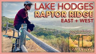
SaveLake Hodges is a picturesque area that is arrayed linearly along an east-west axis, with most of the trails found along the north shore of the lake. Longer rides will, by necessity, be some form of out-and-back requiring significant stretches of fireroad and even a bit of pavement. For shorter loop rides, head to the lake's southeast corner, where a good concentration of flowy singletrack lies. For the (very) advanced rider, there is the difficult climb up Bernardo Mountain Trail, whose summit views are worth the extended hike-a-bike that mortal riders will endure. Don't overlook the area's eastern margin, where East Raptor Ridge and West Raptor Ridge are found. Both are full of flowy goodness and shouldn't be missed. The endurance-inclined can connect Lake Hodges to Black Mountain and then Los Penasquitos, making an epic day out.
The 15 freeway provides easy access to the trails, and there are plenty of trailheads to choose from. Expect to share the trails with horses and many hikers, especially on weekends. A bell is helpful here.
The 15 freeway provides easy access to the trails, and there are plenty of trailheads to choose from. Expect to share the trails with horses and many hikers, especially on weekends. A bell is helpful here.
Primary Trail Type: Cross-Country
Land Status: City Managed
Land Manager: San Dieguito River Park
 google parking directions
 Activities Click to view
- Mountain Bike
23 trails
- E-Bike
22 trails
- Hike
23 trails
- Trail Running
23 trails
Region Details
- 5
- 2
- 6
- 9
- 1
Region Status
Open as of May 27, 2026Local Trail Association
Stats
- Avg Trail Rating
- Trails (view details)
- 23
- Trails Mountain Bike
- 23
- Trails E-Bike
- 22
- Trails Hike
- 23
- Trails Trail Running
- 23
- Total Distance
- 28 miles
- Total Descent
- 2,743 ft
- Total Vertical
- 1,009 ft
- Highest Trailhead
- 1,095 ft
- Reports
- 592
- Photos
- 725
- Ridden Counter
- 19,097
Popular Lake Hodges Mountain Biking Trails
• 100 ★ 1.2 • 3,223 ft • 23 ft • 1,813 •
Paved path that goes under the freeway and connects the parking lot at Sunset Drive to Mission road.
• 100 ★ 4.0 • 6 miles • 308 ft • 1,373 •
The San Dieguito River Parks North Shore trail system surrounds Lake Hodges in North County San Diego. Year round good riding in the scenic California inland valleys. The North Shore trail is a hard pack mostly doubletrack trail with...
• 100 ★ 3.2 • 1 mile • 40 ft • 1,111 •
Portion of San Pasqual Valley trail west of Raptor Ridge.
• 100 ★ 4.5 • 4,213 ft • 356 ft • 1,078 •
West portion of raptor ridge. Many folks ride to the top and turn around. Others continue down the east portion.
• 95 ★ 4.3 • 2 miles • 98 ft • 957 •
Ride along the south shore of Lake Hodges. Easy single track with a small rock pile section to keep you on your toes. Can get a little congested with weekend bike and foot traffic.
• 95 ★ 3.4 • 4 miles • 459 ft • 924 •
This is a great little trail in the Del Dios Gorge area. West from the staging area will take you to the switchbacks and the end of the SDRP inland trail system. The trail is hard pack singletrack that cuts threw the bottom of the gorge...
• 90 ★ 3.8 • 685 ft • 20 ft • 640 •
This single track connects the Upper Fire Road to Bernardo Mountail Trail. Drop in from the Upper single track ride over the log pile and small bridge crossing upper Felicita Creek and then up to Bernardo Trail.
Lake Hodges Mountain Bike Routes
★ 5.0 • 32 miles • 2,008 ft • 7 • Out & Back •
This is a fun flowy single track route that will have you smiling.At just over 31 miles you'll want a...
★ 3.7 • 22 miles • 1,321 ft • 11 • Loop •
Water flows uphill towards money and power, or so it's said. This might answer the question that arises...
★ 5.0 • 9 miles • 474 ft • 4 • Loop •
A loop that takes you around the most eastern point of Lake Hodges. Enjoy a fantastic view at the peak of...
★ 4.0 • 15 miles • 950 ft • 4 • Loop •
Park at Poblado Road near Moon Song Court south of Lake Hodges.
★ 3.0 • 13 miles • 1,197 ft • 7 • Out & Back •
This is a suggested out-and-back route for Raptor Ridge that includes a couple other fun trails, and . For...
★ 2.0 • 34 miles • 2,739 ft • 4 •
Complete route of the 2020 Dirty Duro sponsored by Quick n Dirty. During these uncertain times we have...
Photos of Lake Hodges Mountain Bike
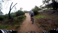
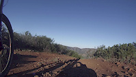
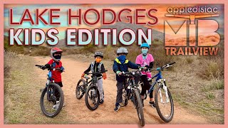
Videos of Lake Hodges Mountain Bike

3:46 |
325 |
Dec 14, 2017
2:37 |
384 |
Dec 8, 2015
trail: Bernardo Mountain Trail
0:28 |
593 |
Mar 30, 2015

trail: Bernardo Mountain Trail
9:58 |
423 |
Dec 17, 2021 , Poway

trail: West Raptor Ridge
6:55 |
409 |
May 7, 2021 , Poway
trail: East Raptor Ridge
6:55 |
584 |
May 7, 2021 , Poway

trail: Bernardo Mountain Trail
10:08 |
677 |
Mar 14, 2021 , Poway
trail: Upper Fireroad
5:59 |
357 |
Feb 19, 2021 , Poway
Recent Trail Reports
Activity Feed
| username | action | type | title | date |
|---|---|---|---|---|
| joseph724 | wishlist | route | activity #97851840 | Jun 26, 2026 @ 12:46pm 11 hours |
| SharonHBv4lf | wishlist | trail | activity #97089463 | Jun 15, 2026 @ 11:08pm Jun 15, 2026 |
| stoker1223 | add | photo | activity #95782473 and 7 more | May 29, 2026 @ 9:16am May 29, 2026 |
| mikesmack | add | report | activity #95727917 and 1 more | May 28, 2026 @ 12:54pm May 28, 2026 |
| Totogogo | wishlist | trail | activity #95603516 | May 26, 2026 @ 5:51pm May 26, 2026 |
Recent Comments
| username | type | title | comment | date |
|---|---|---|---|---|
| trail | Van broken into 11am on a Monday at Del Dios... | Apr 22, 2025 @ 8:01am Apr 22, 2025 | ||
| trail | Just finished this trail. Had 2 walk 2 small... | Jan 24, 2025 @ 2:40pm Jan 24, 2025 | ||
| trail | Came to here to comment about the rock piles... | Nov 1, 2024 @ 1:13pm Nov 1, 2024 | ||
| trail | Needs some love! Very overgrown (you’ll get... | Jul 20, 2024 @ 4:04pm Jul 20, 2024 | ||
| trail | Super tight since track. Pants and a long... | May 19, 2024 @ 5:20pm May 19, 2024 |
Nearby Areas
| name | distance | ||||
|---|---|---|---|---|---|
| San Pasqual Valley | 3 | 1 | 2.1 km | ||
| Elfin Forest Recreational Reserve | 8 | 11 | 4 | 2.4 km | |
| Yellow Truck | 1 | 4.9 km | |||
| Black Mountain | 32 | 20 | 5 | 5.5 km | |
| San Elijo Hills | 11 | 9 | 6.1 km |
Local Badges
-

Completionist4 awarded
Activity Type Stats
| activitytype | trails | distance | descent | descent distance | total vertical | rating | global rank | state rank | photos | reports | routes | ridelogs |
|---|---|---|---|---|---|---|---|---|---|---|---|---|
| Mountain Bike | 23 | 28 miles | 2,743 ft | 11 miles | 1,007 ft | #1,282 | #436 | 726 | 592 | 10 | 27,027 | |
| E-Bike | 22 | 26 miles | 2,717 ft | 11 miles | 1,007 ft | #405 | #575 | 16 | 544 | 2 | 2,053 | |
| Hike | 23 | 28 miles | 2,743 ft | 11 miles | 1,007 ft | #6,796 | #2,476 | 1 | 592 | 2 | 482 | |
| Trail Running | 23 | 28 miles | 2,743 ft | 11 miles | 1,007 ft | #5,732 | #1,781 | 592 | 2 | 628 |
Frequently Asked Questions About Lake Hodges
▼
What are the highest rated mountain biking trails in Lake Hodges?
The highest rated mountain biking trails in Lake Hodges are:
- West Raptor Ridge (4.3/5)
- East Raptor Ridge (4.2/5)
- Bernardo Bay Trail (4.2/5)
- North Shore Lake Hodges Trail (4/5)
- Hodges Outback (4/5)
▼
What is the best time of the year to ride in Lake Hodges?
Based on ride log data, the most popular months to ride in Lake Hodges are:
- July (281 activities)
- October (219 activities)
- May (192 activities)
▼
Where can I park to ride in Lake Hodges?
There are 6 parking locations listed in Lake Hodges. The most popular parking spots are: View all parking and trailhead locations on the map to plan your visit.
▼
What is the longest trail in Lake Hodges?
The longest trail in Lake Hodges is North Shore Lake Hodges Trail at 9.2 km. View all trails sorted by distance.
Activities
Trails
- By The-dirt-farmer
 & contributors
 - Admins: SDMBA
- #7580 - 23,714 views
- lake hodges activity log | embed map of Lake Hodges mountain bike trails | lake hodges mountain biking points of interest
Downloading of trail gps tracks in kml & gpx formats is enabled for Lake Hodges.
You must login to download files.