close
-
Layers w
- Weather Layers
- Pro
- Pro
- Pro
- Pro
- Pro
- Pro
- More Layers
- Pro
- Pro
- Pro
- Pro
-
Upgrade to

3D
Trail Conditions
- Unknown
- Snow Groomed
- Snow Packed
- Snow Covered
- Snow Cover Partial
- Freeze/thaw Cycle
- Icy
- Prevalent Mud
- Wet
- Variable
- Ideal
- Dry
- Very Dry
Trail Flow (Ridden Direction)
Trailforks scans users ridelogs to determine the most popular direction each trail is ridden. A good flowing trail network will have most trails flowing in a single direction according to their intension.
The colour categories are based on what percentage of riders are riding a trail in its intended direction.
The colour categories are based on what percentage of riders are riding a trail in its intended direction.
- > 96%
- > 90%
- > 80%
- > 70%
- > 50%
- < 50%
- bi-directional trail
- no data
Trail Last Ridden
Trailforks scans ridelogs to determine the last time a trail was ridden.
- < 2 days
- < 1 week
- < 2 weeks
- < 1 month
- < 6 months
- > 6 months
Trail Ridden Direction
The intended direction a trail should be ridden.
- Downhill Only
- Downhill Primary
- Both Directions
- Uphill Primary
- Uphill Only
- One Direction
Contribute Details
Colors indicate trail is missing specified detail.
- Description
- Photos
- Description & Photos
- Videos
Trail Popularity ?
Trailforks scans ridelogs to determine which trails are ridden the most in the last 9 months.
Trails are compared with nearby trails in the same city region with a possible 25 colour shades.
Think of this as a heatmap, more rides = more kinetic energy = warmer colors.
- most popular
- popular
- less popular
- not popular
ATV/ORV/OHV Filter
Max Vehicle Width
inches
US Cell Coverage
Legend

Radar Time
Activity Recordings
Trailforks uses anonymized public activity data.
?
Activity Recordings
Trailforks uses anonymized public activity data.
?
Personal Heatmap
▶
Activity Types
all
/
none
▶
Options
2
Date range
month
–
Winter Trails
Warning
A routing network for winter maps does not exist. Selecting trails using the winter trails layer has been disabled.
Missing Trails
Most Popular
Least Popular
Trails are colored based on popularity. The more popular a trail is, the more red. Less popular trails trend towards green.
Jump Magnitude Heatmap
Heatmap of where riders jump on trails. Zoom in to see individual jumps, click circles to view jump details.
BC Backroad Status
![map legend]()
Service Road Atlas is a free to use, community-driven service for viewing and creating reports on the numerous back-country service roads around B.C. and Alberta.

Slope Aspect
Direction the slope faces
Trails Deemphasized
Trails are shown in grey.
Only show trails with no bike usage.
Suggested Layers
Based on selected activity type
Save the current map location and zoom level as your default home location whenever this page is loaded.
Save
No description for Lake Padden has been added yet!
Login or register to submit one.
 google parking directions
Primary Trail Type: Cross-Country
eBikes Allowed:
No
Land Status: City Managed
google parking directions Activities Click to view
- Mountain Bike
12 trails
- Hike
13 trails
- Trail Running
13 trails
Region Details
- 3
- 1
- 5
Region Status
Open as of May 18, 2026Stats
- Avg Trail Rating
- Trails (view details)
- 9
- Trails Mountain Bike
- 12
- Trails Adaptive Bike
- 3
- Trails Hike
- 13
- Trails Trail Running
- 13
- Total Distance
- 9 miles
- Total Descent
- 1,287 ft
- Total Vertical
- 554 ft
- Highest Trailhead
- 902 ft
- Reports
- 148
- Photos
- 5
- Ridden Counter
- 9,116
Popular Lake Padden Mountain Biking Trails
• 55 ★ 3.5 • 2,165 ft • 90 ft • 1,480 •
Moderately popular blue difficulty singletrack. This multi-use trail can be used both directions and has a moderate overall physical rating with a 90 ft blue climb. On average it takes 10 minutes to complete this trail.
• 75 ★ 5.0 • 2,743 ft • 106 ft • 448 •
Popular green difficulty gravel path. This multi-use trail can be used both directions and has a easy overall physical rating with a 106 ft green climb. Trail visibility is always easy to follow. On average it takes 4 minutes to complete this trail.
• 50 ★ 4.0 • 4,755 ft • 301 ft • 361 •
Moderately popular blue difficulty singletrack. This multi-use trail can be used both directions and has a hard overall physical rating with a 301 ft black diamond climb. On average it takes 10 minutes to complete this trail.
• 60 ★ 4.3 • 3 miles • 91 ft • 327 •
Easy gravel path around the lake. Nice for an easy stroll on your gravel grinder, or for mountain biking makes for a good access track to get to Mount Galbraith via the Backcountry Trail connections
• 45 ★ 3.5 • 2 miles • 487 ft • 293 •
Moderately popular blue difficulty singletrack. This multi-use trail can be used both directions and has a moderate overall physical rating with a 487 ft blue climb. On average it takes 17 minutes to complete this trail.
• 65 ★ 3.0 • 728 ft • 0 ft • 291 •
Moderately popular green difficulty gravel path. This multi-use trail can be used both directions and has a easy overall physical rating with a 0 ft green climb. Trail visibility is always easy to follow. On average it takes minutes to complete this trail.
• 50 ★ 2.0 • 1,743 ft • 36 ft • 186 •
Moderately popular blue difficulty singletrack. This multi-use trail can be used both directions and has a moderate overall physical rating with a 36 ft black diamond climb. On average it takes 2 minutes to complete this trail.
• 35 ★ 2.4 • 1 mile • 291 ft • 131 •
Less popular blue difficulty singletrack. This multi-use trail can be used both directions and has a moderate overall physical rating with a 291 ft blue climb. On average it takes 10 minutes to complete this trail.
Lake Padden Mountain Bike Routes
★ 5.0 • 6 miles • 867 ft • 4 • Loop •
Unemployment line, AKA U-Line, is one of the signature trails at Galbraith Mountain. Starting at the end...
★ 4.0 • 7 miles • 1,084 ft • 5 •
riding from the lot up the road, heading through dog patch to pony express, up both pigs, huff and puff to...
★ 5.0 • 12 miles • 2,056 ft • 10 •
★ 5.0 • 10 miles • 873 ft • 14 •
A nice loop that acts as an intro and warm up for Galbraith trails. There are some TTFs to play with, nice...
6 miles • 1,137 ft • 7 •
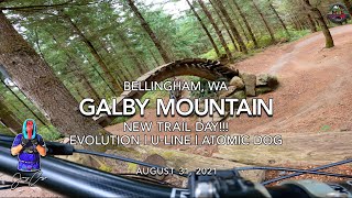
The quintessential Galbraith Southside lap for the last decade: Evo, U-Line, Atomic Dog. If you've ridden...
Videos of Lake Padden Mountain Bike
trail: Upper Backcountry Loop
30:31 |
305 |
Nov 1, 2021 , Bellingham
Recent Trail Reports
| status | trail | date | condition | info | user |
|---|---|---|---|---|---|
| Upper Backcountry Loop | Jul 7, 2025 @ 8:07am Jul 7, 2025 | Dry | J4m3z420 SCoMBA | ||
| Lake Padden Loop | Jun 19, 2025 @ 4:33pm Jun 19, 2025 | Ideal | HucknGnar | ||
| Lower Backcountry Loop | Dec 15, 2024 @ 9:05am Dec 15, 2024 | Variable | Awhite15 | ||
| Padden Gorge Trail | Jun 7, 2024 @ 9:42am Jun 7, 2024 | Ideal | yman98 | ||
| Padden West Ridgeline | May 3, 2024 @ 11:11am May 3, 2024 | Ideal | DavidfB1aU | ||
| Powerline | Nov 18, 2023 @ 5:08am Nov 18, 2023 | Ideal | Awhite15 | ||
| Padden Horse Trail | Nov 18, 2023 @ 5:08am Nov 18, 2023 | Wet | Awhite15 | ||
| Backcountry Connector | Jun 8, 2023 @ 7:38am Jun 8, 2023 | Dry | olliebiker465 |
Activity Feed
| username | action | type | title | date |
|---|---|---|---|---|
| rawket | wishlist | route | activity #97507433 | Jun 21, 2026 @ 11:55am 2 days |
| ReillybWSSeh | wishlist | route | activity #97460690 | Jun 21, 2026 @ 1:06am 2 days |
| JuanPe | wishlist | route | activity #97134233 | Jun 16, 2026 @ 1:17pm Jun 16, 2026 |
| gM1zC8 | wishlist | route | activity #97087450 | Jun 15, 2026 @ 9:53pm Jun 15, 2026 |
| knalani714 | wishlist | route | activity #97039329 | Jun 15, 2026 @ 7:18am Jun 15, 2026 |
Recent Comments
| username | type | title | comment | date |
|---|---|---|---|---|
| trail | Mostly Blue trail with some knarly... | Nov 17, 2025 @ 5:32pm Nov 17, 2025 | ||
| report | Pu | Jul 15, 2024 @ 12:25pm Jul 15, 2024 | ||
| trail | For the Dogs For someone who has had two... | Sep 19, 2021 @ 7:07pm Sep 19, 2021 | ||
| trail | Very technical, I would say black or double... | Aug 17, 2020 @ 12:07pm Aug 17, 2020 | ||
| trail | We f | Jun 7, 2020 @ 6:42pm Jun 7, 2020 |
Nearby Areas
| name | distance | ||||
|---|---|---|---|---|---|
| Galbraith | 58 | 118 | 18 | 3 | 2 km |
| Samish Park | 2 km | ||||
| Hoag's Pond | 6 | 2.2 km | |||
| Samish Crest Open Space | 29 | 6 | 2.4 km | ||
| Chuckanut Mountain | 10 | 13 | 8 | 2.8 km |
Upcoming Local Events
-
-
-
Local Products
Local Products
Activity Type Stats
| activitytype | trails | distance | descent | descent distance | total vertical | rating | global rank | state rank | photos | reports | routes | ridelogs |
|---|---|---|---|---|---|---|---|---|---|---|---|---|
| Mountain Bike | 12 | 9 miles | 1,286 ft | 3 miles | 554 ft | #10,041 | #3,976 | 5 | 148 | 50 | 6,184 | |
| Adaptive Bike | 3 | #2,978 | #1,395 | |||||||||
| Hike | 13 | 9 miles | 1,286 ft | 3 miles | 554 ft | #10,762 | #4,278 | 146 | 1 | 1,195 | ||
| Trail Running | 13 | 9 miles | 1,286 ft | 3 miles | 554 ft | #6,422 | #2,049 | 146 | 2 | 3,939 |
Frequently Asked Questions About Lake Padden
▼
What are the highest rated mountain biking trails in Lake Padden?
The highest rated mountain biking trails in Lake Padden are:
- Padden Gorge Trail (4.1/5)
- Lake Padden Loop (4.1/5)
- Lower Backcountry Loop (4/5)
- Upper Backcountry Loop (4/5)
- Backcountry Connector (3.9/5)
▼
What is the best time of the year to ride in Lake Padden?
Based on ride log data, the most popular months to ride in Lake Padden are:
- July (116 activities)
- June (107 activities)
- August (90 activities)
▼
Where can I park to ride in Lake Padden?
There are 6 parking locations listed in Lake Padden. The most popular parking spots are: View all parking and trailhead locations on the map to plan your visit.
▼
What is the longest trail in Lake Padden?
The longest trail in Lake Padden is Lake Padden Loop at 2.6 miles. View all trails sorted by distance.
Activities
- By kyleyoungtransition & contributors
- Admins: WMBC Admin, WMBC staff, WMBC Admin, WMBC Admin
- #4682 - 12,713 views
- lake padden activity log | embed map of Lake Padden mountain bike trails | lake padden mountain biking points of interest
Downloading of trail gps tracks in kml & gpx formats is enabled for Lake Padden.
You must login to download files.