close
-
Layers w
- Weather Layers
- Pro
- Pro
- Pro
- Pro
- Pro
- Pro
- More Layers
- Pro
- Pro
- Pro
- Pro
-
Upgrade to

3D
Trail Conditions
- Unknown
- Snow Groomed
- Snow Packed
- Snow Covered
- Snow Cover Partial
- Freeze/thaw Cycle
- Icy
- Prevalent Mud
- Wet
- Variable
- Ideal
- Dry
- Very Dry
Trail Flow (Ridden Direction)
Trailforks scans users ridelogs to determine the most popular direction each trail is ridden. A good flowing trail network will have most trails flowing in a single direction according to their intension.
The colour categories are based on what percentage of riders are riding a trail in its intended direction.
The colour categories are based on what percentage of riders are riding a trail in its intended direction.
- > 96%
- > 90%
- > 80%
- > 70%
- > 50%
- < 50%
- bi-directional trail
- no data
Trail Last Ridden
Trailforks scans ridelogs to determine the last time a trail was ridden.
- < 2 days
- < 1 week
- < 2 weeks
- < 1 month
- < 6 months
- > 6 months
Trail Ridden Direction
The intended direction a trail should be ridden.
- Downhill Only
- Downhill Primary
- Both Directions
- Uphill Primary
- Uphill Only
- One Direction
Contribute Details
Colors indicate trail is missing specified detail.
- Description
- Photos
- Description & Photos
- Videos
Trail Popularity ?
Trailforks scans ridelogs to determine which trails are ridden the most in the last 9 months.
Trails are compared with nearby trails in the same city region with a possible 25 colour shades.
Think of this as a heatmap, more rides = more kinetic energy = warmer colors.
- most popular
- popular
- less popular
- not popular
ATV/ORV/OHV Filter
Max Vehicle Width
inches
US Cell Coverage
Legend

Radar Time
Activity Recordings
Trailforks uses anonymized public activity data.
?
Activity Recordings
Trailforks uses anonymized public activity data.
?
Personal Heatmap
▶
Activity Types
all
/
none
▶
Options
2
Date range
month
–
Winter Trails
Warning
A routing network for winter maps does not exist. Selecting trails using the winter trails layer has been disabled.
Missing Trails
Most Popular
Least Popular
Trails are colored based on popularity. The more popular a trail is, the more red. Less popular trails trend towards green.
Jump Magnitude Heatmap
Heatmap of where riders jump on trails. Zoom in to see individual jumps, click circles to view jump details.
BC Backroad Status
![map legend]()
Service Road Atlas is a free to use, community-driven service for viewing and creating reports on the numerous back-country service roads around B.C. and Alberta.

Slope Aspect
Direction the slope faces
Trails Deemphasized
Trails are shown in grey.
Only show trails with no bike usage.
Suggested Layers
Based on selected activity type
Save the current map location and zoom level as your default home location whenever this page is loaded.
Save
No description for Lakeway has been added yet!
Login or register to submit one.
Activities Click to view
- Mountain Bike
99 trails
- E-Bike
59 trails
- Adaptive Bike
0 trails
- Hike
94 trails
- Trail Running
94 trails
Region Details
- 6
- 11
- 13
- 55
- 10
- 1
Region Status
Open as of Jun 7, 2026Local Trail Association
Stats
- Avg Trail Rating
- Trails (view details)
- 96
- Trails Mountain Bike
- 99
- Trails E-Bike
- 59
- Trails Hike
- 94
- Trails Trail Running
- 94
- Total Distance
- 31 miles
- Total Descent
- 3,864 ft
- Total Vertical
- 498 ft
- Highest Trailhead
- 1,177 ft
- Reports
- 327
- Photos
- 52
- Ridden Counter
- 14,161
Sub Regions
-
Canyonlands/Mt Lakeway
- 4
- 39
- 8
- 1
-
Hamilton Greenbelt
- 8
- 15
- 2
-
Lakeway City Park
- 10
Popular Lakeway Mountain Biking Trails
• 65 ★ 0.0 • 1,759 ft • 55 ft • 343 •
The is highly used by MTBers and Hikers who park at the Drive trail head to enter into the area. It is the quickest way to get over to the other side of the from Drive. The trail starts at the bathroom (and purified water dispenser) at...
• 95 ★ 0.0 • 971 ft • 30 ft • 323 •
' ' is a technically challenging and short trail. There is signage on both ends of the trail section marking the name. Its basically a quick down and up either direction you ride it. There's a small creek crossing at the bottom midway...
• 65 ★ 5.0 • 3,914 ft • 64 ft • 308 •
" " is a blue-rated, flowy trail ideal for intermediate riders. Expect a flowy ride and a few small optional jumps.
• 70 ★ 5.0 • 3,274 ft • 185 ft • 293 •
This trail starts just to the south of mnt lakeway. Its was named by the community as ' ' because the local community logo is a bell symbol which looks a lot like the logo :). Going north to south the trail is a gradual and vigorous...
• 70 ★ 5.0 • 1,906 ft • 0 ft • 284 •
Fun primary downhill trail, some interesting features from the terrain were leveraged which is always good.
• 100 ★ 4.0 • 1,296 ft • 17 ft • 273 •
Monkey Wrench Is a connector trail over to Baldavino Connector trail. If you want some additional flow after thin take this line instead of the fire road. There are two bridges that cross the creek so beware when it is wet. Trail is...
• 45 ★ 4.0 • 1 mile • 251 ft • 263 •
About 200 feet of semi-technical switch back climbing to the top (north to south). And technical sharp and rocky switch backs going down the back side (from the top going south towards Hwy71). This is a great workout (interval climb)....
Lakeway Mountain Bike Routes
★ 5.0 • 12 miles • 1,053 ft • 18 • Loop •
The Lake Travis MTB NICA (National Interscholastic Cycling Association) Coaches have put together this...
★ 3.0 • 8 miles • 1,138 ft • 18 • Loop •
This route is a mix of the older, more technical and climby sections with some newer areas like , , and ....
Photos of Lakeway Mountain Bike
Videos of Lakeway Mountain Bike

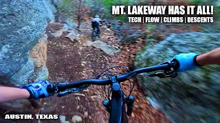
trail: Canyon Trail
2:24 |
413 |
Feb 7, 2012

trail: Rocka Rolla
35:01 |
151 |
Apr 11, 2025 , Lakeway

trail: Camel Back
35:01 |
51 |
Apr 11, 2025 , Lakeway

trail: Skeletor
35:01 |
61 |
Apr 11, 2025 , Lakeway
trail: Canyon Trail
35:01 |
87 |
Apr 11, 2025 , Lakeway

trail: Sidewinder
35:01 |
63 |
Apr 11, 2025 , Lakeway

trail: Viejo Bandito
35:01 |
76 |
Apr 11, 2025 , Lakeway

trail: K38
35:01 |
58 |
Apr 11, 2025 , Lakeway
Recent Trail Reports
| status | trail | date | condition | info | user |
|---|---|---|---|---|---|
| Rocka Rolla | Dec 10, 2025 @ 7:00pm (America/Chicago) Dec 10, 2025 | Variable | Tulkas WMBC | ||
| Mount Lakeway | Mar 30, 2025 @ 2:27pm Mar 30, 2025 | Ideal | ChristopherTX | ||
| Drop Out | Mar 30, 2025 @ 2:27pm Mar 30, 2025 | Variable | ChristopherTX | ||
| Camel Back | Mar 30, 2025 @ 2:27pm Mar 30, 2025 | Variable | ChristopherTX | ||
| Pond Loop South | Mar 30, 2025 @ 2:27pm Mar 30, 2025 | Wet | ChristopherTX | ||
| Bisset Trail | Mar 30, 2025 @ 2:27pm Mar 30, 2025 | Ideal | ChristopherTX | ||
| Butterfly | Mar 10, 2025 @ 6:00pm Mar 10, 2025 | Dry | nikodemus | ||
| Even Continuum | Jan 4, 2025 @ 8:34am Jan 4, 2025 | Ideal | AxelThomsen | ||
| Ken's Plunge | Jan 4, 2025 @ 8:34am Jan 4, 2025 | Ideal | AxelThomsen | ||
| Serene Hills West | Nov 25, 2024 @ 3:52pm Nov 25, 2024 | Ideal | rustyzGUdU |
Activity Feed
| username | action | type | title | date |
|---|---|---|---|---|
| Jackaroni_and_Cheese | wishlist | badge | activity #97790239 | Jun 25, 2026 @ 1:29pm 2 days |
| Jpbredehoft | ridden | route | activity #97562108 | Jun 22, 2026 @ 8:00am Jun 22, 2026 |
| h2oyo | wishlist | route | activity #97407903 and 1 more | Jun 20, 2026 @ 10:00am Jun 20, 2026 |
| Aidan4ypzHj | ridden | trail | activity #97108826 and 1 more | Jun 16, 2026 @ 7:30am Jun 16, 2026 |
| Roughster | ridden | trail | activity #96771210 | Jun 11, 2026 @ 5:15pm Jun 11, 2026 |
Recent Comments
| username | type | title | comment | date |
|---|---|---|---|---|
| trail | Fire | Dec 30, 2024 @ 10:31am Dec 30, 2024 | ||
| trail | Between this trail and habanero probably the... | Dec 30, 2024 @ 10:31am Dec 30, 2024 | ||
| trail | Agree this is mostly blue, but the cliffside... | Feb 13, 2024 @ 2:20pm Feb 13, 2024 | ||
| trail | This section now bears the name "Clown" at... | Feb 12, 2024 @ 2:24pm Feb 12, 2024 | ||
| trail | There are several access points now from the... | Dec 30, 2023 @ 3:15pm Dec 30, 2023 |
Local Badges
-

10 Blue Trails257 awarded -

Epic Ride Climb 2k2 awarded -

Climbing 10k Badge34 awarded -

Climbing 100k Badge3 awarded -

Epic Ride Descent 2k2 awarded -

Descent 10k Badge34 awarded
Activity Type Stats
| activitytype | trails | distance | descent | descent distance | total vertical | rating | global rank | state rank | photos | reports | routes | ridelogs |
|---|---|---|---|---|---|---|---|---|---|---|---|---|
| Mountain Bike | 99 | 31 miles | 3,865 ft | 13 miles | 499 ft | #1,398 | #530 | 52 | 325 | 2 | 10,113 | |
| E-Bike | 59 | 22 miles | 3,179 ft | 10 miles | 456 ft | #3,504 | #1,231 | 308 | 2 | 729 | ||
| Hike | 94 | 30 miles | 3,655 ft | 12 miles | 499 ft | #5,176 | #1,828 | 325 | 423 | |||
| Trail Running | 94 | 30 miles | 3,655 ft | 12 miles | 499 ft | #4,475 | #1,377 | 325 | 468 |
Frequently Asked Questions About Lakeway
▼
What are the best places to ride in Lakeway?
Lakeway has 4 areas to explore for mountain biking. The top rated areas are:
▼
What are the highest rated mountain biking trails in Lakeway?
The highest rated mountain biking trails in Lakeway are:
- Ken's Plunge (4.3/5)
- Taco Bell (4.2/5)
- Rough Hollow Flow Trails (4.2/5)
- Rocka Rolla (4.1/5)
- Hamilton Greenbelt (4.1/5)
▼
What is the best time of the year to ride in Lakeway?
Based on ride log data, the most popular months to ride in Lakeway are:
- July (65 activities)
- April (59 activities)
- June (49 activities)
▼
Where can I park to ride in Lakeway?
There are 5 parking locations listed in Lakeway. The most popular parking spots are:
- Trophy Dr Parking
- Lohmans Crossing Rd Parking
- Lakeway City Park
- Lakeway City Park
- Palos Verdes Dr. Parking
Activities
Trails
Points of Interest
- By Larsacus
 TRAILFORKS & contributors
 - Admins: ARR, mtbatx, LTTC
- #19795 - 7,499 views
- lakeway activity log | embed map of Lakeway mountain bike trails | lakeway mountain biking points of interest
Downloading of trail gps tracks in kml & gpx formats is enabled for Lakeway.
You must login to download files.