close
-
Layers w
- Weather Layers
- Pro
- Pro
- Pro
- Pro
- Pro
- Pro
- More Layers
- Pro
- Pro
- Pro
- Pro
-
Upgrade to

3D
Trail Conditions
- Unknown
- Snow Groomed
- Snow Packed
- Snow Covered
- Snow Cover Partial
- Freeze/thaw Cycle
- Icy
- Prevalent Mud
- Wet
- Variable
- Ideal
- Dry
- Very Dry
Trail Flow (Ridden Direction)
Trailforks scans users ridelogs to determine the most popular direction each trail is ridden. A good flowing trail network will have most trails flowing in a single direction according to their intension.
The colour categories are based on what percentage of riders are riding a trail in its intended direction.
The colour categories are based on what percentage of riders are riding a trail in its intended direction.
- > 96%
- > 90%
- > 80%
- > 70%
- > 50%
- < 50%
- bi-directional trail
- no data
Trail Last Ridden
Trailforks scans ridelogs to determine the last time a trail was ridden.
- < 2 days
- < 1 week
- < 2 weeks
- < 1 month
- < 6 months
- > 6 months
Trail Ridden Direction
The intended direction a trail should be ridden.
- Downhill Only
- Downhill Primary
- Both Directions
- Uphill Primary
- Uphill Only
- One Direction
Contribute Details
Colors indicate trail is missing specified detail.
- Description
- Photos
- Description & Photos
- Videos
Trail Popularity ?
Trailforks scans ridelogs to determine which trails are ridden the most in the last 9 months.
Trails are compared with nearby trails in the same city region with a possible 25 colour shades.
Think of this as a heatmap, more rides = more kinetic energy = warmer colors.
- most popular
- popular
- less popular
- not popular
ATV/ORV/OHV Filter
Max Vehicle Width
inches
US Cell Coverage
Legend

Radar Time
Activity Recordings
Trailforks uses anonymized public activity data.
?
Activity Recordings
Trailforks uses anonymized public activity data.
?
Personal Heatmap
▶
Activity Types
all
/
none
▶
Options
2
Date range
month
–
Winter Trails
Warning
A routing network for winter maps does not exist. Selecting trails using the winter trails layer has been disabled.
Missing Trails
Most Popular
Least Popular
Trails are colored based on popularity. The more popular a trail is, the more red. Less popular trails trend towards green.
Jump Magnitude Heatmap
Heatmap of where riders jump on trails. Zoom in to see individual jumps, click circles to view jump details.
BC Backroad Status
![map legend]()
Service Road Atlas is a free to use, community-driven service for viewing and creating reports on the numerous back-country service roads around B.C. and Alberta.

Slope Aspect
Direction the slope faces
Trails Deemphasized
Trails are shown in grey.
Only show trails with no bike usage.
Suggested Layers
Based on selected activity type
Save the current map location and zoom level as your default home location whenever this page is loaded.
Save
No description for Wigan has been added yet!
Login or register to submit one.
This region uses the Uk/Euro style trail grading system.
Activities Click to view
- Mountain Bike
163 trails
- E-Bike
72 trails
- Hike
126 trails
- Trail Running
126 trails
Region Details
- 27
- 9
- 36
- 56
- 20
- 3
Stats
- Avg Trail Rating
- Trails (view details)
- 158
- Trails Mountain Bike
- 164
- Trails E-Bike
- 72
- Trails Horse
- 1
- Trails Hike
- 126
- Trails Trail Running
- 126
- Total Distance
- 79 miles
- Total Descent
- 24,671 ft
- Total Vertical
- 1,585 ft
- Highest Trailhead
- 1,821 ft
- Reports
- 1,034
- Photos
- 493
- Ridden Counter
- 40,097
Sub Regions
- Blackburn (8)
- Chorley (11)
- Healey Nab (7)
- West Pennine Moors (2)
- Clitheroe (43)
- Gisburn Forest (42)
- Darwen (1)
- Rawtenstall (29)
- Rochdale (8)
- Rochdale (1)
- Rossendale (1)
- Sabden (2)
- Whalley (50)
Popular Wigan Mountain Biking Trails
• 90 ★ 3.4 • 1,857 ft • 20 ft • 1,393 •
Popular red difficulty singletrack. This mountain bike primary trail can be used one direction and has a moderate overall physical rating with a 20 ft blue climb. On average it takes 2 minutes to complete this trail.
• 95 ★ 3.7 • 1,351 ft • 70 ft • 1,390 •
Popular red difficulty singletrack. This mountain bike primary trail can be used uphill only and has a moderate overall physical rating with a 70 ft blue climb. On average it takes 3 minutes to complete this trail.
• 95 ★ 4.0 • 3,829 ft • 52 ft • 1,358 •
A small climb followed by one of the funnest descents "like chasing Ewoks" tight and twisty volunteer handbuilt trail.
• 85 ★ 3.7 • 1,273 ft • 87 ft • 1,343 •
Popular red difficulty singletrack. This mountain bike primary trail can be used uphill only and has a hard overall physical rating with a 87 ft blue climb. On average it takes 3 minutes to complete this trail.
• 75 ★ 4.0 • 2,459 ft • 2 ft • 1,283 •
Popular red difficulty singletrack. This mountain bike primary trail can be used downhill primary. On average it takes 3 minutes to complete this trail.
• 70 ★ 4.5 • 1 mile • 154 ft • 1,269 •
Highly rated popular red difficulty singletrack. This mountain bike primary trail can be used downhill primary. It features berm, rock face and rock garden. On average it takes 19 minutes to complete this trail.
Wigan Mountain Bike Routes
★ 5.0 • 9 miles • 1,053 ft • 9 • Loop •
Starts at the car park, enters Lee Quarry to the East, and gradually takes you on a tour through many of...
★ 3.0 • 12 miles • 1,214 ft • 11 •
Highlights include the volunteer built trail of , gnarly rocks of and the roller coaster ride down Follow...
5 miles • 575 ft • 2 •
Longridge Red Loop - Detour avoiding storm damage
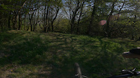
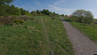
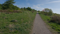
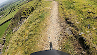
Photos of Wigan Mountain Bike
Videos of Wigan Mountain Bike
trail: Loamer
0:38 |
21 |
May 24, 2025
trail: B-Line
0:52 |
28 |
May 24, 2025
trail: Main Line
0:51 |
26 |
May 24, 2025

trail: Final Trail / 27 Berms
3:36 |
144 |
Apr 25, 2023

trail: Home Baked
4:14 |
122 |
Apr 25, 2023

trail: Hully Gully
6:37 |
574 |
Apr 25, 2023
trail: Lee Quarry Access Track
3:45 |
|
Jun 13, 2021
trail: Lee Quarry Access Track
0:17 |
69 |
Jun 13, 2021
Recent Trail Reports
| status | trail | date | condition | info | user |
|---|---|---|---|---|---|
| Home Baked Gisburn Forest | Jun 14, 2026 @ 9:56am (Europe/London) Jun 14, 2026 | Variable | Vimto-North | ||
| Rocky Road Gisburn Forest | Jun 14, 2026 @ 9:56am (Europe/London) Jun 14, 2026 | Variable | Vimto-North | ||
| Circle Gisburn Forest | Jun 14, 2026 @ 9:56am (Europe/London) Jun 14, 2026 | Variable | Vimto-North | ||
| Over The Hill Gisburn Forest | Jun 14, 2026 @ 9:56am (Europe/London) Jun 14, 2026 | Variable | Vimto-North | ||
| The Snake Gisburn Forest | Jun 14, 2026 @ 9:56am (Europe/London) Jun 14, 2026 | Variable | Vimto-North | ||
| Parkwood Gisburn Forest | May 31, 2026 @ 10:05am (Europe/London) May 31, 2026 | Dry | Vimto-North | ||
| Swoopy Gisburn Forest | May 31, 2026 @ 10:05am (Europe/London) May 31, 2026 | Dry | Vimto-North | ||
| Bottoms Gisburn Forest | May 31, 2026 @ 10:05am (Europe/London) May 31, 2026 | Dry | Vimto-North | ||
| Connector Gisburn Forest | May 31, 2026 @ 10:05am (Europe/London) May 31, 2026 | Dry | Vimto-North | ||
| Hully Gully Gisburn Forest | May 31, 2026 @ 10:05am (Europe/London) May 31, 2026 | Dry | Vimto-North |
Activity Feed
| username | action | type | title | date |
|---|---|---|---|---|
| Vimto-North | add | report | activity #96960039 and 4 more | Jun 14, 2026 @ 6:00am Jun 14, 2026 |
| Dad82uk | wishlist | route | activity #96562996 | Jun 8, 2026 @ 2:06pm Jun 8, 2026 |
| Dad82uk | wishlist | region | activity #96562942 | Jun 8, 2026 @ 2:05pm Jun 8, 2026 |
| Simon6Uebyl | ridden | trail | activity #96480872 and 1 more | Jun 7, 2026 @ 11:15am Jun 7, 2026 |
| Vimto-North | add | report | activity #95942772 and 9 more | May 31, 2026 @ 8:24am May 31, 2026 |
Recent Comments
| username | type | title | comment | date |
|---|---|---|---|---|
| report | I reported on the wrong trail my comments... | Apr 25, 2026 @ 12:48pm Apr 25, 2026 | ||
| trail | Planned trail not ready yet so please do not ride | May 16, 2025 @ 11:13am May 16, 2025 | ||
| trail | Loamy and dry | May 16, 2025 @ 11:12am May 16, 2025 | ||
| trail | Closed due to a serious injury on track | May 16, 2025 @ 11:12am May 16, 2025 | ||
| trail | Good trail with optional features | Feb 21, 2025 @ 7:32am Feb 21, 2025 |
Local Badges
-

Epic Ride Descent 2k16 awarded -

Top 10 Trails1 awarded -

Epic Ride 50k406 awarded -

Descent 100k Badge2 awarded -

Descent 10k Badge19 awarded -

Climbing 10k Badge19 awarded
Bike & Skill Parks
| name | type | city | rating |
|---|---|---|---|
| Gisburn Skills area | skill park | Settle | |
| Mandy's Pump Track | skill park | Blackburn | |
| Padiham Pump Track | skill park | Blackburn |
Local Mountain Biking Directory
-
Pennine Mountain Bike Association
![Pennine Mountain Bike Association]()
-
Morecambe & Lancaster MTB
-
WinstanleysBike Shop
-
Merlin Cycles LtdBike Shop
-
AlansBike Shop
-
Alans BmxBike Shop
Activity Type Stats
| activitytype | trails | distance | descent | descent distance | total vertical | rating | global rank | state rank | photos | reports | routes | ridelogs |
|---|---|---|---|---|---|---|---|---|---|---|---|---|
| Mountain Bike | 163 | 79 miles | 24,672 ft | 54 miles | 1,585 ft | 494 | 1,034 | 9 | 49,007 | |||
| E-Bike | 72 | 36 miles | 13,271 ft | 27 miles | 1,585 ft | 904 | 4 | 7,886 | ||||
| Horse | 1 | 2 miles | 302 ft | 1 mile | 299 ft | 139 | ||||||
| Hike | 126 | 68 miles | 20,472 ft | 47 miles | 1,585 ft | 977 | 1 | 2,156 | ||||
| Trail Running | 126 | 68 miles | 20,472 ft | 47 miles | 1,585 ft | 977 | 1 | 1,380 |
Frequently Asked Questions About Wigan
▼
What are the best places to ride in Wigan?
Wigan has 7 areas to explore for mountain biking. The top rated areas are:
▼
What are the highest rated mountain biking trails in Wigan?
The highest rated mountain biking trails in Wigan are:
- Hully Gully (4.5/5)
- Leap of Faith (4.4/5)
- Final Red Decent (4.3/5)
- Whelpstone Crag (4.3/5)
- Enduro 1 (4.2/5)
▼
What is the best time of the year to ride in Wigan?
Based on ride log data, the most popular months to ride in Wigan are:
- July (213 activities)
- June (177 activities)
- May (158 activities)
▼
What is the longest trail in Wigan?
The longest trail in Wigan is Cragg Quarry XC Loop at 3.4 miles. View all trails sorted by distance.
Activities
Trails
- By pmbaenduro PMBA & contributors
- Admins: UKTP, 20twenty-p, wisey, MathieuC, cemoorelife
- #6163 - 17,188 views
- wigan activity log | embed map of Wigan mountain bike trails | wigan mountain biking points of interest
Downloading of trail gps tracks in kml & gpx formats is enabled for Wigan.
You must login to download files.