close
-
Layers w
- Weather Layers
- Pro
- Pro
- Pro
- Pro
- Pro
- Pro
- More Layers
- Pro
- Pro
- Pro
- Pro
-
Upgrade to

3D
Trail Conditions
- Unknown
- Snow Groomed
- Snow Packed
- Snow Covered
- Snow Cover Partial
- Freeze/thaw Cycle
- Icy
- Prevalent Mud
- Wet
- Variable
- Ideal
- Dry
- Very Dry
Trail Flow (Ridden Direction)
Trailforks scans users ridelogs to determine the most popular direction each trail is ridden. A good flowing trail network will have most trails flowing in a single direction according to their intension.
The colour categories are based on what percentage of riders are riding a trail in its intended direction.
The colour categories are based on what percentage of riders are riding a trail in its intended direction.
- > 96%
- > 90%
- > 80%
- > 70%
- > 50%
- < 50%
- bi-directional trail
- no data
Trail Last Ridden
Trailforks scans ridelogs to determine the last time a trail was ridden.
- < 2 days
- < 1 week
- < 2 weeks
- < 1 month
- < 6 months
- > 6 months
Trail Ridden Direction
The intended direction a trail should be ridden.
- Downhill Only
- Downhill Primary
- Both Directions
- Uphill Primary
- Uphill Only
- One Direction
Contribute Details
Colors indicate trail is missing specified detail.
- Description
- Photos
- Description & Photos
- Videos
Trail Popularity ?
Trailforks scans ridelogs to determine which trails are ridden the most in the last 9 months.
Trails are compared with nearby trails in the same city region with a possible 25 colour shades.
Think of this as a heatmap, more rides = more kinetic energy = warmer colors.
- most popular
- popular
- less popular
- not popular
ATV/ORV/OHV Filter
Max Vehicle Width
inches
US Cell Coverage
Legend

Radar Time
Activity Recordings
Trailforks uses anonymized public activity data.
?
Activity Recordings
Trailforks uses anonymized public activity data.
?
Personal Heatmap
▶
Activity Types
all
/
none
▶
Options
2
Date range
month
–
Winter Trails
Warning
A routing network for winter maps does not exist. Selecting trails using the winter trails layer has been disabled.
Missing Trails
Most Popular
Least Popular
Trails are colored based on popularity. The more popular a trail is, the more red. Less popular trails trend towards green.
Jump Magnitude Heatmap
Heatmap of where riders jump on trails. Zoom in to see individual jumps, click circles to view jump details.
BC Backroad Status
![map legend]()
Service Road Atlas is a free to use, community-driven service for viewing and creating reports on the numerous back-country service roads around B.C. and Alberta.

Slope Aspect
Direction the slope faces
Trails Deemphasized
Trails are shown in grey.
Only show trails with no bike usage.
Suggested Layers
Based on selected activity type
Save the current map location and zoom level as your default home location whenever this page is loaded.
SaveThe Burlington Landlocked Forest is beautiful open space of forest land and meadows surrounded by suburbia, highways and malls. It's a gem worth preserving and the Friends of the Landlocked Forest are working hard to preserve it. Please treat it with the respect it deserves.
source: Greater Boston NEMBA
Primary Trail Type: Cross-Country
Land Status: City Managed
 google parking directions
 Access Info:
Parking is under the powerlines on Turning Mill Road in Lexington.
Activities Click to view
- Mountain Bike
49 trails
- Hike
49 trails
- Trail Running
49 trails
- Snowshoe
5 trails
Region Details
- 3
- 6
- 35
- 4
Region Status
Caution as of Jun 11, 2026Stats
- Avg Trail Rating
- Trails (view details)
- 48
- Trails Mountain Bike
- 49
- Trails Hike
- 49
- Trails Trail Running
- 49
- Trails Snowshoe
- 5
- Total Distance
- 15 miles
- Total Descent
- 1,367 ft
- Total Vertical
- 248 ft
- Highest Trailhead
- 366 ft
- Reports
- 799
- Photos
- 62
- Ridden Counter
- 34,030
Popular Landlocked Forest Mountain Biking Trails
• 100 ★ 0.0 • 1,890 ft • 29 ft • 2,088 •
Popular blue difficulty singletrack. This multi-use trail can be used both directions. Trail visibility is always easy to follow. On average it takes 2 minutes to complete this trail.
• 100 ★ 4.3 • 3,356 ft • 43 ft • 1,359 •
Good twisty and up&down . Fun to ride in both directions, and easy since the start and end are very close together. There are some cut-throughs near the eastern end, so keep an eye out for the logs trying to keep you on the actual...
• 95 ★ 4.0 • 1,818 ft • 30 ft • 1,175 •
One of the hardest trails in LLF, plenty of rock rollers to play on
• 95 ★ 4.4 • 2,244 ft • 55 ft • 1,125 •
Wicked descent with large bowls that are super smooth and rarely filled with mud. Couple steep climbs mixed in there but otherwise a super fun trail.
• 95 ★ 0.0 • 768 ft • 0 ft • 1,093 •
Popular blue difficulty singletrack. This multi-use trail can be used both directions. Trail visibility is always easy to follow. On average it takes 1 minutes to complete this trail.
• 100 ★ 0.0 • 689 ft • 37 ft • 1,028 •
A short connector that follows along Route 3 to the top of the hill among the pine trees.
• 85 ★ 2.0 • 1,827 ft • 12 ft • 969 •
Popular blue difficulty singletrack. This multi-use trail. On average it takes 2 minutes to complete this trail.
Landlocked Forest Mountain Bike Routes
★ 5.0 • 6 miles • 474 ft • 32 • Loop •
Squiggly hitting the three black diamond trails.
5 miles • 420 ft • 8 • Loop •
The best route for a first timer at the LLF. Although this route is not super long, it is a great...
★ 3.5 • 4 miles • 388 ft • 21 • Loop •
Big along the outside boundary of Landlocked Forest
4 miles • 309 ft • 16 • Loop •
Quick to the fun stuff at Landlocked
9 miles • 703 ft • 76 •
This route has you exploring almost every trail in LLF
• 13 miles • 1,231 ft • 23 •
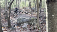
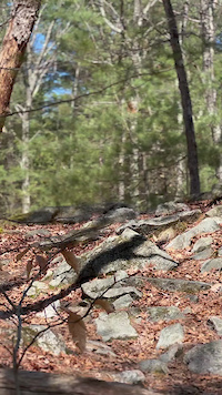
Photos of Landlocked Forest Mountain Bike
Videos of Landlocked Forest Mountain Bike
trail: Refrigerator Door
0:08 |
13 |
May 11, 2026
trail: Milk-Crate
0:08 |
20 |
May 3, 2026

4:32 |
924 |
Aug 28, 2018
Current Trail Warnings
| status | trail | date | condition | user | info |
|---|---|---|---|---|---|
| Abenaki-Pennacook Connector | Jun 11, 2026 @ 8:20am (America/New_York) Jun 11, 2026 | Unknown | RichcxlQqh | Tree down across trail | |
| Yellow Loop Link 2 | Jun 11, 2026 @ 8:20am (America/New_York) Jun 11, 2026 | Unknown | RichcxlQqh | Tree down blocking trail |
Recent Trail Reports
| status | trail | date | condition | info | user |
|---|---|---|---|---|---|
| Penacook | Jan 11, 2026 @ 3:23pm (America/New_York) Jan 11, 2026 | Variable | jbrazda | ||
| Gully Trails | Jan 11, 2026 @ 3:23pm (America/New_York) Jan 11, 2026 | Prevalent Mud | jbrazda | ||
| Pebonki | Jan 11, 2026 @ 3:23pm (America/New_York) Jan 11, 2026 | Variable | jbrazda | ||
| Refrigerator Door | Jan 11, 2026 @ 3:23pm (America/New_York) Jan 11, 2026 | Variable | jbrazda | ||
| Milk-Crate | Jan 11, 2026 @ 3:23pm (America/New_York) Jan 11, 2026 | Variable | jbrazda | ||
| Abenaki | Nov 13, 2025 @ 7:47pm (America/New_York) Nov 13, 2025 | Unknown | Froman1331 | ||
| Eagle | Nov 13, 2025 @ 11:11am (America/New_York) Nov 13, 2025 | Unknown | Froman1331 | ||
| Zatamozik | Nov 13, 2025 @ 10:59am (America/New_York) Nov 13, 2025 | Unknown | Froman1331 | ||
| Yellow Outer Loop | Nov 4, 2025 @ 5:34pm (America/New_York) Nov 4, 2025 | Unknown | Keentone | ||
| Kendall Connector | Aug 12, 2025 @ 7:20pm Aug 12, 2025 | Dry | Keentone |
Activity Feed
| username | action | type | title | date |
|---|---|---|---|---|
| Holliebikebike | wishlist | region | activity #97390123 | Jun 20, 2026 @ 6:54am 2 days |
| gnorin | wishlist | region | activity #97344978 | Jun 19, 2026 @ 2:29pm 3 days |
| BXIzDT | wishlist | route | activity #97276790 and 1 more | Jun 18, 2026 @ 2:39pm Jun 18, 2026 |
| nneumeister342 | ridden | route | activity #97265680 | Jun 18, 2026 @ 11:31am Jun 18, 2026 |
| mkincaid | wishlist | route | activity #96818563 | Jun 12, 2026 @ 11:36am Jun 12, 2026 |
Recent Comments
| username | type | title | comment | date |
|---|---|---|---|---|
| trail | Massive tree down in the trail - avoid! | Jun 4, 2026 @ 7:04pm Jun 4, 2026 | ||
| trail | Still bad. Some deadfall too. Avoid | Mar 18, 2026 @ 6:29am Mar 18, 2026 | ||
| trail | Big bee's nest in the ground right over the... | Sep 1, 2024 @ 11:07am Sep 1, 2024 | ||
| report | I highly agree, having just stumbled onto it. | Aug 17, 2024 @ 6:11am Aug 17, 2024 | ||
| trail | Doesn’t seem to be maintained… | Jul 15, 2024 @ 8:07pm Jul 15, 2024 |
Nearby Areas
| name | distance | ||||
|---|---|---|---|---|---|
| Old Reservoir | 2 | 12 | 0.8 km | ||
| Old Reservoir | 0.9 km | ||||
| Hartwell Town Forest | 7 | 2.2 km | |||
| Wilderness Park | 6 | 2.2 km | |||
| Murray York Conservation Area | 3 | 2.4 km |
Local Badges
-

Completionist40 awarded
Local Mountain Biking Directory
-
Cycle LoftBike Shop
-
The Cycle Loft IncBike Shop
Activity Type Stats
| activitytype | trails | distance | descent | descent distance | total vertical | rating | global rank | state rank | photos | reports | routes | ridelogs |
|---|---|---|---|---|---|---|---|---|---|---|---|---|
| Mountain Bike | 49 | 15 miles | 1,368 ft | 6 miles | 249 ft | #611 | #222 | 58 | 799 | 5 | 19,125 | |
| Hike | 49 | 15 miles | 1,368 ft | 6 miles | 249 ft | #7,886 | #2,919 | 3 | 798 | 191 | ||
| Trail Running | 49 | 15 miles | 1,368 ft | 6 miles | 249 ft | #6,776 | #2,198 | 798 | 1 | 256 | ||
| Snowshoe | 5 | 4,413 ft | 56 ft | 837 ft | 217 ft | #1,219 | #632 | 4 | 6 |
Frequently Asked Questions About Landlocked Forest
▼
What are the highest rated mountain biking trails in Landlocked Forest?
The highest rated mountain biking trails in Landlocked Forest are:
- Milk-Crate (4.2/5)
- Gully Trails (4.2/5)
- Muskrat Pond Trail (4.1/5)
- Out and Back (4/5)
- Refrigerator Door (4/5)
▼
What is the best time of the year to ride in Landlocked Forest?
Based on ride log data, the most popular months to ride in Landlocked Forest are:
- May (313 activities)
- July (307 activities)
- August (287 activities)
▼
Where can I park to ride in Landlocked Forest?
There are 2 parking locations listed in Landlocked Forest. The most popular parking spots are:
▼
What is the longest trail in Landlocked Forest?
The longest trail in Landlocked Forest is Penacook at 1.6 miles. View all trails sorted by distance.
Activities
Trails
Points of Interest
- By brenthillier
 NSMBA TRAILFORKS & contributors
 - Admins: apply
- #3510 - 21,618 views
- landlocked forest activity log | embed map of Landlocked Forest mountain bike trails | landlocked forest mountain biking points of interest
Downloading of trail gps tracks in kml & gpx formats is enabled for Landlocked Forest.
You must login to download files.