close
-
Layers w
- Weather Layers
- Pro
- Pro
- Pro
- Pro
- Pro
- Pro
- More Layers
- Pro
- Pro
- Pro
- Pro
-
Upgrade to

3D
Trail Conditions
- Unknown
- Snow Groomed
- Snow Packed
- Snow Covered
- Snow Cover Partial
- Freeze/thaw Cycle
- Icy
- Prevalent Mud
- Wet
- Variable
- Ideal
- Dry
- Very Dry
Trail Flow (Ridden Direction)
Trailforks scans users ridelogs to determine the most popular direction each trail is ridden. A good flowing trail network will have most trails flowing in a single direction according to their intension.
The colour categories are based on what percentage of riders are riding a trail in its intended direction.
The colour categories are based on what percentage of riders are riding a trail in its intended direction.
- > 96%
- > 90%
- > 80%
- > 70%
- > 50%
- < 50%
- bi-directional trail
- no data
Trail Last Ridden
Trailforks scans ridelogs to determine the last time a trail was ridden.
- < 2 days
- < 1 week
- < 2 weeks
- < 1 month
- < 6 months
- > 6 months
Trail Ridden Direction
The intended direction a trail should be ridden.
- Downhill Only
- Downhill Primary
- Both Directions
- Uphill Primary
- Uphill Only
- One Direction
Contribute Details
Colors indicate trail is missing specified detail.
- Description
- Photos
- Description & Photos
- Videos
Trail Popularity ?
Trailforks scans ridelogs to determine which trails are ridden the most in the last 9 months.
Trails are compared with nearby trails in the same city region with a possible 25 colour shades.
Think of this as a heatmap, more rides = more kinetic energy = warmer colors.
- most popular
- popular
- less popular
- not popular
ATV/ORV/OHV Filter
Max Vehicle Width
inches
US Cell Coverage
Legend

Radar Time
Activity Recordings
Trailforks uses anonymized public activity data.
?
Activity Recordings
Trailforks uses anonymized public activity data.
?
Personal Heatmap
▶
Activity Types
all
/
none
▶
Options
2
Date range
month
–
Winter Trails
Warning
A routing network for winter maps does not exist. Selecting trails using the winter trails layer has been disabled.
Missing Trails
Most Popular
Least Popular
Trails are colored based on popularity. The more popular a trail is, the more red. Less popular trails trend towards green.
Jump Magnitude Heatmap
Heatmap of where riders jump on trails. Zoom in to see individual jumps, click circles to view jump details.
BC Backroad Status
![map legend]()
Service Road Atlas is a free to use, community-driven service for viewing and creating reports on the numerous back-country service roads around B.C. and Alberta.

Slope Aspect
Direction the slope faces
Trails Deemphasized
Trails are shown in grey.
Only show trails with no bike usage.
Suggested Layers
Based on selected activity type
Save the current map location and zoom level as your default home location whenever this page is loaded.
Save
No description for Langdon has been added yet!
Login or register to submit one.
Activities Click to view
- Mountain Bike
23 trails
- E-Bike
1 trails
- Horse
14 trails
- Hike
16 trails
- Trail Running
16 trails
- Dirtbike/Moto
10 trails
- ATV/ORV/OHV
13 trails
- Snowmobile
0 trails
- Snowshoe
15 trails
- Downhill Ski
11 trails
- Backcountry Ski
0 trails
- Nordic Ski
15 trails
Region Details
- 10
- 11
- 1
- 1
Region Status
Open as of May 28, 2025Stats
- Trails (view details)
- 33
- Trails Mountain Bike
- 23
- Trails E-Bike
- 1
- Trails Horse
- 14
- Trails Hike
- 16
- Trails Trail Running
- 16
- Trails Dirtbike/Moto
- 10
- Trails ATV/ORV/OHV
- 13
- Trails Snowshoe
- 15
- Trails Downhill Ski
- 11
- Trails Nordic Ski
- 15
- Total Distance
- 42 miles
- Total Descent
- 4,717 ft
- Total Vertical
- 409 ft
- Highest Trailhead
- 1,500 ft
- Reports
- 69
- Photos
- 17
- Ridden Counter
- 409
Sub Regions
-
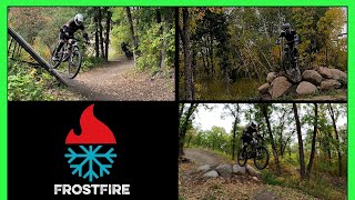
Frost Fire Park
- 3
- 3
- 1
- 1
-
Pembina Gorge State Recreation Area
- 7
- 8
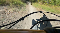
Popular Langdon Mountain Biking Trails
• 85 ★ 0.0 • 2,470 ft • 0 ft • 48 •
Popular blue difficulty singletrack. This mountain bike primary trail can be used downhill only and has a moderate overall physical rating. It features berm, drop, jump, gap jump, ladder bridge and roller coaster. Trail visibility is always easy to follow. On average it takes 1 minutes to complete this trail.
• 80 ★ 0.0 • 1,719 ft • 0 ft • 45 •
Popular green difficulty singletrack. This mountain bike primary trail can be used downhill primary and has a easy overall physical rating. It features roller coaster. Trail visibility is always easy to follow. On average it takes minutes to complete this trail.
• 95 ★ 0.0 • 2,182 ft • 0 ft • 39 •
Popular black diamond difficulty singletrack. This mountain bike primary trail can be used downhill only and has a moderate overall physical rating with a 0 ft black diamond climb. It features berm, drop, jump and roller coaster. Trail visibility is always easy to follow. On average it takes 1 minutes to complete this trail.
• 60 ★ 0.0 • 3,445 ft • 15 ft • 37 •
Moderately popular blue difficulty singletrack. This mountain bike primary trail can be used both directions and has a moderate overall physical rating with a 15 ft blue climb. It features skinny. Trail visibility is always easy to follow. On average it takes 4 minutes to complete this trail.
• 65 ★ 0.0 • 1 mile • 390 ft • 29 •
Moderately popular green difficulty singletrack. This mountain bike primary trail can be used uphill primary. On average it takes 10 minutes to complete this trail.
Photos of Langdon Mountain Bike
Videos of Langdon Mountain Bike
trail: Vertigo
0:16 |
87 |
Sep 19, 2023
14:16 |
73 |
Apr 4, 2025
Recent Trail Reports
| status | trail | date | condition | info | user |
|---|---|---|---|---|---|
| Lady Slippers Connector | May 28, 2025 @ 9:33am May 28, 2025 | Variable | Ford8N | ||
| Connector | May 28, 2025 @ 9:33am May 28, 2025 | Variable | Ford8N | ||
| Three Sisters Trail | May 28, 2025 @ 9:33am May 28, 2025 | Variable | Ford8N | ||
| Summit | Aug 31, 2024 @ 12:12pm Aug 31, 2024 | Ideal | Ford8N | ||
| Tow rope | Aug 31, 2024 @ 12:12pm Aug 31, 2024 | Variable | Ford8N | ||
| Vertigo | Aug 31, 2024 @ 12:12pm Aug 31, 2024 | Wet | Ford8N | ||
| Frosty Freeway | Aug 31, 2024 @ 12:12pm Aug 31, 2024 | Variable | Ford8N | ||
| Lady Slipper Outer Loop | Aug 12, 2024 @ 9:20am Aug 12, 2024 | Dry | philiplesage | ||
| Lady Slipper Loop | Aug 12, 2024 @ 9:16am Aug 12, 2024 | Dry | philiplesage | ||
| Dragonfly | Aug 2, 2024 @ 5:57am Aug 2, 2024 | Wet | Ford8N |
Activity Feed
| username | action | type | title | date |
|---|---|---|---|---|
| markholloway | add | poi | activity #85611858 and 1 more | Dec 16, 2025 @ 8:35am Dec 16, 2025 |
| markholloway | add | trail | activity #85611611 and 4 more | Dec 16, 2025 @ 8:28am Dec 16, 2025 |
| marteneleven | add | photo | activity #81461961 and 2 more | Sep 30, 2025 @ 8:03pm Sep 30, 2025 |
| f20YMO | wishlist | region | activity #77496374 | Aug 5, 2025 @ 6:05pm Aug 5, 2025 |
| Ford8N | add | report | activity #72599840 and 2 more | May 28, 2025 @ 2:56pm May 28, 2025 |
Recent Comments
| username | type | title | comment | date |
|---|---|---|---|---|
| report | Actually I think the wet spot was at the... | Aug 12, 2024 @ 9:22am Aug 12, 2024 | ||
| trail | One mud hole toward the end, right as you... | Aug 7, 2022 @ 3:55pm Aug 7, 2022 | ||
| trail | An unavoidable mud hole on lower Uff Da. | Aug 7, 2022 @ 3:53pm Aug 7, 2022 | ||
| trail | Fast as usual. One soft spot with ruts. | Aug 7, 2022 @ 3:52pm Aug 7, 2022 | ||
| trail | Couple of mud holes, but they bridged the... | Aug 7, 2022 @ 3:51pm Aug 7, 2022 |
Local Badges
-

10 Blue Trails2 awarded -

Epic Mountain Bike Climb 2k3 awarded -

Climbing 10k Badge1 awarded -

Mountain Biking 100k Badge0 awarded -

Epic Ride Descent 2k3 awarded -

Descent 10k Badge1 awarded
Activity Type Stats
| activitytype | trails | distance | descent | descent distance | total vertical | rating | global rank | state rank | photos | reports | routes | ridelogs |
|---|---|---|---|---|---|---|---|---|---|---|---|---|
| Mountain Bike | 23 | 40 miles | 3,891 ft | 10 miles | 410 ft | #10,938 | #3,360 | 17 | 69 | 145 | ||
| E-Bike | 1 | 3,094 ft | 335 ft | 3,009 ft | 338 ft | #10,713 | #3,440 | 63 | 6 | |||
| Horse | 14 | 33 miles | 1,834 ft | 6 miles | 410 ft | #1,696 | #967 | 3 | ||||
| Hike | 16 | 36 miles | 2,339 ft | 7 miles | 410 ft | #6,963 | #2,470 | 67 | 2 | |||
| Trail Running | 16 | 36 miles | 2,339 ft | 7 miles | 410 ft | #6,410 | #2,083 | 67 | ||||
| Dirtbike/Moto | 10 | 31 miles | 1,608 ft | 5 miles | 410 ft | #955 | #355 | 1 | ||||
| ATV/ORV/OHV | 13 | 33 miles | 1,785 ft | 6 miles | 410 ft | #711 | #295 | 2 | 1 | |||
| Snowshoe | 15 | 35 miles | 1,995 ft | 6 miles | 410 ft | #656 | #271 | 3 | ||||
| Downhill Ski | 11 | 2 miles | 823 ft | 1 mile | 302 ft | #701 | #339 | 11 | ||||
| Nordic Ski | 15 | 35 miles | 1,995 ft | 6 miles | 410 ft | #726 | #268 | 3 |
Frequently Asked Questions About Langdon
▼
What are the best places to ride in Langdon?
Langdon has 2 areas to explore for mountain biking. The top rated areas are:
▼
What are the highest rated mountain biking trails in Langdon?
The highest rated mountain biking trails in Langdon are:
- Bullwheel (4.1/5)
- Tow rope (4.1/5)
- Upper Uff Da and Lower Uff Da (0/5)
- Three Sisters Trail (0/5)
- Trapper's Ridge Trail (0/5)
▼
What is the best time of the year to ride in Langdon?
Based on ride log data, the most popular months to ride in Langdon are:
- September (3 activities)
▼
Where can I park to ride in Langdon?
There are 3 parking locations listed in Langdon. The most popular parking spots are: View all parking and trailhead locations on the map to plan your visit.
Activities
- By WillieJacobsz
 Trailforks SBP SWW & contributors
 - Admins: apply
- #48944 - 1,143 views
- langdon activity log | embed map of Langdon mountain bike trails | langdon mountain biking points of interest
Downloading of trail gps tracks in kml & gpx formats is enabled for Langdon.
You must login to download files.