close
-
Layers w
- Weather Layers
- Pro
- Pro
- Pro
- Pro
- Pro
- Pro
- More Layers
- Pro
- Pro
- Pro
- Pro
-
Upgrade to

3D
Trail Conditions
- Unknown
- Snow Groomed
- Snow Packed
- Snow Covered
- Snow Cover Partial
- Freeze/thaw Cycle
- Icy
- Prevalent Mud
- Wet
- Variable
- Ideal
- Dry
- Very Dry
Trail Flow (Ridden Direction)
Trailforks scans users ridelogs to determine the most popular direction each trail is ridden. A good flowing trail network will have most trails flowing in a single direction according to their intension.
The colour categories are based on what percentage of riders are riding a trail in its intended direction.
The colour categories are based on what percentage of riders are riding a trail in its intended direction.
- > 96%
- > 90%
- > 80%
- > 70%
- > 50%
- < 50%
- bi-directional trail
- no data
Trail Last Ridden
Trailforks scans ridelogs to determine the last time a trail was ridden.
- < 2 days
- < 1 week
- < 2 weeks
- < 1 month
- < 6 months
- > 6 months
Trail Ridden Direction
The intended direction a trail should be ridden.
- Downhill Only
- Downhill Primary
- Both Directions
- Uphill Primary
- Uphill Only
- One Direction
Contribute Details
Colors indicate trail is missing specified detail.
- Description
- Photos
- Description & Photos
- Videos
Trail Popularity ?
Trailforks scans ridelogs to determine which trails are ridden the most in the last 9 months.
Trails are compared with nearby trails in the same city region with a possible 25 colour shades.
Think of this as a heatmap, more rides = more kinetic energy = warmer colors.
- most popular
- popular
- less popular
- not popular
ATV/ORV/OHV Filter
Max Vehicle Width
inches
US Cell Coverage
Legend

Radar Time
Activity Recordings
Trailforks uses anonymized public activity data.
?
Activity Recordings
Trailforks uses anonymized public activity data.
?
Personal Heatmap
▶
Activity Types
all
/
none
▶
Options
2
Date range
month
–
Winter Trails
Warning
A routing network for winter maps does not exist. Selecting trails using the winter trails layer has been disabled.
Missing Trails
Most Popular
Least Popular
Trails are colored based on popularity. The more popular a trail is, the more red. Less popular trails trend towards green.
Jump Magnitude Heatmap
Heatmap of where riders jump on trails. Zoom in to see individual jumps, click circles to view jump details.
BC Backroad Status
![map legend]()
Service Road Atlas is a free to use, community-driven service for viewing and creating reports on the numerous back-country service roads around B.C. and Alberta.

Slope Aspect
Direction the slope faces
Trails Deemphasized
Trails are shown in grey.
Only show trails with no bike usage.
Suggested Layers
Based on selected activity type
Save the current map location and zoom level as your default home location whenever this page is loaded.
SaveNorsk
Området tilbyr enkle og litt mer tekniske forsøk, med vakker utsikt over elven.
morsomt område egnet for fotturer og mtb, men mest brukt av turgåere og sportsfiskere, noen av stiene er ikke egnet for mtb.
Vær oppmerksom på frittgående geiter, hunder må være i bånd.
English
The area offer easy & some more technical trials, with beautiful views of the river.
fun area suitable for hiking & mtb, but mostly used by hikers & anglers, some of the trails are not suitable for mtb.
be aware of free roaming goats, dogs must be on a leash.
 google parking directions
Links
This region uses the Uk/Euro style trail grading system.
Activities Click to view
- Mountain Bike
32 trails
- E-Bike
18 trails
- Hike
34 trails
- Trail Running
30 trails
- Dirtbike/Moto
2 trails
- ATV/ORV/OHV
2 trails
Region Details
- 13
- 2
- 3
- 10
- 1
Region Status
Open as of Jun 15, 2026Stats
- Avg Trail Rating
- Trails (view details)
- 35
- Trails Mountain Bike
- 32
- Trails E-Bike
- 18
- Trails Hike
- 34
- Trails Trail Running
- 30
- Trails Dirtbike/Moto
- 2
- Trails ATV/ORV/OHV
- 2
- Total Distance
- 8 miles
- Total Descent Distance
- 3 miles
- Total Descent
- 603 ft
- Total Vertical
- 147 ft
- Highest Trailhead
- 429 ft
- Reports
- 43
- Photos
- 185
- Ridden Counter
- 59
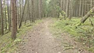
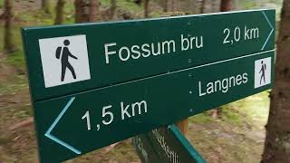
Popular Langnes Mountain Biking Trails
• 5 ★ 5.0 • 764 ft • 5 ft • 3 •
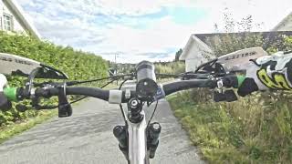
Den delen av veien som starter fra parkeringsplassen fra svingporten. The section of the road that starts from the parking area from the swing gate.
• 5 ★ 5.0 • 308 ft • 0 ft • 3 •
Less popular white difficulty gravel path. This mountain bike primary trail can be used both directions and has a easy overall physical rating with a 0 ft green climb. Trail visibility is always easy to follow. On average it takes minutes to complete this trail.
• 5 ★ 0.0 • 262 ft • 0 ft • 3 • • hike
Skrå, full av røtter, noen flekker med trange trær, bratt på toppen, noen opp og ned midtveis, men lettere nær . Of camber, full of roots, some spots with tight trees, steep at the top, some up and down in midway through, but...
• 5 ★ 5.0 • 446 ft • 23 ft • 3 •
Dette er en skrå jord traktor sti med med noen røtter This is a slanted dirt tractor trail with some roots.
• 5 ★ 5.0 • 1,601 ft • 0 ft • 2 •
På Ihlen er det en svingport, stien er flat der ganske jevn, det er også et enkelt spor i nærheten av svingen der. For det meste flatt, det meste av stien er i god stand mesteparten av tiden, men området nær det store og små...
• 5 ★ 5.0 • 1,306 ft • 34 ft • 2 •
Røtter en liten bekk krysning over en planke bru, lang rett parti er lett, nord partiet er fylt med store røtter helt til hytta, det blir jevnere og lettere etter det, etter skiltet, svinger til høyre ned i muligens gjørmete og lett...
• 5 ★ 5.0 • 358 ft • 5 ft • 2 •
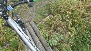
En kort smal sti med en sving, noen røtter, ganske enkle, små tømmerstokker for å unngå gjørmeproblemer i bunnen nær stikryss. A short single track with one turn, some roots, quite easy, small logs for avoiding mud issues at the...
• 5 ★ 5.0 • 341 ft • 15 ft • 2 •
Nederst er det en skarp og bratt sving, som har røtter, fra utsiden av svingen, og det er steiner lenger opp i den, en av steinene er ganske løs. Bunnen er ganske flat, og har ingen hindringer, og er glatt. svingen midt i fjellet er...
Photos of Langnes Mountain Bike
Videos of Langnes Mountain Bike
youtuber
![07 Sep 2022 Trails at Langnes, Askim]()
trail: Privat Veg
9:08 |
110 |
Oct 1, 2023 , Askim
youtuber
![07 Sep 2022 Down to Glomma]()
19:22 |
120 |
Oct 1, 2023 , Askim
youtuber
![07 Sep 2022 Riding trough Tovengen and more]()
trail: Privat Veg
4:01 |
123 |
Oct 1, 2023 , Askim
youtuber
![Langnesstien, Askim 07 sep 2022 _ forgotten...]()
trail: Langnesstien
0:27 |
117 |
Sep 14, 2023 , Askim
youtuber
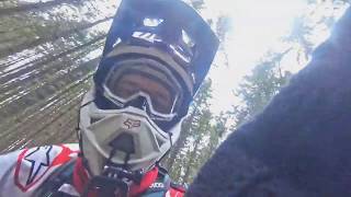
![21 june 2018 second ride near the cabins]()
trail: Hytta - Picnic
0:28 |
187 |
Sep 24, 2018 , Askim
youtuber
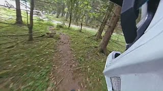
![June 21, 2018 Langnes: second time at Venstre...]()
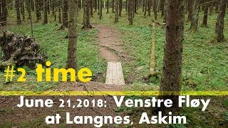
trail: Venstre Fløy
2:55 |
188 |
Sep 24, 2018 , Askim
youtuber
![21 june 2018 Langnes - up was hard but down...]()
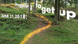
trail: Venstre Fløy
4:01 |
185 |
Oct 7, 2018 , Askim
youtuber
![11 may 2019 Langnes]()
trail: Minne Steinen
2:40 |
168 |
Sep 28, 2019 , Askim
Recent Trail Reports
| status | trail | date | condition | info | user |
|---|---|---|---|---|---|
| Privat Veg | Aug 14, 2020 @ 5:06am Aug 14, 2020 | Ideal | mtbboy1993 TRAILFORKS | ||
| Indre Bruhode | Aug 14, 2020 @ 5:04am Aug 14, 2020 | Variable | mtbboy1993 TRAILFORKS | ||
| Brua-Parkeringa | Aug 14, 2020 @ 3:36am Aug 14, 2020 | Very Dry | mtbboy1993 TRAILFORKS | ||
| Ihlen - Langnes | Feb 6, 2020 @ 11:01pm Feb 6, 2020 | Dry | mtbboy1993 TRAILFORKS | ||
| Hjertestien | Jun 21, 2018 @ 5:26pm Jun 21, 2018 | Dry | mtbboy1993 TRAILFORKS |
Activity Feed
| username | action | type | title | date |
|---|---|---|---|---|
| mtbboy1993 | add | report | activity #67037752 and 1 more | Mar 1, 2025 @ 7:41pm Mar 1, 2025 |
| mtbboy1993 | add | video | activity #44741136 and 2 more | Oct 1, 2023 @ 6:00am Oct 1, 2023 |
| mtbboy1993 | add | video | activity #44116728 | Sep 14, 2023 @ 11:01pm Sep 14, 2023 |
| mtbboy1993 | update | trail | activity #44105366 | Sep 14, 2023 @ 5:44pm Sep 14, 2023 |
| mtbboy1993 | vote | trail | activity #34836197 | Oct 24, 2022 @ 2:45am Oct 24, 2022 |
Nearby Areas
| name | distance | ||||
|---|---|---|---|---|---|
| Prestegårdsskogen | 42 | 53 | 7 | 1.2 km | |
| Griniskogen Turpark | 6 | 5 | 1.4 km | ||
| Kråkåsen | 11 | 17 | 1.5 km | ||
| Romsåsen | 5 | 5 | 1 | 1 | 1.7 km |
| Spydeberg City | 7 | 1.9 km |
Activity Type Stats
| activitytype | trails | distance | descent | descent distance | total vertical | rating | global rank | state rank | photos | reports | routes | ridelogs |
|---|---|---|---|---|---|---|---|---|---|---|---|---|
| Mountain Bike | 32 | 6 miles | 371 ft | 3 miles | 148 ft | #3,704 | #36 | 184 | 41 | 5 | ||
| E-Bike | 18 | 2 miles | 177 ft | 4,731 ft | 148 ft | #3,959 | #84 | 33 | ||||
| Hike | 34 | 7 miles | 535 ft | 3 miles | 148 ft | #5,265 | #58 | 1 | 42 | |||
| Trail Running | 30 | 5 miles | 302 ft | 2 miles | 148 ft | #5,234 | #70 | 39 | 1 | |||
| Dirtbike/Moto | 2 | 2,178 ft | 7 ft | 522 ft | 26 ft | #411 | #6 | 8 | ||||
| ATV/ORV/OHV | 2 | 2,178 ft | 7 ft | 522 ft | 26 ft | #277 | #8 | 8 |
Frequently Asked Questions About Langnes
▼
What are the highest rated mountain biking trails in Langnes?
The highest rated mountain biking trails in Langnes are:
- Bordene (4.1/5)
- Ihlen - Langnes (4.1/5)
- Ned til Langestangen (4.1/5)
- Langnesveien etter porten (4.1/5)
- Schuckertlinna - Langnesstien (4.1/5)
▼
Where can I park to ride in Langnes?
▼
What is the longest trail in Langnes?
The longest trail in Langnes is Schuckertlinna - Langnesstien at 3,360 ft. View all trails sorted by distance.
▼
What are the best & highest rated hiking trails in Langnes?
The best hiking trails in Langnes are: View all hiking trails sorted by popularity score.
Activities
Trails
- By mtbboy1993
 TRAILFORKS SSK & contributors
 - Admins: apply
- #24235 - 2,340 views
- langnes activity log | embed map of Langnes mountain bike trails | langnes mountain biking points of interest polygons
Downloading of trail gps tracks in kml & gpx formats is enabled for Langnes.
You must login to download files.