close
-
Layers w
- Weather Layers
- Pro
- Pro
- Pro
- Pro
- Pro
- Pro
- More Layers
- Pro
- Pro
- Pro
- Pro
-
Upgrade to

3D
Trail Conditions
- Unknown
- Snow Groomed
- Snow Packed
- Snow Covered
- Snow Cover Partial
- Freeze/thaw Cycle
- Icy
- Prevalent Mud
- Wet
- Variable
- Ideal
- Dry
- Very Dry
Trail Flow (Ridden Direction)
Trailforks scans users ridelogs to determine the most popular direction each trail is ridden. A good flowing trail network will have most trails flowing in a single direction according to their intension.
The colour categories are based on what percentage of riders are riding a trail in its intended direction.
The colour categories are based on what percentage of riders are riding a trail in its intended direction.
- > 96%
- > 90%
- > 80%
- > 70%
- > 50%
- < 50%
- bi-directional trail
- no data
Trail Last Ridden
Trailforks scans ridelogs to determine the last time a trail was ridden.
- < 2 days
- < 1 week
- < 2 weeks
- < 1 month
- < 6 months
- > 6 months
Trail Ridden Direction
The intended direction a trail should be ridden.
- Downhill Only
- Downhill Primary
- Both Directions
- Uphill Primary
- Uphill Only
- One Direction
Contribute Details
Colors indicate trail is missing specified detail.
- Description
- Photos
- Description & Photos
- Videos
Trail Popularity ?
Trailforks scans ridelogs to determine which trails are ridden the most in the last 9 months.
Trails are compared with nearby trails in the same city region with a possible 25 colour shades.
Think of this as a heatmap, more rides = more kinetic energy = warmer colors.
- most popular
- popular
- less popular
- not popular
ATV/ORV/OHV Filter
Max Vehicle Width
inches
US Cell Coverage
Legend

Radar Time
Activity Recordings
Trailforks uses anonymized public activity data.
?
Activity Recordings
Trailforks uses anonymized public activity data.
?
Personal Heatmap
▶
Activity Types
all
/
none
▶
Options
2
Date range
month
–
Winter Trails
Warning
A routing network for winter maps does not exist. Selecting trails using the winter trails layer has been disabled.
Missing Trails
Most Popular
Least Popular
Trails are colored based on popularity. The more popular a trail is, the more red. Less popular trails trend towards green.
Jump Magnitude Heatmap
Heatmap of where riders jump on trails. Zoom in to see individual jumps, click circles to view jump details.
BC Backroad Status
![map legend]()
Service Road Atlas is a free to use, community-driven service for viewing and creating reports on the numerous back-country service roads around B.C. and Alberta.

Slope Aspect
Direction the slope faces
Trails Deemphasized
Trails are shown in grey.
Only show trails with no bike usage.
Suggested Layers
Based on selected activity type
Save the current map location and zoom level as your default home location whenever this page is loaded.
Save
No description for Laramie has been added yet!
Login or register to submit one.
Activities Click to view
- Mountain Bike
135 trails
- E-Bike
3 trails
- Gravel Bike
0 trails
- Adaptive Bike
0 trails
- Winter Fat Bike
0 trails
- Horse
103 trails
- Hike
136 trails
- Trail Running
136 trails
- Snowshoe
17 trails
- Nordic Ski
28 trails
Region Details
- 13
- 10
- 32
- 62
- 10
- 4
Region Status
Open as of Jun 13, 2026Local Trail Association
Stats
- Avg Trail Rating
- Trails (view details)
- 155
- Trails Mountain Bike
- 136
- Trails E-Bike
- 3
- Trails Horse
- 103
- Trails Hike
- 136
- Trails Trail Running
- 136
- Trails Dirtbike/Moto
- 1
- Trails ATV/ORV/OHV
- 1
- Trails Snowshoe
- 17
- Trails Backcountry Ski
- 1
- Trails Nordic Ski
- 28
- Total Distance
- 137 miles
- Total Descent
- 13,978 ft
- Total Vertical
- 1,819 ft
- Highest Trailhead
- 8,951 ft
- Reports
- 976
- Photos
- 182
- Ridden Counter
- 20,523
Sub Regions
-
Happy Jack Recreational Area
- 2
- 13
- 26
- 3
- 3
-
Pilot Hill/The Schoolyard
- 1
- 12
- 24
- 3
- 1
-
Vedauwoo / Blair
- 8
- 13
- 5
Popular Laramie Mountain Biking Trails
• 100 ★ 3.9 • 2,557 ft • 13 ft • 573 •
This is a fast and fun trail that zooms you around and in between lots of trees. The trail departs or .
• 100 ★ 4.7 • 1 mile • 347 ft • 560 •
The top part of this trail is like most of : a little rutted, pretty straight, and fast. The bottom section was redone in 2018 to replace some unsustainable, fall-line trail with flowy, sustainable trail with some berms, rollers, and...
• 100 ★ 3.0 • 400 ft • 0 ft • 491 •
Popular green difficulty singletrack. This multi-use trail can be used both directions and has a easy overall physical rating with a 0 ft green climb. On average it takes minutes to complete this trail.
• 95 ★ 4.3 • 2 miles • 472 ft • 472 •
This trail departs and descends quickly through the area. Be prepared for moderate tech, this trail has lots of rocks, roots, and turns. It connects to and . Significantly re-routed in summer 2020. The old trail is still visible in...
• 75 ★ 4.5 • 2 miles • 173 ft • 401 •
is a fantastic downhill descent (or tough climb) that connects and Loop.
• 85 ★ 3.4 • 2,178 ft • 35 ft • 398 •
Popular blue difficulty singletrack. This multi-use trail can be used both directions with a 35 ft blue climb. On average it takes 2 minutes to complete this trail.
• 90 ★ 3.6 • 1 mile • 280 ft • 355 •
Popular blue difficulty singletrack. This multi-use trail can be used both directions and has a moderate overall physical rating with a 280 ft blue climb. Winter use: Backcountry snow grooming. Trail visibility is always easy to follow. On average it takes 12 minutes to complete this trail.
Laramie Mountain Bike Routes
26 miles • 2,006 ft • 5 • Out & Back •
Starting at the Schoolyard, go up the new trail till you hit the double track road and head...
96 miles • 9,280 ft • 29 • Loop •
The Laradise Superloop is a 96 mile lollypop loop in southeast Wyoming that starts and ends in Laramie, WY...
11 miles • 1,540 ft • 17 • Loop •
This routes takes riders through what I would consider to be the best trails that Area has to offer....
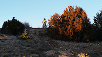
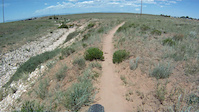
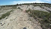
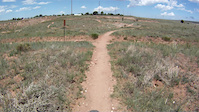
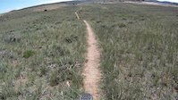
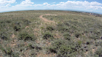
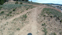
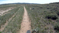
Photos of Laramie Mountain Bike
Videos of Laramie Mountain Bike
trail: Extra Credit
0:10 |
148 |
May 4, 2021
trail: Snow Day
0:49 |
44 |
Jul 4, 2019
trail: LST
0:49 |
62 |
Jul 4, 2019
trail: Homeroom
0:43 |
18 |
Jul 4, 2019
trail: Bluebird
3:18 |
46 |
Jul 4, 2019
trail: Lunch Lady
5:51 |
121 |
Jul 4, 2019
trail: Sticks & Stones
2:58 |
70 |
Jul 4, 2019
trail: PB&J
4:22 |
78 |
Jul 4, 2019
Recent Trail Reports
| status | trail | date | condition | info | user |
|---|---|---|---|---|---|
| Trail 29 | Jun 13, 2026 @ 7:34pm (America/Denver) Jun 13, 2026 | Unknown | lookoutkd14 | ||
| Trail 23 | Jun 13, 2026 @ 7:34pm (America/Denver) Jun 13, 2026 | Unknown | lookoutkd14 | ||
| Headquarters NRT | Jun 11, 2026 @ 12:51pm (America/Denver) Jun 11, 2026 | Very Dry | scottridesemtbusa | ||
| Headquarters Overlook | Jun 11, 2026 @ 12:51pm (America/Denver) Jun 11, 2026 | Very Dry | scottridesemtbusa | ||
| Lower UW | Jun 11, 2026 @ 12:51pm (America/Denver) Jun 11, 2026 | Ideal | scottridesemtbusa | ||
| Crow Creek Loop | Jun 11, 2026 @ 12:51pm (America/Denver) Jun 11, 2026 | Variable | scottridesemtbusa | ||
| Crow Creek Access | Jun 11, 2026 @ 12:51pm (America/Denver) Jun 11, 2026 | Prevalent Mud | scottridesemtbusa | ||
| Pole Creek | Jun 11, 2026 @ 12:51pm (America/Denver) Jun 11, 2026 | Prevalent Mud | scottridesemtbusa | ||
| Aspen | Jun 11, 2026 @ 12:51pm (America/Denver) Jun 11, 2026 | Variable | scottridesemtbusa | ||
| Middle Aspen | Jun 11, 2026 @ 12:51pm (America/Denver) Jun 11, 2026 | Variable | scottridesemtbusa |
Activity Feed
| username | action | type | title | date |
|---|---|---|---|---|
| n6nffX | wishlist | route | activity #97227338 | Jun 17, 2026 @ 7:40pm 7 hours |
| lookoutkd14 | add | report | activity #96932030 and 1 more | Jun 13, 2026 @ 6:34pm Jun 13, 2026 |
| scottridesemtbusa | add | report | activity #96834115 and 7 more | Jun 12, 2026 @ 4:15pm Jun 12, 2026 |
| JasonSpfWIK | wishlist | route | activity #96717163 | Jun 10, 2026 @ 9:05pm Jun 10, 2026 |
| Martymoos | wishlist | route | activity #96486377 | Jun 7, 2026 @ 12:11pm Jun 7, 2026 |
Recent Comments
| username | type | title | comment | date |
|---|---|---|---|---|
| trail | Never been on this trail but you guys stole... | Feb 9, 2026 @ 4:06pm Feb 9, 2026 | ||
| trail | Hard to get to but what a blast! This is an... | Nov 18, 2025 @ 3:20pm Nov 18, 2025 | ||
| trail | Was a hoot in’ hollering’ damn good time.... | Oct 5, 2025 @ 3:57pm Oct 5, 2025 | ||
| trail | Smooth rolling and easy, if a bit sandy. Good... | Aug 11, 2025 @ 10:46am Aug 11, 2025 | ||
| trail | Brand new summer 2025! Basically an extension... | Aug 11, 2025 @ 10:41am Aug 11, 2025 |
Local Badges
-

Top 10 Trails2 awarded -

Descent 100k Badge6 awarded -

Big Ride 30k1,616 awarded -

Epic Ride 50k640 awarded -

Completionist0 awarded -
Completionist0 awarded
Activity Type Stats
| activitytype | trails | distance | descent | descent distance | total vertical | rating | global rank | state rank | photos | reports | routes | ridelogs |
|---|---|---|---|---|---|---|---|---|---|---|---|---|
| Mountain Bike | 135 | 122 miles | 12,461 ft | 48 miles | 1,821 ft | #955 | #378 | 179 | 961 | 9 | 19,303 | |
| E-Bike | 3 | 5 miles | 407 ft | 2 miles | 282 ft | #8,324 | #2,531 | 741 | 109 | |||
| Horse | 103 | 100 miles | 10,541 ft | 38 miles | 1,693 ft | #220 | #424 | 420 | 20 | |||
| Hike | 136 | 126 miles | 12,507 ft | 49 miles | 1,821 ft | #1,711 | #758 | 7 | 955 | 1,024 | ||
| Trail Running | 136 | 126 miles | 12,507 ft | 49 miles | 1,821 ft | #1,325 | #479 | 955 | 1 | 786 | ||
| Dirtbike/Moto | 1 | 4 miles | 371 ft | 2 miles | 282 ft | 308 | 5 | |||||
| ATV/ORV/OHV | 1 | 4 miles | 371 ft | 2 miles | 282 ft | 308 | 1 | |||||
| Snowshoe | 17 | 14 miles | 1,312 ft | 5 miles | 650 ft | #916 | #439 | 112 | 36 | |||
| Backcountry Ski | 1 | 2 miles | 417 ft | 1 mile | 397 ft | 20 | 38 | |||||
| Nordic Ski | 28 | 11 miles | 1,168 ft | 5 miles | 354 ft | #551 | #177 | 31 | 1 | 1,081 |
Frequently Asked Questions About Laramie
▼
What are the best places to ride in Laramie?
Laramie has 3 areas to explore for mountain biking. The top rated areas are:
▼
What are the highest rated mountain biking trails in Laramie?
The highest rated mountain biking trails in Laramie are:
- Middle Aspen (4.3/5)
- Death Crotch (4.3/5)
- Trail 10 (4.2/5)
- Trail 33 (4.1/5)
- Trail 31 (4.1/5)
▼
What is the best time of the year to ride in Laramie?
Based on ride log data, the most popular months to ride in Laramie are:
- July (302 activities)
- September (216 activities)
- August (212 activities)
▼
Where can I park to ride in Laramie?
There are 18 parking locations listed in Laramie. The most popular parking spots are:
- North Boulder Drive Access to Pilot Hill
- Parking
- Tie City Trailhead
- Happy Jack Trailhead
- Summit Trailhead
Activities
Trails
- By brenthillier
 NSMBA TRAILFORKS & contributors
 - Admins: WP, chuktA, BIKENET, laradice, BIKENET, 30percentirish
- #11919 - 13,673 views
- laramie activity log | embed map of Laramie mountain bike trails | laramie mountain biking points of interest
Downloading of trail gps tracks in kml & gpx formats is enabled for Laramie.
You must login to download files.