close
-
Layers w
- Weather Layers
- Pro
- Pro
- Pro
- Pro
- Pro
- Pro
- More Layers
- Pro
- Pro
- Pro
- Pro
-
Upgrade to

3D
Trail Conditions
- Unknown
- Snow Groomed
- Snow Packed
- Snow Covered
- Snow Cover Partial
- Freeze/thaw Cycle
- Icy
- Prevalent Mud
- Wet
- Variable
- Ideal
- Dry
- Very Dry
Trail Flow (Ridden Direction)
Trailforks scans users ridelogs to determine the most popular direction each trail is ridden. A good flowing trail network will have most trails flowing in a single direction according to their intension.
The colour categories are based on what percentage of riders are riding a trail in its intended direction.
The colour categories are based on what percentage of riders are riding a trail in its intended direction.
- > 96%
- > 90%
- > 80%
- > 70%
- > 50%
- < 50%
- bi-directional trail
- no data
Trail Last Ridden
Trailforks scans ridelogs to determine the last time a trail was ridden.
- < 2 days
- < 1 week
- < 2 weeks
- < 1 month
- < 6 months
- > 6 months
Trail Ridden Direction
The intended direction a trail should be ridden.
- Downhill Only
- Downhill Primary
- Both Directions
- Uphill Primary
- Uphill Only
- One Direction
Contribute Details
Colors indicate trail is missing specified detail.
- Description
- Photos
- Description & Photos
- Videos
Trail Popularity ?
Trailforks scans ridelogs to determine which trails are ridden the most in the last 9 months.
Trails are compared with nearby trails in the same city region with a possible 25 colour shades.
Think of this as a heatmap, more rides = more kinetic energy = warmer colors.
- most popular
- popular
- less popular
- not popular
ATV/ORV/OHV Filter
Max Vehicle Width
inches
US Cell Coverage
Legend

Radar Time
Activity Recordings
Trailforks uses anonymized public activity data.
?
Activity Recordings
Trailforks uses anonymized public activity data.
?
Personal Heatmap
▶
Activity Types
all
/
none
▶
Options
2
Date range
month
–
Winter Trails
Warning
A routing network for winter maps does not exist. Selecting trails using the winter trails layer has been disabled.
Missing Trails
Most Popular
Least Popular
Trails are colored based on popularity. The more popular a trail is, the more red. Less popular trails trend towards green.
Jump Magnitude Heatmap
Heatmap of where riders jump on trails. Zoom in to see individual jumps, click circles to view jump details.
BC Backroad Status
![map legend]()
Service Road Atlas is a free to use, community-driven service for viewing and creating reports on the numerous back-country service roads around B.C. and Alberta.

Slope Aspect
Direction the slope faces
Trails Deemphasized
Trails are shown in grey.
Only show trails with no bike usage.
Suggested Layers
Based on selected activity type
Save the current map location and zoom level as your default home location whenever this page is loaded.
SavePopular Trail Networks
view all areas »
No description for Larimer County has been added yet!
Login or register to submit one.
Links
Activities Click to view
- Mountain Bike
393 trails
- E-Bike
57 trails
- Gravel Bike
23 trails
- Horse
159 trails
- Hike
706 trails
- Trail Running
703 trails
- Dirtbike/Moto
12 trails
- Observed Trials
0 trails
- ATV/ORV/OHV
7 trails
- Snowmobile
0 trails
- Snowshoe
4 trails
- Downhill Ski
1 trails
- Backcountry Ski
7 trails
- Nordic Ski
1 trails
Stats
- Avg Trail Rating
- Trails (view details)
- 737
- Trails Mountain Bike
- 393
- Trails E-Bike
- 57
- Trails Gravel Bike
- 23
- Trails Adaptive Bike
- 2
- Trails Horse
- 159
- Trails Hike
- 706
- Trails Trail Running
- 703
- Trails Dirtbike/Moto
- 12
- Trails ATV/ORV/OHV
- 7
- Trails Snowshoe
- 4
- Trails Downhill Ski
- 1
- Trails Backcountry Ski
- 7
- Trails Nordic Ski
- 1
- Total Distance
- 1,283 miles
- Total Descent
- 191,757 ft
- Total Vertical
- 9,581 ft
- Highest Trailhead
- 14,230 ft
- Reports
- 3,728
- Photos
- 1,059
- Ridden Counter
- 68,319
Articles
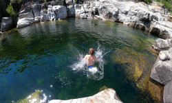
The 9 Best Swimming Holes in Our National Parks
Jun 20, 2025 from outsideonline.com
From waterfalls to deep plunge pools, here the best natural pools for cooling off this summer in national parks.
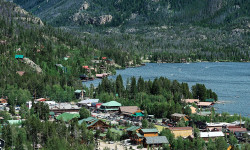
Lesser-Known Lake Escapes in the U.S.
May 22, 2025 from outsideonline.com
From turquoise gems in the Rockies to forest-fringed glacial lakes in New England, escape the crowds at these nine lakes in the U.S. where...
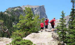
10 Things to Do with Kids at Rocky Mountain National Park
Feb 28, 2022 from outsideonline.com
Family vacation? Find fun for all ages with these kid-friendly activities in and around the park.
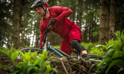
Video: Mountain Biking Meets the Office as Niner get a Brit Visitor
Jul 20, 2019 from pinkbike.com
Dunder Mifflin meets Niner Bikes as Damian Groves picks up his new Niner Rip 9 RDO.
Sub Regions
- Berthoud (42)
- Berthoud Bike Park (42)
- Estes Park (40)
- Fort Collins (179)
- Loveland (38)
- Red Feather Lakes (51)
- Windsor (8)
- Bobcat Ridge (14)
- Comanche Peak Wilderness Area (3)
- Lory State Park (28)
- State Forest State Park (27)
Popular Larimer County Mountain Biking Trails
• 100 ★ 2.5 • 2,374 ft • 14 ft • 1,169 •
Connects parking to Towers/ . Wide gravel path usually full of dogs and people with earbuds in.
• 100 ★ 4.0 • 1,410 ft • 2 ft • 972 •
Highly rated popular blue difficulty singletrack. This mountain bike primary trail can be used both directions. On average it takes 2 minutes to complete this trail.
• 100 ★ 3.2 • 4,517 ft • 95 ft • 962 •
Popular green difficulty singletrack. This mountain bike primary trail can be used both directions. On average it takes 5 minutes to complete this trail.
• 95 ★ 3.8 • 2 miles • 439 ft • 908 •
Popular blue difficulty singletrack. This mountain bike primary trail can be used both directions. On average it takes 19 minutes to complete this trail.
• 95 ★ 2.8 • 1 mile • 62 ft • 888 •
Popular green difficulty gravel path. This mountain bike primary trail can be used downhill primary. On average it takes 7 minutes to complete this trail.
• 95 ★ 4.3 • 4 miles • 567 ft • 873 •
Highly rated popular blue difficulty singletrack. This mountain bike primary trail can be used both directions. On average it takes 33 minutes to complete this trail.
• 95 ★ 3.7 • 1 mile • 169 ft • 856 •
Popular green difficulty singletrack. This mountain bike primary trail can be used downhill primary. On average it takes 8 minutes to complete this trail.
• 100 ★ 3.0 • 670 ft • 8 ft • 844 •
Popular green difficulty singletrack. This mountain bike primary trail can be used both directions. On average it takes minutes to complete this trail.
Larimer County Mountain Bike Routes
8 miles • 1,449 ft • 8 •
Quick eight-Mile ride that takes you up Towers, and gives you a bit of Carey Spring, Loggers, and before...
★ 5.0 • 6 miles • 597 ft • 2 •
Start at the upper lot and connect the two sections of LImber Pine. Great as an out-and-back.
8 miles • 119 ft • 1 • Shuttled •
This route will be used for OMBA's Specialized Soil Searching Dig Day ride on Oct 2nd. It's also a popular...
2 miles • 1,396 ft • 0 • Point to Point •
This is a segment for Pod H! Use this when timing your uphill from Nomad up to the top of Mill Creek.
★ 4.0 • 9 miles • 1,332 ft • 11 • Loop •
Quick loop with multiple variations. Mostly all single track.
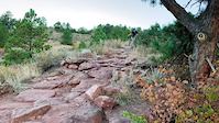
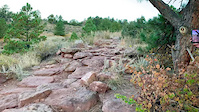
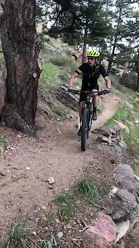
Photos of Larimer County Mountain Bike
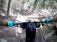
Videos of Larimer County Mountain Bike
trail: Sawmill
0:07 |
|
Nov 4, 2023
trail: Sawmill
0:15 |
|
Nov 4, 2023
trail: Audra Culver
0:08 |
67 |
Jan 25, 2023
trail: Front Range
5:48 |
24 |
May 2, 2020
trail: Front Range
0:55 |
266 |
Aug 30, 2019
trail: Maxwell (A Trail)
2:23 |
145 |
Oct 3, 2018
trail: Front Range
9:39 |
44 |
Jul 21, 2018
trail: Ginny
0:51 |
1077 |
Feb 20, 2017
Recent Trail Reports
National Scenic Trails & Official Routes
-
Continental Divide Trail
- Mountain Bike
- Hike
- Trail Running

Activity Feed
| username | action | type | title | date |
|---|---|---|---|---|
| AgentJ | wishlist | route | activity #97862329 | Jun 26, 2026 @ 4:00pm 14 hours |
| Ckareth | add | report | activity #97718515 | Jun 24, 2026 @ 12:51pm 3 days |
| JGregoryDPT81 | wishlist | trail | activity #97651885 and 2 more | Jun 23, 2026 @ 2:17pm Jun 23, 2026 |
| W33ble | add | report | activity #97602547 | Jun 22, 2026 @ 8:35pm Jun 22, 2026 |
| tiedyetactical | add | photo | activity #97519005 | Jun 21, 2026 @ 2:04pm Jun 21, 2026 |
Recent Comments
| username | type | title | comment | date |
|---|---|---|---|---|
| trail | This trail has been open for over a year, it... | Jun 6, 2026 @ 4:48pm Jun 6, 2026 | ||
| trail | As an out Country visitor I found the trail to... | May 11, 2026 @ 10:11pm May 11, 2026 | ||
| trail | Tough trail, not really a blue, I started from... | May 3, 2026 @ 8:44am May 3, 2026 | ||
| trail | Backdoor to resort trails is right. Let's you... | Apr 23, 2026 @ 3:00pm Apr 23, 2026 | ||
| trail | Such a fun trail! Good work, OMBA. | Mar 23, 2026 @ 12:05pm Mar 23, 2026 |
Local Badges
-

Epic Ride Climb 2k63 awarded -

Climbing 10k Badge23 awarded -

Climbing 100k Badge1 awarded -

Epic Ride Descent 2k70 awarded -

Descent 10k Badge22 awarded -

Descent 100k Badge1 awarded
Bike & Skill Parks
| name | type | city | rating |
|---|---|---|---|
| Spring Canyon skillpark | skill park | Fort Collins |
Local Products
Activity Type Stats
| activitytype | trails | distance | descent | descent distance | total vertical | rating | global rank | state rank | photos | reports | routes | ridelogs |
|---|---|---|---|---|---|---|---|---|---|---|---|---|
| Mountain Bike | 393 | 606 miles | 79,652 ft | 236 miles | 7,631 ft | 832 | 3,705 | 36 | 112,130 | |||
| E-Bike | 57 | 133 miles | 16,132 ft | 52 miles | 6,624 ft | 3,141 | 1 | 2,074 | ||||
| Gravel Bike | 23 | 32 miles | 2,825 ft | 10 miles | 5,833 ft | 355 | 1 | 759 | ||||
| Adaptive Bike | 2 | 1 | ||||||||||
| Horse | 159 | 426 miles | 60,735 ft | 149 miles | 7,474 ft | 434 | 5 | |||||
| Hike | 706 | 1,274 miles | 188,064 ft | 473 miles | 9,580 ft | 223 | 3,720 | 34 | 16,482 | |||
| Trail Running | 703 | 1,273 miles | 187,861 ft | 473 miles | 9,580 ft | 4 | 3,720 | 18 | 10,175 | |||
| Dirtbike/Moto | 12 | 39 miles | 4,944 ft | 12 miles | 2,940 ft | 400 | 30 | |||||
| ATV/ORV/OHV | 7 | 22 miles | 1,509 ft | 4 miles | 2,520 ft | 400 | 5 | |||||
| Snowshoe | 4 | 3 miles | 43 ft | 472 ft | 2,913 ft | 4 | 29 | 169 | ||||
| Downhill Ski | 1 | 856 ft | 13 ft | 243 ft | 13 ft | 4 | 61 | |||||
| Backcountry Ski | 7 | 4 miles | 3,396 ft | 3 miles | 1,985 ft | 4 | 1,589 | |||||
| Nordic Ski | 1 | 5 miles | 128 ft | 1 mile | 420 ft | 5 | 396 |
Frequently Asked Questions About Larimer County
▼
What are the best places to ride in Larimer County?
Larimer County has 30 areas to explore for mountain biking. The top rated areas are:
▼
What are the highest rated mountain biking trails in Larimer County?
The highest rated mountain biking trails in Larimer County are:
- Stout Connector (4.5/5)
- Limber Pine Trail (Lower) (4.4/5)
- Hucka Yucca Alt Line (4.3/5)
- East Shore Trail (4.2/5)
- Elkhorn Creek Trail - Upper (4.2/5)
▼
What is the best time of the year to ride in Larimer County?
Based on ride log data, the most popular months to ride in Larimer County are:
- July (958 activities)
- August (668 activities)
- June (594 activities)
▼
What is the longest trail in Larimer County?
The longest trail in Larimer County is Poudre River Trail at 21.5 miles. View all trails sorted by distance.
Activities
- Larimer County Mountain Biking Trails
- Larimer County E-Biking Trails
- Larimer County Gravel Biking Trails
- Larimer County Horseback Trails
- Larimer County Hiking Trails
- Larimer County Trail Running Trails
- Larimer County Dirtbiking Trails
- Larimer County ATVing/Offroading Trails
- Larimer County Backcountry Skiing Trails
Trails
Points of Interest
- Larimer County Kiosk Information
- Mount Chapin Summit
- Mount Chiquita Summit
- Ypsilon Mountain Summit
- Lulu Mountain Summit
- Dutch Town Campsite Camping
- Lily Mountain Summit
- Ram Horn Mountain Summit
- Map and Kiosk Information
- Kiosk and Map Information
- Longs Peak (14,259 ft)
- Mount Meeker (13,898 ft)
- Hagues Peak (13,566 ft)
- By Subpar-shredder
 & contributors
 - Admins: jpmcghee, msmcfate, cmcquade, OMBA, OMBATrailAgent
- #34182 - 6,690 views
- larimer county activity log | embed map of Larimer County mountain bike trails | larimer county mountain biking points of interest
Downloading of trail gps tracks in kml & gpx formats is enabled for Larimer County.
You must login to download files.