close
-
Layers w
- Weather Layers
- Pro
- Pro
- Pro
- Pro
- Pro
- Pro
- More Layers
- Pro
- Pro
- Pro
- Pro
-
Upgrade to

3D
Trail Conditions
- Unknown
- Snow Groomed
- Snow Packed
- Snow Covered
- Snow Cover Partial
- Freeze/thaw Cycle
- Icy
- Prevalent Mud
- Wet
- Variable
- Ideal
- Dry
- Very Dry
Trail Flow (Ridden Direction)
Trailforks scans users ridelogs to determine the most popular direction each trail is ridden. A good flowing trail network will have most trails flowing in a single direction according to their intension.
The colour categories are based on what percentage of riders are riding a trail in its intended direction.
The colour categories are based on what percentage of riders are riding a trail in its intended direction.
- > 96%
- > 90%
- > 80%
- > 70%
- > 50%
- < 50%
- bi-directional trail
- no data
Trail Last Ridden
Trailforks scans ridelogs to determine the last time a trail was ridden.
- < 2 days
- < 1 week
- < 2 weeks
- < 1 month
- < 6 months
- > 6 months
Trail Ridden Direction
The intended direction a trail should be ridden.
- Downhill Only
- Downhill Primary
- Both Directions
- Uphill Primary
- Uphill Only
- One Direction
Contribute Details
Colors indicate trail is missing specified detail.
- Description
- Photos
- Description & Photos
- Videos
Trail Popularity ?
Trailforks scans ridelogs to determine which trails are ridden the most in the last 9 months.
Trails are compared with nearby trails in the same city region with a possible 25 colour shades.
Think of this as a heatmap, more rides = more kinetic energy = warmer colors.
- most popular
- popular
- less popular
- not popular
ATV/ORV/OHV Filter
Max Vehicle Width
inches
US Cell Coverage
Legend

Radar Time
Activity Recordings
Trailforks uses anonymized public activity data.
?
Activity Recordings
Trailforks uses anonymized public activity data.
?
Personal Heatmap
▶
Activity Types
all
/
none
▶
Options
2
Date range
month
–
Winter Trails
Warning
A routing network for winter maps does not exist. Selecting trails using the winter trails layer has been disabled.
Missing Trails
Most Popular
Least Popular
Trails are colored based on popularity. The more popular a trail is, the more red. Less popular trails trend towards green.
Jump Magnitude Heatmap
Heatmap of where riders jump on trails. Zoom in to see individual jumps, click circles to view jump details.
BC Backroad Status
![map legend]()
Service Road Atlas is a free to use, community-driven service for viewing and creating reports on the numerous back-country service roads around B.C. and Alberta.

Slope Aspect
Direction the slope faces
Trails Deemphasized
Trails are shown in grey.
Only show trails with no bike usage.
Suggested Layers
Based on selected activity type
Save the current map location and zoom level as your default home location whenever this page is loaded.
SaveV bezprostrednej blízkosti mesta Banská Bystrica sa nachádza Laskomerská dolina. Táto lokalita ponúka krásne prírodné scenérie a terény, vhodné pre turistiku, relax a teraz aj pre cyklistov. Uchváti vás nie len svojou rôznorodosťou fauny, krásnymi výhľadmi na Banskú Bystricu, ale i okolité hory.
Laskomerské singletraily vznikli na základe starých lesníckych chodníkov, ktoré tu vznikli ešte začiatkom minulého storočia, aby sa lesníci mohli po lese rýchlo a pohodlne prepravovať.
Ako však plynul čas, chodníčky sa menej a menej používali, až sa na ne takmer zabudlo. Teraz tieto chodníčky opravujeme a prispôsobujeme pre jazdu na horskom bicykli, tak aby vám priniesli zmes atraktívneho jazdenia na prírodných singletrailoch doplnených o umelo vytvorené prekážky, ako sú terénne vlny, klopené zákruty, alebo skoky.
V súčasnosti máme rozpracované dva singletraily v celkovej dĺžke 7km, ktoré by sme chceli oficiálne otvoriť koncom mája 2016 a tým spustiť testovaciu sezónu.
Traily budú ponúkať zmes rôzne náročného jazdenia, preto by si mali na svoje prísť takmer všetci vyznávači jazdy na horskom bicykli.
Okolie Banskej Bystrice však ponúka i množstvo iných zaujímavých lokalít a možností športového vyžitia. Takže jazdu na trailoch si môžete spestriť aj množstvom nie len cyklo výletov po okolí.
source: http://bbtrails.sk/
Primary Trail Type: All-Mountain & Downhill
AKA: Laskomerské singletraily
Land Status: City Managed
 google parking directions
 Activities Click to view
- Mountain Bike
14 trails
- E-Bike
14 trails
- Hike
12 trails
- Trail Running
11 trails
Region Details
- 4
- 7
- 3
Region Status
Open as of Apr 26, 2026Local Trail Association
Stats
- Avg Trail Rating
- Trails (view details)
- 14
- Trails Mountain Bike
- 14
- Trails E-Bike
- 14
- Trails Hike
- 12
- Trails Trail Running
- 11
- Total Distance
- 17 miles
- Total Descent
- 5,388 ft
- Total Vertical
- 1,315 ft
- Highest Trailhead
- 2,714 ft
- Reports
- 542
- Photos
- 56
- Ridden Counter
- 1,575
Popular Laskomer Mountain Biking Trails
• 100 ★ 4.8 • 1 mile • 308 ft • 185 •
Tento singletrail patrí medzi náročné traily s takmer plynulo klesajúcim profilom a hravým flow. Má množstvo terénnych a umelých prekážok, ktoré sa ešte budú dopĺňať o drevené konštrukcie. Tento trail si určite...
• 90 ★ 4.0 • 2 miles • 779 ft • 158 •
singletrail DLHÝ je už takmer hotový. Ide o trail, ktorý má profil s niekoľkými krátkymi stúpaniami a dlhšími klesajúcimi úsekmi, ktoré ponúkajú zmes prírodných a upravených sekcií. Jeho dĺžka 4km, vám prinesie...
• 100 ★ 3.0 • 2,159 ft • 36 ft • 96 •
Popular green difficulty singletrack. This mountain bike primary trail. On average it takes 3 minutes to complete this trail.
• 100 ★ 4.0 • 2,156 ft • 0 ft • 66 •
Popular green difficulty singletrack. This mountain bike primary trail can be used downhill only. On average it takes 4 minutes to complete this trail.
• 25 ★ 4.0 • 2 miles • 715 ft • 34 •
hardest line to uphill but nicest. watch out for runners if you goes downhill !!!
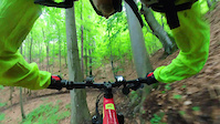
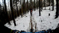
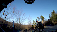
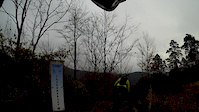
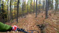
Photos of Laskomer Mountain Bike
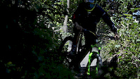
Videos of Laskomer Mountain Bike
trail: Ravasky
0:13 |
7 |
Jul 31, 2025
trail: Laskomersky trail
8:31 |
87 |
Dec 8, 2019
trail: Laskomersky trail
6:05 |
107 |
Mar 20, 2019
trail: Laskomersky trail
3:56 |
41 |
Nov 25, 2018

trail: Laskomersky trail
3:35 |
64 |
Oct 29, 2018

trail: Laskomersky trail
5:45 |
39 |
Oct 21, 2018
trail: Ravasky
4:06 |
80 |
Oct 21, 2018
trail: Laskomersky trail
0:57 |
2979 |
Jul 17, 2018
Recent Trail Reports
| status | trail | date | condition | info | user |
|---|---|---|---|---|---|
| Spiatočka na zvážnicu | Mar 28, 2026 @ 12:26pm (Europe/Budapest) Mar 28, 2026 | Ideal | katko | ||
| Laskomersky trail | Mar 28, 2026 @ 12:26pm (Europe/Budapest) Mar 28, 2026 | Dry | katko | ||
| Laskomer access road | Mar 28, 2026 @ 12:26pm (Europe/Budapest) Mar 28, 2026 | Dry | katko | ||
| navrat na parkovisko v2 z trailu Laskomersky | Aug 29, 2025 @ 10:28am Aug 29, 2025 | Dry | olivagyok | ||
| Koreňovka | Aug 29, 2025 @ 10:28am Aug 29, 2025 | Dry | olivagyok | ||
| Bulikova - Riecanske sedlo | Aug 29, 2025 @ 10:28am Aug 29, 2025 | Ideal | olivagyok | ||
| Pumptrail Hámrik | Aug 19, 2025 @ 5:27pm Aug 19, 2025 | Ideal | JakubKJMDD2 | ||
| Flowtrail Hámor | Aug 19, 2025 @ 5:27pm Aug 19, 2025 | Ideal | JakubKJMDD2 | ||
| návrat na parkovisko z trailu Dlhý | Aug 19, 2025 @ 5:27pm Aug 19, 2025 | Ideal | JakubKJMDD2 | ||
| Dlhy trail | Aug 19, 2025 @ 5:27pm Aug 19, 2025 | Ideal | JakubKJMDD2 |
Activity Feed
| username | action | type | title | date |
|---|---|---|---|---|
| sajmona | wishlist | trail | activity #96090494 and 1 more | Jun 2, 2026 @ 9:37am Jun 2, 2026 |
| jbbrenkus | wishlist | trail | activity #95690686 | May 28, 2026 @ 12:40am May 28, 2026 |
| MiShreds | ridden | trail | activity #94878415 and 2 more | May 17, 2026 @ 1:35am May 17, 2026 |
| MiShreds | ridden | trail | activity #93765178 and 4 more | May 1, 2026 @ 3:00am May 1, 2026 |
| katko | add | report | activity #91455937 and 2 more | Mar 28, 2026 @ 11:20am Mar 28, 2026 |
Recent Comments
| username | type | title | comment | date |
|---|---|---|---|---|
| trail | Perfektny trail, fakt dobra robota! Chybal mi... | Apr 13, 2023 @ 2:10am Apr 13, 2023 | ||
| trail | Toto je fajna makacka tento trail | Apr 13, 2023 @ 1:47am Apr 13, 2023 | ||
| trail | Vacsinou suchy, paradne jazdenie. V istom... | May 5, 2018 @ 12:37pm May 5, 2018 |
Nearby Areas
| name | distance | ||||
|---|---|---|---|---|---|
| Urpín | 2 | 3 | 2.9 km | ||
| Pansky Diel / Sachticky | 1 | 2 | 3 km | ||
| Skalka | 5.4 km | ||||
| Podkonice | 1 | 2 | 1 | 7.4 km | |
| Slovenska Lupca | 3 | 13 | 6 | 7.8 km |
Bike & Skill Parks
| name | type | city | rating |
|---|---|---|---|
| Pumptrack Laskomer | skill park | Banská Bystrica |
Activity Type Stats
| activitytype | trails | distance | descent | descent distance | total vertical | rating | global rank | state rank | photos | reports | routes | ridelogs |
|---|---|---|---|---|---|---|---|---|---|---|---|---|
| Mountain Bike | 14 | 17 miles | 5,387 ft | 8 miles | 1,316 ft | #2,449 | #26 | 56 | 542 | 2,780 | ||
| E-Bike | 14 | 17 miles | 5,387 ft | 8 miles | 1,316 ft | #1,031 | #14 | 539 | 97 | |||
| Hike | 12 | 14 miles | 4,114 ft | 7 miles | 1,316 ft | #2,468 | #38 | 536 | 374 | |||
| Trail Running | 11 | 14 miles | 3,986 ft | 6 miles | 1,309 ft | #1,874 | 536 | 138 |
Frequently Asked Questions About Laskomer
▼
What are the highest rated mountain biking trails in Laskomer?
The highest rated mountain biking trails in Laskomer are:
- Laskomersky trail (4.5/5)
- Ravasky (4.1/5)
- Dlhy trail (4/5)
- Flowtrail Hámor (4/5)
- Podlavicke Vymole (4/5)
▼
What is the best time of the year to ride in Laskomer?
Based on ride log data, the most popular months to ride in Laskomer are:
- July (47 activities)
- May (32 activities)
- August (25 activities)
▼
Where can I park to ride in Laskomer?
▼
What is the longest trail in Laskomer?
The longest trail in Laskomer is Dlhy trail at 2.1 miles. View all trails sorted by distance.
Activities
Trails
Points of Interest
- By bacyl & contributors
- Admins: apply
- #14810 - 7,080 views
- laskomer activity log | embed map of Laskomer mountain bike trails | laskomer mountain biking points of interest
Downloading of trail gps tracks in kml & gpx formats is enabled for Laskomer.
You must login to download files.