close
-
Layers w
- Weather Layers
- Pro
- Pro
- Pro
- Pro
- Pro
- Pro
- More Layers
- Pro
- Pro
- Pro
- Pro
-
Upgrade to

3D
Trail Conditions
- Unknown
- Snow Groomed
- Snow Packed
- Snow Covered
- Snow Cover Partial
- Freeze/thaw Cycle
- Icy
- Prevalent Mud
- Wet
- Variable
- Ideal
- Dry
- Very Dry
Trail Flow (Ridden Direction)
Trailforks scans users ridelogs to determine the most popular direction each trail is ridden. A good flowing trail network will have most trails flowing in a single direction according to their intension.
The colour categories are based on what percentage of riders are riding a trail in its intended direction.
The colour categories are based on what percentage of riders are riding a trail in its intended direction.
- > 96%
- > 90%
- > 80%
- > 70%
- > 50%
- < 50%
- bi-directional trail
- no data
Trail Last Ridden
Trailforks scans ridelogs to determine the last time a trail was ridden.
- < 2 days
- < 1 week
- < 2 weeks
- < 1 month
- < 6 months
- > 6 months
Trail Ridden Direction
The intended direction a trail should be ridden.
- Downhill Only
- Downhill Primary
- Both Directions
- Uphill Primary
- Uphill Only
- One Direction
Contribute Details
Colors indicate trail is missing specified detail.
- Description
- Photos
- Description & Photos
- Videos
Trail Popularity ?
Trailforks scans ridelogs to determine which trails are ridden the most in the last 9 months.
Trails are compared with nearby trails in the same city region with a possible 25 colour shades.
Think of this as a heatmap, more rides = more kinetic energy = warmer colors.
- most popular
- popular
- less popular
- not popular
ATV/ORV/OHV Filter
Max Vehicle Width
inches
US Cell Coverage
Legend

Radar Time
Activity Recordings
Trailforks uses anonymized public activity data.
?
Activity Recordings
Trailforks uses anonymized public activity data.
?
Personal Heatmap
▶
Activity Types
all
/
none
▶
Options
2
Date range
month
–
Winter Trails
Warning
A routing network for winter maps does not exist. Selecting trails using the winter trails layer has been disabled.
Missing Trails
Most Popular
Least Popular
Trails are colored based on popularity. The more popular a trail is, the more red. Less popular trails trend towards green.
Jump Magnitude Heatmap
Heatmap of where riders jump on trails. Zoom in to see individual jumps, click circles to view jump details.
BC Backroad Status
![map legend]()
Service Road Atlas is a free to use, community-driven service for viewing and creating reports on the numerous back-country service roads around B.C. and Alberta.

Slope Aspect
Direction the slope faces
Trails Deemphasized
Trails are shown in grey.
Only show trails with no bike usage.
Suggested Layers
Based on selected activity type
Save the current map location and zoom level as your default home location whenever this page is loaded.
Save
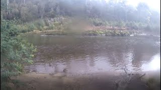
No description for Latrobe has been added yet!
Login or register to submit one.
Activities Click to view
- Mountain Bike
38 trails
- E-Bike
32 trails
- Gravel Bike
0 trails
- Adaptive Bike
0 trails
- Winter Fat Bike
0 trails
- Hike
42 trails
- Trail Running
49 trails
Region Details
- 4
- 4
- 11
- 16
- 2
Region Status
Open as of Jun 27, 2026Stats
- Avg Trail Rating
- Trails (view details)
- 67
- Trails Mountain Bike
- 38
- Trails E-Bike
- 32
- Trails Horse
- 3
- Trails Hike
- 45
- Trails Trail Running
- 49
- Trails Dirtbike/Moto
- 2
- Total Distance
- 122 miles
- Total Descent
- 19,571 ft
- Total Vertical
- 3,126 ft
- Highest Trailhead
- 3,132 ft
- Reports
- 2,057
- Photos
- 173
- Ridden Counter
- 18,142
Sub Regions
-
Wild Mersey
- 3
- 5
- 3
- 1
Popular Latrobe Mountain Biking Trails
• 90 ★ 3.9 • 4,551 ft • 229 ft • 669 •
A great little climb with easy gradient that takes you up to a nice lookout over the Mersey River. Then you have to option to either descend back down or continue to explore the Warrawee trails.
• 100 ★ 3.8 • 4,032 ft • 443 ft • 631 •
A climb back to the top of Dinsdales Hill. Just what the doctor ordered if you want to session any of three descents.
• 100 ★ 4.6 • 2,992 ft • 6 ft • 628 •
is a berm and table top fuelled descent. A great trail to step up your jumping skills with plenty of table tops, step ups and step downs to keep you amused.
• 85 ★ 3.2 • 1,634 ft • 77 ft • 576 •
This trail links you from the lookout at the top of the Climb and links to the
• 95 ★ 4.8 • 4,403 ft • 38 ft • 565 •
A fun, fast and flowing descent from the highest point on the Warrawee Reserve, Dinsdales Hill.
• 75 ★ 4.5 • 3,622 ft • 43 ft • 453 •
is a flowy berm filled descent that lets you " " from the whole climb. It drops you at the bottom of the trail.
• 70 ★ 4.6 • 1 mile • 170 ft • 409 •
starts on a multiuse dual direction section of trail then peels off on a section of singletrack with great views of the Mersey river flood plain, before descending to meet the trail then continues to climb back up to meet the dual...
• 85 ★ 4.3 • 1,703 ft • 17 ft • 333 •
This trail is the narrower, steeper option of the three descents from Dinsdales hill. More tech than speed and the tight turns keep you on your toes.
Latrobe Mountain Bike Routes
★ 4.0 • 17 miles • 2,442 ft • 3 • Out & Back •
A good reasonable distance ride that goes from either Warrawee Reserve to Sheffield or vise versa. It...
★ 3.0 • 29 miles • 2,936 ft • 18 •
21 miles • 2,895 ft • 20 •
A solid 33km loop through the best trails in the Badgers Range.
13 miles • 1,481 ft • 13 •
Start at Sheffiled trail head and finish at the 7 sheds brewery
25 miles • 2,754 ft • 20 •
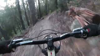
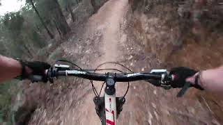
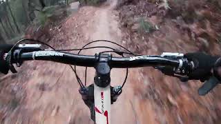
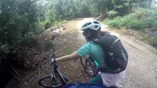
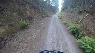
Photos of Latrobe Mountain Bike
Videos of Latrobe Mountain Bike
trail: Paloona DH
0:59 |
631 |
Aug 3, 2018
trail: Off the Hook!
4:10 |
87 |
Sep 23, 2023 , Latrobe
trail: High Voltage
2:12 |
153 |
Sep 23, 2023 , Latrobe
trail: Laughing Gear
3:09 |
140 |
Sep 23, 2023 , Latrobe

trail: Disco
2:13 |
166 |
Oct 31, 2022 , Latrobe
trail: Splash!
0:27 |
134 |
Aug 27, 2022 , Latrobe
11:02 |
515 |
Jan 7, 2021 , Latrobe
15:24 |
499 |
Jan 4, 2021 , Latrobe
Recent Trail Reports
| status | trail | date | condition | info | user |
|---|---|---|---|---|---|
| Off the Hook! | Jun 28, 2026 @ 10:24am (Australia/Hobart) Jun 27, 2026 | Ideal | streddaz CCMBC | ||
| Session Sauce | Jun 28, 2026 @ 10:24am (Australia/Hobart) Jun 27, 2026 | Ideal | streddaz CCMBC | ||
| High Voltage | Jun 28, 2026 @ 10:24am (Australia/Hobart) Jun 27, 2026 | Ideal | streddaz CCMBC | ||
| Big Bend | Jun 28, 2026 @ 10:24am (Australia/Hobart) Jun 27, 2026 | Ideal | streddaz CCMBC | ||
| Quick Link | Jun 28, 2026 @ 10:24am (Australia/Hobart) Jun 27, 2026 | Ideal | streddaz CCMBC | ||
| Easy Does It | Jun 28, 2026 @ 10:24am (Australia/Hobart) Jun 27, 2026 | Ideal | streddaz CCMBC | ||
| Bee Line | Jun 28, 2026 @ 10:24am (Australia/Hobart) Jun 27, 2026 | Ideal | streddaz CCMBC | ||
| Shale Road | May 16, 2026 @ 8:56am (Australia/Hobart) May 15, 2026 | Ideal | streddaz CCMBC | ||
| Railton Express | May 16, 2026 @ 8:56am (Australia/Hobart) May 15, 2026 | Ideal | streddaz CCMBC | ||
| Laughing Gear | May 16, 2026 @ 8:56am (Australia/Hobart) May 15, 2026 | Ideal | streddaz CCMBC |
Activity Feed
| username | action | type | title | date |
|---|---|---|---|---|
| streddaz | add | report | activity #97959466 and 6 more | Jun 27, 2026 @ 8:51pm Jun 27, 2026 |
| Su1bu2 | ridden | trail | activity #96070118 | Jun 2, 2026 @ 2:41am Jun 2, 2026 |
| GeorgeMAEURP | ridden | trail | activity #95069971 | May 19, 2026 @ 3:48pm May 19, 2026 |
| streddaz | add | report | activity #94789613 and 4 more | May 15, 2026 @ 9:51pm May 15, 2026 |
| MAURS | wishlist | route | activity #89444812 | Feb 23, 2026 @ 7:25pm Feb 23, 2026 |
Recent Comments
| username | type | title | comment | date |
|---|---|---|---|---|
| trail | Tree down. Half way through the pine... | Sep 21, 2025 @ 12:20am Sep 21, 2025 | ||
| report | Tree has been removed | Dec 8, 2024 @ 8:15pm Dec 8, 2024 | ||
| trail | As | Oct 1, 2023 @ 2:50am Oct 1, 2023 | ||
| trail | Tree down on second switchback set above river. | Mar 4, 2023 @ 7:57pm Mar 4, 2023 | ||
| trail | A great long trek - start early | Feb 25, 2022 @ 4:57am Feb 25, 2022 |
Local Badges
-

Epic Ride Climb 2k40 awarded -

Climbing 10k Badge53 awarded -

Climbing 100k Badge7 awarded -

Epic Ride Descent 2k40 awarded -

Descent 10k Badge52 awarded -

Descent 100k Badge7 awarded
Bike & Skill Parks
| name | type | city | rating |
|---|---|---|---|
| Goliath Pump Track | skill park | Latrobe | |
| Goliath Park Pump Track | skill park | Latrobe |
Local Trail Supporters
![]()
- Tasmanian Trail Association
![]()
- Latrobe/Kentish Council
Activity Type Stats
| activitytype | trails | distance | descent | descent distance | total vertical | rating | global rank | state rank | photos | reports | routes | ridelogs |
|---|---|---|---|---|---|---|---|---|---|---|---|---|
| Mountain Bike | 38 | 53 miles | 8,471 ft | 23 miles | 1,778 ft | #2,013 | #95 | 171 | 2,057 | 10 | 9,571 | |
| E-Bike | 32 | 47 miles | 7,415 ft | 20 miles | 1,778 ft | #2,432 | #122 | 1,986 | 3 | 1,444 | ||
| Horse | 3 | 10 miles | 604 ft | 3 miles | 974 ft | 112 | ||||||
| Hike | 42 | 95 miles | 13,642 ft | 26 miles | 3,127 ft | #2,374 | #72 | 2 | 1,858 | 1 | 122 | |
| Trail Running | 49 | 107 miles | 15,404 ft | 30 miles | 3,127 ft | #1,739 | #50 | 1,876 | 1 | 79 | ||
| Dirtbike/Moto | 2 | 8 miles | 295 ft | 2 miles | 673 ft | 105 |
Frequently Asked Questions About Latrobe
▼
What are the best places to ride in Latrobe?
Latrobe has 1 areas to explore for mountain biking. The top rated areas are:
▼
What are the highest rated mountain biking trails in Latrobe?
The highest rated mountain biking trails in Latrobe are:
- Laughing Gear (4.5/5)
- High Voltage (4.3/5)
- Big Bend (4.3/5)
- Off the Hook! (4.2/5)
- No Mersey (4.1/5)
▼
What is the best time of the year to ride in Latrobe?
Based on ride log data, the most popular months to ride in Latrobe are:
- December (103 activities)
- February (101 activities)
- January (100 activities)
▼
Where can I park to ride in Latrobe?
There are 4 parking locations listed in Latrobe. The most popular parking spots are: View all parking and trailhead locations on the map to plan your visit.
Activities
Trails
- By streddaz
 CCMBC & contributors
 - Admins: Jake-Hannah, Addzz, Sekt, SchrodingersGat, CCMBC
- #21428 - 5,751 views
- latrobe activity log | embed map of Latrobe mountain bike trails | latrobe mountain biking points of interest
Downloading of trail gps tracks in kml & gpx formats is enabled for Latrobe.
You must login to download files.