close
-
Layers w
- Weather Layers
- Pro
- Pro
- Pro
- Pro
- Pro
- Pro
- More Layers
- Pro
- Pro
- Pro
- Pro
-
Upgrade to

3D
Trail Conditions
- Unknown
- Snow Groomed
- Snow Packed
- Snow Covered
- Snow Cover Partial
- Freeze/thaw Cycle
- Icy
- Prevalent Mud
- Wet
- Variable
- Ideal
- Dry
- Very Dry
Trail Flow (Ridden Direction)
Trailforks scans users ridelogs to determine the most popular direction each trail is ridden. A good flowing trail network will have most trails flowing in a single direction according to their intension.
The colour categories are based on what percentage of riders are riding a trail in its intended direction.
The colour categories are based on what percentage of riders are riding a trail in its intended direction.
- > 96%
- > 90%
- > 80%
- > 70%
- > 50%
- < 50%
- bi-directional trail
- no data
Trail Last Ridden
Trailforks scans ridelogs to determine the last time a trail was ridden.
- < 2 days
- < 1 week
- < 2 weeks
- < 1 month
- < 6 months
- > 6 months
Trail Ridden Direction
The intended direction a trail should be ridden.
- Downhill Only
- Downhill Primary
- Both Directions
- Uphill Primary
- Uphill Only
- One Direction
Contribute Details
Colors indicate trail is missing specified detail.
- Description
- Photos
- Description & Photos
- Videos
Trail Popularity ?
Trailforks scans ridelogs to determine which trails are ridden the most in the last 9 months.
Trails are compared with nearby trails in the same city region with a possible 25 colour shades.
Think of this as a heatmap, more rides = more kinetic energy = warmer colors.
- most popular
- popular
- less popular
- not popular
ATV/ORV/OHV Filter
Max Vehicle Width
inches
US Cell Coverage
Legend

Radar Time
Activity Recordings
Trailforks uses anonymized public activity data.
?
Activity Recordings
Trailforks uses anonymized public activity data.
?
Personal Heatmap
▶
Activity Types
all
/
none
▶
Options
2
Date range
month
–
Winter Trails
Warning
A routing network for winter maps does not exist. Selecting trails using the winter trails layer has been disabled.
Missing Trails
Most Popular
Least Popular
Trails are colored based on popularity. The more popular a trail is, the more red. Less popular trails trend towards green.
Jump Magnitude Heatmap
Heatmap of where riders jump on trails. Zoom in to see individual jumps, click circles to view jump details.
BC Backroad Status
![map legend]()
Service Road Atlas is a free to use, community-driven service for viewing and creating reports on the numerous back-country service roads around B.C. and Alberta.

Slope Aspect
Direction the slope faces
Trails Deemphasized
Trails are shown in grey.
Only show trails with no bike usage.
Suggested Layers
Based on selected activity type
Save the current map location and zoom level as your default home location whenever this page is loaded.
Save
No description for Latvia has been added yet!
Login or register to submit one.
Region Details
- 1
- 6
- 5
- 3
- 1
Stats
- Avg Trail Rating
- Trails (view details)
- 21
- Trails Mountain Bike
- 19
- Trails E-Bike
- 3
- Trails Hike
- 19
- Trails Trail Running
- 18
- Total Distance
- 62 miles
- Total Descent
- 5,278 ft
- Total Vertical
- 958 ft
- Highest Trailhead
- 995 ft
- Reports
- 17
- Photos
- 180
- Ridden Counter
- 131
Sub Regions
Popular Latvia Mountain Biking Trails
• 75 ★ 0.0 • 1,257 ft • 0 ft • 14 •
Popular black diamond difficulty singletrack. This mountain bike primary trail can be used downhill only and has a moderate overall physical rating. On average it takes 3 minutes to complete this trail.
• 100 ★ 0.0 • 2 miles • 48 ft • 13 •
2.8 km long easy XCO loop in the middle of the city (6km from centre). Most of the loop is singletrack.
• 100 ★ 0.0 • 25 miles • 1,370 ft • 10 •
Pavadinimas Cesis-Valmera 40 km / 374 m / Vidzeme Aprašas ✅ 40 km ✅ Vidzeme ✅ ↗️374 m, ↘️ 433
• ★ 0.0 • 1,132 ft • 0 ft • 9 •
Blue difficulty singletrack. This mountain bike primary trail can be used both directions. On average it takes 1 minutes to complete this trail.
• ★ 0.0 • 1,450 ft • 0 ft • 9 •
Red difficulty singletrack. This mountain bike primary trail can be used both directions. On average it takes 9 minutes to complete this trail.
• 100 ★ 0.0 • 1,467 ft • 2 ft • 8 •
Popular black diamond difficulty singletrack. This mountain bike primary trail can be used both directions. It features berm, drop, jump and gap jump. On average it takes 4 minutes to complete this trail.
Latvia Mountain Bike Routes
★ 5.0 • 19 miles • 1,107 ft • 0 • Loop •
Circular route next to the Gauja river. There were two points with fallen trees that destroyed a wooden...
14 miles • 1,477 ft • 0 •
Pavadinimas Tukums Vivus.lv MTB pusmaratons 2020 / 23 km / 421 m / Kurzeme Aprašas ✅ 23,2 km ✅ 421 m...
21 miles • 1,599 ft • 0 •
Pavadinimas VIVUS MTB Alūksne 34 km / 400 m / Vidzeme Aprašas VIVUS MTB 2. POSMS - ALŪKSNE 26.07.2020....
27 miles • 1,332 ft • 0 •
Pavadinimas Ikškile MTB Sporta klase 2019 / 43km / 403 m / Zemgale Aprašas Ikškile MTB Sporta klase...
19 miles • 622 ft • 0 •
Pavadinimas Priekule MTB 30km / 216 m / Priekule, Kurzeme Aprašas LVM Kalnu Divriteņu maratons 2020 -...
19 miles • 358 ft • 0 •
Pavadinimas Liksna - Vabole 32 km / 160 m / Līksna, Latgale Aprašas ✅ 32 km ✅ ↗160 m, ↘ 160 m...
Photos of Latvia Mountain Bike
Videos of Latvia Mountain Bike
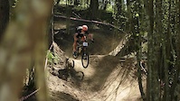
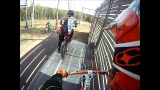
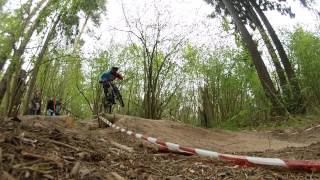
trail: Riekstukalns
3:59 |
194 |
Aug 11, 2017
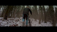
trail: Riekstukalns
2:13 |
90 |
Jan 3, 2016
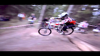
trail: Riekstukalns
6:50 |
1215 |
Dec 28, 2014
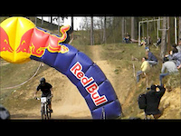
trail: Riekstukalns
2:18 |
292 |
Nov 21, 2012

trail: Riekstukalns
5:16 |
441 |
Jan 26, 2011

trail: Riekstukalns
9:13 |
606 |
Apr 30, 2018 , Baldone
trail: Riekstukalns
4:41 |
743 |
Apr 30, 2018 , Baldone
trail: Riekstukalns
2:51 |
444 |
Apr 30, 2018 , Baldone
Recent Comments
| username | type | title | comment | date |
|---|---|---|---|---|
| trail | Wonderful flowy natural trail among blueberry... | Sep 8, 2021 @ 2:55am Sep 8, 2021 | ||
| trail | CNt really say much about the track. Not well... | Aug 30, 2020 @ 6:23am Aug 30, 2020 |
Bike & Skill Parks
| name | type | city | rating |
|---|---|---|---|
| Kütiorg | bike park | Aluksne | |
| Daugavpils Pump Track | skill park | Daugavpils | |
| Kegums MX | skill park | Baldone |
Activity Type Stats
| activitytype | trails | distance | descent | descent distance | total vertical | rating | global rank | state rank | photos | reports | routes | ridelogs |
|---|---|---|---|---|---|---|---|---|---|---|---|---|
| Mountain Bike | 19 | 59 miles | 5,016 ft | 27 miles | 958 ft | #96 | 167 | 17 | 24 | 12,657 | ||
| E-Bike | 3 | 14 miles | 558 ft | 6 miles | 210 ft | #91 | 17 | 1 | 48 | |||
| Hike | 19 | 61 miles | 5,079 ft | 28 miles | 958 ft | #80 | 13 | 17 | 1 | 325 | ||
| Trail Running | 18 | 60 miles | 5,007 ft | 28 miles | 958 ft | #88 | 17 | 37 |
- By canadaka
 Trailforks & contributors
 - Admins: apply
- #3197 - 17,211 views
- latvia activity log | embed map of Latvia mountain bike trails |
Downloading of trail gps tracks in kml & gpx formats is enabled for Latvia.
You must login to download files.