close
-
Layers w
- Weather Layers
- Pro
- Pro
- Pro
- Pro
- Pro
- Pro
- More Layers
- Pro
- Pro
- Pro
- Pro
-
Upgrade to

3D
Trail Conditions
- Unknown
- Snow Groomed
- Snow Packed
- Snow Covered
- Snow Cover Partial
- Freeze/thaw Cycle
- Icy
- Prevalent Mud
- Wet
- Variable
- Ideal
- Dry
- Very Dry
Trail Flow (Ridden Direction)
Trailforks scans users ridelogs to determine the most popular direction each trail is ridden. A good flowing trail network will have most trails flowing in a single direction according to their intension.
The colour categories are based on what percentage of riders are riding a trail in its intended direction.
The colour categories are based on what percentage of riders are riding a trail in its intended direction.
- > 96%
- > 90%
- > 80%
- > 70%
- > 50%
- < 50%
- bi-directional trail
- no data
Trail Last Ridden
Trailforks scans ridelogs to determine the last time a trail was ridden.
- < 2 days
- < 1 week
- < 2 weeks
- < 1 month
- < 6 months
- > 6 months
Trail Ridden Direction
The intended direction a trail should be ridden.
- Downhill Only
- Downhill Primary
- Both Directions
- Uphill Primary
- Uphill Only
- One Direction
Contribute Details
Colors indicate trail is missing specified detail.
- Description
- Photos
- Description & Photos
- Videos
Trail Popularity ?
Trailforks scans ridelogs to determine which trails are ridden the most in the last 9 months.
Trails are compared with nearby trails in the same city region with a possible 25 colour shades.
Think of this as a heatmap, more rides = more kinetic energy = warmer colors.
- most popular
- popular
- less popular
- not popular
ATV/ORV/OHV Filter
Max Vehicle Width
inches
US Cell Coverage
Legend

Radar Time
Activity Recordings
Trailforks uses anonymized public activity data.
?
Activity Recordings
Trailforks uses anonymized public activity data.
?
Personal Heatmap
▶
Activity Types
all
/
none
▶
Options
2
Date range
month
–
Winter Trails
Warning
A routing network for winter maps does not exist. Selecting trails using the winter trails layer has been disabled.
Missing Trails
Most Popular
Least Popular
Trails are colored based on popularity. The more popular a trail is, the more red. Less popular trails trend towards green.
Jump Magnitude Heatmap
Heatmap of where riders jump on trails. Zoom in to see individual jumps, click circles to view jump details.
BC Backroad Status
![map legend]()
Service Road Atlas is a free to use, community-driven service for viewing and creating reports on the numerous back-country service roads around B.C. and Alberta.

Slope Aspect
Direction the slope faces
Trails Deemphasized
Trails are shown in grey.
Only show trails with no bike usage.
Suggested Layers
Based on selected activity type
Save the current map location and zoom level as your default home location whenever this page is loaded.
Save
No description for Laurencekirk has been added yet!
Login or register to submit one.
This region uses the Uk/Euro style trail grading system.
Activities Click to view
- Mountain Bike
272 trails
- E-Bike
265 trails
- Gravel Bike
2 trails
- Adaptive Bike
0 trails
- Winter Fat Bike
0 trails
- Horse
28 trails
- Hike
200 trails
- Trail Running
200 trails
Region Details
- 105
- 1
- 22
- 66
- 27
- 5
Region Status
Open as of 13 hoursStats
- Avg Trail Rating
- Trails (view details)
- 226
- Trails Mountain Bike
- 273
- Trails E-Bike
- 265
- Trails Gravel Bike
- 2
- Trails Horse
- 28
- Trails Hike
- 200
- Trails Trail Running
- 200
- Trails Dirtbike/Moto
- 1
- Trails Observed Trials
- 1
- Trails ATV/ORV/OHV
- 1
- Total Distance
- 165 miles
- Total Descent
- 37,373 ft
- Total Vertical
- 2,246 ft
- Highest Trailhead
- 2,521 ft
- Reports
- 1,179
- Photos
- 326
- Ridden Counter
- 20,753
Sub Regions
-
Drumtochty
- 1
- 22
- 65
- 27
- 5
-
Glen Esk
- 1
Popular Laurencekirk Mountain Biking Trails
• 95 ★ 4.1 • 623 ft • 0 ft • 438 •
Highly rated popular red difficulty singletrack. This mountain bike primary trail can be used downhill only and has a moderate overall physical rating with a 0 ft blue climb. On average it takes minutes to complete this trail.
• 95 ★ 4.3 • 607 ft • 0 ft • 437 •
Highly rated popular red difficulty singletrack. This mountain bike primary trail can be used downhill only and has a moderate overall physical rating with a 0 ft blue climb. On average it takes minutes to complete this trail.
• 95 ★ 4.0 • 499 ft • 0 ft • 430 •
Highly rated popular red difficulty singletrack. This mountain bike primary trail can be used downhill primary. On average it takes minutes to complete this trail.
• 85 ★ 3.9 • 804 ft • 0 ft • 402 •
Popular red difficulty singletrack. This mountain bike primary trail can be used downhill primary. On average it takes 2 minutes to complete this trail.
• 90 ★ 3.2 • 896 ft • 0 ft • 261 •
Popular red difficulty singletrack. This mountain bike primary trail can be used downhill primary. On average it takes 1 minutes to complete this trail.
• 65 ★ 3.8 • 1,099 ft • 0 ft • 233 •
Moderately popular red difficulty singletrack. This mountain bike primary trail can be used downhill only and has a moderate overall physical rating with a 0 ft green climb. On average it takes minutes to complete this trail.
• 95 ★ 5.0 • 2,178 ft • 0 ft • 197 •
Popular black difficulty singletrack. This mountain bike primary trail can be used one direction and has a moderate overall physical rating. Trail visibility is always easy to follow. On average it takes 1 minutes to complete this trail.
• 95 ★ 3.0 • 2,231 ft • 0 ft • 194 •
Popular blue difficulty singletrack. This mountain bike primary trail can be used one direction. On average it takes 3 minutes to complete this trail.
Laurencekirk Mountain Bike Routes
32 miles • 5,524 ft • 8 • Loop •
A big day out! Starting at Tarfside, ride over to Aboyne and descend towards town via Master Blaster....
12 miles • 2,201 ft • 38 • Out & Back •
An Enduro route around Drumtotchy featuring the best trails.
★ 5.0 • 11 miles • 2,041 ft • 16 • Out & Back • Race •
Drumtochty Enduro 2018. A mountain biking race taking place on the mountain bike trails at Drumtochty on...
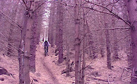
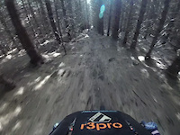
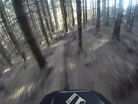
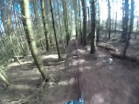
Photos of Laurencekirk Mountain Bike
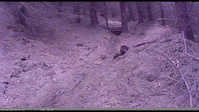
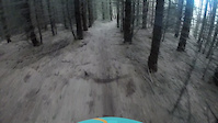
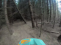
Videos of Laurencekirk Mountain Bike
trail: Snakebite
0:27 |
9 |
Jun 3, 2026
trail: The Serpent
2:34 |
12 |
Apr 30, 2026
trail: Snakebite
0:25 |
|
Feb 13, 2025
trail: The Serpent
2:19 |
171 |
Jul 5, 2024
trail: Black Grouse
0:31 |
91 |
Mar 11, 2024
trail: Valley Down
0:34 |
|
Jan 1, 2024

trail: Valley Down
0:32 |
|
Dec 30, 2023
trail: Valley Down
0:32 |
|
Dec 30, 2023
Recent Trail Reports
| status | trail | date | condition | info | user |
|---|---|---|---|---|---|
| Buzzard | Jun 21, 2026 @ 2:54pm (Europe/London) 13 hours | Variable | w0rldexplorer | ||
| Snakebite | May 19, 2026 @ 6:51am (Europe/London) May 18, 2026 | Ideal | Alejandro72 | ||
| Spare Ribs | May 19, 2026 @ 6:34am (Europe/London) May 18, 2026 | Ideal | Alejandro72 | ||
| Black Grouse | May 19, 2026 @ 6:28am (Europe/London) May 18, 2026 | Ideal | Alejandro72 | ||
| Keep your trout in your pants | May 17, 2026 @ 11:14am (Europe/London) May 17, 2026 | Dry | Faroon | ||
| Cunning Plan | May 17, 2026 @ 11:14am (Europe/London) May 17, 2026 | Dry | Faroon | ||
| Stickleback | May 17, 2026 @ 11:14am (Europe/London) May 17, 2026 | Dry | Faroon | ||
| Coopers Way | May 17, 2026 @ 11:14am (Europe/London) May 17, 2026 | Dry | Faroon | ||
| Doable Too | May 17, 2026 @ 11:14am (Europe/London) May 17, 2026 | Dry | Faroon | ||
| Forest Road | May 17, 2026 @ 11:14am (Europe/London) May 17, 2026 | Dry | Faroon |
Activity Feed
| username | action | type | title | date |
|---|---|---|---|---|
| w0rldexplorer | add | report | activity #97480215 | Jun 21, 2026 @ 6:55am 13 hours |
| w0rldexplorer | add | photo | activity #97122350 and 6 more | Jun 16, 2026 @ 10:40am Jun 16, 2026 |
| w0rldexplorer | add | trail | activity #97097124 | Jun 16, 2026 @ 3:26am Jun 16, 2026 |
| u357yv | wishlist | region | activity #96793675 | Jun 12, 2026 @ 4:13am Jun 12, 2026 |
| Alejandro72 | vote | trail | activity #96662222 | Jun 10, 2026 @ 3:49am Jun 10, 2026 |
Recent Comments
| username | type | title | comment | date |
|---|---|---|---|---|
| trail | Has been mildly raked removing sticks and debri | May 4, 2026 @ 11:27am May 4, 2026 | ||
| report | No felling on trail yet but further up the... | Feb 9, 2026 @ 1:42am Feb 9, 2026 | ||
| trail | Riding prime | Dec 8, 2025 @ 3:33am Dec 8, 2025 | ||
| trail | Roots, rocks, loam with tech and flow. Great... | Dec 8, 2025 @ 3:29am Dec 8, 2025 | ||
| trail | Fast, flowy and full of features. Top trail. | Dec 8, 2025 @ 3:26am Dec 8, 2025 |
Local Badges
-

Epic Ride Climb 2k33 awarded -

Climbing 10k Badge57 awarded -

Climbing 100k Badge3 awarded -

Epic Ride Descent 2k33 awarded -

Descent 10k Badge59 awarded -

Descent 100k Badge3 awarded
Bike & Skill Parks
| name | type | city | rating |
|---|---|---|---|
| Auchenblae Pump Track | skill park | Laurencekirk |
Upcoming Local Events
Activity Type Stats
| activitytype | trails | distance | descent | descent distance | total vertical | rating | global rank | state rank | photos | reports | routes | ridelogs |
|---|---|---|---|---|---|---|---|---|---|---|---|---|
| Mountain Bike | 272 | 165 miles | 37,372 ft | 82 miles | 2,247 ft | #594 | #25 | 326 | 1,179 | 9 | 7,897 | |
| E-Bike | 265 | 153 miles | 34,744 ft | 75 miles | 2,247 ft | #538 | #35 | 1,102 | 5 | 1,196 | ||
| Gravel Bike | 2 | #181 | #158 | 5 | 4 | |||||||
| Horse | 28 | 48 miles | 6,860 ft | 18 miles | 2,133 ft | #949 | #39 | 144 | ||||
| Hike | 200 | 153 miles | 28,533 ft | 72 miles | 2,247 ft | #1,232 | #31 | 876 | 2 | 136 | ||
| Trail Running | 200 | 153 miles | 28,533 ft | 72 miles | 2,247 ft | #910 | #28 | 876 | 2 | 196 | ||
| Dirtbike/Moto | 1 | 2 miles | 13 ft | 725 ft | 1,093 ft | 141 | ||||||
| Observed Trials | 1 | 2 miles | 13 ft | 725 ft | 1,093 ft | 1 | ||||||
| ATV/ORV/OHV | 1 | 2 miles | 13 ft | 725 ft | 1,093 ft | 141 |
Frequently Asked Questions About Laurencekirk
▼
What are the best places to ride in Laurencekirk?
Laurencekirk has 2 areas to explore for mountain biking. The top rated areas are:
▼
What are the highest rated mountain biking trails in Laurencekirk?
The highest rated mountain biking trails in Laurencekirk are:
- Coopers Way (4.4/5)
- Valley (4.3/5)
- Yorkie (4.3/5)
- Logrun (4.2/5)
- Death Wish (4.2/5)
▼
What is the best time of the year to ride in Laurencekirk?
Based on ride log data, the most popular months to ride in Laurencekirk are:
- April (39 activities)
- May (35 activities)
- August (34 activities)
▼
Where can I park to ride in Laurencekirk?
There are 5 parking locations listed in Laurencekirk. The most popular parking spots are:
- North Drumtochty Car Park
- South Drumtochty: Forest Gate
- Small Parking Layby
- Parking
- Parking with Cafe, shop, toilets, outdoor tap. Bikers welcomed!!
Activities
Trails
- By londondl
 & contributors
 - Admins: DMBinS, FLS, ATA, NEAT
- #17755 - 3,445 views
- laurencekirk activity log | embed map of Laurencekirk mountain bike trails | laurencekirk mountain biking points of interest
Downloading of trail gps tracks in kml & gpx formats is enabled for Laurencekirk.
You must login to download files.