close
-
Layers w
- Weather Layers
- Pro
- Pro
- Pro
- Pro
- Pro
- Pro
- More Layers
- Pro
- Pro
- Pro
- Pro
-
Upgrade to

3D
Trail Conditions
- Unknown
- Snow Groomed
- Snow Packed
- Snow Covered
- Snow Cover Partial
- Freeze/thaw Cycle
- Icy
- Prevalent Mud
- Wet
- Variable
- Ideal
- Dry
- Very Dry
Trail Flow (Ridden Direction)
Trailforks scans users ridelogs to determine the most popular direction each trail is ridden. A good flowing trail network will have most trails flowing in a single direction according to their intension.
The colour categories are based on what percentage of riders are riding a trail in its intended direction.
The colour categories are based on what percentage of riders are riding a trail in its intended direction.
- > 96%
- > 90%
- > 80%
- > 70%
- > 50%
- < 50%
- bi-directional trail
- no data
Trail Last Ridden
Trailforks scans ridelogs to determine the last time a trail was ridden.
- < 2 days
- < 1 week
- < 2 weeks
- < 1 month
- < 6 months
- > 6 months
Trail Ridden Direction
The intended direction a trail should be ridden.
- Downhill Only
- Downhill Primary
- Both Directions
- Uphill Primary
- Uphill Only
- One Direction
Contribute Details
Colors indicate trail is missing specified detail.
- Description
- Photos
- Description & Photos
- Videos
Trail Popularity ?
Trailforks scans ridelogs to determine which trails are ridden the most in the last 9 months.
Trails are compared with nearby trails in the same city region with a possible 25 colour shades.
Think of this as a heatmap, more rides = more kinetic energy = warmer colors.
- most popular
- popular
- less popular
- not popular
ATV/ORV/OHV Filter
Max Vehicle Width
inches
US Cell Coverage
Legend

Radar Time
Activity Recordings
Trailforks uses anonymized public activity data.
?
Activity Recordings
Trailforks uses anonymized public activity data.
?
Personal Heatmap
▶
Activity Types
all
/
none
▶
Options
2
Date range
month
–
Winter Trails
Warning
A routing network for winter maps does not exist. Selecting trails using the winter trails layer has been disabled.
Missing Trails
Most Popular
Least Popular
Trails are colored based on popularity. The more popular a trail is, the more red. Less popular trails trend towards green.
Jump Magnitude Heatmap
Heatmap of where riders jump on trails. Zoom in to see individual jumps, click circles to view jump details.
BC Backroad Status
![map legend]()
Service Road Atlas is a free to use, community-driven service for viewing and creating reports on the numerous back-country service roads around B.C. and Alberta.

Slope Aspect
Direction the slope faces
Trails Deemphasized
Trails are shown in grey.
Only show trails with no bike usage.
Suggested Layers
Based on selected activity type
Save the current map location and zoom level as your default home location whenever this page is loaded.
SavePopular Trail Networks
view all areas »
No description for Lazio has been added yet!
Login or register to submit one.
This region uses the Uk/Euro style trail grading system.
Region Details
- 113
- 28
- 188
- 251
- 7
- 2
Stats
- Avg Trail Rating
- Trails (view details)
- 694
- Trails Mountain Bike
- 721
- Trails E-Bike
- 570
- Trails Gravel Bike
- 16
- Trails Adaptive Bike
- 3
- Trails Horse
- 82
- Trails Hike
- 562
- Trails Trail Running
- 543
- Trails Dirtbike/Moto
- 55
- Trails Observed Trials
- 19
- Trails ATV/ORV/OHV
- 35
- Trails Snowmobile
- 2
- Trails Snowshoe
- 25
- Trails Downhill Ski
- 17
- Trails Backcountry Ski
- 24
- Trails Nordic Ski
- 15
- Total Distance
- 718 miles
- Total Descent
- 243,772 ft
- Total Vertical
- 7,205 ft
- Highest Trailhead
- 7,215 ft
- Reports
- 5,129
- Photos
- 649
- Ridden Counter
- 18,041
Sub Regions
- Frosinone (195)
- Cassino (13)
- Alvito (9)
- Castelliri (2)
- Castrocielo (5)
- Cervaro (24)
- Cervaro Enduro Area (24)
- Fiuggi (125)
- Fiuggi Outdoor Area (56)
- Isola del Liri (3)
- Morolo (3)
- Valle Rotonda (16)
- Valle Rotonda (16)
- Parco Di Monte Menola (3)
- Serrone Enduro Park (15)
- Val Comino (0)
- Cassino (13)
- Latina (83)
- Bassiano (8)
- Cori (20)
- Freeride Cori (17)
- formia (26)
- Formia trail network (24)
- Terracina (28)
- Bassiano (8)
- Rieti (172)
- Ascrea (2)
- Borgo Velino (1)
- Cantalice (11)
- Castelfranco (29)
- La Foresta (28)
- Castelnuovo Di Farfa (1)
- Cittaducale (10)
- Collalto Sabino (6)
- Colle di Tora (4)
- Collegiove (2)
- Fara In Sabina (3)
- Fiamignano (3)
- Leonessa (1)
- Nespolo (2)
- Paganico Sabino (3)
- Poggio Bustone (2)
- Rieti (88)
- Colle Puzzaro (10)
- Terminillo (55)
- Santa Rufina (30)
- Ascrea (2)
- Roma (190)
- Capranica Prenestina (2)
- Monte Guadagnolo (2)
- Carpineto Romano (5)
- Cerveteri (10)
- Civitavecchia (15)
- Formello (30)
- Gorga (1)
- Palombara Sabina (9)
- Rocca di Papa (28)
- Rocca Priora (15)
- Roma (38)
- Sacrofano (2)
- VeioTrails (9)
- Subiaco (5)
- Tivoli (16)
- Monte Catillo (5)
- Tibur Trail Center (8)
- Trevignano Romano (17)
- Vicovaro (1)
- Capranica Prenestina (2)
- Viterbo (83)
- Civitella D’Agliano (6)
- Nepi (7)
- Soriano nel cimino (36)
- Faggeta_Monti_Cimini (20)
- Vetralla (17)
- Viterbo (2)
- Proceno (16)
- Civitella D’Agliano (6)
Popular Lazio Mountain Biking Trails
• 80 ★ 4.4 • 4,434 ft • 24 ft • 174 •
Popular blue difficulty singletrack. This mountain bike primary trail can be used downhill primary. On average it takes 8 minutes to complete this trail.
• 100 ★ 4.0 • 1 mile • 266 ft • 171 •
Beautiful dirt road in the Macchia di Sacrofano to the top of Monte Musino (380m) connecting all the best trails of the area (Volpe, Pungitopo, Scoiattolo, Cinghiale, Capra, Pecora in order from bottom to top). The road is well kept,...
• 60 ★ 3.7 • 2 miles • 181 ft • 169 •
Moderately popular blue difficulty singletrack. This mountain bike primary trail can be used downhill primary and has a moderate overall physical rating. It features drop and jump. On average it takes 15 minutes to complete this trail.
• 100 ★ 4.0 • 1 mile • 26 ft • 160 •
The sister trail of , it is much longer and comes down in the second part parallel to .
• 70 ★ 3.5 • 2,406 ft • 38 ft • 141 •
Panoramic, wonderful trail that runs on a panoramic crest and features some nice jumps and technical spots.
• 95 ★ 5.0 • 4,265 ft • 108 ft • 130 •
Popular green difficulty singletrack. This multi-use trail can be used both directions. On average it takes 7 minutes to complete this trail.
• 50 ★ 2.5 • 1,497 ft • 23 ft • 128 •
Short trail with many jumps. What does a squirrel ( ) all day? Jumps!
Lazio Mountain Bike Routes
★ 5.0 • 14 miles • 710 ft • 5 • Loop •
Percorso Facile adatto a tutti i riders che attraversa i e gira intorno il paro naturale del lago di canterno
★ 5.0 • 20 miles • 3,235 ft • 3 • Loop •
All mountain route in Terracina with the trails , e
15 miles • 209 ft • 4 • Loop •
Anello della ciclovia della conca reatina, con partenza e arrivo alla Centrale del latte di Rieti. Giro...
★ 4.0 • 11 miles • 1,755 ft • 2 • Loop •
Partenza dalle catacombe, trails: Dark Deer; Snake; Boschetto. *per soft intendiamo la difficoltà dei trails
17 miles • 1,411 ft • 1 • Loop •
Passegiata cicloturistica che parte e termina al museo archeologico di Cerveteri, passando tra le...
Photos of Lazio Mountain Bike
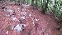
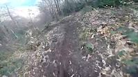
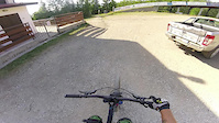
Videos of Lazio Mountain Bike
trail: Strada per Valle Gelata
0:15 |
5 |
May 5, 2025
trail: Punta Della Valle
2:22 |
61 |
Aug 30, 2020
trail: B-Line
0:09 |
132 |
Mar 31, 2020
trail: granpicchio
3:57 |
188 |
Aug 2, 2017
trail: Pettirosso Basso
7:23 |
259 |
Sep 24, 2014
trail: Snake
5:30 |
348 |
Jul 24, 2013
trail: Superintegrale
0:02 |
326 |
Jul 2, 2013
trail: Rocca Romana
4:19 |
49 |
May 20, 2025 , Trevignano Romano
Current Trail Warnings
| status | trail | date | condition | user | info |
|---|---|---|---|---|---|
| Pineta Fiuggi Outdoor Area | Jun 17, 2026 @ 8:49am (Europe/Rome) 2 days | Dry | sp1marco | Il trail è molto rovinato perchè scavato |
Recent Trail Reports
Activity Feed
| username | action | type | title | date |
|---|---|---|---|---|
| metareal | add | trail | activity #97171454 and 9 more | Jun 17, 2026 @ 3:28am 2 days |
| sp1marco | add | report | activity #97165632 | Jun 16, 2026 @ 11:50pm 2 days |
| DiegozyIpzP | comment | trail | activity #97070110 | Jun 15, 2026 @ 3:46pm Jun 15, 2026 |
| metareal | add | trail | activity #97062098 | Jun 15, 2026 @ 1:18pm Jun 15, 2026 |
| Dani81 | add | trail | activity #97062062 and 1 more | Jun 15, 2026 @ 1:17pm Jun 15, 2026 |
Recent Comments
| username | type | title | comment | date |
|---|---|---|---|---|
| trail | Molto polveroso e scivoloso ma pulito 👍🏼 | Jun 15, 2026 @ 3:46pm Jun 15, 2026 | ||
| trail | Questo, ossia il sentiero principale è... | May 21, 2026 @ 3:00pm May 21, 2026 | ||
| trail | Percorso in salita con mtb il 7 aprile 2026.... | Apr 7, 2026 @ 10:37pm Apr 7, 2026 | ||
| trail | Percorso in data 7 aprile con mtb. Non sembra... | Apr 7, 2026 @ 10:33pm Apr 7, 2026 | ||
| trail | Nice green trail, but please delete old... | Nov 13, 2025 @ 1:08am Nov 13, 2025 |
Local Badges
-

Climbing 10k Badge2 awarded -

Epic Mountain Bike Climb 2k1 awarded -
Climbing 10k Badge8 awarded -
Climbing 10k Badge7 awarded -
Epic Mountain Bike Climb 2k15 awarded -

Mountain Biking 100k Badge0 awarded
Bike & Skill Parks
| name | type | city | rating |
|---|---|---|---|
| All Park Roma | skill park | Roma | |
| Pump Track e Skate Park Rieti | skill park | Rieti | |
| Crossdromo Malagrotta (Rom) | skill park | Roma | |
| Crossdromo Vasanello | skill park | Soriano nel cimino | |
| Crossdromo Fiano | skill park | Fara in Sabina |
Activity Type Stats
| activitytype | trails | distance | descent | descent distance | total vertical | rating | global rank | state rank | photos | reports | routes | ridelogs |
|---|---|---|---|---|---|---|---|---|---|---|---|---|
| Mountain Bike | 716 | 706 miles | 240,072 ft | 398 miles | 6,969 ft | 608 | 5,171 | 73 | 82,498 | |||
| E-Bike | 570 | 538 miles | 178,740 ft | 302 miles | 6,969 ft | 39 | 4,998 | 42 | 16,713 | |||
| Gravel Bike | 16 | 93 | 1,035 | |||||||||
| Adaptive Bike | 3 | 1 | ||||||||||
| Horse | 82 | 113 miles | 23,396 ft | 52 miles | 5,423 ft | 2 | 573 | 2 | 45 | |||
| Hike | 562 | 537 miles | 165,682 ft | 295 miles | 7,205 ft | 5,013 | 6 | 3,178 | ||||
| Trail Running | 543 | 512 miles | 155,965 ft | 277 miles | 7,195 ft | 5,007 | 7 | 996 | ||||
| Dirtbike/Moto | 55 | 61 miles | 13,465 ft | 27 miles | 5,092 ft | 557 | 1 | 14 | ||||
| Observed Trials | 19 | 15 miles | 4,508 ft | 9 miles | 4,009 ft | 25 | 1 | 1 | ||||
| ATV/ORV/OHV | 35 | 49 miles | 7,779 ft | 17 miles | 3,681 ft | 552 | 1 | |||||
| Snowmobile | 2 | 2 miles | 755 ft | 1 mile | 472 ft | 13 | ||||||
| Snowshoe | 25 | 36 miles | 6,624 ft | 15 miles | 4,997 ft | 14 | 22 | |||||
| Downhill Ski | 17 | 12 miles | 3,507 ft | 7 miles | 4,108 ft | 13 | 33 | |||||
| Backcountry Ski | 24 | 35 miles | 6,617 ft | 15 miles | 4,997 ft | 13 | 97 | |||||
| Nordic Ski | 15 | 23 miles | 5,013 ft | 12 miles | 5,538 ft | 13 | 35 |
Activities
- Lazio Mountain Biking Trails
- Lazio E-Biking Trails
- Lazio Gravel Biking Trails
- Lazio Horseback Trails
- Lazio Hiking Trails
- Lazio Trail Running Trails
- Lazio Dirtbiking Trails
- Lazio Observed Trials Trails
- Lazio ATVing/Offroading Trails
- Lazio Snowshoeing Trails
- Lazio Skiing Trails
- Lazio Backcountry Skiing Trails
- Lazio Nordic Skiing Trails
Trails
Points of Interest
- Santuario Francescano di Greccio Sight
- [Mountain retreat] Rifugio Sebastiani Other
- [Mountain retreat] Rifugio Massimo Rinaldi Other
- [Mountain retreat] Rifugio La Fossa Other
- Casale di Valle Gelata Other
- Macchiole Other
- Rovine di San Rocco Other
- Centro Visite di Ripasottile Information
- Santuario Francescano di Fonte Colombo Sight
- Cima di Vall'Organo Summit
- Monte Terminillo (7,211 ft)
- Terminillo - Vetta Est (7,182 ft)
- Vetta Sassetelli (6,883 ft)
- By brenthillier
 NSMBA TRAILFORKS & contributors
 - Admins: denitopia, marcoangeletti, cemoorelife
- #9482 - 16,692 views
- lazio activity log | embed map of Lazio mountain bike trails | lazio mountain biking points of interest polygons
Downloading of trail gps tracks in kml & gpx formats is enabled for Lazio.
You must login to download files.