
close
-
Layers w
- Weather Layers
- Pro
- Pro
- Pro
- Pro
- Pro
- Pro
- More Layers
- Pro
- Pro
- Pro
- Pro
-
Upgrade to

3D
Trail Conditions
- Unknown
- Snow Groomed
- Snow Packed
- Snow Covered
- Snow Cover Partial
- Freeze/thaw Cycle
- Icy
- Prevalent Mud
- Wet
- Variable
- Ideal
- Dry
- Very Dry
Trail Flow (Ridden Direction)
Trailforks scans users ridelogs to determine the most popular direction each trail is ridden. A good flowing trail network will have most trails flowing in a single direction according to their intension.
The colour categories are based on what percentage of riders are riding a trail in its intended direction.
The colour categories are based on what percentage of riders are riding a trail in its intended direction.
- > 96%
- > 90%
- > 80%
- > 70%
- > 50%
- < 50%
- bi-directional trail
- no data
Trail Last Ridden
Trailforks scans ridelogs to determine the last time a trail was ridden.
- < 2 days
- < 1 week
- < 2 weeks
- < 1 month
- < 6 months
- > 6 months
Trail Ridden Direction
The intended direction a trail should be ridden.
- Downhill Only
- Downhill Primary
- Both Directions
- Uphill Primary
- Uphill Only
- One Direction
Contribute Details
Colors indicate trail is missing specified detail.
- Description
- Photos
- Description & Photos
- Videos
Trail Popularity ?
Trailforks scans ridelogs to determine which trails are ridden the most in the last 9 months.
Trails are compared with nearby trails in the same city region with a possible 25 colour shades.
Think of this as a heatmap, more rides = more kinetic energy = warmer colors.
- most popular
- popular
- less popular
- not popular
ATV/ORV/OHV Filter
Max Vehicle Width
inches
US Cell Coverage
Legend

Radar Time
Activity Recordings
Trailforks uses anonymized public activity data.
?
Activity Recordings
Trailforks uses anonymized public activity data.
?
Personal Heatmap
▶
Activity Types
all
/
none
▶
Options
2
Date range
month
–
Winter Trails
Warning
A routing network for winter maps does not exist. Selecting trails using the winter trails layer has been disabled.
Missing Trails
Most Popular
Least Popular
Trails are colored based on popularity. The more popular a trail is, the more red. Less popular trails trend towards green.
Jump Magnitude Heatmap
Heatmap of where riders jump on trails. Zoom in to see individual jumps, click circles to view jump details.
BC Backroad Status
![map legend]()
Service Road Atlas is a free to use, community-driven service for viewing and creating reports on the numerous back-country service roads around B.C. and Alberta.

Slope Aspect
Direction the slope faces
Trails Deemphasized
Trails are shown in grey.
Only show trails with no bike usage.
Suggested Layers
Based on selected activity type
Save the current map location and zoom level as your default home location whenever this page is loaded.
SaveOne of the best-kept secrets of Scottish biking is north of Inverness, at Learnie. Trails criss-cross intricately and at one point are are so tight, that sections have been cut out of two trees to allow handlebars through
One of the best kept secrets of Scottish mountain biking has now been officially launched and opened (March 2006) - the new single track trails are now open at Learnie Forest on the Black Isle. Mountain biking on the Black Isle - not actually an island, but a peninsula - has been popular among those from Inverness and elsewhere in the north of Scotland for some years; but with the building of the trails at Learnie Red Rock - it is moving to a whole new level.
These trails also provide a very different - and more varied - riding experience than the other routes on the Black isle. These new trails (designed by Paul Masson of Cycletherapy, who also designed the Laggan Wolftrax trails) have evolved from, and have replaced, the remains of some long-established trails, which in turn have evolved over several years' use by local mountain bikers. In February 2005, a substantial funding package was secured which gave Forestry Commission Scotland the green light to build new trails and upgrade the existing network in Learnie Forest. The existing trails were built by local mountain bikers - many of them involved with the Highland Mountain Bike Association (HiMBA) - but they were becoming so popular that, without work and regular maintenance, there were concerns that they might not last.
Now there are 16kms of high quality trails for all skill levels and they include some spectacular views. The Learnie Red Rock also include something for everyone, with forest roads, green, blue and black-graded single-track trails, as well as orange-graded bike park and dirt jump areas. The green-graded route offers a real mountain biking experience - it includes some rugged trail features to challenge novices and young riders.
The dirt jump area is adjacent to the car park, in the woodlands east of the A832 Rosemark to Cromarty Road. This area includes three different levels of jump, from beginner to expert.
From the car park the forest road takes you to the start of the trails, with the first fork offering two options: turn right for Home Green and Callachy Hill - including the bike park - or left for the start of the Muirhead Climb, taking you over to the 'Firth View' or the start of the black grade routes.
Home Green is a green-graded trail that serves as the perfect introduction to the art of single-track riding. There are features such as double jumps and table tops but they can be negotiated at slow speed, and by rolling over, rather than taking off. It is possible to link Home Green with Callachy Hill, a 1.5km blue graded climb that meanders to the top of the hill, weaving between tall, swaying larch trees.
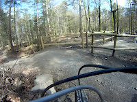
After Callachy Hill a short ride along the forest road takes you to the mouth of the bike park - an orange graded downhill trail that includes large bermed corners, tabletops and double jumps, and where it is possible to pick up some speed. Alternatively, to stick to green and blue-graded trail, carry straight on for the less technical but no less thriling Callachy Downhill, a twisting 1.3km descent, or take the Green Link - another green-graded single track.
Muirhead Climb is another blue-graded ascent that connects to the Firth View - blue-graded, offering spectacular views of the Moray Firth - Learnie Hill is where the epxerienced mountian bikers will head: it is a black graded section with challenging technical climbs and descents.
Learnie Hill includes the Quarry Climb and Traacy's Trees, a downhill rock feature which, if it proves too daunting, has an alternative trail as a bypass. More rocky trails, rock features and some North Shore follow with Seisometer, Gyroscope, and the "unique rock horseshoe," Dextrality. Finally there is Mephisto a 10ft stone-pitched drop from the bank to the road.
Routes
Green - Home 0.5km
Blue - Callachy Hill Climb 1.5km
Blue - Callachy Downhill 1.3kms
Blue - Muirhead Climb 1.1km, Firth View 2.2kms
Black - sections are graded black
Orange - Bike Park 1.1kms
Orange - Dirt Jump Area
One of the best kept secrets of Scottish mountain biking has now been officially launched and opened (March 2006) - the new single track trails are now open at Learnie Forest on the Black Isle. Mountain biking on the Black Isle - not actually an island, but a peninsula - has been popular among those from Inverness and elsewhere in the north of Scotland for some years; but with the building of the trails at Learnie Red Rock - it is moving to a whole new level.
These trails also provide a very different - and more varied - riding experience than the other routes on the Black isle. These new trails (designed by Paul Masson of Cycletherapy, who also designed the Laggan Wolftrax trails) have evolved from, and have replaced, the remains of some long-established trails, which in turn have evolved over several years' use by local mountain bikers. In February 2005, a substantial funding package was secured which gave Forestry Commission Scotland the green light to build new trails and upgrade the existing network in Learnie Forest. The existing trails were built by local mountain bikers - many of them involved with the Highland Mountain Bike Association (HiMBA) - but they were becoming so popular that, without work and regular maintenance, there were concerns that they might not last.
Now there are 16kms of high quality trails for all skill levels and they include some spectacular views. The Learnie Red Rock also include something for everyone, with forest roads, green, blue and black-graded single-track trails, as well as orange-graded bike park and dirt jump areas. The green-graded route offers a real mountain biking experience - it includes some rugged trail features to challenge novices and young riders.
The dirt jump area is adjacent to the car park, in the woodlands east of the A832 Rosemark to Cromarty Road. This area includes three different levels of jump, from beginner to expert.
From the car park the forest road takes you to the start of the trails, with the first fork offering two options: turn right for Home Green and Callachy Hill - including the bike park - or left for the start of the Muirhead Climb, taking you over to the 'Firth View' or the start of the black grade routes.
Home Green is a green-graded trail that serves as the perfect introduction to the art of single-track riding. There are features such as double jumps and table tops but they can be negotiated at slow speed, and by rolling over, rather than taking off. It is possible to link Home Green with Callachy Hill, a 1.5km blue graded climb that meanders to the top of the hill, weaving between tall, swaying larch trees.
After Callachy Hill a short ride along the forest road takes you to the mouth of the bike park - an orange graded downhill trail that includes large bermed corners, tabletops and double jumps, and where it is possible to pick up some speed. Alternatively, to stick to green and blue-graded trail, carry straight on for the less technical but no less thriling Callachy Downhill, a twisting 1.3km descent, or take the Green Link - another green-graded single track.
Muirhead Climb is another blue-graded ascent that connects to the Firth View - blue-graded, offering spectacular views of the Moray Firth - Learnie Hill is where the epxerienced mountian bikers will head: it is a black graded section with challenging technical climbs and descents.
Learnie Hill includes the Quarry Climb and Traacy's Trees, a downhill rock feature which, if it proves too daunting, has an alternative trail as a bypass. More rocky trails, rock features and some North Shore follow with Seisometer, Gyroscope, and the "unique rock horseshoe," Dextrality. Finally there is Mephisto a 10ft stone-pitched drop from the bank to the road.
Routes
Green - Home 0.5km
Blue - Callachy Hill Climb 1.5km
Blue - Callachy Downhill 1.3kms
Blue - Muirhead Climb 1.1km, Firth View 2.2kms
Black - sections are graded black
Orange - Bike Park 1.1kms
Orange - Dirt Jump Area
Primary Trail Type: Cross-Country
Land Status: Community Forest
 google parking directions
Files
- LearnieRedRocksTrailMap.pdf (848 KB)
This region uses the Uk/Euro style trail grading system.
Activities Click to view
- Mountain Bike
22 trails
- E-Bike
4 trails
- Hike
16 trails
- Trail Running
16 trails
Region Details
- 5
- 2
- 5
- 8
- 1
Region Status
Open as of Jul 3, 2026Stats
- Avg Trail Rating
- Trails (view details)
- 21
- Trails Mountain Bike
- 22
- Trails E-Bike
- 4
- Trails Hike
- 16
- Trails Trail Running
- 16
- Total Distance
- 11 miles
- Total Descent
- 2,458 ft
- Total Vertical
- 258 ft
- Highest Trailhead
- 741 ft
- Reports
- 398
- Photos
- 30
- Ridden Counter
- 5,819
Popular Learnie Red Rocks Mountain Biking Trails
• 90 ★ 3.0 • 1,621 ft • 27 ft • 441 •
Popular green difficulty singletrack. This mountain bike primary trail can be used downhill primary. On average it takes 1 minutes to complete this trail.
• 100 ★ 4.4 • 4,019 ft • 235 ft • 438 •
Popular blue difficulty singletrack. This mountain bike primary trail can be used uphill primary. On average it takes 9 minutes to complete this trail.
• 85 ★ 4.7 • 3,914 ft • 16 ft • 423 •
Popular blue difficulty singletrack. This mountain bike primary trail can be used downhill primary and has a moderate overall physical rating. Trail visibility is always easy to follow. On average it takes 5 minutes to complete this trail.
• 95 ★ 4.7 • 3,540 ft • 3 ft • 414 •
Popular red difficulty singletrack. This mountain bike primary trail. On average it takes 3 minutes to complete this trail.
• 80 ★ 2.5 • 3,442 ft • 78 ft • 402 •
Popular green difficulty singletrack. This mountain bike primary trail can be used uphill primary. On average it takes 5 minutes to complete this trail.
• 95 ★ 3.0 • 3,422 ft • 131 ft • 355 •
Popular blue difficulty singletrack. This mountain bike primary trail can be used uphill primary. On average it takes 8 minutes to complete this trail.
• 65 ★ 4.9 • 1,555 ft • 0 ft • 295 •
Highly rated moderately popular black difficulty singletrack. This mountain bike primary trail can be used downhill primary. On average it takes 4 minutes to complete this trail.
• 60 ★ 3.0 • 1 mile • 132 ft • 272 •
Moderately popular blue difficulty singletrack. This mountain bike primary trail can be used downhill primary. On average it takes 14 minutes to complete this trail.
Learnie Red Rocks Mountain Bike Routes
• 13 miles • 2,155 ft • 25 •
• 14 miles • 1,928 ft • 23 •
• 15 miles • 2,038 ft • 16 •
• 10 miles • 1,534 ft • 17 •
• 7 miles • 760 ft • 7 •
Photos of Learnie Red Rocks Mountain Bike
Videos of Learnie Red Rocks Mountain Bike

trail: Bike Park
5:27 |
173 |
Jan 1, 2017
trail: Bike Park
4:29 |
451 |
Sep 23, 2015
trail: Bike Park
0:39 |
195 |
Oct 19, 2014
trail: Bike Park
3:58 |
751 |
Sep 9, 2014
trail: Bike Park
2:41 |
61 |
Apr 21, 2014
trail: Bike Park
0:01 |
73 |
Apr 21, 2014
trail: Bike Park
0:25 |
51 |
Feb 24, 2014
trail: Bike Park
0:25 |
47 |
Feb 24, 2014
Recent Trail Reports
| status | trail | date | condition | info | user |
|---|---|---|---|---|---|
| Path | Jul 3, 2026 @ 2:41pm (Europe/Isle_of_Man) Jul 3, 2026 | Ideal | tononinjaman | ||
| Path | Jul 3, 2026 @ 2:41pm (Europe/Isle_of_Man) Jul 3, 2026 | Ideal | tononinjaman | ||
| Home Run | Jul 3, 2026 @ 2:41pm (Europe/Isle_of_Man) Jul 3, 2026 | Ideal | tononinjaman | ||
| Rockit | Jul 3, 2026 @ 2:41pm (Europe/Isle_of_Man) Jul 3, 2026 | Ideal | tononinjaman | ||
| Muirhead Blue climb | Jul 3, 2026 @ 2:41pm (Europe/Isle_of_Man) Jul 3, 2026 | Ideal | tononinjaman | ||
| Groot | Jul 3, 2026 @ 2:41pm (Europe/Isle_of_Man) Jul 3, 2026 | Ideal | tononinjaman | ||
| Bike Park | Jul 3, 2026 @ 2:41pm (Europe/Isle_of_Man) Jul 3, 2026 | Ideal | tononinjaman | ||
| A Fully Trimmed Bush | Jul 3, 2026 @ 2:41pm (Europe/Isle_of_Man) Jul 3, 2026 | Ideal | tononinjaman | ||
| Callachy Blue Climb | Jul 3, 2026 @ 2:41pm (Europe/Isle_of_Man) Jul 3, 2026 | Ideal | tononinjaman | ||
| Toby's Trail | Jul 3, 2026 @ 2:41pm (Europe/Isle_of_Man) Jul 3, 2026 | Ideal | tononinjaman |
Activity Feed
| username | action | type | title | date |
|---|---|---|---|---|
| balders2 | wishlist | trail | activity #99002176 | Jul 12, 2026 @ 3:17am Jul 12, 2026 |
| tononinjaman | add | report | activity #98353135 and 11 more | Jul 3, 2026 @ 11:20am Jul 3, 2026 |
| tononinjaman | add | report | activity #95198673 and 11 more | May 21, 2026 @ 1:48pm May 21, 2026 |
| GatisqqvIUS | wishlist | trail | activity #94000660 | May 3, 2026 @ 6:16pm May 3, 2026 |
| 12Sophie12 | ridden | trail | activity #93949400 | May 3, 2026 @ 8:20am May 3, 2026 |
Recent Comments
| username | type | title | comment | date |
|---|---|---|---|---|
| trail | Nice loop, still ridable since forestry works... | May 21, 2025 @ 9:44am May 21, 2025 | ||
| trail | Trail no longer there after forestry work | May 2, 2025 @ 7:42am May 2, 2025 | ||
| trail | Thank you for this dream of a blue trail. It... | Aug 7, 2024 @ 2:36am Aug 7, 2024 | ||
| trail | Pump track trail. | Oct 25, 2023 @ 1:21am Oct 25, 2023 | ||
| report | Flows like ass | Aug 4, 2023 @ 4:24pm Aug 4, 2023 |
Nearby Areas
| name | distance | ||||
|---|---|---|---|---|---|
| High Wood | 9 | 1 | 8 km | ||
| Ord Hill and Kilmuir Hill | 5 | 8.7 km | |||
| Culloden Forest | 22 | 5 | 9.4 km | ||
| Craigphadrig Forest | 5 | 11.2 km | |||
| Laiken Forest | 11.4 km |
Local Badges
-

Completionist0 awarded
Bike & Skill Parks
| name | type | city | rating |
|---|---|---|---|
| Learnie Jump Track | skill park | Inverness |
Activity Type Stats
| activitytype | trails | distance | descent | descent distance | total vertical | rating | global rank | state rank | photos | reports | routes | ridelogs |
|---|---|---|---|---|---|---|---|---|---|---|---|---|
| Mountain Bike | 22 | 11 miles | 2,457 ft | 6 miles | 259 ft | #4,138 | #126 | 30 | 397 | 1 | 3,025 | |
| E-Bike | 4 | 1 mile | 643 ft | 5,177 ft | 246 ft | #5,786 | #266 | 369 | 344 | |||
| Hike | 16 | 8 miles | 1,325 ft | 4 miles | 246 ft | #8,598 | #218 | 395 | 54 | |||
| Trail Running | 16 | 8 miles | 1,325 ft | 4 miles | 246 ft | #7,703 | #202 | 395 | 27 |
Frequently Asked Questions About Learnie Red Rocks
▼
What are the highest rated mountain biking trails in Learnie Red Rocks?
The highest rated mountain biking trails in Learnie Red Rocks are:
- A Fully Trimmed Bush (4.4/5)
- Bike Park (4.1/5)
- Callachy Blue Descent (4.1/5)
- Callachy Blue Climb (4.1/5)
- Rockit (3.9/5)
▼
What is the best time of the year to ride in Learnie Red Rocks?
Based on ride log data, the most popular months to ride in Learnie Red Rocks are:
- September (18 activities)
- July (17 activities)
- May (13 activities)
▼
Where can I park to ride in Learnie Red Rocks?
There are 1 parking locations listed in Learnie Red Rocks. The most popular parking spots are:
▼
What is the longest trail in Learnie Red Rocks?
The longest trail in Learnie Red Rocks is Black Trail at 2.0 miles. View all trails sorted by distance.
Activities
- By trickythomas & contributors
- Admins: LTA
- #8712 - 12,532 views
- learnie red rocks activity log | embed map of Learnie Red Rocks mountain bike trails | learnie red rocks mountain biking points of interest
Downloading of trail gps tracks in kml & gpx formats is enabled for Learnie Red Rocks.
You must login to download files.