close
-
Layers w
- Weather Layers
- Pro
- Pro
- Pro
- Pro
- Pro
- Pro
- More Layers
- Pro
- Pro
- Pro
- Pro
-
Upgrade to

3D
Trail Conditions
- Unknown
- Snow Groomed
- Snow Packed
- Snow Covered
- Snow Cover Partial
- Freeze/thaw Cycle
- Icy
- Prevalent Mud
- Wet
- Variable
- Ideal
- Dry
- Very Dry
Trail Flow (Ridden Direction)
Trailforks scans users ridelogs to determine the most popular direction each trail is ridden. A good flowing trail network will have most trails flowing in a single direction according to their intension.
The colour categories are based on what percentage of riders are riding a trail in its intended direction.
The colour categories are based on what percentage of riders are riding a trail in its intended direction.
- > 96%
- > 90%
- > 80%
- > 70%
- > 50%
- < 50%
- bi-directional trail
- no data
Trail Last Ridden
Trailforks scans ridelogs to determine the last time a trail was ridden.
- < 2 days
- < 1 week
- < 2 weeks
- < 1 month
- < 6 months
- > 6 months
Trail Ridden Direction
The intended direction a trail should be ridden.
- Downhill Only
- Downhill Primary
- Both Directions
- Uphill Primary
- Uphill Only
- One Direction
Contribute Details
Colors indicate trail is missing specified detail.
- Description
- Photos
- Description & Photos
- Videos
Trail Popularity ?
Trailforks scans ridelogs to determine which trails are ridden the most in the last 9 months.
Trails are compared with nearby trails in the same city region with a possible 25 colour shades.
Think of this as a heatmap, more rides = more kinetic energy = warmer colors.
- most popular
- popular
- less popular
- not popular
ATV/ORV/OHV Filter
Max Vehicle Width
inches
US Cell Coverage
Legend

Radar Time
Activity Recordings
Trailforks uses anonymized public activity data.
?
Activity Recordings
Trailforks uses anonymized public activity data.
?
Personal Heatmap
▶
Activity Types
all
/
none
▶
Options
2
Date range
month
–
Winter Trails
Warning
A routing network for winter maps does not exist. Selecting trails using the winter trails layer has been disabled.
Missing Trails
Most Popular
Least Popular
Trails are colored based on popularity. The more popular a trail is, the more red. Less popular trails trend towards green.
Jump Magnitude Heatmap
Heatmap of where riders jump on trails. Zoom in to see individual jumps, click circles to view jump details.
BC Backroad Status
![map legend]()
Service Road Atlas is a free to use, community-driven service for viewing and creating reports on the numerous back-country service roads around B.C. and Alberta.

Slope Aspect
Direction the slope faces
Trails Deemphasized
Trails are shown in grey.
Only show trails with no bike usage.
Suggested Layers
Based on selected activity type
Save the current map location and zoom level as your default home location whenever this page is loaded.
SaveWelcome to Lecco and surroundings
Lecco Province is rich of outdoor activities for all.
Never ending fun thanks to the historical network of trails.
Lecco and its surrounding mountains: the beautiful Alpine range of Orobie. The mountains of Lecco are pure and white in winter and warm in autumn, always fresh for its generous and lush vegetation.
Lecco is surrounded by all its peaks in their inimitable beauty. San Martino mountain, who seems to fall steeply into the Lake Como, and then the Grigne and Resegone, with its unmistakable profile as a saw. The mountains of Lecco combine their orogeny nature of limestone, dolomite and clay rocks and due to this are called the Dolomites of Lecco.
The mountains of Lecco, thanks to their size and peculiarities, have a rich mountain vegetation and a typical alpine wildlife, such as ibex and chamois.
Many the opportunities to discover and experience the Prealps Orobie enjoying excursion and trekking along the several paths.
Lecco is a jewel of the nature with a breathtaking landscape: the mountains considered the Dolomites of Lecco and the peaceful Lake Como, the green of the lush vegetation and colorful alpine surroundings. Heights and depths, smells and colors blend together in a unique natural and spectacular picture, which remains engraved in mind.
Lecco offers a variety of outdoors activities with its many excursion and trekking routes, walks in the Natural Regional Parks of the alpine region of the Orobie, climbing the walls of the beautiful mountains to dominate from above or enjoy it along the scenic and new pedestrian and cycle routes along the lake.
There is no time to get bored, because of the many choices to enjoy your time in Lecco
Links
- Red Bull: le bike area in crescita in Italia che dovresti visitare
- SOIL SEARCHING LECCO, ITALIA NORTH N LINE
- Adotta e salva un sentiero con Lecco MTB Trails
- Mtb, turismo e potenzialità del territorio
- Outstanding Local Trail Crew – North N Line, Italy
- Montagne Lago di Como
- EccoLecco
- Local-heroes- lake como's steep descents
Files
- cartina-MTB-DERVIO.pdf (4.56 MB)
This region uses the Uk/Euro style trail grading system.
Activities Click to view
- Mountain Bike
794 trails
- E-Bike
698 trails
- Horse
227 trails
- Hike
900 trails
- Trail Running
882 trails
- Snowshoe
132 trails
- Downhill Ski
6 trails
- Backcountry Ski
65 trails
- Nordic Ski
11 trails
Region Details
- 135
- 26
- 205
- 219
- 105
- 96
- 7
Stats
- Avg Trail Rating
- Trails (view details)
- 943
- Trails Mountain Bike
- 794
- Trails E-Bike
- 698
- Trails Gravel Bike
- 26
- Trails Adaptive Bike
- 106
- Trails Winter Fat Bike
- 158
- Trails Horse
- 227
- Trails Hike
- 900
- Trails Trail Running
- 882
- Trails Dirtbike/Moto
- 1
- Trails ATV/ORV/OHV
- 1
- Trails Snowshoe
- 132
- Trails Downhill Ski
- 6
- Trails Backcountry Ski
- 65
- Trails Nordic Ski
- 11
- Total Distance
- 967 miles
- Total Descent
- 387,503 ft
- Total Vertical
- 7,617 ft
- Highest Trailhead
- 8,247 ft
- Reports
- 8,224
- Photos
- 1,881
- Ridden Counter
- 43,066
Popular Trail Networks
view all areas »Sub Regions
- Abbadia Lariana (65)
- Grigna Meridionale (61)
- Ballabio (26)
- Monte Due Mani (22)
- Barzago (2)
- Barzanò (1)
- Barzio (22)
- Piani di Bobbio (20)
- Bellano (25)
- Alpe Giumello (16)
- Brivio (4)
- Carenno (6)
- Casatenovo (8)
- Cernusco Lombardone (2)
- Civate (35)
- Monte Cornizzolo (33)
- Colico (41)
- Monte Legnone (39)
- Dervio (3)
- Dolzago (161)
- Monte di Brianza (126)
- Galbiate (16)
- Monte Barro (14)
- Gravedona (4)
- Imbersago (2)
- Introbio (14)
- Val Biandino (13)
- Lecco (97)
- Monte Melma (14)
- Monte Resegone (64)
- Lierna (20)
- Mandello Del Lario (56)
- Merate (21)
- Meratese (21)
- Missaglia (11)
- Moggio (28)
- Piani di Artavaggio (25)
- Monte Marenzo (9)
- Montevecchia (22)
- Oggiono (1)
- Oliveto Lario (1)
- Pasturo (46)
- Robbiate (5)
- Santa Maria Hoè (2)
- Sirone (2)
- Sirtori (14)
- Taceno (13)
- Piani delle Betulle (12)
- Torre De Busi (6)
- Unione Dei Comuni Della Valvarrone (16)
- Val Varrone (16)
- Valgreghentino (4)
- Valmadrera (14)
- Varenna (21)
Popular Lecco Mountain Biking Trails
• 100 ★ 0.0 • 3,967 ft • 428 ft • 320 •
Salita impegnativa ma regolare su fondo sterrato nel complesso ben tenuto
• 100 ★ 4.6 • 2,726 ft • 0 ft • 267 •
Discesa tecnica con alternanza di gradini, radici, pietre e qualche tratto più scorrevole.
• 100 ★ 3.8 • 4,478 ft • 91 ft • 262 •
Sentiero che da Sirtori arriva alla Via Panoramica del Parco di Montevecchia, ricco di saliscendi e godibile in entrambi i sensi.
• 95 ★ 4.0 • 3,307 ft • 139 ft • 249 •
Noto anche come Sentiero Dei Leoni vista la presenza di due leoni di pietra all'interno del cancello dove parte il trail lato via Pianello - La Valletta
• 100 ★ 3.0 • 1 mile • 27 ft • 234 •
Divertente singletrack nel bosco, poi qualche tratturo
Lecco Mountain Bike Routes
Abbadia - Parco Valentino - Enduro Featured
14 miles • 4,300 ft • 6 • Loop •
From Abbadia to Piani dei Resinelli throught Campelli. It is a very steep climb a with cemented surface....
★ 5.0 • 6 miles • 1,961 ft • 2 • Out & Back •
Bel tracciato che si snoda in cresta tra Biandino e Varrone. Il collegamento con il Rifugio Santa Rita non...
★ 5.0 • 7 miles • 669 ft • 7 • Shuttled •
Group bike Freeride: Piani Resinelli - Lecco and back via Shuttle. Posti Limitati! info: [email protected]
★ 5.0 • 15 miles • 4,134 ft • 1 •
Tour caratterizzato da panorami superlativi sul lago; la salita risulta impegnativa solo nella parte...
★ 4.0 • 9 miles • 1,432 ft • 2 • Point to Point •
Margno - Piani delle Betulle Salita per il Cimone e in cresta fino al . DIscesa verso la Val Varrone...
★ 3.0 • 15 miles • 2,597 ft • 1 • Point to Point •
Partendo da Tremenico e dirigendosi verso Colico, questo itinerario offre un affascinante viaggio...
Photos of Lecco Mountain Bike
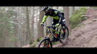
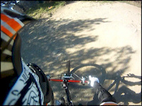
Videos of Lecco Mountain Bike

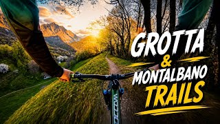
trail: Venom
3:28 |
51 |
Sep 21, 2022
trail: LOURDES
2:52 |
9996 |
Apr 27, 2016
trail: San Rocco
4:45 |
250 |
Apr 15, 2013

trail: Crossing
5:18 |
136 |
Aug 28, 2012
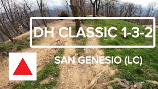
trail: DH Classic 1-3-2
20:34 |
35 |
May 26, 2026 , Dolzago

trail: DH Classic 1-3-2
20:34 |
32 |
May 26, 2026 , Dolzago

trail: DH Classic 1-3-2
20:34 |
24 |
May 26, 2026 , Dolzago
trail: BONACINA DH
11:21 |
59 |
May 5, 2026 , Lecco
Current Trail Warnings
| status | trail | date | condition | user | info |
|---|---|---|---|---|---|
| Secaù Monte di Brianza | Jun 14, 2026 @ 2:38pm (Europe/Vaduz) Jun 14, 2026 | Dry | ettorez | rovi che quasi chiudono il passaggio.... | |
| Sasso Rott Piani delle Betulle | Jun 17, 2026 @ 5:49pm (Europe/Rome) Jun 17, 2026 | Variable | edobk | Sentiero interamente sistemato negli... | |
| Valle Dongoli Variante Blu Monte Due Mani | Jun 7, 2026 @ 3:05pm (Europe/Rome) Jun 7, 2026 | Unknown | samueeell NORTHNLINE | Causa lavori forestali percorso ostruito... |
Recent Trail Reports
Activity Feed
| username | action | type | title | date |
|---|---|---|---|---|
| ettorez | add | report | activity #97326719 and 2 more | Jun 19, 2026 @ 10:05am 1 day |
| edobk | add | report | activity #97186137 and 1 more | Jun 17, 2026 @ 8:33am Jun 17, 2026 |
| edobk | add | photo | activity #97186030 and 4 more | Jun 17, 2026 @ 8:32am Jun 17, 2026 |
| edobk | add | trail | activity #97171168 | Jun 17, 2026 @ 3:19am Jun 17, 2026 |
| andrekona | add | report | activity #97105296 | Jun 16, 2026 @ 6:31am Jun 16, 2026 |
Recent Comments
| username | type | title | comment | date |
|---|---|---|---|---|
| report | Lato sx idrografico. | Jun 15, 2026 @ 5:20am Jun 15, 2026 | ||
| report | Ottimo! | Jun 9, 2026 @ 7:00am Jun 9, 2026 | ||
| report | pianta rimossa! | Jun 5, 2026 @ 2:57pm Jun 5, 2026 | ||
| trail | E' fattibile in salita? | Jun 5, 2026 @ 3:44am Jun 5, 2026 | ||
| report | Bisogna aggiungere felci lungo tutta la tratta | May 23, 2026 @ 11:49am May 23, 2026 |
Local Badges
-

Descent 100k Badge0 awarded -
Descent 100k Badge1 awarded -
Descent 100k Badge0 awarded -
Descent 100k Badge5 awarded -

Descent 10k Badge0 awarded -
Descent 100k Badge0 awarded
Bike & Skill Parks
| name | type | city | rating |
|---|---|---|---|
| Pump Track Carozzi Formaggi | skill park | Pasturo | |
| LAMPON PARK | skill park | Monte Marenzo | |
| ValgreDirt | skill park | Valgreghentino | |
| Alba Orobia Bike | skill park | Merate | |
| Montalbano | skill park | Lecco |
Activity Type Stats
| activitytype | trails | distance | descent | descent distance | total vertical | rating | global rank | state rank | photos | reports | routes | ridelogs |
|---|---|---|---|---|---|---|---|---|---|---|---|---|
| Mountain Bike | 794 | 867 miles | 345,381 ft | 459 miles | 7,618 ft | 1,768 | 8,210 | 49 | 32,614 | |||
| E-Bike | 698 | 788 miles | 306,627 ft | 407 miles | 7,618 ft | 30 | 7,914 | 38 | 7,471 | |||
| Gravel Bike | 26 | 30 miles | 5,889 ft | 8 miles | 4,780 ft | 79 | 13 | 438 | ||||
| Adaptive Bike | 106 | 223 miles | 20,046 ft | 64 miles | 5,856 ft | 1 | 1,193 | |||||
| Winter Fat Bike | 158 | 271 miles | 51,647 ft | 101 miles | 6,263 ft | 326 | 7 | |||||
| Horse | 227 | 330 miles | 106,263 ft | 147 miles | 7,224 ft | 711 | 11 | |||||
| Hike | 900 | 915 miles | 364,865 ft | 461 miles | 7,618 ft | 62 | 7,968 | 25 | 5,599 | |||
| Trail Running | 882 | 903 miles | 359,934 ft | 454 miles | 7,618 ft | 10 | 7,965 | 21 | 2,818 | |||
| Dirtbike/Moto | 1 | 2 miles | 522 ft | 5,059 ft | 551 ft | 4 | 160 | 2 | 2 | |||
| ATV/ORV/OHV | 1 | 2 miles | 522 ft | 5,059 ft | 551 ft | 160 | ||||||
| Snowshoe | 132 | 203 miles | 68,753 ft | 87 miles | 6,503 ft | 253 | 21 | |||||
| Downhill Ski | 6 | 6 miles | 5,761 ft | 5 miles | 5,344 ft | 9 | 241 | |||||
| Backcountry Ski | 65 | 81 miles | 31,355 ft | 39 miles | 5,745 ft | 115 | 271 | |||||
| Nordic Ski | 11 | 18 miles | 5,758 ft | 6 miles | 4,783 ft | 25 | 60 |
Frequently Asked Questions About Lecco
▼
What are the best places to ride in Lecco?
Lecco has 16 areas to explore for mountain biking. The top rated areas are:
▼
What are the highest rated mountain biking trails in Lecco?
The highest rated mountain biking trails in Lecco are:
- Forcella di Olino - Bivio Forbesette (4.5/5)
- Cresta San Defendente (4.4/5)
- San Defendente (4.4/5)
- CAI 12 (4.4/5)
- Roccoli Lorla to Artesso (4.4/5)
▼
What is the best time of the year to ride in Lecco?
Based on ride log data, the most popular months to ride in Lecco are:
- June (211 activities)
- May (177 activities)
- August (177 activities)
▼
What is the longest trail in Lecco?
The longest trail in Lecco is Sentiero Valtellina at 25.6 miles. View all trails sorted by distance.
Activities
Trails
Points of Interest
- Chiesetta San Rocco Viewpoint
- Museo Villa Gerosa Sight
- Monte di Borbino Viewpoint
- Chiesa Sight
- Azienda Agricola il Melograno Other
- Olivedo Other
- Azienda Agricola Figina Other
- Ostello Monte barro Lodge
- Chiesa San Nicola Sight
- Trattoria Bellavista Other
- Monte Galleggione (10,075 ft)
- Pizzun (9,662 ft)
- Piz dal Märc (9,570 ft)
- By brenthillier
 NSMBA TRAILFORKS & contributors
 - Admins: denitopia, marcoangeletti, cemoorelife, marcoangeletti, adessoomaipiu, micheletraversi, NORTHNLINE
- #9506 - 23,526 views
- lecco activity log | embed map of Lecco mountain bike trails | lecco mountain biking points of interest
Downloading of trail gps tracks in kml & gpx formats is enabled for Lecco.
You must login to download files.