close
-
Layers w
- Weather Layers
- Pro
- Pro
- Pro
- Pro
- Pro
- Pro
- More Layers
- Pro
- Pro
- Pro
- Pro
-
Upgrade to

3D
Trail Conditions
- Unknown
- Snow Groomed
- Snow Packed
- Snow Covered
- Snow Cover Partial
- Freeze/thaw Cycle
- Icy
- Prevalent Mud
- Wet
- Variable
- Ideal
- Dry
- Very Dry
Trail Flow (Ridden Direction)
Trailforks scans users ridelogs to determine the most popular direction each trail is ridden. A good flowing trail network will have most trails flowing in a single direction according to their intension.
The colour categories are based on what percentage of riders are riding a trail in its intended direction.
The colour categories are based on what percentage of riders are riding a trail in its intended direction.
- > 96%
- > 90%
- > 80%
- > 70%
- > 50%
- < 50%
- bi-directional trail
- no data
Trail Last Ridden
Trailforks scans ridelogs to determine the last time a trail was ridden.
- < 2 days
- < 1 week
- < 2 weeks
- < 1 month
- < 6 months
- > 6 months
Trail Ridden Direction
The intended direction a trail should be ridden.
- Downhill Only
- Downhill Primary
- Both Directions
- Uphill Primary
- Uphill Only
- One Direction
Contribute Details
Colors indicate trail is missing specified detail.
- Description
- Photos
- Description & Photos
- Videos
Trail Popularity ?
Trailforks scans ridelogs to determine which trails are ridden the most in the last 9 months.
Trails are compared with nearby trails in the same city region with a possible 25 colour shades.
Think of this as a heatmap, more rides = more kinetic energy = warmer colors.
- most popular
- popular
- less popular
- not popular
ATV/ORV/OHV Filter
Max Vehicle Width
inches
US Cell Coverage
Legend

Radar Time
Activity Recordings
Trailforks uses anonymized public activity data.
?
Activity Recordings
Trailforks uses anonymized public activity data.
?
Personal Heatmap
▶
Activity Types
all
/
none
▶
Options
2
Date range
month
–
Winter Trails
Warning
A routing network for winter maps does not exist. Selecting trails using the winter trails layer has been disabled.
Missing Trails
Most Popular
Least Popular
Trails are colored based on popularity. The more popular a trail is, the more red. Less popular trails trend towards green.
Jump Magnitude Heatmap
Heatmap of where riders jump on trails. Zoom in to see individual jumps, click circles to view jump details.
BC Backroad Status
![map legend]()
Service Road Atlas is a free to use, community-driven service for viewing and creating reports on the numerous back-country service roads around B.C. and Alberta.

Slope Aspect
Direction the slope faces
Trails Deemphasized
Trails are shown in grey.
Only show trails with no bike usage.
Suggested Layers
Based on selected activity type
Save the current map location and zoom level as your default home location whenever this page is loaded.
Save
No description for Leeds has been added yet!
Login or register to submit one.
This region uses the Uk/Euro style trail grading system.
Activities Click to view
- Mountain Bike
53 trails
- E-Bike
19 trails
- Adaptive Bike
0 trails
- Winter Fat Bike
0 trails
- Hike
34 trails
- Trail Running
34 trails
Region Details
- 10
- 9
- 14
- 14
- 5
- 1
Region Status
Open as of May 16, 2026Local Trail Association
Stats
- Avg Trail Rating
- Trails (view details)
- 55
- Trails Mountain Bike
- 54
- Trails E-Bike
- 19
- Trails Horse
- 2
- Trails Hike
- 34
- Trails Trail Running
- 34
- Total Distance
- 23 miles
- Total Descent
- 3,132 ft
- Total Vertical
- 490 ft
- Highest Trailhead
- 508 ft
- Reports
- 360
- Photos
- 102
- Ridden Counter
- 15,706
Articles

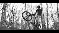
Video: Techy Jumps and Dreamy Corners in Abel Woods
Jul 12, 2020 from pinkbike.com
A day spent in Leeds' "Theatre of Dreams".
Sub Regions
-
Adel Woods
-
Harewood Estate
-
Leeds bike park
-
Leeds Urban Bike Park
- 2
- 5
- 9
- 3
- 1
-
Micklefield
- 2
-
Oakwell Hall County Park
- 1
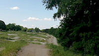
Popular Leeds Mountain Biking Trails
• 100 ★ 1.5 • 436 ft • 0 ft • 742 •
Popular blue difficulty singletrack. This mountain bike primary trail can be used both directions. On average it takes 1 minutes to complete this trail.
• 75 ★ 3.2 • 3,783 ft • 116 ft • 677 •
Popular red difficulty singletrack. This mountain bike primary trail can be used downhill primary. It features berm, drop and jump. On average it takes 13 minutes to complete this trail.
• 95 ★ 2.7 • 860 ft • 3 ft • 669 •
Popular blue difficulty singletrack. This mountain bike primary trail can be used one direction. On average it takes 1 minutes to complete this trail.
• 95 ★ 3.3 • 1,027 ft • 3 ft • 635 •
Huge tabletops, including over the large metal bridge, and berms. Links to the woodland trail.
• 90 ★ 2.5 • 581 ft • 27 ft • 635 •
Popular red difficulty singletrack. This mountain bike primary trail can be used downhill only. It features berm and jump. On average it takes minutes to complete this trail.
• 80 ★ 2.0 • 1,788 ft • 41 ft • 633 •
Popular red difficulty singletrack. This mountain bike primary trail can be used one direction. On average it takes 4 minutes to complete this trail.
• 90 ★ 3.3 • 889 ft • 8 ft • 599 •
Popular proline difficulty singletrack. This mountain bike primary trail can be used one direction. On average it takes 3 minutes to complete this trail.
• 70 ★ 2.0 • 1,148 ft • 12 ft • 569 •
Popular red difficulty singletrack. This mountain bike primary trail can be used uphill only. On average it takes 3 minutes to complete this trail.
Leeds Mountain Bike Routes
★ 4.0 • 5 miles • 445 ft • 0 • Out & Back •
This trail is officially a walking route with sections of public/permissive bridgeway, so please give way...
13 miles • 1,511 ft • 0 • Loop •
Classic Yorkshire Dales cross country loop starting from Kilnsey. Mastiles Lane is fine year round, but...
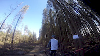
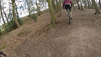
Photos of Leeds Mountain Bike
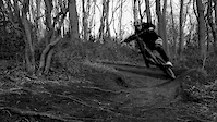
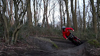
Videos of Leeds Mountain Bike
trail: Adel Jumps
3:00 |
1527 |
May 4, 2020
trail: Adel Jumps
2:48 |
356 |
Mar 25, 2019
trail: Adel Jumps
2:01 |
248 |
Mar 24, 2019
trail: Jump Line
7:07 |
200 |
Nov 23, 2018
trail: Jump Line
0:30 |
396 |
Jun 11, 2018

trail: Jump Line
2:41 |
316 |
Apr 20, 2017
trail: Blue Trail
3:09 |
268 |
Apr 8, 2017
trail: Woodland Red Trail
0:56 |
141 |
Apr 2, 2017
Recent Trail Reports
| status | trail | date | condition | info | user |
|---|---|---|---|---|---|
| Bridge Track | May 16, 2026 @ 2:18pm (Europe/London) May 16, 2026 | Variable | zIsNaZ | ||
| Blue Trail | May 2, 2026 @ 10:40pm (Europe/London) May 2, 2026 | Ideal | Dad82uk | ||
| Secret Singletrack | Oct 11, 2025 @ 11:23pm (Europe/London) Oct 11, 2025 | Unknown | GGgKCa | ||
| Adel Jumps | Jun 29, 2025 @ 11:16am Jun 29, 2025 | Dry | Raymond051280 | ||
| Woodland Trail Return | Jul 21, 2024 @ 3:59am Jul 21, 2024 | Dry | lewiscraik | ||
| Woodland Red Trail | Jul 21, 2024 @ 3:59am Jul 21, 2024 | Dry | lewiscraik | ||
| Woodland Trail Mainline | Jul 21, 2024 @ 3:59am Jul 21, 2024 | Dry | lewiscraik | ||
| The Omen (Climb) | Jul 21, 2024 @ 3:59am Jul 21, 2024 | Dry | lewiscraik | ||
| The Omen (Descent) | Jul 21, 2024 @ 3:59am Jul 21, 2024 | Dry | lewiscraik | ||
| Woodland Trail Start | Jul 21, 2024 @ 3:59am Jul 21, 2024 | Dry | lewiscraik |
Activity Feed
| username | action | type | title | date |
|---|---|---|---|---|
| zIsNaZ | add | report | activity #94808265 | May 16, 2026 @ 6:18am May 16, 2026 |
| Dad82uk | add | report | activity #93895642 | May 2, 2026 @ 2:40pm May 2, 2026 |
| Dad82uk | ridden | trail | activity #93895514 and 3 more | May 2, 2026 @ 2:38pm May 2, 2026 |
| Dad82uk | wishlist | trail | activity #92592430 | Apr 14, 2026 @ 6:09am Apr 14, 2026 |
| Spesh-Evo-Carbon | add | photo | activity #87633988 and 5 more | Jan 22, 2026 @ 10:34am Jan 22, 2026 |
Recent Comments
| username | type | title | comment | date |
|---|---|---|---|---|
| report | Needs work. | Oct 11, 2025 @ 3:24pm Oct 11, 2025 | ||
| report | Dry* | Oct 11, 2025 @ 3:24pm Oct 11, 2025 | ||
| trail | Currently re doing the track to be a red trail... | May 4, 2024 @ 3:17pm May 4, 2024 | ||
| trail | They have recently changed this, - there is... | Jul 15, 2022 @ 7:12am Jul 15, 2022 | ||
| trail | Looking at the satellite basemap this is... | Nov 8, 2020 @ 4:43pm Nov 8, 2020 |
Local Badges
-

Epic Ride Climb 2k37 awarded -

Climbing 10k Badge69 awarded -

Climbing 100k Badge4 awarded -

Epic Ride Descent 2k40 awarded -

Descent 10k Badge70 awarded -

Descent 100k Badge5 awarded
Bike & Skill Parks
| name | type | city | rating |
|---|---|---|---|
| Leeds Urban Bike Park BMX Track | skill park | Leeds | |
| Leeds Urban Bike Park Pumptrack | skill park | Leeds |
Activity Type Stats
| activitytype | trails | distance | descent | descent distance | total vertical | rating | global rank | state rank | photos | reports | routes | ridelogs |
|---|---|---|---|---|---|---|---|---|---|---|---|---|
| Mountain Bike | 53 | 23 miles | 3,038 ft | 10 miles | 489 ft | #1,702 | #57 | 101 | 363 | 2 | 22,102 | |
| E-Bike | 19 | 12 miles | 889 ft | 4 miles | 476 ft | #3,034 | #103 | 1 | 345 | 1,877 | ||
| Horse | 2 | 3 miles | 52 ft | 3,822 ft | 157 ft | 20 | ||||||
| Hike | 34 | 19 miles | 2,142 ft | 7 miles | 489 ft | #4,588 | #105 | 348 | 414 | |||
| Trail Running | 34 | 19 miles | 2,142 ft | 7 miles | 489 ft | #4,053 | #94 | 348 | 539 |
Frequently Asked Questions About Leeds
▼
What are the best places to ride in Leeds?
Leeds has 5 areas to explore for mountain biking. The top rated areas are:
▼
What are the highest rated mountain biking trails in Leeds?
The highest rated mountain biking trails in Leeds are:
- Bradford Cycling (4.2/5)
- Middle line (4.2/5)
- U bend (4.1/5)
- The Eastenders line (4.1/5)
- Scotland Wood Main Line (4/5)
▼
What is the best time of the year to ride in Leeds?
Based on ride log data, the most popular months to ride in Leeds are:
- July (87 activities)
- June (56 activities)
- September (56 activities)
▼
Where can I park to ride in Leeds?
There are 1 parking locations listed in Leeds. The most popular parking spots are:
- By willbikeleeds & contributors
- Admins: wisey, MathieuC, cemoorelife, LUBP
- #8251 - 13,568 views
- leeds activity log | embed map of Leeds mountain bike trails | leeds mountain biking points of interest polygons
Downloading of trail gps tracks in kml & gpx formats is enabled for Leeds.
You must login to download files.