close
-
Layers w
- Weather Layers
- Pro
- Pro
- Pro
- Pro
- Pro
- Pro
- More Layers
- Pro
- Pro
- Pro
- Pro
-
Upgrade to

3D
Trail Conditions
- Unknown
- Snow Groomed
- Snow Packed
- Snow Covered
- Snow Cover Partial
- Freeze/thaw Cycle
- Icy
- Prevalent Mud
- Wet
- Variable
- Ideal
- Dry
- Very Dry
Trail Flow (Ridden Direction)
Trailforks scans users ridelogs to determine the most popular direction each trail is ridden. A good flowing trail network will have most trails flowing in a single direction according to their intension.
The colour categories are based on what percentage of riders are riding a trail in its intended direction.
The colour categories are based on what percentage of riders are riding a trail in its intended direction.
- > 96%
- > 90%
- > 80%
- > 70%
- > 50%
- < 50%
- bi-directional trail
- no data
Trail Last Ridden
Trailforks scans ridelogs to determine the last time a trail was ridden.
- < 2 days
- < 1 week
- < 2 weeks
- < 1 month
- < 6 months
- > 6 months
Trail Ridden Direction
The intended direction a trail should be ridden.
- Downhill Only
- Downhill Primary
- Both Directions
- Uphill Primary
- Uphill Only
- One Direction
Contribute Details
Colors indicate trail is missing specified detail.
- Description
- Photos
- Description & Photos
- Videos
Trail Popularity ?
Trailforks scans ridelogs to determine which trails are ridden the most in the last 9 months.
Trails are compared with nearby trails in the same city region with a possible 25 colour shades.
Think of this as a heatmap, more rides = more kinetic energy = warmer colors.
- most popular
- popular
- less popular
- not popular
ATV/ORV/OHV Filter
Max Vehicle Width
inches
US Cell Coverage
Legend

Radar Time
Activity Recordings
Trailforks uses anonymized public activity data.
?
Activity Recordings
Trailforks uses anonymized public activity data.
?
Personal Heatmap
▶
Activity Types
all
/
none
▶
Options
2
Date range
month
–
Winter Trails
Warning
A routing network for winter maps does not exist. Selecting trails using the winter trails layer has been disabled.
Missing Trails
Most Popular
Least Popular
Trails are colored based on popularity. The more popular a trail is, the more red. Less popular trails trend towards green.
Jump Magnitude Heatmap
Heatmap of where riders jump on trails. Zoom in to see individual jumps, click circles to view jump details.
BC Backroad Status
![map legend]()
Service Road Atlas is a free to use, community-driven service for viewing and creating reports on the numerous back-country service roads around B.C. and Alberta.

Slope Aspect
Direction the slope faces
Trails Deemphasized
Trails are shown in grey.
Only show trails with no bike usage.
Suggested Layers
Based on selected activity type
Save the current map location and zoom level as your default home location whenever this page is loaded.
Save
No description for Legutiano has been added yet!
Login or register to submit one.
This region uses the Uk/Euro style trail grading system.
Activities Click to view
- Mountain Bike
45 trails
- E-Bike
44 trails
- Adaptive Bike
0 trails
- Hike
40 trails
- Trail Running
40 trails
Region Details
- 14
- 8
- 17
- 5
- 1
Region Status
Open as of Jun 20, 2026Stats
- Avg Trail Rating
- Trails (view details)
- 45
- Trails Mountain Bike
- 45
- Trails E-Bike
- 44
- Trails Gravel Bike
- 1
- Trails Horse
- 1
- Trails Hike
- 40
- Trails Trail Running
- 40
- Total Distance
- 28 miles
- Total Descent Distance
- 17 miles
- Total Descent
- 7,904 ft
- Total Vertical
- 1,096 ft
- Highest Trailhead
- 2,886 ft
- Reports
- 699
- Photos
- 96
- Ridden Counter
- 4,088
Sub Regions
-
Legutio
- 5
- 19
- 2
- 2
Popular Legutiano Mountain Biking Trails
• 95 ★ 4.4 • 1 mile • 0 ft • 251 •
Sendero de bajada divertidisimo por bosquecillo sin ninguna dificultad tecnica, hasta los pilotos menos expertos encuentran el flow en esta senda, donde la velocidad y la vegetacion hacen que la senda sea disfrutona. Empieza en las...
• 100 ★ 4.7 • 2,336 ft • 0 ft • 223 •
Oso dibertigarria den jeitsiera, orain dela urte batzuk Legutioko DH lasterketarako erabiltzen zen zirkuitua aprobetxatuz. Salto errez eta peralteez gozatuko dugu. Erdi inguruan dagoen salto bat nahiko luzea da, kontuz ibili lehenengo...
• 90 ★ 4.2 • 4,429 ft • 5 ft • 188 •
Albertiako tontorretik errekara jeisten den bidetxurra, peralte eta saltoz prestatua. Ez dauka aldapa edo desnibel haundirik. Erdi inguruan dauden saltoekin adi, pistak gurutzatzen dituzte eta nahiko luzeak dira. Hala ere, salto guztiek...
• 100 ★ 3.9 • 1,424 ft • 0 ft • 186 •
Orain dela urte batzuk Legutioko DH lasterketarako erabiltzen zen zirkuituaren lehenengo zatian oinarrituta dagoen jeitsiera da. Salto eta peralteez gozatuko dugu. Aldapa eta inklinazio gutxi dauka, eta beheko zatia baino errezagoa da....
• 85 ★ 4.0 • 1,260 ft • 33 ft • 172 •
Sendero que conecta el arroyo con el GR282 y con el descenso Legutio Flow.
• 90 ★ 4.8 • 2,589 ft • 0 ft • 159 •
Albertiako tontorretik hasten den bidetxur natural, tekniko eta dibertigarria. Pagaditik barrena txirristez, aldapez eta kurba zorrotz eta kontraperaltatuez gozatuko dugu. Ez dauka zailtasun handirik, baina zatitxoren bat nahiko...
• 70 ★ 3.0 • 1 mile • 119 ft • 152 •
Popular blue difficulty singletrack. This multi-use trail can be used both directions and has a moderate overall physical rating with a 119 ft blue climb. Trail visibility is always easy to follow. On average it takes 11 minutes to complete this trail.
Legutiano Mountain Bike Routes
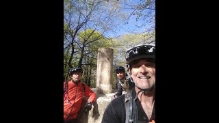
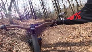
Photos of Legutiano Mountain Bike
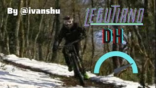
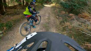
Videos of Legutiano Mountain Bike

trail: Golfa ⛳️
0:02 |
265 |
Oct 29, 2023
trail: Simas
13:13 |
115 |
May 24, 2025 , Legutiano
trail: Legutio Flow -Beheko Zatia
2:33 |
269 |
Jan 6, 2023 , Legutiano
trail: Legutio Flow - Goiko Zatia
2:13 |
226 |
Jan 1, 2023 , Legutiano
trail: La Casita
26:26 |
303 |
Oct 29, 2021 , Legutiano
Recent Trail Reports
| status | trail | date | condition | info | user |
|---|---|---|---|---|---|
| La Casita | Jun 20, 2026 @ 9:51am (Europe/Madrid) Jun 20, 2026 | Ideal | krasty1002 TMD | ||
| Txabolo | Jun 20, 2026 @ 9:51am (Europe/Madrid) Jun 20, 2026 | Dry | krasty1002 TMD | ||
| Golfa ⛳️ | Jun 20, 2026 @ 9:51am (Europe/Madrid) Jun 20, 2026 | Dry | krasty1002 TMD | ||
| Simas | Jun 20, 2026 @ 9:51am (Europe/Madrid) Jun 20, 2026 | Ideal | krasty1002 TMD | ||
| Legutio Flow -Beheko Zatia | Jun 20, 2026 @ 9:51am (Europe/Madrid) Jun 20, 2026 | Dry | krasty1002 TMD | ||
| Legutio Flow - Goiko Zatia | Jun 20, 2026 @ 9:51am (Europe/Madrid) Jun 20, 2026 | Dry | krasty1002 TMD | ||
| Enlace Tantaidui Erreka - GR282 | Jun 20, 2026 @ 9:51am (Europe/Madrid) Jun 20, 2026 | Dry | krasty1002 TMD | ||
| Albertia - Tantaidui Erreka | Jun 20, 2026 @ 9:51am (Europe/Madrid) Jun 20, 2026 | Dry | krasty1002 TMD | ||
| Acceso Cima Albertia | Jun 20, 2026 @ 9:51am (Europe/Madrid) Jun 20, 2026 | Ideal | krasty1002 TMD | ||
| Albertia | Jun 20, 2026 @ 9:51am (Europe/Madrid) Jun 20, 2026 | Ideal | krasty1002 TMD |
Activity Feed
| username | action | type | title | date |
|---|---|---|---|---|
| krasty1002 | add | report | activity #97544749 and 9 more | Jun 21, 2026 @ 11:09pm 3 days |
| zigor-ark | add | report | activity #97022985 and 7 more | Jun 14, 2026 @ 9:58pm Jun 14, 2026 |
| northernbraaap | vote | trail | activity #96405606 and 4 more | Jun 6, 2026 @ 2:15pm Jun 6, 2026 |
| northernbraaap | add | report | activity #96405547 and 6 more | Jun 6, 2026 @ 2:14pm Jun 6, 2026 |
| Arroiabe | add | report | activity #96170553 and 1 more | Jun 3, 2026 @ 11:38am Jun 3, 2026 |
Recent Comments
| username | type | title | comment | date |
|---|---|---|---|---|
| report | 🙏🙏 | Apr 27, 2026 @ 2:49pm Apr 27, 2026 | ||
| trail | Nuevo tramo en la parte de arriba | Apr 17, 2026 @ 2:28am Apr 17, 2026 | ||
| trail | Roja por unos toboganes bastante pendientes,... | Aug 17, 2025 @ 6:10am Aug 17, 2025 | ||
| trail | flow y pedaleo, muy buena . Para todos los... | Aug 17, 2025 @ 6:08am Aug 17, 2025 | ||
| trail | Top, una gozadera | Aug 17, 2025 @ 6:06am Aug 17, 2025 |
Local Badges
-

Completionist0 awarded -

Epic Mountain Bike Climb 2k2 awarded -

Climbing 10k Badge3 awarded -

Mountain Biking 100k Badge0 awarded -

Epic Ride Descent 2k2 awarded -

Descent 10k Badge3 awarded
Activity Type Stats
| activitytype | trails | distance | descent | descent distance | total vertical | rating | global rank | state rank | photos | reports | routes | ridelogs |
|---|---|---|---|---|---|---|---|---|---|---|---|---|
| Mountain Bike | 45 | 28 miles | 7,904 ft | 17 miles | 1,096 ft | #5,016 | #297 | 96 | 699 | 2 | 722 | |
| E-Bike | 44 | 28 miles | 7,772 ft | 17 miles | 1,096 ft | #826 | #203 | 697 | 292 | |||
| Gravel Bike | 1 | #4,753 | #199 | 2 | 12 | |||||||
| Horse | 1 | 2 | ||||||||||
| Hike | 40 | 28 miles | 7,904 ft | 17 miles | 1,096 ft | #1,685 | #179 | 696 | 24 | |||
| Trail Running | 40 | 28 miles | 7,904 ft | 17 miles | 1,096 ft | #5,814 | #373 | 696 | 7 |
Frequently Asked Questions About Legutiano
▼
What are the best places to ride in Legutiano?
Legutiano has 1 areas to explore for mountain biking. The top rated areas are:
▼
What are the highest rated mountain biking trails in Legutiano?
The highest rated mountain biking trails in Legutiano are:
- Legor (4.6/5)
- Legutio Flow -Beheko Zatia (4.4/5)
- Simas (4.4/5)
- Acceso Cima Albertia (4.4/5)
- Lapiaz (4.2/5)
▼
What is the best time of the year to ride in Legutiano?
Based on ride log data, the most popular months to ride in Legutiano are:
- May (6 activities)
- June (4 activities)
- December (4 activities)
▼
Where can I park to ride in Legutiano?
Activities
Trails
Points of Interest
- By Matejas
 & contributors
 - Admins: Altavoz, krasty1002, Altavoz, krasty1002
- #37208 - 1,065 views
- legutiano activity log | embed map of Legutiano mountain bike trails | legutiano mountain biking points of interest
Downloading of trail gps tracks in kml & gpx formats is enabled for Legutiano.
You must login to download files.