close
-
Layers w
- Weather Layers
- Pro
- Pro
- Pro
- Pro
- Pro
- Pro
- More Layers
- Pro
- Pro
- Pro
- Pro
-
Upgrade to

3D
Trail Conditions
- Unknown
- Snow Groomed
- Snow Packed
- Snow Covered
- Snow Cover Partial
- Freeze/thaw Cycle
- Icy
- Prevalent Mud
- Wet
- Variable
- Ideal
- Dry
- Very Dry
Trail Flow (Ridden Direction)
Trailforks scans users ridelogs to determine the most popular direction each trail is ridden. A good flowing trail network will have most trails flowing in a single direction according to their intension.
The colour categories are based on what percentage of riders are riding a trail in its intended direction.
The colour categories are based on what percentage of riders are riding a trail in its intended direction.
- > 96%
- > 90%
- > 80%
- > 70%
- > 50%
- < 50%
- bi-directional trail
- no data
Trail Last Ridden
Trailforks scans ridelogs to determine the last time a trail was ridden.
- < 2 days
- < 1 week
- < 2 weeks
- < 1 month
- < 6 months
- > 6 months
Trail Ridden Direction
The intended direction a trail should be ridden.
- Downhill Only
- Downhill Primary
- Both Directions
- Uphill Primary
- Uphill Only
- One Direction
Contribute Details
Colors indicate trail is missing specified detail.
- Description
- Photos
- Description & Photos
- Videos
Trail Popularity ?
Trailforks scans ridelogs to determine which trails are ridden the most in the last 9 months.
Trails are compared with nearby trails in the same city region with a possible 25 colour shades.
Think of this as a heatmap, more rides = more kinetic energy = warmer colors.
- most popular
- popular
- less popular
- not popular
ATV/ORV/OHV Filter
Max Vehicle Width
inches
US Cell Coverage
Legend

Radar Time
Activity Recordings
Trailforks uses anonymized public activity data.
?
Activity Recordings
Trailforks uses anonymized public activity data.
?
Personal Heatmap
▶
Activity Types
all
/
none
▶
Options
2
Date range
month
–
Winter Trails
Warning
A routing network for winter maps does not exist. Selecting trails using the winter trails layer has been disabled.
Missing Trails
Most Popular
Least Popular
Trails are colored based on popularity. The more popular a trail is, the more red. Less popular trails trend towards green.
Jump Magnitude Heatmap
Heatmap of where riders jump on trails. Zoom in to see individual jumps, click circles to view jump details.
BC Backroad Status
![map legend]()
Service Road Atlas is a free to use, community-driven service for viewing and creating reports on the numerous back-country service roads around B.C. and Alberta.

Slope Aspect
Direction the slope faces
Trails Deemphasized
Trails are shown in grey.
Only show trails with no bike usage.
Suggested Layers
Based on selected activity type
Save the current map location and zoom level as your default home location whenever this page is loaded.
SaveLeiza (en euskera y de forma oficial Leitza) es una villa y municipio español de la Comunidad Foral de Navarra, situado en la merindad de Pamplona, en la comarca Norte de Aralar, en el valle de Leizarán y a 47 km de la capital de la comunidad, Pamplona.
Primary Trail Type: All-Mountain & Downhill
eBikes Allowed:
Yes
This region uses the Uk/Euro style trail grading system.
Region Supporters & Maintainers
![]()
Leitza MTBMaintainer
Activities Click to view
- Mountain Bike
70 trails
- E-Bike
71 trails
- Horse
26 trails
- Hike
72 trails
- Trail Running
72 trails
- Dirtbike/Moto
5 trails
Region Details
- 33
- 1
- 20
- 5
- 2
Region Status
Caution as of Jun 14, 2026Local Trail Association
Stats
- Avg Trail Rating
- Trails (view details)
- 62
- Trails Mountain Bike
- 71
- Trails E-Bike
- 71
- Trails Gravel Bike
- 1
- Trails Horse
- 26
- Trails Hike
- 72
- Trails Trail Running
- 72
- Trails Dirtbike/Moto
- 5
- Total Distance
- 82 miles
- Total Descent Distance
- 38 miles
- Total Descent
- 22,719 ft
- Total Vertical
- 2,531 ft
- Highest Trailhead
- 3,475 ft
- Reports
- 296
- Photos
- 149
- Ridden Counter
- 1,179
Popular Leitza Mountain Biking Trails
• 85 ★ 4.1 • 1 mile • 0 ft • 52 •
Sendero de bajada técnico y muy completo, con zonas empinadas, saltos, cortados, rock gardens, curvas...no se aconseja hacerla en mojado, puede ser peligroso.
• 95 ★ 4.4 • 2,864 ft • 0 ft • 51 •
Sendero entre hayedo y pinar, con toboganes y algún salto.
• 95 ★ 3.3 • 3,763 ft • 11 ft • 46 •
Sendero que comienza desde el eólico 10. Estilo natural, con flow. La senda empieza justo al lado de un molino
• 90 ★ 4.9 • 1 mile • 6 ft • 41 •
Sendero de bajada divertido, con muchas curvas, drops, etc.
• 90 ★ 3.0 • 1,368 ft • 88 ft • 38 •
Popular blue difficulty singletrack. This multi-use trail can be used both directions.
Leitza Mountain Bike Routes
★ 4.8 • 16 miles • 3,831 ft • 10 • Loop •
Ruta de viernes tarde, en una asombrosamente calurosa tarde de abril en la que decido visitar la zona de...
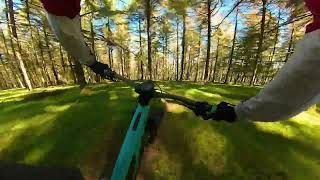
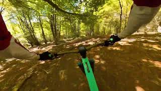
Photos of Leitza Mountain Bike
Videos of Leitza Mountain Bike
trail: Kordaun
8:20 |
68 |
Oct 25, 2025 , Lekunberri
trail: Patxin-Patxan
4:11 |
57 |
Oct 25, 2025 , Lekunberri
Recent Trail Reports
| status | trail | date | condition | info | user |
|---|---|---|---|---|---|
| Guratz | Jun 15, 2026 @ 8:04am (Europe/Madrid) Jun 14, 2026 | Ideal | jeremias77 | ||
| Txoribaso | Jun 7, 2026 @ 4:50pm (Europe/Madrid) Jun 7, 2026 | Unknown | ezpal81 | ||
| Eolik10 | Jun 5, 2026 @ 6:08am (Europe/Madrid) Jun 4, 2026 | Unknown | ezpal81 | ||
| Patxin-Patxan | Jun 5, 2026 @ 6:08am (Europe/Madrid) Jun 4, 2026 | Unknown | ezpal81 | ||
| Txatxi-Piruli | Jun 1, 2026 @ 3:13pm (Europe/Madrid) Jun 1, 2026 | Ideal | josemp | ||
| Galtxagorri | May 30, 2026 @ 9:38am (Europe/Andorra) May 30, 2026 | Ideal | efefunk | ||
| Fast And Purius | May 30, 2026 @ 9:38am (Europe/Andorra) May 30, 2026 | Ideal | efefunk | ||
| Sugandille | May 30, 2026 @ 9:38am (Europe/Andorra) May 30, 2026 | Ideal | efefunk | ||
| Barraskillo Up | May 30, 2026 @ 9:38am (Europe/Andorra) May 30, 2026 | Ideal | efefunk | ||
| Leitza Eolikok | May 30, 2026 @ 9:38am (Europe/Andorra) May 30, 2026 | Ideal | efefunk |
Activity Feed
| username | action | type | title | date |
|---|---|---|---|---|
| JOSEBAkLdeEi | ridden | trail | activity #97110083 and 2 more | Jun 16, 2026 @ 7:50am 3 days |
| jeremias77 | add | report | activity #97024509 | Jun 14, 2026 @ 11:07pm Jun 14, 2026 |
| apeze58 | ridden | trail | activity #96798099 | Jun 12, 2026 @ 6:04am Jun 12, 2026 |
| IBE1985 | update | event | activity #96527794 | Jun 8, 2026 @ 2:56am Jun 8, 2026 |
| ezpal81 | add | report | activity #96460434 | Jun 7, 2026 @ 7:50am Jun 7, 2026 |
Recent Comments
| username | type | title | comment | date |
|---|---|---|---|---|
| trail | Arbol caido en mitad de la senda, visible pero ojo | Apr 8, 2026 @ 12:17am Apr 8, 2026 | ||
| report | Kordaun ideal estaba😂 | Sep 22, 2025 @ 12:29pm Sep 22, 2025 | ||
| report | Pasarela arreglada!!! | Sep 7, 2025 @ 2:19pm Sep 7, 2025 | ||
| report | El comienzo es lo mas técnico del tramo con... | Aug 6, 2025 @ 4:26am Aug 6, 2025 | ||
| report | A vosotros por el mantenimiento!. La he gozado. | Jun 29, 2025 @ 1:35pm Jun 29, 2025 |
Nearby Areas
| name | distance | ||||
|---|---|---|---|---|---|
| Berastegi | 1 | 6 | 3.3 km | ||
| Lekunberri-Larraun | 2 | 19 | 4.1 km | ||
| Araitz-Betelu | 3 | 5 km | |||
| Artikutza | 5.4 km | ||||
| Goizueta | 2 | 11 | 6.1 km |
Local Badges
-

Completionist0 awarded
Bike & Skill Parks
| name | type | city | rating |
|---|---|---|---|
| Pumptrack Leitza | skill park | Lekunberri |
Upcoming Local Events
Activity Type Stats
| activitytype | trails | distance | descent | descent distance | total vertical | rating | global rank | state rank | photos | reports | routes | ridelogs |
|---|---|---|---|---|---|---|---|---|---|---|---|---|
| Mountain Bike | 70 | 81 miles | 22,323 ft | 38 miles | 2,530 ft | #2,773 | #215 | 158 | 296 | 1 | 470 | |
| E-Bike | 71 | 81 miles | 22,323 ft | 38 miles | 2,530 ft | #1,644 | #357 | 295 | 1 | 128 | ||
| Gravel Bike | 1 | 2 | ||||||||||
| Horse | 26 | 18 miles | 5,000 ft | 9 miles | 2,218 ft | #1,075 | #74 | 36 | ||||
| Hike | 72 | 82 miles | 22,720 ft | 38 miles | 2,530 ft | #2,470 | #279 | 296 | 2 | 16 | ||
| Trail Running | 72 | 82 miles | 22,720 ft | 38 miles | 2,530 ft | #1,790 | #248 | 295 | 11 | |||
| Dirtbike/Moto | 5 | 4 miles | 1,496 ft | 3 miles | 1,870 ft | #444 | #21 | 5 |
Frequently Asked Questions About Leitza
▼
What are the highest rated mountain biking trails in Leitza?
The highest rated mountain biking trails in Leitza are:
- Galtxagorri (4.5/5)
- Patxin-Patxan (4.3/5)
- Sugandille (4.2/5)
- Txikipestrail (4.1/5)
- Txatxi-Piruli (4.1/5)
▼
Where can I park to ride in Leitza?
Check the Leitza trail map for trailhead and parking information. Community members regularly update access and parking details for trails in the area.
▼
What is the longest trail in Leitza?
The longest trail in Leitza is Asketa at 3.7 miles. View all trails sorted by distance.
▼
What are the best & highest rated hiking trails in Leitza?
The best hiking trails in Leitza are: View all hiking trails sorted by popularity score.
Activities
Trails
Points of Interest
- leitza activity log | embed map of Leitza mountain bike trails | leitza mountain biking points of interest
Downloading of trail gps tracks in kml & gpx formats is enabled for Leitza.
You must login to download files.