close
-
Layers w
- Weather Layers
- Pro
- Pro
- Pro
- Pro
- Pro
- Pro
- More Layers
- Pro
- Pro
- Pro
- Pro
-
Upgrade to

3D
Trail Conditions
- Unknown
- Snow Groomed
- Snow Packed
- Snow Covered
- Snow Cover Partial
- Freeze/thaw Cycle
- Icy
- Prevalent Mud
- Wet
- Variable
- Ideal
- Dry
- Very Dry
Trail Flow (Ridden Direction)
Trailforks scans users ridelogs to determine the most popular direction each trail is ridden. A good flowing trail network will have most trails flowing in a single direction according to their intension.
The colour categories are based on what percentage of riders are riding a trail in its intended direction.
The colour categories are based on what percentage of riders are riding a trail in its intended direction.
- > 96%
- > 90%
- > 80%
- > 70%
- > 50%
- < 50%
- bi-directional trail
- no data
Trail Last Ridden
Trailforks scans ridelogs to determine the last time a trail was ridden.
- < 2 days
- < 1 week
- < 2 weeks
- < 1 month
- < 6 months
- > 6 months
Trail Ridden Direction
The intended direction a trail should be ridden.
- Downhill Only
- Downhill Primary
- Both Directions
- Uphill Primary
- Uphill Only
- One Direction
Contribute Details
Colors indicate trail is missing specified detail.
- Description
- Photos
- Description & Photos
- Videos
Trail Popularity ?
Trailforks scans ridelogs to determine which trails are ridden the most in the last 9 months.
Trails are compared with nearby trails in the same city region with a possible 25 colour shades.
Think of this as a heatmap, more rides = more kinetic energy = warmer colors.
- most popular
- popular
- less popular
- not popular
ATV/ORV/OHV Filter
Max Vehicle Width
inches
US Cell Coverage
Legend

Radar Time
Activity Recordings
Trailforks uses anonymized public activity data.
?
Activity Recordings
Trailforks uses anonymized public activity data.
?
Personal Heatmap
▶
Activity Types
all
/
none
▶
Options
2
Date range
month
–
Winter Trails
Warning
A routing network for winter maps does not exist. Selecting trails using the winter trails layer has been disabled.
Missing Trails
Most Popular
Least Popular
Trails are colored based on popularity. The more popular a trail is, the more red. Less popular trails trend towards green.
Jump Magnitude Heatmap
Heatmap of where riders jump on trails. Zoom in to see individual jumps, click circles to view jump details.
BC Backroad Status
![map legend]()
Service Road Atlas is a free to use, community-driven service for viewing and creating reports on the numerous back-country service roads around B.C. and Alberta.

Slope Aspect
Direction the slope faces
Trails Deemphasized
Trails are shown in grey.
Only show trails with no bike usage.
Suggested Layers
Based on selected activity type
Save the current map location and zoom level as your default home location whenever this page is loaded.
Save
No description for Lekunberri has been added yet!
Login or register to submit one.
This region uses the Uk/Euro style trail grading system.
Activities Click to view
- Mountain Bike
586 trails
- E-Bike
583 trails
- Gravel Bike
2 trails
- Adaptive Bike
0 trails
- Horse
56 trails
- Hike
594 trails
- Trail Running
593 trails
- Dirtbike/Moto
18 trails
Region Details
- 289
- 29
- 102
- 29
- 4
Region Status
Open as of Jun 21, 2026Local Trail Association
Stats
- Avg Trail Rating
- Trails (view details)
- 458
- Trails Mountain Bike
- 590
- Trails E-Bike
- 583
- Trails Gravel Bike
- 2
- Trails Horse
- 56
- Trails Hike
- 595
- Trails Trail Running
- 593
- Trails Dirtbike/Moto
- 18
- Trails ATV/ORV/OHV
- 1
- Total Distance
- 477 miles
- Total Descent Distance
- 207 miles
- Total Descent
- 107,083 ft
- Total Vertical
- 4,182 ft
- Highest Trailhead
- 4,647 ft
- Reports
- 5,654
- Photos
- 3,041
- Ridden Counter
- 25,519
Sub Regions
-
Araitz-Betelu
- 3
-
Basaburua
- 21
- 49
- 26
- 13
-
Goizueta
- 2
- 11
- 1
- 1
-
Leitza
- 1
- 20
- 5
- 2
-
Lekunberri-Larraun
- 2
- 19
- 5
- 1
-
Sierra de Aralar
- 15
- 11
- 2
Popular Lekunberri Mountain Biking Trails
• 100 ★ 4.8 • 1 mile • 76 ft • 333 •
en el bosque, en el que tendremos que buscar bien todas las inercias para ganar velocidad. Sendero muy variado, divertido y físico, que nos dejará cerca del pueblo de (Basaburua).
• 100 ★ 4.7 • 1 mile • 499 ft • 266 •
Sendero de subida que nos llevará por un maravilloso entorno a través de un trazado serpenteante.
• 100 ★ 5.0 • 1 mile • 4 ft • 252 •
Sendero "Sorginak". Las sacerdotisas de la religión vasca eran similares a los druidas celtas, y eran las responsables de los espacios de culto y ceremonias. Eran responsables de recolectar hierbas y frutas silvestres para curar a las...
• 100 ★ 4.9 • 922 ft • 0 ft • 246 •
en el bosque, en el que tendremos que buscar bien todas las inercias para ganar velocidad. Sendero muy variado, divertido y físico, que nos dejará cerca del pueblo de (Basaburua).
• 100 ★ 5.0 • 1,811 ft • 0 ft • 243 •
Zona baja del sendero "Sorginak". Un trazado muy rápido aprovechando un sendero antiguo, pero con el toque de magia de Basaburua MTB. La entrada es vertical, pero un maravilloso wallride nos acogerá en sus brazos para llevarnos de...
• 100 ★ 4.9 • 4,892 ft • 2 ft • 222 •
, en un majestuoso hayedo, por el que nos divertiremos durante el primer tercio de la bajada a través de enlazar divertidas curvas peraltadas. Saldremos del bosque y se hará la luz, atravesando un helechal que nos llevará al segundo...
• 95 ★ 4.4 • 2,051 ft • 53 ft • 197 •
Nuevo tramo de la vía verde del Plazaola, como alternativa del túnel Bartolo. Bastante más directo y menos exigente que el .
Lekunberri Mountain Bike Routes
★ 4.8 • 16 miles • 3,831 ft • 10 • Loop •
Ruta de viernes tarde, en una asombrosamente calurosa tarde de abril en la que decido visitar la zona de...
★ 5.0 • 17 miles • 4,490 ft • 20 • Loop •
El punto de salida son las escuelas de , un lugar perfecto, donde no solo tenemos lugar de aparcamiento...
★ 5.0 • 10 miles • 2,420 ft • 11 • Loop •
de , , que une las últimas novedades de . Podremos comenzar la ruta tanto desde el pueblo de Beruete,...
★ 5.0 • 4 miles • 307 ft • 8 • Loop •
Ruta de , ideal para los primeros pasos en la bicicleta de montaña, a través de senderos de iniciación,...
★ 4.0 • 12 miles • 2,718 ft • 9 • Loop •
de , , que une varias bajadas divertidas en bucle, cuidadas con mucho mimo y cariño para que siempre...
★ 4.5 • 11 miles • 3,432 ft • 11 • Loop •
de , , que une tres buenos y variados senderos de bajada. Comenzando desde , no habrá tiempo para...
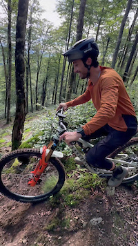
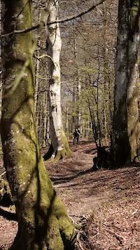
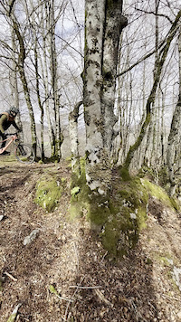
Photos of Lekunberri Mountain Bike
Videos of Lekunberri Mountain Bike
Current Trail Warnings
| status | trail | date | condition | user | info |
|---|---|---|---|---|---|
| Acceso Lur | Jun 18, 2026 @ 3:59pm (Europe/Andorra) Jun 18, 2026 | Dry | krasty1002 TMD | ||
| Traganarru | Jun 10, 2026 @ 8:38pm (Europe/Madrid) Jun 10, 2026 | Unknown | ikerX7UYQt | están retirando leña, última tramo... | |
| MDL | Jun 3, 2026 @ 8:08am (Europe/Madrid) Jun 2, 2026 | Variable | ipartrails TFSPAIN | Cerrada. Hay un haya caído que bloquea... |
Recent Trail Reports
| status | trail | date | condition | info | user |
|---|---|---|---|---|---|
| Enlace Escuela | Jun 20, 2026 @ 11:26pm (Pacific/Midway) Jun 21, 2026 | Dry | zigor-ark | ||
| Lauburu | Jun 20, 2026 @ 11:26pm (Pacific/Midway) Jun 21, 2026 | Dry | zigor-ark | ||
| Lauburu Sarrera | Jun 20, 2026 @ 11:26pm (Pacific/Midway) Jun 21, 2026 | Very Dry | zigor-ark | ||
| Enlace Lauburu | Jun 20, 2026 @ 11:26pm (Pacific/Midway) Jun 21, 2026 | Dry | zigor-ark | ||
| Antsoneko Borda | Jun 20, 2026 @ 11:26pm (Pacific/Midway) Jun 21, 2026 | Dry | zigor-ark | ||
| Baxurde | Jun 20, 2026 @ 11:26pm (Pacific/Midway) Jun 21, 2026 | Dry | zigor-ark | ||
| NagiNi | Jun 20, 2026 @ 11:26pm (Pacific/Midway) Jun 21, 2026 | Dry | zigor-ark | ||
| Arrarats Bordak | Jun 20, 2026 @ 11:26pm (Pacific/Midway) Jun 21, 2026 | Dry | zigor-ark | ||
| Sorginak Zona Baja | Jun 20, 2026 @ 11:26pm (Pacific/Midway) Jun 21, 2026 | Very Dry | zigor-ark | ||
| Sorginak Zona Alta | Jun 20, 2026 @ 11:26pm (Pacific/Midway) Jun 21, 2026 | Very Dry | zigor-ark |
Activity Feed
| username | action | type | title | date |
|---|---|---|---|---|
| DiegoMp2LBX | wishlist | route | activity #97705020 | Jun 24, 2026 @ 9:47am 13 hours |
| juanjocovert | ridden | trail | activity #97680495 | Jun 24, 2026 @ 12:47am 22 hours |
| AlbertoaIhZrx | wishlist | region | activity #97576169 | Jun 22, 2026 @ 11:45am 2 days |
| ipartrails | update | directory | activity #97562568 | Jun 22, 2026 @ 8:09am 3 days |
| zigor-ark | add | report | activity #97542833 and 25 more | Jun 21, 2026 @ 9:58pm Jun 21, 2026 |
Recent Comments
| username | type | title | comment | date |
|---|---|---|---|---|
| trail | Espectacular, mucho, mucho flow, saltos, zonas... | Jun 19, 2026 @ 12:35am Jun 19, 2026 | ||
| trail | Je confirme, ce trail est ultra technique. Une... | Jun 16, 2026 @ 11:11am Jun 16, 2026 | ||
| trail | Doy fe de la reseña anterior. Me he metido en... | May 23, 2026 @ 7:02am May 23, 2026 | ||
| trail | Sendero sencillo hasta la borda. A... | Apr 15, 2026 @ 8:33am Apr 15, 2026 | ||
| trail | Bajada bonita pero muy sucia | Apr 8, 2026 @ 12:19am Apr 8, 2026 |
Local Badges
-

Akerbeltz19 awarded -
Basaburua Salvaje1 awarded -
Señor de las Montañas en Basaburua39 awarded -

Epic Ride 50k308 awarded -

Top 10 Trails0 awarded -

Big Ride 30k745 awarded
Bike & Skill Parks
| name | type | city | rating |
|---|---|---|---|
| Basati Park | skill park | Lekunberri | |
| Hirumuga Park | skill park | Lekunberri | |
| Pumptrack Leitza | skill park | Lekunberri |
Upcoming Local Events
Activity Type Stats
| activitytype | trails | distance | descent | descent distance | total vertical | rating | global rank | state rank | photos | reports | routes | ridelogs |
|---|---|---|---|---|---|---|---|---|---|---|---|---|
| Mountain Bike | 586 | 472 miles | 104,334 ft | 205 miles | 3,862 ft | #297 | #40 | 3,006 | 5,654 | 15 | 4,003 | |
| E-Bike | 583 | 465 miles | 99,124 ft | 199 miles | 3,862 ft | #78 | #47 | 10 | 6,139 | 15 | 1,364 | |
| Gravel Bike | 2 | #248 | #60 | 121 | 3 | 77 | ||||||
| Horse | 56 | 42 miles | 8,924 ft | 19 miles | 3,031 ft | #664 | #34 | 165 | ||||
| Hike | 594 | 477 miles | 106,860 ft | 207 miles | 4,183 ft | #139 | #35 | 22 | 6,130 | 26 | 315 | |
| Trail Running | 593 | 475 miles | 104,826 ft | 206 miles | 4,183 ft | #124 | #37 | 6,135 | 1 | 96 | ||
| Dirtbike/Moto | 18 | 19 miles | 4,777 ft | 9 miles | 2,871 ft | #378 | #15 | 131 | ||||
| ATV/ORV/OHV | 1 | 2 miles | 56 ft | 1,673 ft | 663 ft | 128 |
Frequently Asked Questions About Lekunberri
▼
What are the best places to ride in Lekunberri?
Lekunberri has 6 areas to explore for mountain biking. The top rated areas are:
▼
What are the highest rated mountain biking trails in Lekunberri?
The highest rated mountain biking trails in Lekunberri are:
- Sorginak Zona Alta (4.8/5)
- Sorginak Zona Baja (4.8/5)
- Iratxo (4.7/5)
- Lauburu (4.7/5)
- Lauburu Sarrera (4.6/5)
▼
What is the best time of the year to ride in Lekunberri?
Based on ride log data, the most popular months to ride in Lekunberri are:
- October (28 activities)
- May (24 activities)
- July (24 activities)
▼
Where can I park to ride in Lekunberri?
There are 11 parking locations listed in Lekunberri. The most popular parking spots are: View all parking and trailhead locations on the map to plan your visit.
Activities
Trails
Points of Interest
- Peruskenea Lodge
- Road Gap TTF
- Laberinto Mitológico Viewpoint
- Cima Beigañe Summit
- San Miguel de Aralar 1218m. Summit
- Nacedero del Larráun (Manantial de Aitzarraleta) Other
- Manantial de Basakaitz Other
- Rock Garden TTF
- Pasarela TTF
- Herio´s Gap TTF
- Intzako Dorrea (4,652 ft)
- Beldarregi (4,567 ft)
- Aldaon (4,557 ft)
- By IMBAEuskadi
 & contributors
 - Admins: Angelreing, raullopezch, ipartrails
- #40520 - 6,190 views
- lekunberri activity log | embed map of Lekunberri mountain bike trails | lekunberri mountain biking points of interest polygons
Downloading of trail gps tracks in kml & gpx formats is enabled for Lekunberri.
You must login to download files.