close
-
Layers w
- Weather Layers
- Pro
- Pro
- Pro
- Pro
- Pro
- Pro
- More Layers
- Pro
- Pro
- Pro
- Pro
-
Upgrade to

3D
Trail Conditions
- Unknown
- Snow Groomed
- Snow Packed
- Snow Covered
- Snow Cover Partial
- Freeze/thaw Cycle
- Icy
- Prevalent Mud
- Wet
- Variable
- Ideal
- Dry
- Very Dry
Trail Flow (Ridden Direction)
Trailforks scans users ridelogs to determine the most popular direction each trail is ridden. A good flowing trail network will have most trails flowing in a single direction according to their intension.
The colour categories are based on what percentage of riders are riding a trail in its intended direction.
The colour categories are based on what percentage of riders are riding a trail in its intended direction.
- > 96%
- > 90%
- > 80%
- > 70%
- > 50%
- < 50%
- bi-directional trail
- no data
Trail Last Ridden
Trailforks scans ridelogs to determine the last time a trail was ridden.
- < 2 days
- < 1 week
- < 2 weeks
- < 1 month
- < 6 months
- > 6 months
Trail Ridden Direction
The intended direction a trail should be ridden.
- Downhill Only
- Downhill Primary
- Both Directions
- Uphill Primary
- Uphill Only
- One Direction
Contribute Details
Colors indicate trail is missing specified detail.
- Description
- Photos
- Description & Photos
- Videos
Trail Popularity ?
Trailforks scans ridelogs to determine which trails are ridden the most in the last 9 months.
Trails are compared with nearby trails in the same city region with a possible 25 colour shades.
Think of this as a heatmap, more rides = more kinetic energy = warmer colors.
- most popular
- popular
- less popular
- not popular
ATV/ORV/OHV Filter
Max Vehicle Width
inches
US Cell Coverage
Legend

Radar Time
Activity Recordings
Trailforks uses anonymized public activity data.
?
Activity Recordings
Trailforks uses anonymized public activity data.
?
Personal Heatmap
▶
Activity Types
all
/
none
▶
Options
2
Date range
month
–
Winter Trails
Warning
A routing network for winter maps does not exist. Selecting trails using the winter trails layer has been disabled.
Missing Trails
Most Popular
Least Popular
Trails are colored based on popularity. The more popular a trail is, the more red. Less popular trails trend towards green.
Jump Magnitude Heatmap
Heatmap of where riders jump on trails. Zoom in to see individual jumps, click circles to view jump details.
BC Backroad Status
![map legend]()
Service Road Atlas is a free to use, community-driven service for viewing and creating reports on the numerous back-country service roads around B.C. and Alberta.

Slope Aspect
Direction the slope faces
Trails Deemphasized
Trails are shown in grey.
Only show trails with no bike usage.
Suggested Layers
Based on selected activity type
Save the current map location and zoom level as your default home location whenever this page is loaded.
Save
No description for Lemhi County has been added yet!
Login or register to submit one.
Links
Activities Click to view
- Mountain Bike
655 trails
- E-Bike
194 trails
- Horse
267 trails
- Hike
713 trails
- Trail Running
705 trails
- Dirtbike/Moto
180 trails
- Observed Trials
1 trails
- ATV/ORV/OHV
108 trails
- Snowmobile
49 trails
- Snowshoe
68 trails
- Downhill Ski
1 trails
- Backcountry Ski
63 trails
- Nordic Ski
16 trails
Stats
- Avg Trail Rating
- Trails (view details)
- 693
- Trails Mountain Bike
- 687
- Trails E-Bike
- 194
- Trails Gravel Bike
- 2
- Trails Adaptive Bike
- 1
- Trails Winter Fat Bike
- 1
- Trails Horse
- 267
- Trails Hike
- 714
- Trails Trail Running
- 705
- Trails Dirtbike/Moto
- 180
- Trails Observed Trials
- 1
- Trails ATV/ORV/OHV
- 108
- Trails Snowmobile
- 49
- Trails Snowshoe
- 68
- Trails Downhill Ski
- 1
- Trails Backcountry Ski
- 64
- Trails Nordic Ski
- 16
- Total Distance
- 1,613 miles
- Total Descent
- 367,874 ft
- Total Vertical
- 7,087 ft
- Highest Trailhead
- 10,283 ft
- Reports
- 3,992
- Photos
- 1,711
- Ridden Counter
- 8,537
Sub Regions
- Leadore (118)
- CDT - Bannock Pass (38)
- Lemhi Mountains (60)
- North Fork (145)
- CDT - North Beaverheads (30)
- Panther Creek/Down River (16)
- State Line - Divide (42)
- Wagonhammer (50)
- Salmon (390)
- Barracks Lane - Mulkey Creek (32)
- Discovery Hill (69)
- Iron Creek/Hat Creek (57)
- Lemhi Badlands (44)
- Stormy Peak (18)
- Twelvemile (38)
- Williams Creek (83)
- Tendoy (10)
- Upper Birch Creek (12)
Popular Lemhi County Mountain Biking Trails
• 100 ★ 3.5 • 3 miles • 372 ft • 492 •
Singletrack from the Disco Hill Trailhead to the main trail junction with and the beginning of at Trail Marker #3. This is where most rides at Disco Hill begin. The trail is well traveled and relatively gentle for the first mile, then...
• 100 ★ 4.4 • 2 miles • 0 ft • 172 •
This trail follows a broad ridge for a fun cross country descent into with a few moments of great flowy fun, or a stout climb from the bottom of to the cow trough at the top. For those that want to avoid the short, steep section in the...
• 100 ★ 4.4 • 1 mile • 198 ft • 166 •
Nice singletrack climb and descent over a broad ridge providing a fun alternative to access the inner trails of Disco Hill. Great fun in both directions. New section of singletrack built April 2023 to eliminate the 300-foot section of...
• 100 ★ 4.0 • 1,765 ft • 57 ft • 154 •
This is an important and well-used connector trail between the and , allowing for some classic "Lower Disco" loop routes. Expect mostly gentle terrain with a couple crossings of small drainages.
• 95 ★ 3.0 • 4,682 ft • 125 ft • 147 •
Ridden in either direction, this trail drops into and climbs out of , a drainage that features a good sized stock pond that often has water in the springtime. This trail has a couple spots that are slightly more technical than many of...
• 100 ★ 3.0 • 2 miles • 336 ft • 123 •
This upper section of the features some nice varied terrain and generally smooth cross country riding with just a couple of steeper hills, accessing a hub junction of several trails at the cow trough at the top. From there, ride down to...
• 100 ★ 2.0 • 2 miles • 716 ft • 117 •
Good singletrack from the trail head with sections of rocks on old road bed. Several stream crossings can be expected. There are gates across the trail too, leave them how you found them please.
• 100 ★ 3.0 • 3,921 ft • 30 ft • 117 •
Good singletrack connecting the to BLM121 near the Motocross Park. The trail follows a gentle draw to the north and runs along a cobbly bench to the south.
Lemhi County Mountain Bike Routes
Divide to Twin Creek Featured
★ 4.5 • 17 miles • 2,409 ft • 4 • Shuttled •
Challenging all riders, this heavily wooded, high-elevation route starts near the top of Lost Trail Ski...
CDT - Sheep Creek Featured
13 miles • 1,405 ft • 6 • Point to Point •
The Continental Divide Trail to is a classic Idaho back-country ride. Great single-track mixed w/ scenery...
Yellow Peak Loop Featured
22 miles • 3,371 ft • 4 • Loop •
This remote and scenic loop around Yellow Peak, for advanced riders only, follows Big Timber and s....
Rippey Loop Featured
★ 3.0 • 11 miles • 1,576 ft • 13 •
The Barracks Trail System is about 8 miles Southeast of Salmon, Id. Barracks Trails begin to open up in...
Disco Hill Loops Featured
23 miles • 2,733 ft • 32 •
loops colored to match the arrows on the trail markers posted along the trails and on the trailhead map.
Photos of Lemhi County Mountain Bike
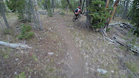
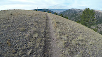
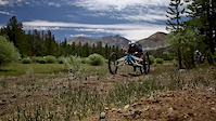
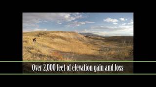
Videos of Lemhi County Mountain Bike
6:23 |
98 |
Oct 4, 2018
6:57 |
50 |
Oct 4, 2018

trail: Mammoth Canyon Trail
2:27 |
1191 |
Sep 19, 2016
trail: Mammoth Canyon Trail
5:50 |
225 |
Jan 30, 2016

trail: China Gulch
3:45 |
514 |
Dec 9, 2018 , North Fork

trail: Powderhouse Gulch (Upper)
850 |
Oct 18, 2017 , Salmon
706 |
Jan 23, 2017

trail: Rippey Canyon
934 |
Nov 20, 2014 , Salmon
Current Trail Warnings
| status | trail | date | condition | user | info |
|---|---|---|---|---|---|
| Hughes Creek (Upper) State Line - Divide | Jun 14, 2026 @ 8:04am (America/Boise) Jun 14, 2026 | Variable | mtdirtjunkie | Trail has at least 200 250 down trees and... | |
| Double R (Upper) Williams Creek | Jun 2, 2026 @ 9:50pm (America/Boise) Jun 2, 2026 | Ideal | wildbillmac simba | Clearing in progress. Cleared all... | |
| South Fork Williams Phoneline Williams Creek | May 31, 2026 @ 6:52pm (America/Boise) May 31, 2026 | Dry | sidehiller1 TRAILFORKS | About 20 trees down mostly in the upper... |
Recent Trail Reports
National Scenic Trails & Official Routes
-
Continental Divide Trail
- Mountain Bike
- Hike
- Trail Running

Activity Feed
| username | action | type | title | date |
|---|---|---|---|---|
| elsquatcho | vote | trail | activity #97270605 | Jun 18, 2026 @ 12:42pm 2 days |
| wildbillmac | update | trail | activity #97260213 and 6 more | Jun 18, 2026 @ 10:09am 2 days |
| wildbillmac | add | report | activity #97255951 | Jun 18, 2026 @ 9:00am 2 days |
| wildbillmac | add | report | activity #97231145 and 1 more | Jun 17, 2026 @ 9:18pm 2 days |
| ccmski | wishlist | route | activity #97212867 | Jun 17, 2026 @ 3:30pm 3 days |
Recent Comments
| username | type | title | comment | date |
|---|---|---|---|---|
| trail | Yes it’s pretty steep, but it’s also... | Jun 14, 2026 @ 2:27pm Jun 14, 2026 | ||
| report | Tell me about it I’m here now, this sucks!... | Jun 14, 2026 @ 2:24pm Jun 14, 2026 | ||
| trail | It is in fact rocky | Oct 11, 2025 @ 9:17pm Oct 11, 2025 | ||
| trail | We were heading north to South, and the steep... | Sep 16, 2025 @ 1:14pm Sep 16, 2025 | ||
| trail | We rode this trail West to East (CDT heading... | Sep 16, 2025 @ 1:09pm Sep 16, 2025 |
Activity Type Stats
| activitytype | trails | distance | descent | descent distance | total vertical | rating | global rank | state rank | photos | reports | routes | ridelogs |
|---|---|---|---|---|---|---|---|---|---|---|---|---|
| Mountain Bike | 655 | 1,514 miles | 349,088 ft | 706 miles | 6,969 ft | 1,602 | 3,953 | 30 | 5,983 | |||
| E-Bike | 194 | 593 miles | 92,753 ft | 225 miles | 6,919 ft | 3,021 | 54 | |||||
| Gravel Bike | 2 | 6 | 3 | |||||||||
| Winter Fat Bike | 1 | 31 | 42 | |||||||||
| Horse | 267 | 709 miles | 152,861 ft | 328 miles | 7,087 ft | 3 | 2,980 | 2 | 3 | |||
| Hike | 713 | 1,573 miles | 360,358 ft | 733 miles | 7,087 ft | 101 | 3,980 | 4 | 1,377 | |||
| Trail Running | 705 | 1,562 miles | 356,611 ft | 728 miles | 7,087 ft | 4 | 3,976 | 4 | 360 | |||
| Dirtbike/Moto | 180 | 493 miles | 90,791 ft | 208 miles | 6,821 ft | 2,584 | 61 | |||||
| Observed Trials | 1 | 9 miles | 249 ft | 2 miles | 2,595 ft | 54 | ||||||
| ATV/ORV/OHV | 108 | 259 miles | 25,653 ft | 89 miles | 6,614 ft | 2,348 | 9 | |||||
| Snowmobile | 49 | 137 miles | 14,760 ft | 53 miles | 5,236 ft | 5 | 67 | 5 | ||||
| Snowshoe | 68 | 112 miles | 15,410 ft | 44 miles | 5,141 ft | 213 | 10 | |||||
| Downhill Ski | 1 | 1,745 ft | 69 ft | 12 | 153 | |||||||
| Backcountry Ski | 63 | 96 miles | 15,564 ft | 43 miles | 5,141 ft | 20 | 216 | 208 | ||||
| Nordic Ski | 16 | 87 miles | 9,852 ft | 30 miles | 5,141 ft | 184 | 245 |
Frequently Asked Questions About Lemhi County
▼
What are the best places to ride in Lemhi County?
Lemhi County has 15 areas to explore for mountain biking. The top rated areas are:
▼
What are the highest rated mountain biking trails in Lemhi County?
The highest rated mountain biking trails in Lemhi County are:
- Thunder Mountain (4.4/5)
- Snowbank (4.4/5)
- Henry Creek (Upper) (4.3/5)
- East Fork Hayden Creek (4.3/5)
- Lower Williams/Perreau (DH) (4.3/5)
▼
What is the best time of the year to ride in Lemhi County?
Based on ride log data, the most popular months to ride in Lemhi County are:
- May (222 activities)
- July (208 activities)
- June (152 activities)
▼
What is the longest trail in Lemhi County?
The longest trail in Lemhi County is Snowbank at 14.5 miles. View all trails sorted by distance.
Activities
- Lemhi County Mountain Biking Trails
- Lemhi County E-Biking Trails
- Lemhi County Horseback Trails
- Lemhi County Hiking Trails
- Lemhi County Trail Running Trails
- Lemhi County Dirtbiking Trails
- Lemhi County ATVing/Offroading Trails
- Lemhi County Snowmobiling Trails
- Lemhi County Snowshoeing Trails
- Lemhi County Backcountry Skiing Trails
- Lemhi County Nordic Skiing Trails
Trails
Points of Interest
- Round de Fir Tree Other
- Woodstick Summit
- Disco Trough Other
- Warm Springs Ranger Cabin
- Comm Site Other
- Agency Creek Campground Camping
- Charcoal Kilns Interpretive Site Sight
- Rock TTF
- Electronic Site Sight
- Old Cabin Remains Sight
- Big Creek Peak (11,283 ft)
- Flatiron Mountain (11,004 ft)
- Lem Peak (10,978 ft)
- By chuktA
 TRAILFORKS NFTA & contributors
 - Admins: chuktA, IdahoEnduroSeries, macgyver96, simba, sidehiller1, WRTC
- #5106 - 6,868 views
- lemhi county activity log | embed map of Lemhi County mountain bike trails | lemhi county mountain biking points of interest
Downloading of trail gps tracks in kml & gpx formats is enabled for Lemhi County.
You must login to download files.