close
-
Layers w
- Weather Layers
- Pro
- Pro
- Pro
- Pro
- Pro
- Pro
- More Layers
- Pro
- Pro
- Pro
- Pro
-
Upgrade to

3D
Trail Conditions
- Unknown
- Snow Groomed
- Snow Packed
- Snow Covered
- Snow Cover Partial
- Freeze/thaw Cycle
- Icy
- Prevalent Mud
- Wet
- Variable
- Ideal
- Dry
- Very Dry
Trail Flow (Ridden Direction)
Trailforks scans users ridelogs to determine the most popular direction each trail is ridden. A good flowing trail network will have most trails flowing in a single direction according to their intension.
The colour categories are based on what percentage of riders are riding a trail in its intended direction.
The colour categories are based on what percentage of riders are riding a trail in its intended direction.
- > 96%
- > 90%
- > 80%
- > 70%
- > 50%
- < 50%
- bi-directional trail
- no data
Trail Last Ridden
Trailforks scans ridelogs to determine the last time a trail was ridden.
- < 2 days
- < 1 week
- < 2 weeks
- < 1 month
- < 6 months
- > 6 months
Trail Ridden Direction
The intended direction a trail should be ridden.
- Downhill Only
- Downhill Primary
- Both Directions
- Uphill Primary
- Uphill Only
- One Direction
Contribute Details
Colors indicate trail is missing specified detail.
- Description
- Photos
- Description & Photos
- Videos
Trail Popularity ?
Trailforks scans ridelogs to determine which trails are ridden the most in the last 9 months.
Trails are compared with nearby trails in the same city region with a possible 25 colour shades.
Think of this as a heatmap, more rides = more kinetic energy = warmer colors.
- most popular
- popular
- less popular
- not popular
ATV/ORV/OHV Filter
Max Vehicle Width
inches
US Cell Coverage
Legend

Radar Time
Activity Recordings
Trailforks uses anonymized public activity data.
?
Activity Recordings
Trailforks uses anonymized public activity data.
?
Personal Heatmap
▶
Activity Types
all
/
none
▶
Options
2
Date range
month
–
Winter Trails
Warning
A routing network for winter maps does not exist. Selecting trails using the winter trails layer has been disabled.
Missing Trails
Most Popular
Least Popular
Trails are colored based on popularity. The more popular a trail is, the more red. Less popular trails trend towards green.
Jump Magnitude Heatmap
Heatmap of where riders jump on trails. Zoom in to see individual jumps, click circles to view jump details.
BC Backroad Status
![map legend]()
Service Road Atlas is a free to use, community-driven service for viewing and creating reports on the numerous back-country service roads around B.C. and Alberta.

Slope Aspect
Direction the slope faces
Trails Deemphasized
Trails are shown in grey.
Only show trails with no bike usage.
Suggested Layers
Based on selected activity type
Save the current map location and zoom level as your default home location whenever this page is loaded.
Save
No description for Leogang has been added yet!
Login or register to submit one.
This region uses the Uk/Euro style trail grading system.
Activities Click to view
- Mountain Bike
31 trails
- E-Bike
24 trails
- Gravel Bike
0 trails
- Adaptive Bike
0 trails
- Winter Fat Bike
0 trails
- Hike
6 trails
- Trail Running
6 trails
- Backcountry Ski
4 trails
Region Details
- 3
- 2
- 5
- 7
- 10
Region Status
Caution as of 9 hoursStats
- Avg Trail Rating
- Trails (view details)
- 31
- Trails Mountain Bike
- 32
- Trails E-Bike
- 24
- Trails Hike
- 6
- Trails Trail Running
- 6
- Trails ATV/ORV/OHV
- 1
- Trails Snowshoe
- 2
- Trails Backcountry Ski
- 4
- Total Distance
- 37 miles
- Total Descent Distance
- 25 miles
- Total Descent
- 18,601 ft
- Total Vertical
- 3,627 ft
- Highest Trailhead
- 6,187 ft
- Reports
- 5,494
- Photos
- 1,059
- Ridden Counter
- 28,537
Articles
Inside Leogang's Historic 25th Anniversary World Cup Mega-Festival
Jun 17, 2026 from pinkbike.com
From Jenny Rissveds' dominant cross-country masterclass to Winnie Goldsbury’s enduro triumph, over 800 international athletes battle chaotic...
Women to Headline Leogang DH: New Schedule & Track Details for 2026 World Cup
May 12, 2026 from pinkbike.com
For the first time, Elite Women take center stage as the final event in Austria, alongside a reworked XCO course and a massive Triple Header weekend.
Austria's First Bike Park Turns 25: How Leogang Built a 270,000-Ride Powerhouse
Feb 3, 2026 from pinkbike.com
Since opening in 2001 with just four lines, EPIC Bikepark Leogang has expanded to 30 trails and 120km of riding, setting the standard for European...

Video: WynTV Finals Day - Leogang XCO and Enduro World Cup 2025
Jun 9, 2025 from pinkbike.com
Wyn catches up with racers after finals in Leogang.
Sub Regions
-
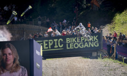
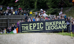
The EPIC Bikepark Leogang
- 4
- 4
- 8
Popular Leogang Mountain Biking Trails
• 60 ★ 4.1 • 2 miles • 16 ft • 1,538 •
Eine breite Strecke, mit aufeinander folgenden Anliegerkurven und Tables, die Flow erleben lassen und auch für fortgeschrittene Rider viel zu bieten hat. Ideal, um seine Technik zu verbessern. A wide track, with successive berms and...
• 70 ★ 3.9 • 4,600 ft • 6 ft • 1,468 •
Ab dem führt diese kurven- & anliegerreiche Line, ausgestattet mit einer großzügigen Northshorebrücke in Richtung Steinbergbahn Talstation. Full of curves and berms. From over a generous northshore section down to the Steinberg...
• 100 ★ 4.4 • 2 miles • 68 ft • 731 •
Highly rated popular red difficulty singletrack. This mountain bike primary trail and has a moderate overall physical rating. Trail visibility is always easy to follow. On average it takes 12 minutes to complete this trail.
• 80 ★ 4.0 • 2 miles • 4 ft • 459 •
Very natural singletrail near Bikepark Leogang. Not very wide with roots, some wet spots and a mix of fast and tight corners.
• 90 ★ 3.9 • 4,708 ft • 65 ft • 341 •
Easy, flowy but narrow Trail. Something for your enduro bike rather than a downhill rig.
• 70 ★ 4.5 • 1,991 ft • 0 ft • 252 •
Handmade trail which diverts from the easier Schwarzleo-Trail. Mixed underground (natural, gravel) with some northshore-elements (wooden bridges). Also a few quite techy sections.
• 40 ★ 0.0 • 2,621 ft • 0 ft • 98 •
Moderately popular black difficulty singletrack. This mountain bike primary trail can be used downhill only and has a extreme overall physical rating. It features berm, jump, gap jump, rock face and skinny. Trail visibility is sometimes hard to follow.
• 45 ★ 0.0 • 869 ft • 0 ft • 85 •
Technical, raw and uncompromising: the black bypass of delivers around 300 meters of intense old-school singletrail riding with roots, rock gardens, North Shores and tight berms. Precise line choice and solid technique are essential...
Leogang Mountain Bike Routes
★ 4.0 • 4 miles • 755 ft • 1 • Loop •
Hier erwartet dich eine märchenhafte Landschaft! Der Trail führt vorbei an hohen Felsen und quert...
★ 3.0 • 32 miles • 5,847 ft • 0 • Loop •
Ein steiler Aufstieg, reichlich Höhenmeter, Skipisten im ersten Teil und eine schöne Abfahrt im zweiten...
★ 2.0 • 5 miles • 780 ft • 0 • Loop •
Short MTB tour with a short Trail part - ideal for beginner! Start at the sports field in Leogang and...
27 miles • 5,339 ft • 0 •
1 mile • 2 ft • 4 • Shuttled • Race •
Race course for the UCI Downhill World Series
41 miles • 14,947 ft • 8 • Loop • Race •
Race course for the UCI Enduro World Cup 2023 #4 Leogang
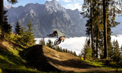
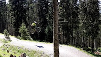
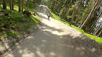
Photos of Leogang Mountain Bike
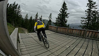
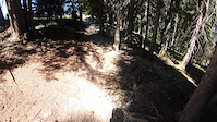
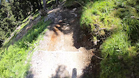
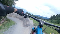
Videos of Leogang Mountain Bike
trail: Vali's Hölle
0:20 |
|
Apr 9, 2026

0:50 |
15 |
Apr 11, 2025
trail: Hot Shots – fired by GoPRO
3:06 |
80 |
Oct 11, 2023
trail: Hangman I
0:05 |
32 |
Sep 8, 2022
trail: Hangman I
0:08 |
52 |
Sep 8, 2022
trail: Flying Gangster
0:17 |
725 |
Aug 17, 2022
trail: Hot Shots – fired by GoPRO
0:13 |
242 |
Jul 4, 2022
trail: Hot Shots – fired by GoPRO
0:15 |
148 |
Jun 30, 2022
Current Trail Warnings
| status | trail | date | condition | user | info |
|---|---|---|---|---|---|
| Forsthof Trail | Jun 10, 2026 @ 2:18pm (Europe/Vienna) Jun 10, 2026 | Unknown | tristanbotteram | Closed | |
| Asitzbahn I | Jun 6, 2026 @ 9:24am (Europe/Vienna) Jun 6, 2026 | Unknown | luckyLukell | Unfall mit Kran |
Recent Trail Reports
| status | trail | date | condition | info | user |
|---|---|---|---|---|---|
| Steinberg Link | Jun 16, 2026 @ 11:01am (Europe/Ljubljana) 2 days | Ideal | VodruamvomBergqnt1hT | ||
| Hangman II | Jun 6, 2026 @ 8:27am (Europe/Vienna) Jun 5, 2026 | Unknown | TomDer83 | ||
| Vali's Hölle | Jan 10, 2026 @ 9:23am (Europe/Vienna) Jan 10, 2026 | Unknown | ktm-boy-69 TRAILFORKS | ||
| Steinberg Line by FOX | Jan 10, 2026 @ 9:22am (Europe/Vienna) Jan 10, 2026 | Unknown | ktm-boy-69 TRAILFORKS | ||
| Speedster | Jan 10, 2026 @ 9:22am (Europe/Vienna) Jan 10, 2026 | Unknown | ktm-boy-69 TRAILFORKS | ||
| Lumberjack Line | Jan 10, 2026 @ 9:22am (Europe/Vienna) Jan 10, 2026 | Unknown | ktm-boy-69 TRAILFORKS | ||
| Hot Shots – fired by GoPRO | Jan 10, 2026 @ 9:22am (Europe/Vienna) Jan 10, 2026 | Unknown | ktm-boy-69 TRAILFORKS | ||
| Hangman I | Jan 10, 2026 @ 9:22am (Europe/Vienna) Jan 10, 2026 | Unknown | ktm-boy-69 TRAILFORKS | ||
| Gateway | Jan 10, 2026 @ 9:22am (Europe/Vienna) Jan 10, 2026 | Unknown | ktm-boy-69 TRAILFORKS | ||
| Flying Gangster | Jan 10, 2026 @ 9:22am (Europe/Vienna) Jan 10, 2026 | Unknown | ktm-boy-69 TRAILFORKS |
Activity Feed
| username | action | type | title | date |
|---|---|---|---|---|
| trailforks | add | article_links | activity #97169325 | Jun 17, 2026 @ 2:02am 17 hours |
| XTAdventures | ridden | trail | activity #97160637 | Jun 16, 2026 @ 8:50pm 22 hours |
| VodruamvomBergqnt1hT | add | report | activity #97129529 | Jun 16, 2026 @ 12:06pm 1 day |
| trailforks | add | video | activity #97106930 | Jun 16, 2026 @ 7:00am 1 day |
| rasoulution | add | photo | activity #97093252 | Jun 16, 2026 @ 12:57am 2 days |
Recent Comments
| username | type | title | comment | date |
|---|---|---|---|---|
| trail | Ab 23.05 | May 25, 2026 @ 4:42am May 25, 2026 | ||
| report | Offen | May 15, 2026 @ 2:16pm May 15, 2026 | ||
| trail | A big big jump line with some huge gap jumps... | Aug 1, 2025 @ 2:43am Aug 1, 2025 | ||
| trail | For the 2025 season some tables were extended.... | Jun 22, 2025 @ 6:38am Jun 22, 2025 | ||
| trail | Amazing trial!! I did It with dry conditions.... | Aug 10, 2024 @ 6:17am Aug 10, 2024 |
Local Badges
-

Epic Ride Climb 2k1,580 awarded -

Climbing 10k Badge199 awarded -

Climbing 100k Badge1 awarded -

Epic Ride Descent 2k2,681 awarded -

Descent 10k Badge357 awarded -

Descent 100k Badge6 awarded
Bike & Skill Parks
| name | type | city | rating |
|---|---|---|---|
| The EPIC Bikepark Leogang | bike park | Leogang | |
| GoPro Bagjump | skill park | Leogang |
Activity Type Stats
| activitytype | trails | distance | descent | descent distance | total vertical | rating | global rank | state rank | photos | reports | routes | ridelogs |
|---|---|---|---|---|---|---|---|---|---|---|---|---|
| Mountain Bike | 31 | 31 miles | 16,621 ft | 21 miles | 3,579 ft | #686 | #3 | 1,062 | 5,501 | 7 | 9,043 | |
| E-Bike | 24 | 27 miles | 13,789 ft | 18 miles | 3,579 ft | #317 | #6 | 5,207 | 4 | 715 | ||
| Hike | 6 | 9 miles | 335 ft | 1 mile | 3,579 ft | #1,840 | #27 | 5,244 | 593 | |||
| Trail Running | 6 | 9 miles | 335 ft | 1 mile | 3,579 ft | #1,373 | #21 | 5,237 | 85 | |||
| ATV/ORV/OHV | 1 | 5,233 ft | 56 ft | 1,358 ft | 449 ft | 489 | ||||||
| Snowshoe | 2 | 2 miles | 23 ft | 207 ft | 2,444 ft | 16 | 2 | |||||
| Backcountry Ski | 4 | 6 miles | 1,982 ft | 4 miles | 2,444 ft | #127 | #23 | 21 | 82 |
Frequently Asked Questions About Leogang
▼
What are the best places to ride in Leogang?
Leogang has 1 areas to explore for mountain biking. The top rated areas are:
▼
What are the highest rated mountain biking trails in Leogang?
The highest rated mountain biking trails in Leogang are:
- Bongo Bongo (4.5/5)
- Hangman I (4.3/5)
- Speedster (4.3/5)
- Lumberjack Line (4.2/5)
- Knappen-Trail (4.2/5)
▼
What is the best time of the year to ride in Leogang?
Based on ride log data, the most popular months to ride in Leogang are:
- July (120 activities)
- August (60 activities)
- June (41 activities)
▼
Where can I park to ride in Leogang?
There are 2 parking locations listed in Leogang. The most popular parking spots are:
Activities
Trails
Points of Interest
- Viewpoint Top of Asitz
- Cableway Drop-Off (Asitzbahn) Other
- Middle station Asitzbahn Other
- Cableway Pick-Up (Asitzbahn) Other
- Cableway Drop-Off (Steinbergbahn) Other
- Middle station Steinbergbahn Other
- Cableway Pick-Up (Steinbergbahn) Other
- Birnhorn (8,110 ft)
- Scharleithörner (7,897 ft)
- Grießener Hochbrett (7,854 ft)
- By daSteff & contributors
- Admins: ktm-boy-69, lgs1
- #5615 - 24,185 views
- leogang activity log | embed map of Leogang mountain bike trails | leogang mountain biking points of interest polygons
Downloading of trail gps tracks in kml & gpx formats is enabled for Leogang.
You must login to download files.