close
-
Layers w
- Weather Layers
- Pro
- Pro
- Pro
- Pro
- Pro
- Pro
- More Layers
- Pro
- Pro
- Pro
- Pro
-
Upgrade to

3D
Trail Conditions
- Unknown
- Snow Groomed
- Snow Packed
- Snow Covered
- Snow Cover Partial
- Freeze/thaw Cycle
- Icy
- Prevalent Mud
- Wet
- Variable
- Ideal
- Dry
- Very Dry
Trail Flow (Ridden Direction)
Trailforks scans users ridelogs to determine the most popular direction each trail is ridden. A good flowing trail network will have most trails flowing in a single direction according to their intension.
The colour categories are based on what percentage of riders are riding a trail in its intended direction.
The colour categories are based on what percentage of riders are riding a trail in its intended direction.
- > 96%
- > 90%
- > 80%
- > 70%
- > 50%
- < 50%
- bi-directional trail
- no data
Trail Last Ridden
Trailforks scans ridelogs to determine the last time a trail was ridden.
- < 2 days
- < 1 week
- < 2 weeks
- < 1 month
- < 6 months
- > 6 months
Trail Ridden Direction
The intended direction a trail should be ridden.
- Downhill Only
- Downhill Primary
- Both Directions
- Uphill Primary
- Uphill Only
- One Direction
Contribute Details
Colors indicate trail is missing specified detail.
- Description
- Photos
- Description & Photos
- Videos
Trail Popularity ?
Trailforks scans ridelogs to determine which trails are ridden the most in the last 9 months.
Trails are compared with nearby trails in the same city region with a possible 25 colour shades.
Think of this as a heatmap, more rides = more kinetic energy = warmer colors.
- most popular
- popular
- less popular
- not popular
ATV/ORV/OHV Filter
Max Vehicle Width
inches
US Cell Coverage
Legend

Radar Time
Activity Recordings
Trailforks uses anonymized public activity data.
?
Activity Recordings
Trailforks uses anonymized public activity data.
?
Personal Heatmap
▶
Activity Types
all
/
none
▶
Options
2
Date range
month
–
Winter Trails
Warning
A routing network for winter maps does not exist. Selecting trails using the winter trails layer has been disabled.
Missing Trails
Most Popular
Least Popular
Trails are colored based on popularity. The more popular a trail is, the more red. Less popular trails trend towards green.
Jump Magnitude Heatmap
Heatmap of where riders jump on trails. Zoom in to see individual jumps, click circles to view jump details.
BC Backroad Status
![map legend]()
Service Road Atlas is a free to use, community-driven service for viewing and creating reports on the numerous back-country service roads around B.C. and Alberta.

Slope Aspect
Direction the slope faces
Trails Deemphasized
Trails are shown in grey.
Only show trails with no bike usage.
Suggested Layers
Based on selected activity type
Save the current map location and zoom level as your default home location whenever this page is loaded.
Save
No description for Lerici has been added yet!
Login or register to submit one.
This region uses the Uk/Euro style trail grading system.
Activities Click to view
- Mountain Bike
45 trails
- E-Bike
43 trails
- Gravel Bike
0 trails
- Adaptive Bike
0 trails
- Winter Fat Bike
0 trails
- Hike
43 trails
- Trail Running
42 trails
Region Details
- 9
- 13
- 16
- 1
Region Status
Caution as of May 23, 2026Stats
- Avg Trail Rating
- Trails (view details)
- 45
- Trails Mountain Bike
- 45
- Trails E-Bike
- 43
- Trails Horse
- 1
- Trails Hike
- 43
- Trails Trail Running
- 42
- Trails Dirtbike/Moto
- 1
- Trails Observed Trials
- 1
- Trails ATV/ORV/OHV
- 1
- Total Distance
- 29 miles
- Total Descent
- 12,981 ft
- Total Vertical
- 1,288 ft
- Highest Trailhead
- 1,291 ft
- Reports
- 1,010
- Photos
- 108
- Ridden Counter
- 3,734
Articles
Race Report: Superenduro Round 3 - Lerici
Jun 17, 2019 from pinkbike.com
We’re back for the third round of the 2019 Superenduro, this weekend we’re coming to you from the southern border of Liguria. A new venue for...
Sub Regions
-
Lerici-Ameglia Trail Area
- 11
- 16
- 1
Popular Lerici Mountain Biking Trails
• 95 ★ 4.6 • 2 miles • 181 ft • 150 •
It is a Trail that flow thrue , Cacciatori and single track down to Ameglia
• 75 ★ 3.7 • 4,206 ft • 50 ft • 130 •
Moderate the spped because the trail is use also by pedestran turists Moderare la velocità, prestare attenzione agli escursionisti a piedi!! Arrivati al Borgo di Tellaro, sulla strada asfaltata, si sconsiglia di scendere dalle...
• 85 ★ 3.6 • 1,949 ft • 323 ft • 117 •
Popular blue difficulty singletrack. This mountain bike primary trail can be used uphill primary and has a moderate overall physical rating with a 323 ft blue climb. On average it takes 6 minutes to complete this trail.
• 70 ★ 4.7 • 3,002 ft • 28 ft • 111 •
Highly rated popular blue difficulty singletrack. This mountain bike primary trail can be used downhill only and has a moderate overall physical rating with a 28 ft blue climb. On average it takes 4 minutes to complete this trail.
• 70 ★ 4.8 • 1,915 ft • 10 ft • 101 •
Popular blue difficulty singletrack. This mountain bike primary trail can be used downhill primary and has a moderate overall physical rating. On average it takes 3 minutes to complete this trail.
• 70 ★ 4.0 • 3,235 ft • 0 ft • 96 •
Da un'idea dei ragazzi di Ameglia nasce il Trail. Non molto lungo ma molto bello e divertente. All'Altezza del Belvedere di Ameglia questo trail vi permette di arrivare direttamente a Bocca di Magra.
• 55 ★ 2.7 • 3,855 ft • 112 ft • 93 •
Moderately popular red difficulty singletrack. This mountain bike primary trail can be used downhill only and has a moderate overall physical rating. On average it takes 9 minutes to complete this trail.
Lerici Mountain Bike Routes
14 miles • 2,321 ft • 4 • Loop •
Un tour E-bike impegnativo e tecnico dove si toccano trail tra i più belli della Lerici-Ameglia Trail...
13 miles • 2,101 ft • 2 • Loop •
Italian: Anello Verde, Anello Cicloturistico, l'anello parte da Lerici, sale sul Monte Rocchetta, scende...
18 miles • 3,256 ft • 4 • Loop •
Italian: L'anello Arancione è mediamente impegnativo, sopratutto i tratti dei sentieri sopra il borgo di...
23 miles • 3,879 ft • 8 • Loop •
Italian: L'anello Nero parte da Lerici, anello impegnativo che tocca tutti i Borghi del Territorio, tra...
★ 5.0 • 14 miles • 2,127 ft • 0 • Loop •
Come arrivare In auto: Autostrada A12 (uscita Sarzana), proseguire su SP59 in direzione La Spezia....
26 miles • 5,090 ft • 11 • Out & Back •
Wonderful trail around Lerici and Monte Marcello
Photos of Lerici Mountain Bike
Videos of Lerici Mountain Bike

0:28 |
6 |
Mar 12, 2024
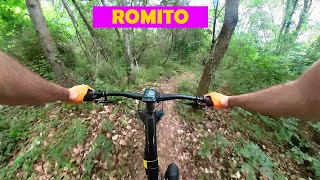
trail: Romito
16:50 |
294 |
Jun 9, 2022 , Lerici
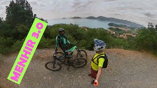
trail: Menhir 3.0
9:29 |
283 |
May 31, 2022 , Lerici

trail: Gratta E Vinci
6:03 |
336 |
May 21, 2022 , Lerici
Recent Trail Reports
Activity Feed
| username | action | type | title | date |
|---|---|---|---|---|
| w60IU2 | comment | report | activity #96985272 | Jun 14, 2026 @ 10:41am Jun 14, 2026 |
| G4byF0 | wishlist | trail | activity #95617972 | May 27, 2026 @ 12:36am May 27, 2026 |
| G4byF0 | wishlist | trail | activity #95472782 and 3 more | May 25, 2026 @ 2:28am May 25, 2026 |
| fabioooo | add | report | activity #95319124 and 3 more | May 23, 2026 @ 8:05am May 23, 2026 |
| andreac4 | comment | trail | activity #94963847 | May 18, 2026 @ 1:25am May 18, 2026 |
Recent Comments
| username | type | title | comment | date |
|---|---|---|---|---|
| report | Perfetto pulito rifatto da poco | Jun 14, 2026 @ 10:41am Jun 14, 2026 | ||
| trail | Divertente ma gli ultimi 5 metri sono... | May 18, 2026 @ 1:25am May 18, 2026 | ||
| trail | Da evitare col bagnato, argilloso e molto... | Feb 23, 2026 @ 5:29am Feb 23, 2026 | ||
| report | Big Tree in the beginning, can be push... | Oct 9, 2025 @ 6:34am Oct 9, 2025 | ||
| trail | Molto scorrevole e flow, diverso dagli altri... | Jan 26, 2025 @ 1:22am Jan 26, 2025 |
Local Badges
-

10 Blue Trails47 awarded -

Epic Ride Climb 2k96 awarded -

Climbing 10k Badge54 awarded -

Climbing 100k Badge8 awarded -

Epic Ride Descent 2k99 awarded -

Descent 10k Badge54 awarded
Activity Type Stats
| activitytype | trails | distance | descent | descent distance | total vertical | rating | global rank | state rank | photos | reports | routes | ridelogs |
|---|---|---|---|---|---|---|---|---|---|---|---|---|
| Mountain Bike | 45 | 29 miles | 12,982 ft | 15 miles | 1,286 ft | #2,998 | #150 | 102 | 1,005 | 11 | 7,146 | |
| E-Bike | 43 | 29 miles | 12,933 ft | 15 miles | 1,286 ft | #700 | #81 | 4 | 984 | 6 | 2,111 | |
| Horse | 1 | 4,462 ft | 23 ft | 735 ft | 148 ft | 133 | ||||||
| Hike | 43 | 27 miles | 11,598 ft | 14 miles | 1,286 ft | #5,537 | #252 | 985 | 267 | |||
| Trail Running | 42 | 26 miles | 10,945 ft | 13 miles | 1,286 ft | #5,091 | #239 | 982 | 98 | |||
| Dirtbike/Moto | 1 | 4,462 ft | 23 ft | 735 ft | 148 ft | 133 | ||||||
| Observed Trials | 1 | 4,462 ft | 23 ft | 735 ft | 148 ft | 4 | ||||||
| ATV/ORV/OHV | 1 | 4,462 ft | 23 ft | 735 ft | 148 ft | 133 |
Frequently Asked Questions About Lerici
▼
What are the best places to ride in Lerici?
Lerici has 1 areas to explore for mountain biking. The top rated areas are:
▼
What are the highest rated mountain biking trails in Lerici?
The highest rated mountain biking trails in Lerici are:
- Guercio (4.4/5)
- Menhir 3.0 (4.4/5)
- La Stamperia (4.4/5)
- Ameglia Var Cinghiale (4.3/5)
- La Stamperia alta (4.2/5)
▼
What is the best time of the year to ride in Lerici?
Based on ride log data, the most popular months to ride in Lerici are:
- August (35 activities)
- July (22 activities)
- October (15 activities)
▼
Where can I park to ride in Lerici?
There are 5 parking locations listed in Lerici. The most popular parking spots are: View all parking and trailhead locations on the map to plan your visit.
Activities
Trails
- By MTBLericiTrail & contributors
- Admins: denitopia, LericiBike
- #10532 - 7,338 views
- lerici activity log | embed map of Lerici mountain bike trails | lerici mountain biking points of interest
Downloading of trail gps tracks in kml & gpx formats is enabled for Lerici.
You must login to download files.