close
-
Layers w
- Weather Layers
- Pro
- Pro
- Pro
- Pro
- Pro
- Pro
- More Layers
- Pro
- Pro
- Pro
- Pro
-
Upgrade to

3D
Trail Conditions
- Unknown
- Snow Groomed
- Snow Packed
- Snow Covered
- Snow Cover Partial
- Freeze/thaw Cycle
- Icy
- Prevalent Mud
- Wet
- Variable
- Ideal
- Dry
- Very Dry
Trail Flow (Ridden Direction)
Trailforks scans users ridelogs to determine the most popular direction each trail is ridden. A good flowing trail network will have most trails flowing in a single direction according to their intension.
The colour categories are based on what percentage of riders are riding a trail in its intended direction.
The colour categories are based on what percentage of riders are riding a trail in its intended direction.
- > 96%
- > 90%
- > 80%
- > 70%
- > 50%
- < 50%
- bi-directional trail
- no data
Trail Last Ridden
Trailforks scans ridelogs to determine the last time a trail was ridden.
- < 2 days
- < 1 week
- < 2 weeks
- < 1 month
- < 6 months
- > 6 months
Trail Ridden Direction
The intended direction a trail should be ridden.
- Downhill Only
- Downhill Primary
- Both Directions
- Uphill Primary
- Uphill Only
- One Direction
Contribute Details
Colors indicate trail is missing specified detail.
- Description
- Photos
- Description & Photos
- Videos
Trail Popularity ?
Trailforks scans ridelogs to determine which trails are ridden the most in the last 9 months.
Trails are compared with nearby trails in the same city region with a possible 25 colour shades.
Think of this as a heatmap, more rides = more kinetic energy = warmer colors.
- most popular
- popular
- less popular
- not popular
ATV/ORV/OHV Filter
Max Vehicle Width
inches
US Cell Coverage
Legend

Radar Time
Activity Recordings
Trailforks uses anonymized public activity data.
?
Activity Recordings
Trailforks uses anonymized public activity data.
?
Personal Heatmap
▶
Activity Types
all
/
none
▶
Options
2
Date range
month
–
Winter Trails
Warning
A routing network for winter maps does not exist. Selecting trails using the winter trails layer has been disabled.
Missing Trails
Most Popular
Least Popular
Trails are colored based on popularity. The more popular a trail is, the more red. Less popular trails trend towards green.
Jump Magnitude Heatmap
Heatmap of where riders jump on trails. Zoom in to see individual jumps, click circles to view jump details.
BC Backroad Status
![map legend]()
Service Road Atlas is a free to use, community-driven service for viewing and creating reports on the numerous back-country service roads around B.C. and Alberta.

Slope Aspect
Direction the slope faces
Trails Deemphasized
Trails are shown in grey.
Only show trails with no bike usage.
Suggested Layers
Based on selected activity type
Save the current map location and zoom level as your default home location whenever this page is loaded.
Save
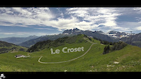
No description for Les Crosets has been added yet!
Login or register to submit one.
This region uses the Uk/Euro style trail grading system.
Activities Click to view
- Mountain Bike
11 trails
- E-Bike
8 trails
- Adaptive Bike
0 trails
- Hike
7 trails
- Trail Running
7 trails
Region Details
- 5
- 1
- 4
- 1
Region Status
Open as of Mar 28, 2026Stats
- Avg Trail Rating
- Trails (view details)
- 11
- Trails Mountain Bike
- 11
- Trails E-Bike
- 8
- Trails Hike
- 7
- Trails Trail Running
- 7
- Total Distance
- 9 miles
- Total Descent
- 6,047 ft
- Total Vertical
- 2,567 ft
- Highest Trailhead
- 7,380 ft
- Reports
- 132
- Photos
- 75
- Ridden Counter
- 7,687
Sub Regions
-
Bikepark Les Crosets
- 4
Popular Les Crosets Mountain Biking Trails
• 100 ★ 4.8 • 1 mile • 31 ft • 1,028 •
Highly rated popular red difficulty singletrack. This mountain bike primary trail. Trail visibility is always easy to follow. On average it takes 9 minutes to complete this trail.
• 75 ★ 4.6 • 4,262 ft • 0 ft • 918 •
A series of berms a rock gardens right under the lift. Steep in places, and rough all over!
• 70 ★ 2.0 • 2,116 ft • 23 ft • 884 •
Popular blue difficulty singletrack. This multi-use trail can be used downhill primary and has a moderate overall physical rating with a 23 ft blue climb. On average it takes 2 minutes to complete this trail.
• 50 ★ 4.7 • 1,936 ft • 0 ft • 646 •
Moderately popular red difficulty singletrack. This mountain bike primary trail. It features berm, drop and jump. Trail visibility is always easy to follow. On average it takes 3 minutes to complete this trail.
• 5 ★ 4.0 • 1 mile • 127 ft • 123 •
Less popular black difficulty singletrack. This mountain bike primary trail can be used downhill primary with a 127 ft black diamond climb. On average it takes 10 minutes to complete this trail.
• 25 ★ 5.0 • 3,701 ft • 0 ft • 118 •
First half is techs and berms with lower half being a jump line with some optional gap jumps.
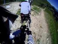
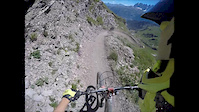
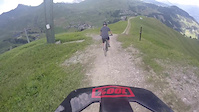
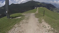
Photos of Les Crosets Mountain Bike
Videos of Les Crosets Mountain Bike
trail: Crosets
3:23 |
22 |
Dec 6, 2020
trail: Grand-Conche
5:29 |
308 |
Oct 17, 2020

trail: PDS (Aiguille des Champeys)
5:59 |
187 |
Aug 12, 2019

trail: Loquet
0:06 |
253 |
Aug 16, 2017
trail: Loquet
2:51 |
66 |
Jul 30, 2017
trail: Loquet
3:54 |
66 |
Jul 7, 2017
trail: Loquet
2:46 |
98 |
Jul 6, 2017
trail: Loquet
2:30 |
185 |
Jul 5, 2017
Recent Trail Reports
| status | trail | date | condition | info | user |
|---|---|---|---|---|---|
| La Colline des Crosets | Sep 8, 2025 @ 9:27am Sep 8, 2025 | Wet | Jv0fwKJE | ||
| Portes De l'Hiver | Sep 8, 2025 @ 9:27am Sep 8, 2025 | Wet | Jv0fwKJE | ||
| Grand-Conche | Aug 14, 2025 @ 3:24am Aug 14, 2025 | Unknown | cbennette | ||
| TS Connector | Jun 27, 2025 @ 9:01am Jun 27, 2025 | Ideal | Allmann10 | ||
| Sundance | Jul 13, 2025 @ 5:24am Jul 13, 2025 | Ideal | bmillerz | ||
| Pointe des Mossettes | Aug 15, 2024 @ 10:01am Aug 15, 2024 | Ideal | dSxZB4 | ||
| Grand Conche - Pointe des Mossettes | Aug 15, 2024 @ 10:01am Aug 15, 2024 | Ideal | dSxZB4 | ||
| Loquet | Aug 13, 2024 @ 10:33am Aug 13, 2024 | Ideal | agrey71 | ||
| Crosets | Jun 29, 2024 @ 11:57pm Jun 29, 2024 | Variable | Sanski | ||
| Vallimoz Climb | May 28, 2023 @ 1:53am May 28, 2023 | Ideal | Giuze |
Activity Feed
| username | action | type | title | date |
|---|---|---|---|---|
| DinisBRodrigues | ridden | trail | activity #97023133 and 1 more | Jun 14, 2026 @ 10:04pm Jun 14, 2026 |
| minimusprime | wishlist | trail | activity #95641804 | May 27, 2026 @ 9:53am May 27, 2026 |
| trailforks | add | video | activity #94512629 | May 11, 2026 @ 1:00pm May 11, 2026 |
| hatchleader | wishlist | trail | activity #87931965 | Jan 28, 2026 @ 1:22am Jan 28, 2026 |
| hannahjay | wishlist | trail | activity #84296135 and 1 more | Nov 17, 2025 @ 6:46am Nov 17, 2025 |
Recent Comments
| username | type | title | comment | date |
|---|---|---|---|---|
| trail | Very fun! | Aug 14, 2025 @ 3:23am Aug 14, 2025 | ||
| trail | Incredible trail. Fast and playful - whoever... | Aug 22, 2023 @ 12:19pm Aug 22, 2023 | ||
| trail | Great trail. One big drop, one biggish gap and... | Aug 22, 2023 @ 12:18pm Aug 22, 2023 | ||
| trail | Amazing trail - quite loose and rocky with... | Aug 22, 2023 @ 12:16pm Aug 22, 2023 | ||
| trail | Just ridden this today and it is running so... | Jul 9, 2022 @ 12:51am Jul 9, 2022 |
Local Badges
-

Epic Mountain Bike Climb 2k11 awarded -

Climbing 10k Badge2 awarded -

Mountain Biking 100k Badge0 awarded -

Epic Ride Descent 2k11 awarded -

Descent 10k Badge2 awarded -

Descent 100k Badge0 awarded
Bike & Skill Parks
| name | type | city | rating |
|---|---|---|---|
| Bikepark Les Crosets | bike park | Les Crosets |
Activity Type Stats
| activitytype | trails | distance | descent | descent distance | total vertical | rating | global rank | state rank | photos | reports | routes | ridelogs |
|---|---|---|---|---|---|---|---|---|---|---|---|---|
| Mountain Bike | 11 | 9 miles | 6,047 ft | 8 miles | 2,569 ft | #3,520 | #59 | 75 | 132 | 688 | ||
| E-Bike | 8 | 7 miles | 3,412 ft | 5 miles | 2,569 ft | #3,851 | #158 | 119 | 51 | |||
| Hike | 7 | 6 miles | 2,805 ft | 5 miles | 1,453 ft | #6,014 | #152 | 123 | 36 | |||
| Trail Running | 7 | 6 miles | 2,805 ft | 5 miles | 1,453 ft | #5,469 | #134 | 123 | 13 |
Frequently Asked Questions About Les Crosets
▼
What are the best places to ride in Les Crosets?
Les Crosets has 1 areas to explore for mountain biking. The top rated areas are:
▼
What are the highest rated mountain biking trails in Les Crosets?
The highest rated mountain biking trails in Les Crosets are:
- Grand-Conche (4.5/5)
- Crosets (4.3/5)
- Sundance (4.2/5)
- Loquet (4.2/5)
- PDS (Aiguille des Champeys) (4/5)
▼
What is the best time of the year to ride in Les Crosets?
Based on ride log data, the most popular months to ride in Les Crosets are:
- July (13 activities)
- August (11 activities)
- May (4 activities)
▼
Where can I park to ride in Les Crosets?
There are 1 parking locations listed in Les Crosets. The most popular parking spots are:
Activities
Trails
- By uberscott & contributors
- Admins: VS-Admin, VS-Admin
- #15398 - 4,754 views
- les crosets activity log | embed map of Les Crosets mountain bike trails | les crosets mountain biking points of interest
Downloading of trail gps tracks in kml & gpx formats is enabled for Les Crosets.
You must login to download files.