close
-
Layers w
- Weather Layers
- Pro
- Pro
- Pro
- Pro
- Pro
- Pro
- More Layers
- Pro
- Pro
- Pro
- Pro
-
Upgrade to

3D
Trail Conditions
- Unknown
- Snow Groomed
- Snow Packed
- Snow Covered
- Snow Cover Partial
- Freeze/thaw Cycle
- Icy
- Prevalent Mud
- Wet
- Variable
- Ideal
- Dry
- Very Dry
Trail Flow (Ridden Direction)
Trailforks scans users ridelogs to determine the most popular direction each trail is ridden. A good flowing trail network will have most trails flowing in a single direction according to their intension.
The colour categories are based on what percentage of riders are riding a trail in its intended direction.
The colour categories are based on what percentage of riders are riding a trail in its intended direction.
- > 96%
- > 90%
- > 80%
- > 70%
- > 50%
- < 50%
- bi-directional trail
- no data
Trail Last Ridden
Trailforks scans ridelogs to determine the last time a trail was ridden.
- < 2 days
- < 1 week
- < 2 weeks
- < 1 month
- < 6 months
- > 6 months
Trail Ridden Direction
The intended direction a trail should be ridden.
- Downhill Only
- Downhill Primary
- Both Directions
- Uphill Primary
- Uphill Only
- One Direction
Contribute Details
Colors indicate trail is missing specified detail.
- Description
- Photos
- Description & Photos
- Videos
Trail Popularity ?
Trailforks scans ridelogs to determine which trails are ridden the most in the last 9 months.
Trails are compared with nearby trails in the same city region with a possible 25 colour shades.
Think of this as a heatmap, more rides = more kinetic energy = warmer colors.
- most popular
- popular
- less popular
- not popular
ATV/ORV/OHV Filter
Max Vehicle Width
inches
US Cell Coverage
Legend

Radar Time
Activity Recordings
Trailforks uses anonymized public activity data.
?
Activity Recordings
Trailforks uses anonymized public activity data.
?
Personal Heatmap
▶
Activity Types
all
/
none
▶
Options
2
Date range
month
–
Winter Trails
Warning
A routing network for winter maps does not exist. Selecting trails using the winter trails layer has been disabled.
Missing Trails
Most Popular
Least Popular
Trails are colored based on popularity. The more popular a trail is, the more red. Less popular trails trend towards green.
Jump Magnitude Heatmap
Heatmap of where riders jump on trails. Zoom in to see individual jumps, click circles to view jump details.
BC Backroad Status
![map legend]()
Service Road Atlas is a free to use, community-driven service for viewing and creating reports on the numerous back-country service roads around B.C. and Alberta.

Slope Aspect
Direction the slope faces
Trails Deemphasized
Trails are shown in grey.
Only show trails with no bike usage.
Suggested Layers
Based on selected activity type
Save the current map location and zoom level as your default home location whenever this page is loaded.
Save
No description for Lesotho has been added yet!
Login or register to submit one.
Region Details
- 82
- 1
- 29
- 39
- 6
- 1
Stats
- Avg Trail Rating
- Trails (view details)
- 168
- Trails Mountain Bike
- 159
- Trails E-Bike
- 143
- Trails Horse
- 27
- Trails Hike
- 141
- Trails Trail Running
- 137
- Trails Dirtbike/Moto
- 73
- Trails Observed Trials
- 9
- Trails ATV/ORV/OHV
- 26
- Total Distance
- 261 miles
- Total Descent
- 49,064 ft
- Total Vertical
- 5,936 ft
- Highest Trailhead
- 10,878 ft
- Reports
- 23
- Photos
- 121
- Ridden Counter
- 520
Articles
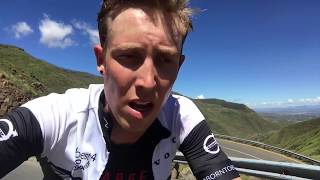
Video: Rob Warner & Matt Jones Explore Africa's Highest Country
Nov 20, 2019 from pinkbike.com
Witch doctor villages, horse racing in the clouds, the world's longest abseil and even a bit of bike riding

Video: How Pump Track Racing Has Impacted a Community in Lesotho
Oct 11, 2019 from pinkbike.com
The Roma Trading Post in Lesotho featured the first #pumpforpeace Velosolutions Pump Track in the world.
Sub Regions
- Butha Buthe Disctrict (111)
- Khukune (45)
- Ha Malapo (44)
- Afriski Mountain Resort (56)
- Khukune (45)
- Mafeteng District (47)
- Malealea (47)
- Maseru District (1)
- Roma (1)
Popular Lesotho Mountain Biking Trails
• 75 ★ 0.0 • 945 ft • 0 ft • 16 •
Popular black diamond difficulty machine groomed. This mountain bike primary trail can be used downhill only and has a moderate overall physical rating. It features drop, jump and gap jump. Trail visibility is always easy to follow. On average it takes 1 minutes to complete this trail.
• 5 ★ 0.0 • 784 ft • 0 ft • 15 •
Less popular green difficulty singletrack. This mountain bike primary trail can be used downhill only and has a easy overall physical rating. It features berm, drop, jump and gap jump. Trail visibility is always easy to follow. On average it takes minutes to complete this trail.
• 75 ★ 0.0 • 3,127 ft • 0 ft • 15 •
Popular blue difficulty singletrack. This mountain bike primary trail can be used downhill only and has a moderate overall physical rating. It features berm, drop, jump and gap jump. Trail visibility is always easy to follow. On average it takes 4 minutes to complete this trail.
• 5 ★ 0.0 • 3,061 ft • 0 ft • 14 •
Less popular blue difficulty singletrack. This mountain bike primary trail can be used downhill only and has a moderate overall physical rating. It features berm, drop, jump, gap jump and rock garden. Trail visibility is always easy to follow. On average it takes 5 minutes to complete this trail.
• 90 ★ 0.0 • 1,276 ft • 25 ft • 13 •
Popular green difficulty singletrack. This mountain bike primary trail can be used both directions and has a easy overall physical rating with a 25 ft green climb. Trail visibility is always easy to follow. On average it takes 1 minutes to complete this trail.
• 85 ★ 0.0 • 8 miles • 293 ft • 11 •
Popular blue difficulty singletrack. This mountain bike primary trail can be used one direction and has a moderate overall physical rating with a 293 ft blue climb. It features berm and drop. Trail visibility is always easy to follow. On average it takes 1 hour5 minutes to complete this trail.
• 90 ★ 0.0 • 2 miles • 34 ft • 11 •
Popular blue difficulty singletrack. This mountain bike primary trail can be used downhill only and has a moderate overall physical rating. It features berm and jump. Trail visibility is always easy to follow. On average it takes 17 minutes to complete this trail.
• 75 ★ 0.0 • 2,287 ft • 0 ft • 11 •
Popular blue difficulty singletrack. This mountain bike primary trail can be used downhill only and has a moderate overall physical rating. Trail visibility is always easy to follow. On average it takes 2 minutes to complete this trail.
Lesotho Mountain Bike Routes
2,306 ft • 4 ft • 1 • Point to Point •
Bosman's Trail is one of the very first trails which was built when starting Kapoko Snow and Bike Park....
4,213 ft • 10 ft • 2 • Point to Point •
The is one of Afriski Downhill Trails. Riders can expect Flowy Berms and a few Wooden and Dirt Jumps along...
2 miles • 295 ft • 2 • Loop •
SKi Village trail Starts in the resort base following Some easy dirt Road until it reaches Bosmans Way for...
3,802 ft • 3 • Point to Point •
The Gooi Mielies Trail is one of Afriski Downhill Trails. Riders can expect Flowy Berms and a few Wooden...
4,150 ft • 2 • Point to Point •
The Trail is one of Afriski Downhill Trails. Riders can expect Flowy Berms and a few Wooden and Dirt Jumps...
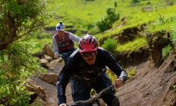
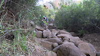
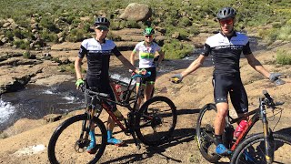
Photos of Lesotho Mountain Bike
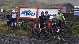
Videos of Lesotho Mountain Bike

trail: Black Mountain Pass Trail
3:16 |
12 |
Nov 4, 2020
trail: Freefall
0:57 |
263 |
Dec 21, 2017
2:37 |
286 |
Oct 8, 2020
6:12 |
302 |
Oct 8, 2020
4:39 |
268 |
Oct 8, 2020
Bike & Skill Parks
| name | type | city | rating |
|---|---|---|---|
| Afriski Mountain Resort | bike park | ||
| Roma Pump Track by VeloSolutions | skill park | Roma | |
| Bocheletsane Pump Track by VeloSolutions | skill park | Mantsonyane | |
| Sepheo VeloSolutions Pump Track | skill park | Maseru |
Activity Type Stats
| activitytype | trails | distance | descent | descent distance | total vertical | rating | global rank | state rank | photos | reports | routes | ridelogs |
|---|---|---|---|---|---|---|---|---|---|---|---|---|
| Mountain Bike | 159 | 191 miles | 35,043 ft | 103 miles | 5,935 ft | #74 | 84 | 23 | 18 | 2,731 | ||
| E-Bike | 143 | 177 miles | 28,166 ft | 93 miles | 5,935 ft | #60 | 22 | 15 | 176 | |||
| Horse | 27 | 50 miles | 7,510 ft | 28 miles | 5,823 ft | #50 | 17 | |||||
| Hike | 141 | 205 miles | 35,131 ft | 110 miles | 5,935 ft | #70 | 23 | 9 | 407 | |||
| Trail Running | 137 | 191 miles | 32,720 ft | 104 miles | 5,935 ft | #70 | 23 | 9 | 35 | |||
| Dirtbike/Moto | 73 | 142 miles | 25,089 ft | 81 miles | 5,837 ft | #35 | 1 | 4 | 20 | |||
| Observed Trials | 9 | 21 miles | 4,216 ft | 14 miles | 5,154 ft | #42 | 8 | |||||
| ATV/ORV/OHV | 26 | 47 miles | 7,011 ft | 27 miles | 5,837 ft | #41 |
Activities
Trails
- By canadaka
 Trailforks & contributors
 - Admins: WillieJacobsz
- #18123 - 5,535 views
- lesotho activity log | embed map of Lesotho mountain bike trails | lesotho mountain biking points of interest
Downloading of trail gps tracks in kml & gpx formats is enabled for Lesotho.
You must login to download files.