close
-
Layers w
- Weather Layers
- Pro
- Pro
- Pro
- Pro
- Pro
- Pro
- More Layers
- Pro
- Pro
- Pro
- Pro
-
Upgrade to

3D
Trail Conditions
- Unknown
- Snow Groomed
- Snow Packed
- Snow Covered
- Snow Cover Partial
- Freeze/thaw Cycle
- Icy
- Prevalent Mud
- Wet
- Variable
- Ideal
- Dry
- Very Dry
Trail Flow (Ridden Direction)
Trailforks scans users ridelogs to determine the most popular direction each trail is ridden. A good flowing trail network will have most trails flowing in a single direction according to their intension.
The colour categories are based on what percentage of riders are riding a trail in its intended direction.
The colour categories are based on what percentage of riders are riding a trail in its intended direction.
- > 96%
- > 90%
- > 80%
- > 70%
- > 50%
- < 50%
- bi-directional trail
- no data
Trail Last Ridden
Trailforks scans ridelogs to determine the last time a trail was ridden.
- < 2 days
- < 1 week
- < 2 weeks
- < 1 month
- < 6 months
- > 6 months
Trail Ridden Direction
The intended direction a trail should be ridden.
- Downhill Only
- Downhill Primary
- Both Directions
- Uphill Primary
- Uphill Only
- One Direction
Contribute Details
Colors indicate trail is missing specified detail.
- Description
- Photos
- Description & Photos
- Videos
Trail Popularity ?
Trailforks scans ridelogs to determine which trails are ridden the most in the last 9 months.
Trails are compared with nearby trails in the same city region with a possible 25 colour shades.
Think of this as a heatmap, more rides = more kinetic energy = warmer colors.
- most popular
- popular
- less popular
- not popular
ATV/ORV/OHV Filter
Max Vehicle Width
inches
US Cell Coverage
Legend

Radar Time
Activity Recordings
Trailforks uses anonymized public activity data.
?
Activity Recordings
Trailforks uses anonymized public activity data.
?
Personal Heatmap
▶
Activity Types
all
/
none
▶
Options
2
Date range
month
–
Winter Trails
Warning
A routing network for winter maps does not exist. Selecting trails using the winter trails layer has been disabled.
Missing Trails
Most Popular
Least Popular
Trails are colored based on popularity. The more popular a trail is, the more red. Less popular trails trend towards green.
Jump Magnitude Heatmap
Heatmap of where riders jump on trails. Zoom in to see individual jumps, click circles to view jump details.
BC Backroad Status
![map legend]()
Service Road Atlas is a free to use, community-driven service for viewing and creating reports on the numerous back-country service roads around B.C. and Alberta.

Slope Aspect
Direction the slope faces
Trails Deemphasized
Trails are shown in grey.
Only show trails with no bike usage.
Suggested Layers
Based on selected activity type
Save the current map location and zoom level as your default home location whenever this page is loaded.
Save
No description for Leusden has been added yet!
Login or register to submit one.
Activities Click to view
- Mountain Bike
78 trails
- E-Bike
25 trails
- Adaptive Bike
- Hike
25 trails
- Trail Running
25 trails
Region Details
- 16
- 8
- 45
- 9
Region Status
Open as of May 4, 2026Stats
- Avg Trail Rating
- Trails (view details)
- 78
- Trails Mountain Bike
- 78
- Trails E-Bike
- 25
- Trails Hike
- 25
- Trails Trail Running
- 25
- Total Distance
- 24 miles
- Total Descent Distance
- 8 miles
- Total Descent
- 909 ft
- Total Vertical
- 150 ft
- Highest Trailhead
- 179 ft
- Reports
- 309
- Photos
- 25
- Ridden Counter
- 31,558
Sub Regions
-
Den Treek
- 8
- 45
- 9
Popular Leusden Mountain Biking Trails
• 100 ★ 5.0 • 1,394 ft • 3 ft • 554 •
Popular green difficulty singletrack. This mountain bike primary trail can be used one direction and has a easy overall physical rating with a 3 ft green climb. It features berm and jump. Trail visibility is always easy to follow. On average it takes 1 minutes to complete this trail.
• 100 ★ 5.0 • 1,191 ft • 9 ft • 549 •
Popular blue difficulty family friendly singletrack. This mountain bike primary trail can be used one direction and has a easy overall physical rating with a 9 ft blue climb. It features berm and jump. Trail visibility is always easy to follow. On average it takes 1 minutes to complete this trail.
• 100 ★ 3.0 • 2,142 ft • 15 ft • 548 •
Popular blue difficulty family friendly singletrack. This mountain bike primary trail can be used one direction and has a moderate overall physical rating with a 15 ft blue climb. It features berm, drop and jump. Trail visibility is always easy to follow. On average it takes 2 minutes to complete this trail.
• 100 ★ 0.0 • 600 ft • 0 ft • 505 •
Popular white difficulty family friendly doubletrack. This mountain bike primary trail can be used both directions and has a easy overall physical rating. Trail visibility is always easy to follow. On average it takes minutes to complete this trail.
• 95 ★ 0.0 • 620 ft • 0 ft • 504 •
Popular white difficulty family friendly doubletrack. This mountain bike primary trail can be used both directions and has a easy overall physical rating with a 0 ft green climb. Trail visibility is always easy to follow. On average it takes minutes to complete this trail.
• 80 ★ 0.0 • 2,946 ft • 12 ft • 495 •
Popular green difficulty family friendly singletrack. This mountain bike primary trail can be used one direction and has a easy overall physical rating with a 12 ft green climb. Trail visibility is always easy to follow. On average it takes 2 minutes to complete this trail.
• 85 ★ 0.0 • 2,503 ft • 20 ft • 492 •
Popular green difficulty family friendly singletrack. This mountain bike primary trail can be used one direction and has a easy overall physical rating with a 20 ft green climb. Trail visibility is always easy to follow. On average it takes 2 minutes to complete this trail.
Leusden Mountain Bike Routes
11 miles • 184 ft • 0 • Loop •
XC track in "Landgoed Den Treek" track is not finalized yet but nearing completion. could be that in...
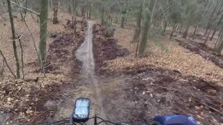
Photos of Leusden Mountain Bike
Videos of Leusden Mountain Bike
trail: Op naar de splitsing
3:35 |
487 |
Apr 17, 2020 , Leusden
Recent Trail Reports
Activity Feed
| username | action | type | title | date |
|---|---|---|---|---|
| MikerEuial | wishlist | region | activity #94792744 | May 16, 2026 @ 12:22am May 16, 2026 |
| rjd22 | update | region | activity #94741421 | May 15, 2026 @ 4:21am May 15, 2026 |
| BasjCfhoK | wishlist | region | activity #94708450 | May 14, 2026 @ 1:16pm May 14, 2026 |
| Knagie | add | report | activity #94145455 and 24 more | May 6, 2026 @ 3:33am May 6, 2026 |
| Mtempelman | add | report | activity #92209358 and 19 more | Apr 8, 2026 @ 2:01pm Apr 8, 2026 |
Recent Comments
| username | type | title | comment | date |
|---|---|---|---|---|
| trail | Leuke uitdagende trail. Soms zijn is er wat... | Aug 15, 2020 @ 4:54am Aug 15, 2020 |
Local Badges
-

Completionist46 awarded
Activity Type Stats
| activitytype | trails | distance | descent | descent distance | total vertical | rating | global rank | state rank | photos | reports | routes | ridelogs |
|---|---|---|---|---|---|---|---|---|---|---|---|---|
| Mountain Bike | 78 | 24 miles | 909 ft | 8 miles | 151 ft | #659 | #1 | 25 | 309 | 1 | 7,460 | |
| E-Bike | 25 | 6 miles | 197 ft | 2 miles | 144 ft | #2,561 | #31 | 309 | 215 | |||
| Hike | 25 | 4 miles | 39 ft | 2 miles | 141 ft | #6,132 | #69 | 309 | 148 | |||
| Trail Running | 25 | 4 miles | 39 ft | 2 miles | 141 ft | #5,532 | #69 | 309 | 235 |
Frequently Asked Questions About Leusden
▼
What are the best places to ride in Leusden?
Leusden has 1 areas to explore for mountain biking. The top rated areas are:
▼
What are the highest rated mountain biking trails in Leusden?
The highest rated mountain biking trails in Leusden are:
- Rood en blauw (4.1/5)
- Lange klim en bochten (4.1/5)
- Omtrekkende beweging (4.1/5)
- Weer het bos in (4/5)
- En weer door (4/5)
▼
What is the best time of the year to ride in Leusden?
Based on ride log data, the most popular months to ride in Leusden are:
- October (34 activities)
- July (32 activities)
- January (32 activities)
▼
Where can I park to ride in Leusden?
There are 1 parking locations listed in Leusden. The most popular parking spots are:
- By Mtempelman & contributors
- Admins: apply
- #35953 - 1,034 views
- leusden activity log | embed map of Leusden mountain bike trails | leusden mountain biking points of interest
Downloading of trail gps tracks in kml & gpx formats is enabled for Leusden.
You must login to download files.