close
-
Layers w
- Weather Layers
- Pro
- Pro
- Pro
- Pro
- Pro
- Pro
- More Layers
- Pro
- Pro
- Pro
- Pro
-
Upgrade to

3D
Trail Conditions
- Unknown
- Snow Groomed
- Snow Packed
- Snow Covered
- Snow Cover Partial
- Freeze/thaw Cycle
- Icy
- Prevalent Mud
- Wet
- Variable
- Ideal
- Dry
- Very Dry
Trail Flow (Ridden Direction)
Trailforks scans users ridelogs to determine the most popular direction each trail is ridden. A good flowing trail network will have most trails flowing in a single direction according to their intension.
The colour categories are based on what percentage of riders are riding a trail in its intended direction.
The colour categories are based on what percentage of riders are riding a trail in its intended direction.
- > 96%
- > 90%
- > 80%
- > 70%
- > 50%
- < 50%
- bi-directional trail
- no data
Trail Last Ridden
Trailforks scans ridelogs to determine the last time a trail was ridden.
- < 2 days
- < 1 week
- < 2 weeks
- < 1 month
- < 6 months
- > 6 months
Trail Ridden Direction
The intended direction a trail should be ridden.
- Downhill Only
- Downhill Primary
- Both Directions
- Uphill Primary
- Uphill Only
- One Direction
Contribute Details
Colors indicate trail is missing specified detail.
- Description
- Photos
- Description & Photos
- Videos
Trail Popularity ?
Trailforks scans ridelogs to determine which trails are ridden the most in the last 9 months.
Trails are compared with nearby trails in the same city region with a possible 25 colour shades.
Think of this as a heatmap, more rides = more kinetic energy = warmer colors.
- most popular
- popular
- less popular
- not popular
ATV/ORV/OHV Filter
Max Vehicle Width
inches
US Cell Coverage
Legend

Radar Time
Activity Recordings
Trailforks uses anonymized public activity data.
?
Activity Recordings
Trailforks uses anonymized public activity data.
?
Personal Heatmap
▶
Activity Types
all
/
none
▶
Options
2
Date range
month
–
Winter Trails
Warning
A routing network for winter maps does not exist. Selecting trails using the winter trails layer has been disabled.
Missing Trails
Most Popular
Least Popular
Trails are colored based on popularity. The more popular a trail is, the more red. Less popular trails trend towards green.
Jump Magnitude Heatmap
Heatmap of where riders jump on trails. Zoom in to see individual jumps, click circles to view jump details.
BC Backroad Status
![map legend]()
Service Road Atlas is a free to use, community-driven service for viewing and creating reports on the numerous back-country service roads around B.C. and Alberta.

Slope Aspect
Direction the slope faces
Trails Deemphasized
Trails are shown in grey.
Only show trails with no bike usage.
Suggested Layers
Based on selected activity type
Save the current map location and zoom level as your default home location whenever this page is loaded.
Save
No description for Leysin has been added yet!
Login or register to submit one.
This region uses the Uk/Euro style trail grading system.
Activities Click to view
- Mountain Bike
33 trails
- E-Bike
31 trails
- Hike
28 trails
- Trail Running
28 trails
Region Details
- 7
- 15
- 10
Region Status
Open as of 3 daysStats
- Avg Trail Rating
- Trails (view details)
- 35
- Trails Mountain Bike
- 33
- Trails E-Bike
- 31
- Trails Horse
- 1
- Trails Hike
- 28
- Trails Trail Running
- 28
- Trails Backcountry Ski
- 3
- Total Distance
- 15 miles
- Total Descent
- 9,168 ft
- Total Vertical
- 3,895 ft
- Highest Trailhead
- 7,470 ft
- Reports
- 51
- Photos
- 81
- Ridden Counter
- 1,493
Sub Regions
-
Leysin Bike Park
- 2
- 3
Popular Leysin Mountain Biking Trails
• 100 ★ 5.0 • 1,736 ft • 0 ft • 150 •
Last section of the infamous "Nérine" track, fast and jumpy this last section is here to put even more smile on your face at the end of your run. If you are out of breath during your run, just stop and enjoy the magnificent view on the...
• 80 ★ 4.0 • 3,904 ft • 0 ft • 143 •
2,2km of pure flow, big berms, jumps, highspeed and naturals sections. This track has everything you could ask for even a 12m table jump. If you are out of breath during your run, just stop and enjoy the magnificent view on the...
• 60 ★ 5.0 • 3,153 ft • 0 ft • 92 •
This part is one of the oldest in Leysin Bike Park. It use to be ridden by the best rider in the world back in 2000 when Leysin host a World Cup Downhill Cup. The track is natural and flowy, it's more a natural singletrail than a Bike...
• 40 ★ 5.0 • 2,310 ft • 0 ft • 74 •
An expert level downhill trail. The trail starts with two large gap jumps that have go-arounds. The middle fo the trail features a steep and loose limestone rock garden with some tight switchback (Enduro rider will love it) then it's go...
• 85 ★ 0.0 • 3,891 ft • 42 ft • 64 • • hike
A traversing trail that takes you from Leysin to Corberyier/Luan area. Sustained straight gradient and very consequential drop on left side of trail. Caution is to be exercised! Do not fall to the left!! Hikers have right-of-way.
• 80 ★ 4.0 • 1 mile • 0 ft • 54 • • hike
Nice singletrail with a panoramic view over Aigle, Yvorne and Corbeyrier. Start with some alpine sections, tight switchback and loose rocks on the top. Be aware of the risk of falling rocks, leave space between riders. From mid-June to...
• 70 ★ 0.0 • 1,385 ft • 44 ft • 31 • • hike
The trail is short but flowy. It has a few blind corners as well as the occasional hiker, so beware and ride responsibly! There are two sets stairs: one in the middle and one at the end. Both sets are difficult but rideable.
• 35 ★ 0.0 • 1,593 ft • 10 ft • 27 • • hike
A short and flowy trail that gives access from upper village to middle village. Large gap jump an option halfway down trail.
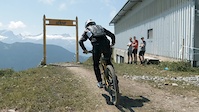
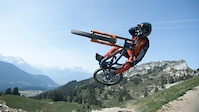
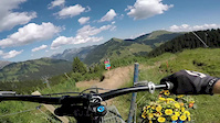
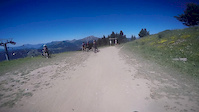
Photos of Leysin Mountain Bike
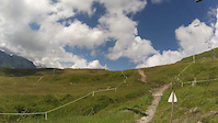
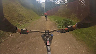
Videos of Leysin Mountain Bike
trail: Nérine - Upper section
2:05 |
491 |
Jul 26, 2021
trail: Nérine - Upper section
0:50 |
151 |
Jun 29, 2021

trail: Nérine - Upper section
4:16 |
118 |
Jul 10, 2020
trail: Nérine - Upper section
2:07 |
71 |
Aug 14, 2018
trail: Nérine - Upper section
4:57 |
64 |
Feb 15, 2017
trail: Nérine - Black section
2:00 |
146 |
May 18, 2016
trail: Nérine - Upper section
0:15 |
32 |
Jul 31, 2015
trail: Nérine - Upper section
2:39 |
284 |
Dec 15, 2014
Recent Trail Reports
| status | trail | date | condition | info | user |
|---|---|---|---|---|---|
| Nérine - Lower section | Jun 20, 2026 @ 9:34am (Europe/Zurich) 3 days | Ideal | arthurit | ||
| Nérine - Black section | Jun 20, 2026 @ 9:34am (Europe/Zurich) 3 days | Dry | arthurit | ||
| Nérine - Upper section | Jun 20, 2026 @ 9:34am (Europe/Zurich) 3 days | Ideal | arthurit | ||
| Eau Froide | Jan 18, 2026 @ 9:39am (Europe/Zurich) Jan 18, 2026 | Variable | joe27a | ||
| ETraversin | Jan 18, 2026 @ 9:39am (Europe/Zurich) Jan 18, 2026 | Variable | joe27a | ||
| Plan Girard | Oct 3, 2025 @ 3:29pm (Europe/Zurich) Oct 3, 2025 | Unknown | enforce | ||
| Lac d'Aï - Luan | Oct 3, 2025 @ 3:29pm (Europe/Zurich) Oct 3, 2025 | Ideal | enforce | ||
| Doubletrack | Oct 3, 2025 @ 3:29pm (Europe/Zurich) Oct 3, 2025 | Ideal | enforce | ||
| Sentier Leysin-Tour D'Ai | Oct 3, 2025 @ 11:42am (Europe/Zurich) Oct 3, 2025 | Ideal | enforce | ||
| Chemin de Traverseé | Jul 12, 2025 @ 2:11pm Jul 12, 2025 | Ideal | Syncra |
Activity Feed
| username | action | type | title | date |
|---|---|---|---|---|
| arthurit | add | report | activity #97481171 and 2 more | Jun 21, 2026 @ 7:08am 1 day |
| Aman123 | ridden | trail | activity #94498659 | May 11, 2026 @ 9:09am May 11, 2026 |
| YlR995 | ridden | trail | activity #93817433 and 1 more | May 1, 2026 @ 4:12pm May 1, 2026 |
| joe27a | add | report | activity #87413095 and 1 more | Jan 18, 2026 @ 8:14am Jan 18, 2026 |
| enforce | add | report | activity #81608267 and 3 more | Oct 3, 2025 @ 8:47am Oct 3, 2025 |
Recent Comments
| username | type | title | comment | date |
|---|---|---|---|---|
| trail | Can’t believe more people seem to ride this.... | Sep 2, 2023 @ 10:53am Sep 2, 2023 |
Local Badges
-

Epic Ride Climb 2k182 awarded -

Climbing 10k Badge22 awarded -

Climbing 100k Badge1 awarded -

Epic Ride Descent 2k182 awarded -

Descent 10k Badge35 awarded -

Descent 100k Badge2 awarded
Bike & Skill Parks
| name | type | city | rating |
|---|---|---|---|
| Leysin Bike Park | bike park | Leysin |
Activity Type Stats
| activitytype | trails | distance | descent | descent distance | total vertical | rating | global rank | state rank | photos | reports | routes | ridelogs |
|---|---|---|---|---|---|---|---|---|---|---|---|---|
| Mountain Bike | 33 | 11 miles | 7,782 ft | 7 miles | 3,120 ft | #4,283 | #84 | 81 | 51 | 1,513 | ||
| E-Bike | 31 | 1 mile | 778 ft | 3,865 ft | 1,621 ft | #4,109 | #172 | 51 | 2 | 118 | ||
| Horse | 1 | 1 | ||||||||||
| Hike | 28 | 9 miles | 5,427 ft | 5 miles | 3,117 ft | #5,126 | #121 | 51 | 226 | |||
| Trail Running | 28 | 9 miles | 5,427 ft | 5 miles | 3,117 ft | #5,218 | #124 | 51 | 37 | |||
| Backcountry Ski | 3 | 4 miles | 1,388 ft | 2 miles | 2,700 ft | 133 |
Frequently Asked Questions About Leysin
▼
What are the best places to ride in Leysin?
Leysin has 1 areas to explore for mountain biking. The top rated areas are:
▼
What are the highest rated mountain biking trails in Leysin?
The highest rated mountain biking trails in Leysin are:
- Nérine - Lower section (4.1/5)
- Lisin - Middle section (4.1/5)
- Nérine - Black section (4.1/5)
- Nérine - Upper section (4/5)
- Lac d'Aï - Luan (4/5)
▼
What is the best time of the year to ride in Leysin?
Based on ride log data, the most popular months to ride in Leysin are:
- July (24 activities)
- June (9 activities)
- August (6 activities)
▼
Where can I park to ride in Leysin?
Activities
Trails
Points of Interest
- By brenthillier
 NSMBA TRAILFORKS & contributors
 - Admins: apply
- #29629 - 4,018 views
- leysin activity log | embed map of Leysin mountain bike trails | leysin mountain biking points of interest
Downloading of trail gps tracks in kml & gpx formats is enabled for Leysin.
You must login to download files.