close
-
Layers w
- Weather Layers
- Pro
- Pro
- Pro
- Pro
- Pro
- Pro
- More Layers
- Pro
- Pro
- Pro
- Pro
-
Upgrade to

3D
Trail Conditions
- Unknown
- Snow Groomed
- Snow Packed
- Snow Covered
- Snow Cover Partial
- Freeze/thaw Cycle
- Icy
- Prevalent Mud
- Wet
- Variable
- Ideal
- Dry
- Very Dry
Trail Flow (Ridden Direction)
Trailforks scans users ridelogs to determine the most popular direction each trail is ridden. A good flowing trail network will have most trails flowing in a single direction according to their intension.
The colour categories are based on what percentage of riders are riding a trail in its intended direction.
The colour categories are based on what percentage of riders are riding a trail in its intended direction.
- > 96%
- > 90%
- > 80%
- > 70%
- > 50%
- < 50%
- bi-directional trail
- no data
Trail Last Ridden
Trailforks scans ridelogs to determine the last time a trail was ridden.
- < 2 days
- < 1 week
- < 2 weeks
- < 1 month
- < 6 months
- > 6 months
Trail Ridden Direction
The intended direction a trail should be ridden.
- Downhill Only
- Downhill Primary
- Both Directions
- Uphill Primary
- Uphill Only
- One Direction
Contribute Details
Colors indicate trail is missing specified detail.
- Description
- Photos
- Description & Photos
- Videos
Trail Popularity ?
Trailforks scans ridelogs to determine which trails are ridden the most in the last 9 months.
Trails are compared with nearby trails in the same city region with a possible 25 colour shades.
Think of this as a heatmap, more rides = more kinetic energy = warmer colors.
- most popular
- popular
- less popular
- not popular
ATV/ORV/OHV Filter
Max Vehicle Width
inches
US Cell Coverage
Legend

Radar Time
Activity Recordings
Trailforks uses anonymized public activity data.
?
Activity Recordings
Trailforks uses anonymized public activity data.
?
Personal Heatmap
▶
Activity Types
all
/
none
▶
Options
2
Date range
month
–
Winter Trails
Warning
A routing network for winter maps does not exist. Selecting trails using the winter trails layer has been disabled.
Missing Trails
Most Popular
Least Popular
Trails are colored based on popularity. The more popular a trail is, the more red. Less popular trails trend towards green.
Jump Magnitude Heatmap
Heatmap of where riders jump on trails. Zoom in to see individual jumps, click circles to view jump details.
BC Backroad Status
![map legend]()
Service Road Atlas is a free to use, community-driven service for viewing and creating reports on the numerous back-country service roads around B.C. and Alberta.

Slope Aspect
Direction the slope faces
Trails Deemphasized
Trails are shown in grey.
Only show trails with no bike usage.
Suggested Layers
Based on selected activity type
Save the current map location and zoom level as your default home location whenever this page is loaded.
Save
No description for Libby has been added yet!
Login or register to submit one.
Activities Click to view
- Mountain Bike
14 trails
- Gravel Bike
0 trails
- Adaptive Bike
0 trails
- Winter Fat Bike
0 trails
- Horse
43 trails
- Hike
63 trails
- Trail Running
63 trails
- Downhill Ski
28 trails
Region Details
- 2
- 2
- 8
- 2
Region Status
Caution as of Jun 13, 2026Stats
- Avg Trail Rating
- Trails (view details)
- 91
- Trails Mountain Bike
- 14
- Trails Horse
- 43
- Trails Hike
- 63
- Trails Trail Running
- 63
- Trails Downhill Ski
- 28
- Total Distance
- 203 miles
- Total Descent
- 43,037 ft
- Total Vertical
- 6,220 ft
- Highest Trailhead
- 8,168 ft
- Reports
- 19
- Photos
- 13
- Ridden Counter
- 416
Sub Regions
-
Kootenai Falls Wildlife Management Area
- 1
Popular Libby Mountain Biking Trails
• 90 ★ 4.7 • 2 miles • 19 ft • 35 •
Classic fast singletrack with several tight switchbacks just outside Libby, MT. This trail can be combined with Sheldon Mountain - Trail Access for a great loop ride. The most common route down begins at the radio repeater/cell tower on...
• 95 ★ 4.5 • 6 miles • 693 ft • 11 •
is an excellent cross-country / all-mountain ride. A loop ride takes a bit of effort, but is well with the trip down. The trail is well-maintained as a biking trial. The trail begins with several miles of rolling ridgeline. It consists...
• 5 ★ 2.0 • 8 miles • 1,177 ft • 9 •
This is a great cross-country trail that has a sweet descent! Happy Trails!
• 80 ★ 0.0 • 3,503 ft • 95 ft • 8 •
Cruise through some 500 year old cedar trees on the easy nature loop or continue on trail #142 beyond the cedar grove farther upstream. There are two trails (#142 Ross Creek and #321 S. Fork Ross Creek) that continue on but both...
• 5 ★ 4.0 • 1,713 ft • 309 ft • 8 •
A super fun trail with lots of off camber and pretty technical
• 65 ★ 0.0 • 2 miles • 414 ft • 5 •
Moderately popular blue difficulty singletrack. This multi-use trail can be used both directions. On average it takes 28 minutes to complete this trail.
• 100 ★ 0.0 • 5 miles • 319 ft • 5 •
Popular green difficulty singletrack. This multi-use trail can be used both directions. On average it takes 24 minutes to complete this trail.
Libby Mountain Bike Routes
17 miles • 4,788 ft • 3 • Loop •
This is a difficult day run that has been done by several of my friends. In the planning phase for this...
Videos of Libby Mountain Bike
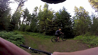
trail: School Trail
2:52 |
233 |
Jun 14, 2016
Recent Trail Reports
| status | trail | date | condition | info | user |
|---|---|---|---|---|---|
| Redtop | Apr 5, 2026 @ 8:23am (America/Denver) Apr 5, 2026 | Dry | kfizzlemynizzle | ||
| Redtop Access | Apr 5, 2026 @ 8:23am (America/Denver) Apr 5, 2026 | Dry | kfizzlemynizzle | ||
| Mt. Baldy | Aug 11, 2024 @ 8:30pm Aug 11, 2024 | Dry | Flynkiwi | ||
| Bobtail Ridge | Aug 13, 2021 @ 10:24pm Aug 13, 2021 | Very Dry | maffein |
Activity Feed
| username | action | type | title | date |
|---|---|---|---|---|
| otterpop86 | wishlist | trail | activity #97038076 | Jun 15, 2026 @ 6:54am Jun 15, 2026 |
| DavidAlanTroyer | add | report | activity #96961407 | Jun 14, 2026 @ 6:20am Jun 14, 2026 |
| DavidAlanTroyer | add | report | activity #96556162 | Jun 8, 2026 @ 12:07pm Jun 8, 2026 |
| DavidAlanTroyer | add | report | activity #95217723 | May 21, 2026 @ 7:22pm May 21, 2026 |
| zacharystephenmiller | ridden | trail | activity #93662345 and 2 more | Apr 29, 2026 @ 11:37am Apr 29, 2026 |
Recent Comments
| username | type | title | comment | date |
|---|---|---|---|---|
| trail | With logging up above the trail, it is a... | Dec 21, 2022 @ 8:04pm Dec 21, 2022 | ||
| trail | Classic descent on an old semi techy fs trail.... | Oct 9, 2021 @ 6:58am Oct 9, 2021 | ||
| trail | Unfortunately, trail is not quite what it used... | Aug 13, 2021 @ 10:27pm Aug 13, 2021 | ||
| report | This was an error. Not dry. Very snowy. | Dec 5, 2020 @ 6:22pm Dec 5, 2020 | ||
| trail | Due to a wind storm there are many fallen... | Apr 27, 2020 @ 10:53am Apr 27, 2020 |
Local Badges
-

Epic Mountain Bike Climb 2k2 awarded -

Climbing 10k Badge2 awarded -

Mountain Biking 100k Badge0 awarded -

Epic Ride Descent 2k2 awarded -

Descent 10k Badge2 awarded -

Descent 100k Badge0 awarded
Activity Type Stats
| activitytype | trails | distance | descent | descent distance | total vertical | rating | global rank | state rank | photos | reports | routes | ridelogs |
|---|---|---|---|---|---|---|---|---|---|---|---|---|
| Mountain Bike | 14 | 50 miles | 14,767 ft | 25 miles | 4,459 ft | #7,913 | #2,567 | 4 | 18 | 1 | 651 | |
| Horse | 43 | 153 miles | 22,211 ft | 42 miles | 6,184 ft | #249 | #436 | 8 | 1 | |||
| Hike | 63 | 193 miles | 32,011 ft | 60 miles | 6,220 ft | #1,071 | #490 | 3 | 19 | 1 | 487 | |
| Trail Running | 63 | 193 miles | 32,011 ft | 60 miles | 6,220 ft | #954 | #356 | 6 | 19 | 1 | 36 | |
| Downhill Ski | 28 | 10 miles | 11,027 ft | 10 miles | 2,083 ft | #612 | #281 | 19 |
Frequently Asked Questions About Libby
▼
What are the best places to ride in Libby?
Libby has 4 areas to explore for mountain biking. The top rated areas are:
▼
What are the highest rated mountain biking trails in Libby?
The highest rated mountain biking trails in Libby are:
- Sheldon Mountain (4.2/5)
- Bobtail Ridge (4.2/5)
- School Trail (4/5)
- Vinal Creek (3.7/5)
- Secret Stump (3.7/5)
▼
What is the best time of the year to ride in Libby?
Based on ride log data, the most popular months to ride in Libby are:
- September (11 activities)
- August (8 activities)
- May (8 activities)
▼
Where can I park to ride in Libby?
Activities
Trails
- By willisthethrill & contributors
- Admins: FAMB, JeffVonKiper
- #14467 - 5,931 views
- libby activity log | embed map of Libby mountain bike trails | libby mountain biking points of interest
Downloading of trail gps tracks in kml & gpx formats is enabled for Libby.
You must login to download files.